Lethe Grove

Wood, Forest in Essex Colchester

England

Lethe Grove

Haye Lane, Abberton A lane north of the village of Abberton.
Haye Lane, Abberton Credit: Trevor Harris

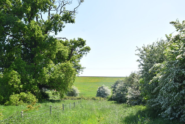
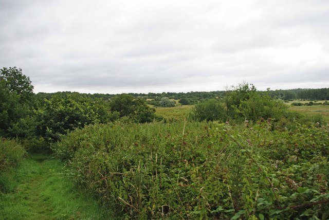
Lethe Grove is a serene woodland located in Essex, England. Situated in the heart of the county, this enchanting forest is a hidden gem for nature enthusiasts and those seeking tranquility. Covering an area of approximately 200 acres, Lethe Grove offers a peaceful retreat from the bustling city life.

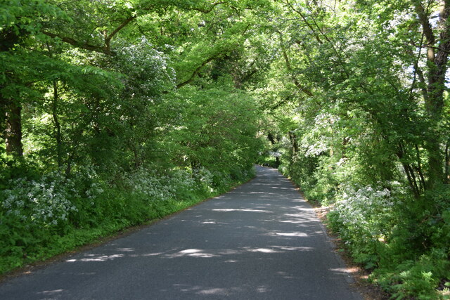
The forest is predominantly composed of a variety of deciduous trees, such as oak, beech, and ash, creating a vibrant and ever-changing landscape throughout the seasons. The dense foliage provides a lush canopy, offering shade during the hot summer months and a kaleidoscope of colors during autumn.

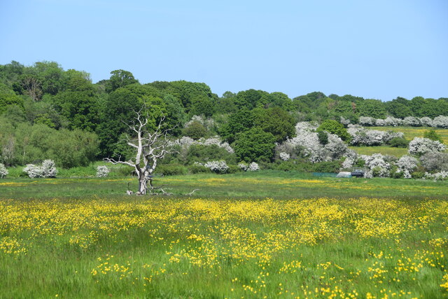
Lethe Grove is home to a diverse range of flora and fauna. The forest floor is adorned with a colorful carpet of wildflowers, including bluebells and primroses, which bloom in abundance during spring. It also harbors a rich array of wildlife, including deer, foxes, squirrels, and numerous species of birds, making it a haven for nature lovers and birdwatchers.

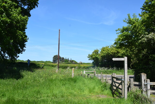
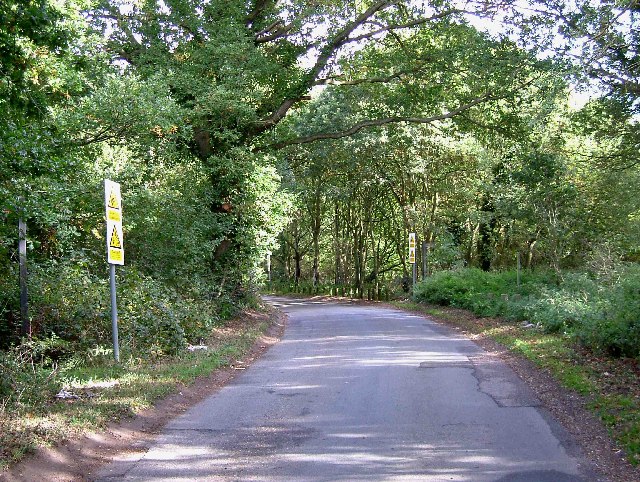
The woodland is crisscrossed by a network of well-maintained walking trails, allowing visitors to explore the beauty of Lethe Grove at their own pace. These pathways lead to secluded clearings, babbling brooks, and picturesque ponds, adding to the magical atmosphere of the forest.

Lethe Grove is not only a cherished natural retreat but also a valuable educational resource. It offers guided nature walks and workshops, providing visitors with the opportunity to learn about the local ecosystem and environmental conservation.

In summary, Lethe Grove in Essex, England is a captivating woodland that offers an idyllic escape into nature. With its diverse flora and fauna, well-marked trails, and educational programs, it is the perfect destination for anyone seeking a peaceful and enriching experience in the heart of the Essex countryside.

If you have any feedback on the listing, please let us know in the comments section below.
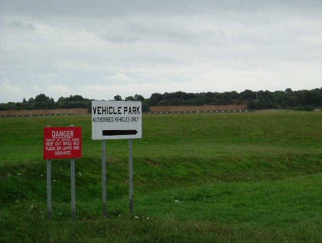
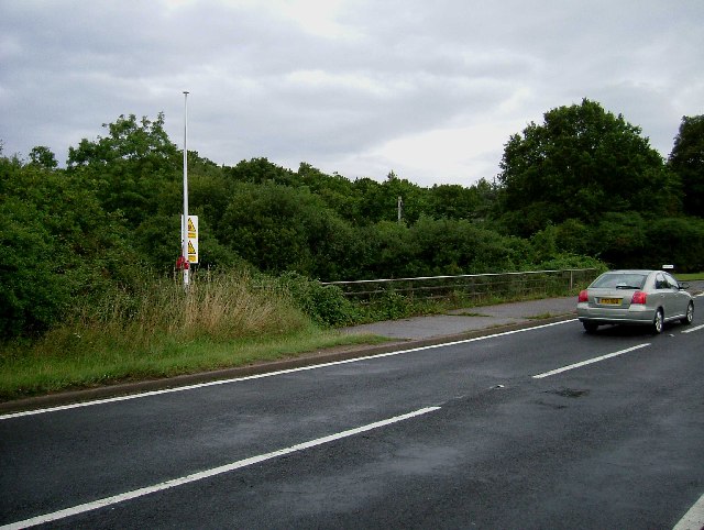
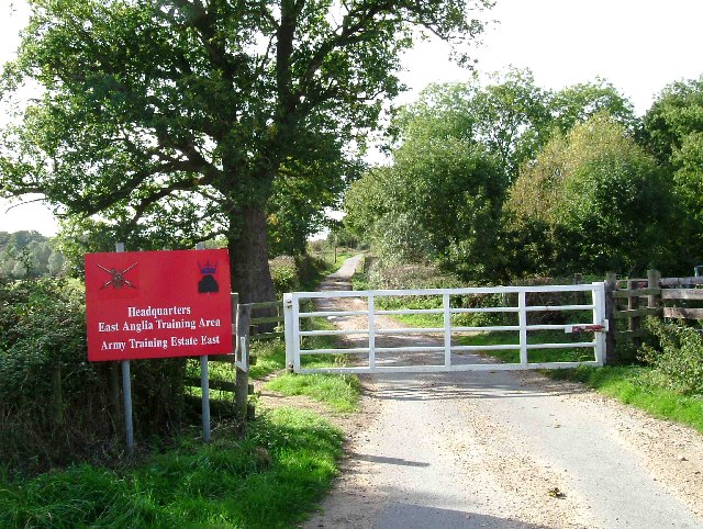
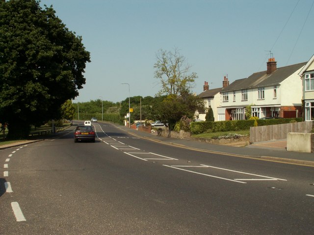
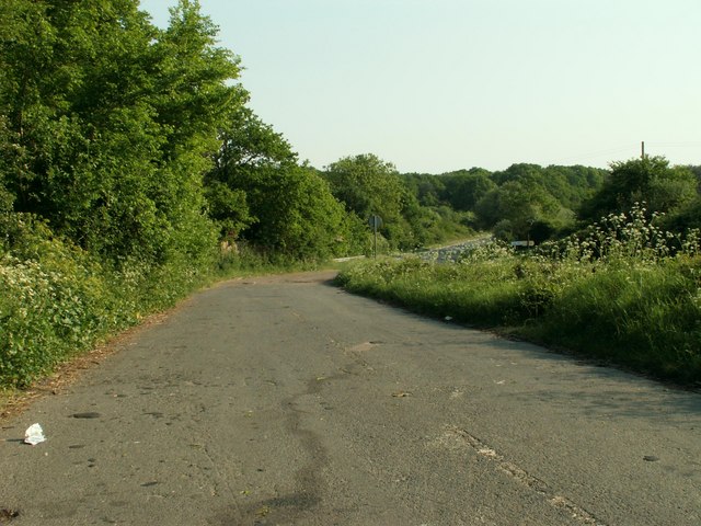
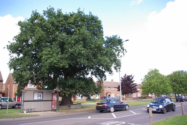
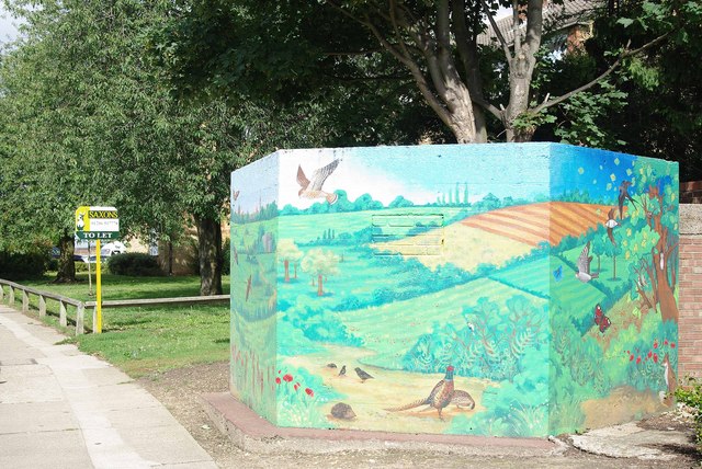
Lethe Grove Images

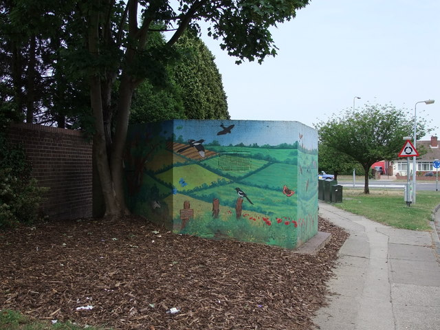
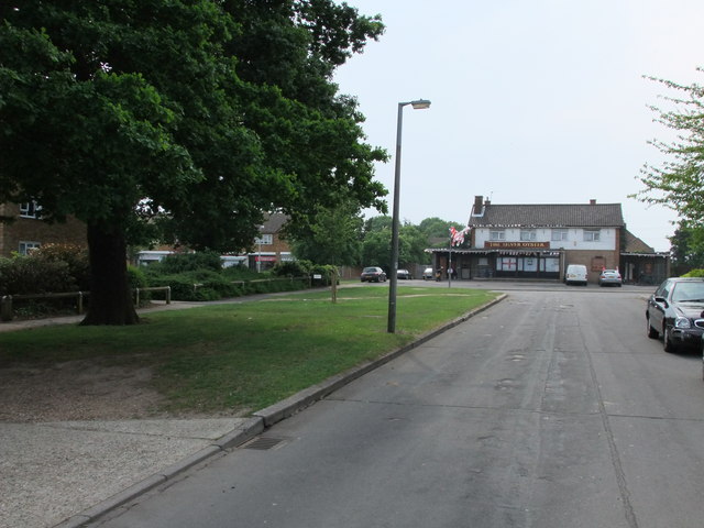
Images are sourced within 2km of 51.855887/0.90174671 or Grid Reference TL9921. Thanks to Geograph Open Source API. All images are credited.

Haye Lane, Abberton A lane north of the village of Abberton.
Haye Lane, Abberton
A lane north of the village of Abberton.
Corporal Budd VC Gymnasium Berechurch Rd
Dead oak, buttercups, hawthorn blossom A view across a pasture north of Abberton Reservoir.
Dead oak, buttercups, hawthorn blossom
A view across a pasture north of Abberton Reservoir.
Looking across Abberton Road  Taken from the permissive footpath which runs north of the dam of Abberton Reservoir.
Looking across Abberton Road
Taken from the permissive footpath which runs north of the dam of Abberton Reservoir.
Dam of Abberton Reservoir Ahead is the back slope of the dam of Abberton Reservoir taken from the permissive footpath which runs behind the dam.
Dam of Abberton Reservoir
Ahead is the back slope of the dam of Abberton Reservoir taken from the permissive footpath which runs behind the dam.
Pump House at Abberton Dam This is a photo of a small pump house just to the east of the Abberton Reservoir dam.
Pump House at Abberton Dam
This is a photo of a small pump house just to the east of the Abberton Reservoir dam.
Footpath to Friday Wood This footpath goes from Oxley Hill down the Roman River valley and then on to Friday Wood.
Footpath to Friday Wood
This footpath goes from Oxley Hill down the Roman River valley and then on to Friday Wood.
Rose Cottages Located in Blackheath Colchester, 80 & 82 Blackheath, the middle two houses were the original Rose Cottage built in 1882 as farm labourers cottages. All mod cons included a brick built outside bake/wash house and earth closet. There was a slate roofed wooden stable block at the rear of the property. Not much more than 100 years later the outbuildings were demolished and the semi-detached house was turned into a terrace with flying freehold’s to allow access to a car park at the rear.
Rose Cottages
Located in Blackheath Colchester, 80 & 82 Blackheath, the middle two houses were the original Rose Cottage built in 1882 as farm labourers cottages. All mod cons included a brick built outside bake/wash house and earth closet. There was a slate roofed wooden stable block at the rear of the property. Not much more than 100 years later the outbuildings were demolished and the semi-detached house was turned into a terrace with flying freehold’s to allow access to a car park at the rear.
Middlewick Rifle Range The rifle range and butts date originally from around the time of the 1st world war. The danger area behind the butts has preserved countryside that would almost certainly been developed for housing
Middlewick Rifle Range
The rifle range and butts date originally from around the time of the 1st world war. The danger area behind the butts has preserved countryside that would almost certainly been developed for housing
Flagpole by Manwood Bridge The flagpole flies a red flag when the middlewick range <a href="https://www.geograph.org.uk/gridref/TM0022">TM0022</a> is in use. Enter the woods at your peril. Manwood bridge carries the B1025  over Roman River.
Flagpole by Manwood Bridge
The flagpole flies a red flag when the middlewick range TM0022 is in use. Enter the woods at your peril. Manwood bridge carries the B1025 over Roman River.
Ball farm Bridleway This is a Bridleway across Ball Farm. The metalled road surface is provided courtesy of the Army. The photo was taken looking west. The other end of the path can be seen at <a href="https://www.geograph.org.uk/gridref/TL9920">TL9920</a>.
Ball farm Bridleway
This is a Bridleway across Ball Farm. The metalled road surface is provided courtesy of the Army. The photo was taken looking west. The other end of the path can be seen at TL9920.
Weir Lane Weir Lane runs from the B1025 Near Blackheath Colchester to Donnyland Heath near Rowhedge. The lane passes through the danger area of the Middlewick Rifle Range <a href="https://www.geograph.org.uk/gridref/TM0022">TM0022</a>. When the range is in use the road is closed with gates at each end. The yellow signs beside the footpath fingerposts warn of the fatal consequences of interfering with any military debris you may find on the army’s grounds. The picture was taken looking towards Rowhedge.
Weir Lane
Weir Lane runs from the B1025 Near Blackheath Colchester to Donnyland Heath near Rowhedge. The lane passes through the danger area of the Middlewick Rifle Range TM0022. When the range is in use the road is closed with gates at each end. The yellow signs beside the footpath fingerposts warn of the fatal consequences of interfering with any military debris you may find on the army’s grounds. The picture was taken looking towards Rowhedge.
Part of the B1025 Mersea Road This direction is heading towards Colchester.
Part of the B1025 Mersea Road
This direction is heading towards Colchester.
A lay-by along the B1025, Mersea Road Cats eyes in this lay-by is an indication that it was once part of the original B1025.
A lay-by along the B1025, Mersea Road
Cats eyes in this lay-by is an indication that it was once part of the original B1025.
Monkwick Oak (14944) This Oak survived the building of the Monkwick Estate in Blackheath Colchester during the late 1950's. It is recorded as tree 14944 in the Woodland trusts Ancient Tree Hunt <span class="nowrap"><a title="http://www.ancient-tree-hunt.org.uk/" rel="nofollow ugc noopener" href="http://www.ancient-tree-hunt.org.uk/">Link</a><img style="margin-left:2px;" alt="External link" title="External link - shift click to open in new window" src="https://s1.geograph.org.uk/img/external.png" width="10" height="10"/></span>
Monkwick Oak (14944)
This Oak survived the building of the Monkwick Estate in Blackheath Colchester during the late 1950's. It is recorded as tree 14944 in the Woodland trusts Ancient Tree Hunt LinkExternal link
Pillbox Camouflage? An imaginative way to disguise the brutal concrete of a type 24 pillbox. Created by the children of Monkwick and Lisa Temple <span class="nowrap"><a title="http://www.lisatemple-cox.co.uk/index.html" rel="nofollow ugc noopener" href="http://www.lisatemple-cox.co.uk/index.html">Link</a><img style="margin-left:2px;" alt="External link" title="External link - shift click to open in new window" src="https://s1.geograph.org.uk/img/external.png" width="10" height="10"/></span> It is heartening to note that even though the painting was finished a couple of years ago no artist/vandal has deemed it necessary to add their tag to it.
Pillbox Camouflage?
An imaginative way to disguise the brutal concrete of a type 24 pillbox. Created by the children of Monkwick and Lisa Temple LinkExternal link It is heartening to note that even though the painting was finished a couple of years ago no artist/vandal has deemed it necessary to add their tag to it.
Decorated World War two pillbox in Stansted Road, Colchester. More photos of the project can be seen here: <span class="nowrap"><a title="http://www.flickr.com/photos/deepgreenart/sets/72157605776353897/" rel="nofollow ugc noopener" href="http://www.flickr.com/photos/deepgreenart/sets/72157605776353897/">Link</a><img style="margin-left:2px;" alt="External link" title="External link - shift click to open in new window" src="https://s1.geograph.org.uk/img/external.png" width="10" height="10"/></span>
Decorated World War two pillbox in Stansted Road, Colchester.
More photos of the project can be seen here: LinkExternal link
The Silver Oyster Public House, Queen Elizabeth Way, Colchester Viewed from Stansted Road
The Silver Oyster Public House, Queen Elizabeth Way, Colchester
Viewed from Stansted Road
Show me another place!

Lethe Grove is located at Grid Ref: TL9921 (Lat: 51.855887, Lng: 0.90174671)

Administrative County: Essex

District: Colchester

Police Authority: Essex

What 3 Words

///nobody.jelly.shunts. Near Layer de la Haye, Essex

Nearby Locations

Lethe Grove

Related Wikis

Berechurch

Berechurch is an suburb of Colchester in Essex, England. Berechurch was formerly a separate civil parish. In 1891 the parish had a population of 167. On...

St Michael's Church, Berechurch

St Michael's Church is a redundant Anglican church in the village of Berechurch, Essex, England. It is recorded in the National Heritage List for England...

Roman River SSSI

Roman River is a 275.6-hectare (681-acre) biological Site of Special Scientific Interest (SSSI) south of Colchester in Essex. Two areas, Friday Wood and...

Thomas Lord Audley School

Thomas Lord Audley School is a mixed 11–16 secondary school with academy status for 800 pupils, to the south of Colchester, Essex. It serves a wide catchment...

Nearby Amenities

Located within 500m of 51.855887,0.90174671
Power: tower
Ref: PUD 19
Lat/Long: 51.8560281/0.898276
Barrier: stile
Foot: yes
Lat/Long: 51.8568098/0.8983929
Power: tower
Ref: PUD 18A
Lat/Long: 51.8576541/0.8993445
Barrier: stile
Foot: yes
Lat/Long: 51.8566562/0.8987218
Post Box
Operator: Royal Mail
Ref: CO2 418
Lat/Long: 51.8595646/0.9018339
Power: tower
Ref: PUD 20
Lat/Long: 51.8539573/0.8969453
Crossing
Lat/Long: 51.8599895/0.8991626
Crossing
Crossing: unmarked
Crossing Island: yes
Lat/Long: 51.8597608/0.9010278
Barrier: motorcycle_barrier
Lat/Long: 51.8575605/0.9065746
Barrier: motorcycle_barrier
Lat/Long: 51.8567016/0.9059436
Barrier: motorcycle_barrier
Lat/Long: 51.8578401/0.9061512
Lethe Grove
Naptan AtcoCode: 150033055100
Naptan BusStopType: CUS
Naptan NaptanCode: esxjgjgd
Naptan Verified: no
Public Transport: platform
Source: naptan
Lat/Long: 51.8597272/0.901471
Lethe Grove
Naptan AtcoCode: 1500330551Y0
Naptan BusStopType: CUS
Naptan NaptanCode: esxjgjgj
Naptan Verified: no
Public Transport: platform
Source: naptan
Lat/Long: 51.8595958/0.9024212
Generator Method: photovoltaic
Generator Output Electricity: yes
Generator Source: solar
Generator Type: solar_photovoltaic_panel
Location: roof
Power: generator
Lat/Long: 51.8596291/0.9031765
Generator Method: photovoltaic
Generator Output Electricity: yes
Generator Source: solar
Generator Type: solar_photovoltaic_panel
Location: roof
Power: generator
Lat/Long: 51.8596506/0.9032221
Generator Method: photovoltaic
Generator Output Electricity: yes
Generator Source: solar
Generator Type: solar_photovoltaic_panel
Location: roof
Power: generator
Lat/Long: 51.8596705/0.9032677
Generator Method: photovoltaic
Generator Output Electricity: yes
Generator Source: solar
Generator Type: solar_photovoltaic_panel
Location: roof
Power: generator
Lat/Long: 51.8596937/0.9033267
Generator Method: photovoltaic
Generator Output Electricity: yes
Generator Source: solar
Generator Type: solar_photovoltaic_panel
Location: roof
Power: generator
Lat/Long: 51.8594055/0.9035064
Generator Method: photovoltaic
Generator Output Electricity: yes
Generator Source: solar
Generator Type: solar_photovoltaic_panel
Location: roof
Power: generator
Lat/Long: 51.8594386/0.903611
Generator Method: photovoltaic
Generator Output Electricity: yes
Generator Source: solar
Generator Type: solar_photovoltaic_panel
Location: roof
Power: generator
Lat/Long: 51.8594701/0.9037478
Generator Method: photovoltaic
Generator Output Electricity: yes
Generator Source: solar
Generator Type: solar_photovoltaic_panel
Location: roof
Power: generator
Lat/Long: 51.8595198/0.9038819
Generator Method: photovoltaic
Generator Output Electricity: yes
Generator Source: solar
Generator Type: solar_photovoltaic_panel
Location: roof
Power: generator
Lat/Long: 51.8592912/0.9034259
Generator Method: photovoltaic
Generator Output Electricity: yes
Generator Source: solar
Generator Type: solar_photovoltaic_panel
Location: roof
Power: generator
Lat/Long: 51.8592183/0.9034849
Generator Method: photovoltaic
Generator Output Electricity: yes
Generator Source: solar
Generator Type: solar_photovoltaic_panel
Location: roof
Power: generator
Lat/Long: 51.8591288/0.9035413
Generator Method: photovoltaic
Generator Output Electricity: yes
Generator Source: solar
Generator Type: solar_photovoltaic_panel
Location: roof
Power: generator
Lat/Long: 51.8590543/0.9036056
Generator Method: photovoltaic
Generator Output Electricity: yes
Generator Source: solar
Generator Type: solar_photovoltaic_panel
Location: roof
Power: generator
Lat/Long: 51.8586501/0.9040348
Generator Method: photovoltaic
Generator Output Electricity: yes
Generator Source: solar
Generator Type: solar_photovoltaic_panel
Location: roof
Power: generator
Lat/Long: 51.8586899/0.9044693
Generator Method: photovoltaic
Generator Output Electricity: yes
Generator Source: solar
Generator Type: solar_photovoltaic_panel
Location: roof
Power: generator
Lat/Long: 51.8580529/0.9045527
Generator Method: photovoltaic
Generator Output Electricity: yes
Generator Source: solar
Generator Type: solar_photovoltaic_panel
Location: roof
Power: generator
Lat/Long: 51.8582679/0.9051201
Generator Method: photovoltaic
Generator Output Electricity: yes
Generator Source: solar
Generator Type: solar_photovoltaic_panel
Location: roof
Power: generator
Lat/Long: 51.8577247/0.9047332
Generator Method: photovoltaic
Generator Output Electricity: yes
Generator Source: solar
Generator Type: solar_photovoltaic_panel
Location: roof
Power: generator
Lat/Long: 51.8578984/0.9052439
Generator Method: photovoltaic
Generator Output Electricity: yes
Generator Source: solar
Generator Type: solar_photovoltaic_panel
Location: roof
Power: generator
Lat/Long: 51.8579127/0.90528
Generator Method: photovoltaic
Generator Output Electricity: yes
Generator Source: solar
Generator Type: solar_photovoltaic_panel
Location: roof
Power: generator
Lat/Long: 51.85761/0.9054606
Generator Method: photovoltaic
Generator Output Electricity: yes
Generator Source: solar
Generator Type: solar_photovoltaic_panel
Location: roof
Power: generator
Lat/Long: 51.8577024/0.9062808
Generator Method: photovoltaic
Generator Output Electricity: yes
Generator Source: solar
Generator Type: solar_photovoltaic_panel
Location: roof
Power: generator
Lat/Long: 51.858209/0.9065129
Generator Method: photovoltaic
Generator Output Electricity: yes
Generator Source: solar
Generator Type: solar_photovoltaic_panel
Location: roof
Power: generator
Lat/Long: 51.858381/0.9065774
Generator Method: photovoltaic
Generator Output Electricity: yes
Generator Source: solar
Generator Type: solar_photovoltaic_panel
Location: roof
Power: generator
Lat/Long: 51.8584384/0.9065877
Generator Method: photovoltaic
Generator Output Electricity: yes
Generator Source: solar
Generator Type: solar_photovoltaic_panel
Location: roof
Power: generator
Lat/Long: 51.8583125/0.9057288
Generator Method: photovoltaic
Generator Output Electricity: yes
Generator Source: solar
Generator Type: solar_photovoltaic_panel
Location: roof
Power: generator
Lat/Long: 51.8587044/0.9059609
Generator Method: photovoltaic
Generator Output Electricity: yes
Generator Source: solar
Generator Type: solar_photovoltaic_panel
Location: roof
Power: generator
Lat/Long: 51.859031/0.9052852
Generator Method: photovoltaic
Generator Output Electricity: yes
Generator Source: solar
Generator Type: solar_photovoltaic_panel
Location: roof
Power: generator
Lat/Long: 51.8595079/0.905728
Generator Method: photovoltaic
Generator Output Electricity: yes
Generator Source: solar
Generator Type: solar_photovoltaic_panel
Location: roof
Power: generator
Lat/Long: 51.8597994/0.9047624
Generator Method: photovoltaic
Generator Output Electricity: yes
Generator Source: solar
Generator Type: solar_photovoltaic_panel
Location: roof
Power: generator
Lat/Long: 51.8597166/0.9045317
Generator Method: photovoltaic
Generator Output Electricity: yes
Generator Source: solar
Generator Type: solar_photovoltaic_panel
Location: roof
Power: generator
Lat/Long: 51.8595807/0.9049716
Generator Method: photovoltaic
Generator Output Electricity: yes
Generator Source: solar
Generator Type: solar_photovoltaic_panel
Location: roof
Power: generator
Lat/Long: 51.8592246/0.9041213
Generator Method: photovoltaic
Generator Output Electricity: yes
Generator Source: solar
Generator Type: solar_photovoltaic_panel
Location: roof
Power: generator
Lat/Long: 51.8593397/0.904202
Generator Method: photovoltaic
Generator Output Electricity: yes
Generator Source: solar
Generator Type: solar_photovoltaic_panel
Location: roof
Power: generator
Lat/Long: 51.8596116/0.9041281
Generator Method: photovoltaic
Generator Output Electricity: yes
Generator Source: solar
Generator Type: solar_photovoltaic_panel
Location: roof
Power: generator
Lat/Long: 51.8580009/0.9071593
Generator Method: photovoltaic
Generator Output Electricity: yes
Generator Source: solar
Generator Type: solar_photovoltaic_panel
Location: roof
Power: generator
Lat/Long: 51.8582494/0.9075308
Generator Method: photovoltaic
Generator Output Electricity: yes
Generator Source: solar
Generator Type: solar_photovoltaic_panel
Location: roof
Power: generator
Lat/Long: 51.8581466/0.9074637
Generator Method: photovoltaic
Generator Output Electricity: yes
Generator Source: solar
Generator Type: solar_photovoltaic_panel
Location: roof
Power: generator
Lat/Long: 51.8588192/0.9021342
Generator Method: photovoltaic
Generator Output Electricity: yes
Generator Source: solar
Generator Type: solar_photovoltaic_panel
Location: roof
Power: generator
Lat/Long: 51.8577955/0.9018633
Generator Method: photovoltaic
Generator Output Electricity: yes
Generator Source: solar
Generator Type: solar_photovoltaic_panel
Location: roof
Power: generator
Lat/Long: 51.8580257/0.9049854
Generator Method: photovoltaic
Generator Output Electricity: yes
Generator Source: solar
Generator Type: solar_photovoltaic_panel
Location: roof
Power: generator
Lat/Long: 51.8582311/0.9048271
Generator Method: photovoltaic
Generator Output Electricity: yes
Generator Source: solar
Generator Type: solar_photovoltaic_panel
Location: roof
Power: generator
Lat/Long: 51.8582179/0.9048754
Generator Method: photovoltaic
Generator Output Electricity: yes
Generator Source: solar
Generator Type: solar_photovoltaic_panel
Location: roof
Power: generator
Lat/Long: 51.8583007/0.9053662
Generator Method: photovoltaic
Generator Output Electricity: yes
Generator Source: solar
Generator Type: solar_photovoltaic_panel
Location: roof
Power: generator
Lat/Long: 51.8592979/0.9051409
Generator Method: photovoltaic
Generator Output Electricity: yes
Generator Source: solar
Generator Type: solar_photovoltaic_panel
Location: roof
Power: generator
Lat/Long: 51.860325/0.9021302
Generator Method: photovoltaic
Generator Output Electricity: yes
Generator Source: solar
Generator Type: solar_photovoltaic_panel
Location: roof
Power: generator
Lat/Long: 51.8602935/0.9021704
Crossing
Lat/Long: 51.8589176/0.9013965
The data included in this document is from www.openstreetmap.org. The data is made available under ODbL.

Have you been to Lethe Grove?

Leave your review of Lethe Grove below (or comments, questions and feedback).