Ash Plantation

Wood, Forest in Suffolk Mid Suffolk

England

Ash Plantation

The Old Moot House, Rattlesden
The Old Moot House, Rattlesden Credit: Chris Andrews

Ash Plantation is a wooded area located in Suffolk, England. It is a part of the larger Suffolk Wood, Forest, and covers an area of approximately 200 acres. The plantation is situated near the village of Ash, which is known for its picturesque landscapes and rural charm.

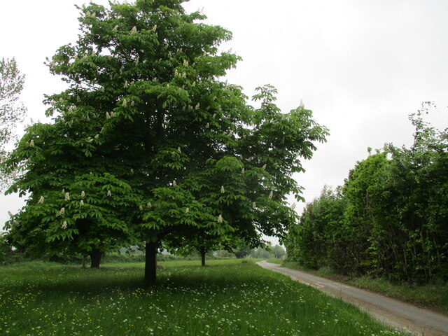
The plantation predominantly consists of ash trees, hence its name. These trees create a dense canopy, providing a habitat for a variety of wildlife species. The tranquil atmosphere and abundance of flora and fauna make Ash Plantation a popular destination for nature enthusiasts and hikers.

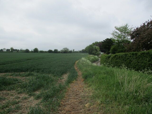
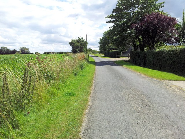
The woodland is crisscrossed by several walking trails, allowing visitors to explore its diverse ecosystem. These trails are well-maintained and offer opportunities for both leisurely strolls and more rigorous hikes. Along the way, visitors may come across wildflowers, mushrooms, and various bird species, adding to the natural beauty of the area.

Ash Plantation is also home to a small stream, which meanders through the woodland, adding to its charm. The stream provides a water source for the wildlife and offers a serene backdrop for picnickers and those seeking a peaceful spot for relaxation.

The plantation is open to the public throughout the year, with no admission fees. It is managed by the local forestry commission, which ensures the preservation and conservation of the area's natural resources. Visitors are encouraged to follow the designated paths and respect the flora and fauna of the plantation.

Overall, Ash Plantation in Suffolk offers a tranquil and scenic retreat for nature lovers, providing an opportunity to connect with the beauty of the natural world.

If you have any feedback on the listing, please let us know in the comments section below.

Ash Plantation Images

Images are sourced within 2km of 52.196724/0.91440841 or Grid Reference TL9959. Thanks to Geograph Open Source API. All images are credited.

The Old Moot House, Rattlesden
Shelland Green
Shelland Green
The church of King Charles the Martyr, Shelland A medieval church virtually rebuilt in 1767 <span class="nowrap"><a title="https://historicengland.org.uk/listing/the-list/list-entry/1352321?section=official-list-entry" rel="nofollow ugc noopener" href="https://historicengland.org.uk/listing/the-list/list-entry/1352321?section=official-list-entry">Link</a><img style="margin-left:2px;" alt="External link" title="External link - shift click to open in new window" src="https://s1.geograph.org.uk/img/external.png" width="10" height="10"/></span>
The church of King Charles the Martyr, Shelland
A medieval church virtually rebuilt in 1767 LinkExternal link
The church of King Charles the Martyr, Shelland Of medieval origin but largely of the eighteenth century <span class="nowrap"><a title="https://historicengland.org.uk/listing/the-list/list-entry/1352321?section=official-list-entry" rel="nofollow ugc noopener" href="https://historicengland.org.uk/listing/the-list/list-entry/1352321?section=official-list-entry">Link</a><img style="margin-left:2px;" alt="External link" title="External link - shift click to open in new window" src="https://s1.geograph.org.uk/img/external.png" width="10" height="10"/></span>
The church of King Charles the Martyr, Shelland
Of medieval origin but largely of the eighteenth century LinkExternal link
Shelland Green
Shelland Green
Footpath to Harleston
Horse chestnut at Shelland
Wheat field, Buxhall Fen Street
Red Telephone Box Telephone box at Rattlesden, Suffolk.
Red Telephone Box
Telephone box at Rattlesden, Suffolk.
Entrance To Fishing Lake Entrance to Bakers Puddle fishing lake at Buxhall, Suffolk also see <a title="https://www.geograph.org.uk/photo/2646620" href="https://www.geograph.org.uk/photo/2646620">Link</a>
Entrance To Fishing Lake
Entrance to Bakers Puddle fishing lake at Buxhall, Suffolk also see Link
Bakers Puddle Sign for fishing lake at Buxhall, Suffolk.
Bakers Puddle
Sign for fishing lake at Buxhall, Suffolk.
Buxhall Windmill Buxhall windmill on Mill Road Buxhall, Suffolk. For more info on the mill see <span class="nowrap"><a title="http://en.wikipedia.org/wiki/Buxhall_Windmill" rel="nofollow ugc noopener" href="http://en.wikipedia.org/wiki/Buxhall_Windmill">Link</a><img style="margin-left:2px;" alt="External link" title="External link - shift click to open in new window" src="https://s1.geograph.org.uk/img/external.png" width="10" height="10"/></span>
Buxhall Windmill
Buxhall windmill on Mill Road Buxhall, Suffolk. For more info on the mill see LinkExternal link
Buxhall Windmill Buxhall windmill now converted see <span class="nowrap"><a title="http://en.wikipedia.org/wiki/Buxhall_Windmill" rel="nofollow ugc noopener" href="http://en.wikipedia.org/wiki/Buxhall_Windmill">Link</a><img style="margin-left:2px;" alt="External link" title="External link - shift click to open in new window" src="https://s1.geograph.org.uk/img/external.png" width="10" height="10"/></span> and the now converted Primitive Methodist Chapel at Buxhall, Suffolk.
Buxhall Windmill
Buxhall windmill now converted see LinkExternal link and the now converted Primitive Methodist Chapel at Buxhall, Suffolk.
Village Hall Buxhall village hall Buxhall, Suffolk.
Village Hall
Buxhall village hall Buxhall, Suffolk.
St Nicholas Church, Rattlesdon as seen from Lower Street
Junction of Mitchery Lane and Baby Lane
Footpath alongside a field of sugar beet, Poystreet Green
Mitchery Lane, Poystreet Green
Show me another place!

Ash Plantation is located at Grid Ref: TL9959 (Lat: 52.196724, Lng: 0.91440841)

Administrative County: Suffolk

District: Mid Suffolk

Police Authority: Suffolk

What 3 Words

///glove.starlight.half. Near Woolpit, Suffolk

Nearby Locations

Ash Plantation

Related Wikis

Rattlesden

Rattlesden is a village and civil parish in the Mid Suffolk district of Suffolk in eastern England. It is approximately 15 miles (24 km) north-west from...

2011 murder of the Ding family

The 2011 murder of the Ding family occurred in Wootton, a suburb of Northampton, England, in late April. Four members of the Ding family—Professor Jifeng...

Shelland

Shelland is a small village and civil parish located just off the A14, 4 miles west of Stowmarket in Suffolk, England. Shelland consists of roughly 10...

Mill Green, Buxhall

Mill Green is a hamlet near the village of Buxhall, in the English county of Suffolk. == See also == Buxhall Windmill == References == Philip's Street...

Have you been to Ash Plantation?

Leave your review of Ash Plantation below (or comments, questions and feedback).