Colemans' Kitchen Wood

Wood, Forest in Kent Ashford

England

Colemans' Kitchen Wood

Farmland, Chilmington Green Road This will form part of a vast development, to be known as Chilmington Green, for which planning permission has been granted by Ashford Borough Council under application number 12/00400/AS. This is  an “outline application for a Comprehensive Mixed Use Development comprising: up to 5,750 residential units, in a mix of sizes, types and tenures; up to 10,000 m² (gross external floor space) of Class Bl use; up to 9,000 m² (gross external floor space) of Class Al to A5 uses; Education (including a secondary school of up to 8 ha and up to four primary schools of up to 2.1 ha each); Community Uses (class Dl) up to 7,000 m² (gross external floor space); Leisure Uses (class D2) up to 6,000 m² (gross external floor space); Provision of local recycling facilities; Provision of areas of formal and informal open space; Installation of appropriate utilities infrastructure as required to serve the development, including flood attenuation works, SUDS, water supply and wastewater infrastructure, gas supply, electricity supply (including substations), telecommunications infrastructure and renewable energy infrastructure (including CHP in the District Centre); Transport infrastructure, including provision of three accesses on to the A28, an access on to Coulter Road/Cuckoo Lane, other connections on to the local road network, and a network of internal roads, footpaths and cycle routes; New planting and landscaping, both within the Proposed Development and on its boundaries, and ecological enhancement works; and associated ground works where appearance, landscaping, layout and scale are reserved for future approval and where access is reserved for future approval with the exception of the three accesses on to the A28 and the access on to Coulter Road/Cuckoo Lane”.

Here, there is a footpath crossing a harvested field.
Farmland, Chilmington Green Road Credit: John Baker

Colemans' Kitchen Wood is a picturesque woodland located in the county of Kent, England. Situated in the heart of the Kent Downs Area of Outstanding Natural Beauty, this woodland is a haven for nature enthusiasts and outdoor adventurers alike.

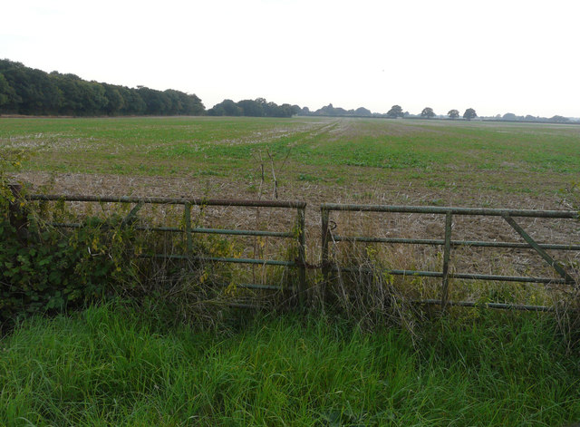
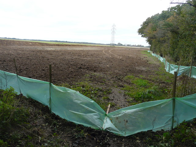
Covering an area of approximately 100 acres, Colemans' Kitchen Wood is characterized by its dense canopy of deciduous trees, including oak, beech, and ash. These towering trees create a tranquil and serene atmosphere, offering a welcome respite from the hustle and bustle of everyday life.

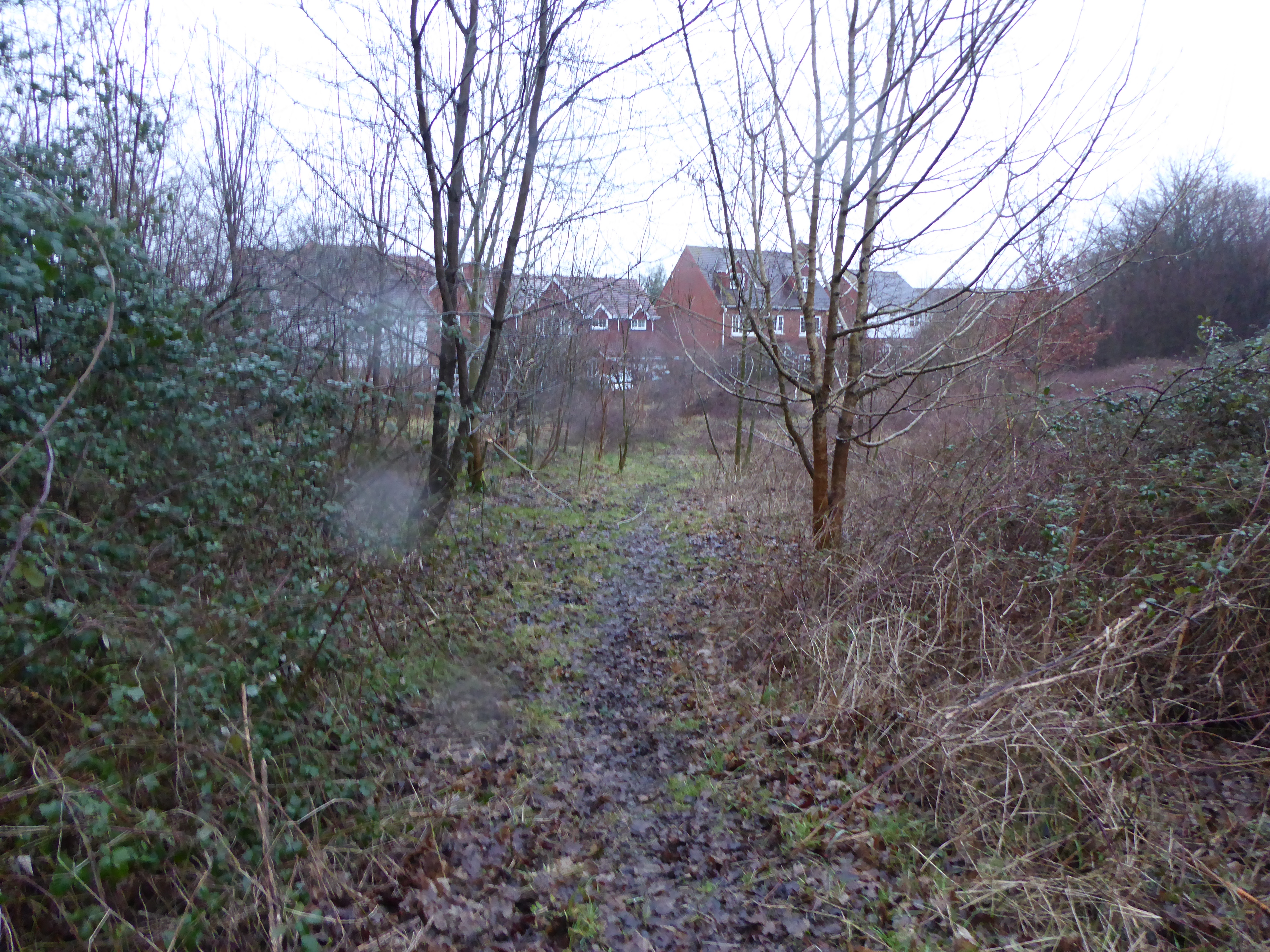
The woodland is crisscrossed with a network of well-maintained footpaths, allowing visitors to explore the area at their own pace. These paths lead to various hidden gems within the wood, such as a babbling brook, wildflower meadows, and an abundance of wildlife. Birdwatchers will be delighted to spot a variety of species, including woodpeckers, owls, and thrushes.

Colemans' Kitchen Wood is also home to a diverse range of flora, with woodland flowers such as bluebells, primroses, and foxgloves carpeting the forest floor during the spring months. This explosion of color creates a truly enchanting sight for visitors.

The woodland is open to the public year-round and offers ample parking facilities. There are also picnic areas and benches scattered throughout the wood, providing the perfect spot to relax and enjoy the natural surroundings.

Whether you are seeking a peaceful stroll, a birdwatching adventure, or simply a place to reconnect with nature, Colemans' Kitchen Wood in Kent is a hidden gem that promises to captivate and inspire all who visit.

If you have any feedback on the listing, please let us know in the comments section below.

Colemans' Kitchen Wood Images

Images are sourced within 2km of 51.13025/0.83713714 or Grid Reference TQ9840. Thanks to Geograph Open Source API. All images are credited.

Farmland, Chilmington Green Road This will form part of a vast development, to be known as Chilmington Green, for which planning permission has been granted by Ashford Borough Council under application number 12/00400/AS. This is  an “outline application for a Comprehensive Mixed Use Development comprising: up to 5,750 residential units, in a mix of sizes, types and tenures; up to 10,000 m² (gross external floor space) of Class Bl use; up to 9,000 m² (gross external floor space) of Class Al to A5 uses; Education (including a secondary school of up to 8 ha and up to four primary schools of up to 2.1 ha each); Community Uses (class Dl) up to 7,000 m² (gross external floor space); Leisure Uses (class D2) up to 6,000 m² (gross external floor space); Provision of local recycling facilities; Provision of areas of formal and informal open space; Installation of appropriate utilities infrastructure as required to serve the development, including flood attenuation works, SUDS, water supply and wastewater infrastructure, gas supply, electricity supply (including substations), telecommunications infrastructure and renewable energy infrastructure (including CHP in the District Centre); Transport infrastructure, including provision of three accesses on to the A28, an access on to Coulter Road/Cuckoo Lane, other connections on to the local road network, and a network of internal roads, footpaths and cycle routes; New planting and landscaping, both within the Proposed Development and on its boundaries, and ecological enhancement works; and associated ground works where appearance, landscaping, layout and scale are reserved for future approval and where access is reserved for future approval with the exception of the three accesses on to the A28 and the access on to Coulter Road/Cuckoo Lane”.

Here, there is a footpath crossing a harvested field.
Farmland, Chilmington Green Road
This will form part of a vast development, to be known as Chilmington Green, for which planning permission has been granted by Ashford Borough Council under application number 12/00400/AS. This is an “outline application for a Comprehensive Mixed Use Development comprising: up to 5,750 residential units, in a mix of sizes, types and tenures; up to 10,000 m² (gross external floor space) of Class Bl use; up to 9,000 m² (gross external floor space) of Class Al to A5 uses; Education (including a secondary school of up to 8 ha and up to four primary schools of up to 2.1 ha each); Community Uses (class Dl) up to 7,000 m² (gross external floor space); Leisure Uses (class D2) up to 6,000 m² (gross external floor space); Provision of local recycling facilities; Provision of areas of formal and informal open space; Installation of appropriate utilities infrastructure as required to serve the development, including flood attenuation works, SUDS, water supply and wastewater infrastructure, gas supply, electricity supply (including substations), telecommunications infrastructure and renewable energy infrastructure (including CHP in the District Centre); Transport infrastructure, including provision of three accesses on to the A28, an access on to Coulter Road/Cuckoo Lane, other connections on to the local road network, and a network of internal roads, footpaths and cycle routes; New planting and landscaping, both within the Proposed Development and on its boundaries, and ecological enhancement works; and associated ground works where appearance, landscaping, layout and scale are reserved for future approval and where access is reserved for future approval with the exception of the three accesses on to the A28 and the access on to Coulter Road/Cuckoo Lane”. Here, there is a footpath crossing a harvested field.
Farmland, Chilmington Green Road This will form part of a vast development, to be known as Chilmington Green, for which planning permission has been granted by Ashford Borough Council under application number 12/00400/AS. This is  an “outline application for a Comprehensive Mixed Use Development comprising: up to 5,750 residential units, in a mix of sizes, types and tenures; up to 10,000 m² (gross external floor space) of Class Bl use; up to 9,000 m² (gross external floor space) of Class Al to A5 uses; Education (including a secondary school of up to 8 ha and up to four primary schools of up to 2.1 ha each); Community Uses (class Dl) up to 7,000 m² (gross external floor space); Leisure Uses (class D2) up to 6,000 m² (gross external floor space); Provision of local recycling facilities; Provision of areas of formal and informal open space; Installation of appropriate utilities infrastructure as required to serve the development, including flood attenuation works, SUDS, water supply and wastewater infrastructure, gas supply, electricity supply (including substations), telecommunications infrastructure and renewable energy infrastructure (including CHP in the District Centre); Transport infrastructure, including provision of three accesses on to the A28, an access on to Coulter Road/Cuckoo Lane, other connections on to the local road network, and a network of internal roads, footpaths and cycle routes; New planting and landscaping, both within the Proposed Development and on its boundaries, and ecological enhancement works; and associated ground works where appearance, landscaping, layout and scale are reserved for future approval and where access is reserved for future approval with the exception of the three accesses on to the A28 and the access on to Coulter Road/Cuckoo Lane”.

Here, Stubbscross Wood lies to the left of the field.
Farmland, Chilmington Green Road
This will form part of a vast development, to be known as Chilmington Green, for which planning permission has been granted by Ashford Borough Council under application number 12/00400/AS. This is an “outline application for a Comprehensive Mixed Use Development comprising: up to 5,750 residential units, in a mix of sizes, types and tenures; up to 10,000 m² (gross external floor space) of Class Bl use; up to 9,000 m² (gross external floor space) of Class Al to A5 uses; Education (including a secondary school of up to 8 ha and up to four primary schools of up to 2.1 ha each); Community Uses (class Dl) up to 7,000 m² (gross external floor space); Leisure Uses (class D2) up to 6,000 m² (gross external floor space); Provision of local recycling facilities; Provision of areas of formal and informal open space; Installation of appropriate utilities infrastructure as required to serve the development, including flood attenuation works, SUDS, water supply and wastewater infrastructure, gas supply, electricity supply (including substations), telecommunications infrastructure and renewable energy infrastructure (including CHP in the District Centre); Transport infrastructure, including provision of three accesses on to the A28, an access on to Coulter Road/Cuckoo Lane, other connections on to the local road network, and a network of internal roads, footpaths and cycle routes; New planting and landscaping, both within the Proposed Development and on its boundaries, and ecological enhancement works; and associated ground works where appearance, landscaping, layout and scale are reserved for future approval and where access is reserved for future approval with the exception of the three accesses on to the A28 and the access on to Coulter Road/Cuckoo Lane”. Here, Stubbscross Wood lies to the left of the field.
Farmland, Chilmington Green Road This will form part of a vast development, to be known as Chilmington Green, for which planning permission has been granted by Ashford Borough Council under application number 12/00400/AS. This is  an “outline application for a Comprehensive Mixed Use Development comprising: up to 5,750 residential units, in a mix of sizes, types and tenures; up to 10,000 m² (gross external floor space) of Class Bl use; up to 9,000 m² (gross external floor space) of Class Al to A5 uses; Education (including a secondary school of up to 8 ha and up to four primary schools of up to 2.1 ha each); Community Uses (class Dl) up to 7,000 m² (gross external floor space); Leisure Uses (class D2) up to 6,000 m² (gross external floor space); Provision of local recycling facilities; Provision of areas of formal and informal open space; Installation of appropriate utilities infrastructure as required to serve the development, including flood attenuation works, SUDS, water supply and wastewater infrastructure, gas supply, electricity supply (including substations), telecommunications infrastructure and renewable energy infrastructure (including CHP in the District Centre); Transport infrastructure, including provision of three accesses on to the A28, an access on to Coulter Road/Cuckoo Lane, other connections on to the local road network, and a network of internal roads, footpaths and cycle routes; New planting and landscaping, both within the Proposed Development and on its boundaries, and ecological enhancement works; and associated ground works where appearance, landscaping, layout and scale are reserved for future approval and where access is reserved for future approval with the exception of the three accesses on to the A28 and the access on to Coulter Road/Cuckoo Lane”.

Here, the hedge, on the far side of the field, runs along the road called Long Length.
Farmland, Chilmington Green Road
This will form part of a vast development, to be known as Chilmington Green, for which planning permission has been granted by Ashford Borough Council under application number 12/00400/AS. This is an “outline application for a Comprehensive Mixed Use Development comprising: up to 5,750 residential units, in a mix of sizes, types and tenures; up to 10,000 m² (gross external floor space) of Class Bl use; up to 9,000 m² (gross external floor space) of Class Al to A5 uses; Education (including a secondary school of up to 8 ha and up to four primary schools of up to 2.1 ha each); Community Uses (class Dl) up to 7,000 m² (gross external floor space); Leisure Uses (class D2) up to 6,000 m² (gross external floor space); Provision of local recycling facilities; Provision of areas of formal and informal open space; Installation of appropriate utilities infrastructure as required to serve the development, including flood attenuation works, SUDS, water supply and wastewater infrastructure, gas supply, electricity supply (including substations), telecommunications infrastructure and renewable energy infrastructure (including CHP in the District Centre); Transport infrastructure, including provision of three accesses on to the A28, an access on to Coulter Road/Cuckoo Lane, other connections on to the local road network, and a network of internal roads, footpaths and cycle routes; New planting and landscaping, both within the Proposed Development and on its boundaries, and ecological enhancement works; and associated ground works where appearance, landscaping, layout and scale are reserved for future approval and where access is reserved for future approval with the exception of the three accesses on to the A28 and the access on to Coulter Road/Cuckoo Lane”. Here, the hedge, on the far side of the field, runs along the road called Long Length.
Farmland, Chilmington Green Road This will form part of a vast development, to be known as Chilmington Green, for which planning permission has been granted by Ashford Borough Council under application number 12/00400/AS. This is  an “outline application for a Comprehensive Mixed Use Development comprising: up to 5,750 residential units, in a mix of sizes, types and tenures; up to 10,000 m² (gross external floor space) of Class Bl use; up to 9,000 m² (gross external floor space) of Class Al to A5 uses; Education (including a secondary school of up to 8 ha and up to four primary schools of up to 2.1 ha each); Community Uses (class Dl) up to 7,000 m² (gross external floor space); Leisure Uses (class D2) up to 6,000 m² (gross external floor space); Provision of local recycling facilities; Provision of areas of formal and informal open space; Installation of appropriate utilities infrastructure as required to serve the development, including flood attenuation works, SUDS, water supply and wastewater infrastructure, gas supply, electricity supply (including substations), telecommunications infrastructure and renewable energy infrastructure (including CHP in the District Centre); Transport infrastructure, including provision of three accesses on to the A28, an access on to Coulter Road/Cuckoo Lane, other connections on to the local road network, and a network of internal roads, footpaths and cycle routes; New planting and landscaping, both within the Proposed Development and on its boundaries, and ecological enhancement works; and associated ground works where appearance, landscaping, layout and scale are reserved for future approval and where access is reserved for future approval with the exception of the three accesses on to the A28 and the access on to Coulter Road/Cuckoo Lane”.
Farmland, Chilmington Green Road
This will form part of a vast development, to be known as Chilmington Green, for which planning permission has been granted by Ashford Borough Council under application number 12/00400/AS. This is an “outline application for a Comprehensive Mixed Use Development comprising: up to 5,750 residential units, in a mix of sizes, types and tenures; up to 10,000 m² (gross external floor space) of Class Bl use; up to 9,000 m² (gross external floor space) of Class Al to A5 uses; Education (including a secondary school of up to 8 ha and up to four primary schools of up to 2.1 ha each); Community Uses (class Dl) up to 7,000 m² (gross external floor space); Leisure Uses (class D2) up to 6,000 m² (gross external floor space); Provision of local recycling facilities; Provision of areas of formal and informal open space; Installation of appropriate utilities infrastructure as required to serve the development, including flood attenuation works, SUDS, water supply and wastewater infrastructure, gas supply, electricity supply (including substations), telecommunications infrastructure and renewable energy infrastructure (including CHP in the District Centre); Transport infrastructure, including provision of three accesses on to the A28, an access on to Coulter Road/Cuckoo Lane, other connections on to the local road network, and a network of internal roads, footpaths and cycle routes; New planting and landscaping, both within the Proposed Development and on its boundaries, and ecological enhancement works; and associated ground works where appearance, landscaping, layout and scale are reserved for future approval and where access is reserved for future approval with the exception of the three accesses on to the A28 and the access on to Coulter Road/Cuckoo Lane”.
Field, Long Length It looks so peaceful but for how long? However, there don’t seem to be development plans to ruin it, at the moment.
Field, Long Length
It looks so peaceful but for how long? However, there don’t seem to be development plans to ruin it, at the moment.
Greensand Way heading towards Chilmington Green Eventually, this footpath will be incorporated into a vast development, to be known as Chilmington Green, for which planning permission has been granted by Ashford Borough Council under application number 12/00400/AS. This is an “outline application for a Comprehensive Mixed Use Development comprising: up to 5,750 residential units, in a mix of sizes, types and tenures; up to 10,000 m² (gross external floor space) of Class Bl use; up to 9,000 m² (gross external floor space) of Class Al to A5 uses; Education (including a secondary school of up to 8 ha and up to four primary schools of up to 2.1 ha each); Community Uses (class Dl) up to 7,000 m² (gross external floor space); Leisure Uses (class D2) up to 6,000 m² (gross external floor space); Provision of local recycling facilities; Provision of areas of formal and informal open space; Installation of appropriate utilities infrastructure as required to serve the development, including flood attenuation works, SUDS, water supply and wastewater infrastructure, gas supply, electricity supply (including substations), telecommunications infrastructure and renewable energy infrastructure (including CHP in the District Centre); Transport infrastructure, including provision of three accesses on to the A28, an access on to Coulter Road/Cuckoo Lane, other connections on to the local road network, and a network of internal roads, footpaths and cycle routes; New planting and landscaping, both within the Proposed Development and on its boundaries, and ecological enhancement works; and associated ground works where appearance, landscaping, layout and scale are reserved for future approval and where access is reserved for future approval with the exception of the three accesses on to the A28 and the access on to Coulter Road/Cuckoo Lane”. The development is to be known as Chilmington Green.
Greensand Way heading towards Chilmington Green
Eventually, this footpath will be incorporated into a vast development, to be known as Chilmington Green, for which planning permission has been granted by Ashford Borough Council under application number 12/00400/AS. This is an “outline application for a Comprehensive Mixed Use Development comprising: up to 5,750 residential units, in a mix of sizes, types and tenures; up to 10,000 m² (gross external floor space) of Class Bl use; up to 9,000 m² (gross external floor space) of Class Al to A5 uses; Education (including a secondary school of up to 8 ha and up to four primary schools of up to 2.1 ha each); Community Uses (class Dl) up to 7,000 m² (gross external floor space); Leisure Uses (class D2) up to 6,000 m² (gross external floor space); Provision of local recycling facilities; Provision of areas of formal and informal open space; Installation of appropriate utilities infrastructure as required to serve the development, including flood attenuation works, SUDS, water supply and wastewater infrastructure, gas supply, electricity supply (including substations), telecommunications infrastructure and renewable energy infrastructure (including CHP in the District Centre); Transport infrastructure, including provision of three accesses on to the A28, an access on to Coulter Road/Cuckoo Lane, other connections on to the local road network, and a network of internal roads, footpaths and cycle routes; New planting and landscaping, both within the Proposed Development and on its boundaries, and ecological enhancement works; and associated ground works where appearance, landscaping, layout and scale are reserved for future approval and where access is reserved for future approval with the exception of the three accesses on to the A28 and the access on to Coulter Road/Cuckoo Lane”. The development is to be known as Chilmington Green.
Farmland, Long Length The green polythene, affixed to the stakes, and the earth bank are the first signs of the vast development, to be known as Chilmington Green, which will one day be visible from this location. 

Planning permission has been granted by Ashford Borough Council under application number 12/00400/AS. This is  an “outline application for a Comprehensive Mixed Use Development comprising: up to 5,750 residential units, in a mix of sizes, types and tenures; up to 10,000 m² (gross external floor space) of Class Bl use; up to 9,000 m² (gross external floor space) of Class Al to A5 uses; Education (including a secondary school of up to 8 ha and up to four primary schools of up to 2.1 ha each); Community Uses (class Dl) up to 7,000 m² (gross external floor space); Leisure Uses (class D2) up to 6,000 m² (gross external floor space); Provision of local recycling facilities; Provision of areas of formal and informal open space; Installation of appropriate utilities infrastructure as required to serve the development, including flood attenuation works, SUDS, water supply and wastewater infrastructure, gas supply, electricity supply (including substations), telecommunications infrastructure and renewable energy infrastructure (including CHP in the District Centre); Transport infrastructure, including provision of three accesses on to the A28, an access on to Coulter Road/Cuckoo Lane, other connections on to the local road network, and a network of internal roads, footpaths and cycle routes; New planting and landscaping, both within the Proposed Development and on its boundaries, and ecological enhancement works; and associated ground works where appearance, landscaping, layout and scale are reserved for future approval and where access is reserved for future approval with the exception of the three accesses on to the A28 and the access on to Coulter Road/Cuckoo Lane”.    

Nearly all traces of the footpath, which once crossed this field, have been obliterated.
Farmland, Long Length
The green polythene, affixed to the stakes, and the earth bank are the first signs of the vast development, to be known as Chilmington Green, which will one day be visible from this location. Planning permission has been granted by Ashford Borough Council under application number 12/00400/AS. This is an “outline application for a Comprehensive Mixed Use Development comprising: up to 5,750 residential units, in a mix of sizes, types and tenures; up to 10,000 m² (gross external floor space) of Class Bl use; up to 9,000 m² (gross external floor space) of Class Al to A5 uses; Education (including a secondary school of up to 8 ha and up to four primary schools of up to 2.1 ha each); Community Uses (class Dl) up to 7,000 m² (gross external floor space); Leisure Uses (class D2) up to 6,000 m² (gross external floor space); Provision of local recycling facilities; Provision of areas of formal and informal open space; Installation of appropriate utilities infrastructure as required to serve the development, including flood attenuation works, SUDS, water supply and wastewater infrastructure, gas supply, electricity supply (including substations), telecommunications infrastructure and renewable energy infrastructure (including CHP in the District Centre); Transport infrastructure, including provision of three accesses on to the A28, an access on to Coulter Road/Cuckoo Lane, other connections on to the local road network, and a network of internal roads, footpaths and cycle routes; New planting and landscaping, both within the Proposed Development and on its boundaries, and ecological enhancement works; and associated ground works where appearance, landscaping, layout and scale are reserved for future approval and where access is reserved for future approval with the exception of the three accesses on to the A28 and the access on to Coulter Road/Cuckoo Lane”. Nearly all traces of the footpath, which once crossed this field, have been obliterated.
Farmland, Long Length In the distance, work was being carried out to transform a corner of the field and the result can be seen in this image of <a href="https://www.geograph.org.uk/photo/5583007">TQ9939 : Farmland, Long Length</a>. This was one of the first signs of the vast development, to be known as Chilmington Green, which will one day be visible from this location.
 
Planning permission has been granted by Ashford Borough Council under application number 12/00400/AS. This is  an “outline application for a Comprehensive Mixed Use Development comprising: up to 5,750 residential units, in a mix of sizes, types and tenures; up to 10,000 m² (gross external floor space) of Class Bl use; up to 9,000 m² (gross external floor space) of Class Al to A5 uses; Education (including a secondary school of up to 8 ha and up to four primary schools of up to 2.1 ha each); Community Uses (class Dl) up to 7,000 m² (gross external floor space); Leisure Uses (class D2) up to 6,000 m² (gross external floor space); Provision of local recycling facilities; Provision of areas of formal and informal open space; Installation of appropriate utilities infrastructure as required to serve the development, including flood attenuation works, SUDS, water supply and wastewater infrastructure, gas supply, electricity supply (including substations), telecommunications infrastructure and renewable energy infrastructure (including CHP in the District Centre); Transport infrastructure, including provision of three accesses on to the A28, an access on to Coulter Road/Cuckoo Lane, other connections on to the local road network, and a network of internal roads, footpaths and cycle routes; New planting and landscaping, both within the Proposed Development and on its boundaries, and ecological enhancement works; and associated ground works where appearance, landscaping, layout and scale are reserved for future approval and where access is reserved for future approval with the exception of the three accesses on to the A28 and the access on to Coulter Road/Cuckoo Lane”.
Farmland, Long Length
In the distance, work was being carried out to transform a corner of the field and the result can be seen in this image of TQ9939 : Farmland, Long Length. This was one of the first signs of the vast development, to be known as Chilmington Green, which will one day be visible from this location. Planning permission has been granted by Ashford Borough Council under application number 12/00400/AS. This is an “outline application for a Comprehensive Mixed Use Development comprising: up to 5,750 residential units, in a mix of sizes, types and tenures; up to 10,000 m² (gross external floor space) of Class Bl use; up to 9,000 m² (gross external floor space) of Class Al to A5 uses; Education (including a secondary school of up to 8 ha and up to four primary schools of up to 2.1 ha each); Community Uses (class Dl) up to 7,000 m² (gross external floor space); Leisure Uses (class D2) up to 6,000 m² (gross external floor space); Provision of local recycling facilities; Provision of areas of formal and informal open space; Installation of appropriate utilities infrastructure as required to serve the development, including flood attenuation works, SUDS, water supply and wastewater infrastructure, gas supply, electricity supply (including substations), telecommunications infrastructure and renewable energy infrastructure (including CHP in the District Centre); Transport infrastructure, including provision of three accesses on to the A28, an access on to Coulter Road/Cuckoo Lane, other connections on to the local road network, and a network of internal roads, footpaths and cycle routes; New planting and landscaping, both within the Proposed Development and on its boundaries, and ecological enhancement works; and associated ground works where appearance, landscaping, layout and scale are reserved for future approval and where access is reserved for future approval with the exception of the three accesses on to the A28 and the access on to Coulter Road/Cuckoo Lane”.
Long Length It may appear as an idyllic country lane but the farmland, beyond the trees on the right, is already showing signs of the vast development, to be known as Chilmington Green, which may change the appearance of this lane one day.  
 
Planning permission has been granted by Ashford Borough Council under application number 12/00400/AS. This is  an “outline application for a Comprehensive Mixed Use Development comprising: up to 5,750 residential units, in a mix of sizes, types and tenures; up to 10,000 m² (gross external floor space) of Class Bl use; up to 9,000 m² (gross external floor space) of Class Al to A5 uses; Education (including a secondary school of up to 8 ha and up to four primary schools of up to 2.1 ha each); Community Uses (class Dl) up to 7,000 m² (gross external floor space); Leisure Uses (class D2) up to 6,000 m² (gross external floor space); Provision of local recycling facilities; Provision of areas of formal and informal open space; Installation of appropriate utilities infrastructure as required to serve the development, including flood attenuation works, SUDS, water supply and wastewater infrastructure, gas supply, electricity supply (including substations), telecommunications infrastructure and renewable energy infrastructure (including CHP in the District Centre); Transport infrastructure, including provision of three accesses on to the A28, an access on to Coulter Road/Cuckoo Lane, other connections on to the local road network, and a network of internal roads, footpaths and cycle routes; New planting and landscaping, both within the Proposed Development and on its boundaries, and ecological enhancement works; and associated ground works where appearance, landscaping, layout and scale are reserved for future approval and where access is reserved for future approval with the exception of the three accesses on to the A28 and the access on to Coulter Road/Cuckoo Lane”.
Long Length
It may appear as an idyllic country lane but the farmland, beyond the trees on the right, is already showing signs of the vast development, to be known as Chilmington Green, which may change the appearance of this lane one day. Planning permission has been granted by Ashford Borough Council under application number 12/00400/AS. This is an “outline application for a Comprehensive Mixed Use Development comprising: up to 5,750 residential units, in a mix of sizes, types and tenures; up to 10,000 m² (gross external floor space) of Class Bl use; up to 9,000 m² (gross external floor space) of Class Al to A5 uses; Education (including a secondary school of up to 8 ha and up to four primary schools of up to 2.1 ha each); Community Uses (class Dl) up to 7,000 m² (gross external floor space); Leisure Uses (class D2) up to 6,000 m² (gross external floor space); Provision of local recycling facilities; Provision of areas of formal and informal open space; Installation of appropriate utilities infrastructure as required to serve the development, including flood attenuation works, SUDS, water supply and wastewater infrastructure, gas supply, electricity supply (including substations), telecommunications infrastructure and renewable energy infrastructure (including CHP in the District Centre); Transport infrastructure, including provision of three accesses on to the A28, an access on to Coulter Road/Cuckoo Lane, other connections on to the local road network, and a network of internal roads, footpaths and cycle routes; New planting and landscaping, both within the Proposed Development and on its boundaries, and ecological enhancement works; and associated ground works where appearance, landscaping, layout and scale are reserved for future approval and where access is reserved for future approval with the exception of the three accesses on to the A28 and the access on to Coulter Road/Cuckoo Lane”.
Farmland, Long Length
Farmland, Criol Lane This will eventually form part of a vast development, to be known as Chilmington Green, for which planning permission has been granted by Ashford Borough Council under application number 12/00400/AS. This is  an “outline application for a Comprehensive Mixed Use Development comprising: up to 5,750 residential units, in a mix of sizes, types and tenures; up to 10,000 m² (gross external floor space) of Class Bl use; up to 9,000 m² (gross external floor space) of Class Al to A5 uses; Education (including a secondary school of up to 8 ha and up to four primary schools of up to 2.1 ha each); Community Uses (class Dl) up to 7,000 m² (gross external floor space); Leisure Uses (class D2) up to 6,000 m² (gross external floor space); Provision of local recycling facilities; Provision of areas of formal and informal open space; Installation of appropriate utilities infrastructure as required to serve the development, including flood attenuation works, SUDS, water supply and wastewater infrastructure, gas supply, electricity supply (including substations), telecommunications infrastructure and renewable energy infrastructure (including CHP in the District Centre); Transport infrastructure, including provision of three accesses on to the A28, an access on to Coulter Road/Cuckoo Lane, other connections on to the local road network, and a network of internal roads, footpaths and cycle routes; New planting and landscaping, both within the Proposed Development and on its boundaries, and ecological enhancement works; and associated ground works where appearance, landscaping, layout and scale are reserved for future approval and where access is reserved for future approval with the exception of the three accesses on to the A28 and the access on to Coulter Road/Cuckoo Lane”.
Farmland, Criol Lane
This will eventually form part of a vast development, to be known as Chilmington Green, for which planning permission has been granted by Ashford Borough Council under application number 12/00400/AS. This is an “outline application for a Comprehensive Mixed Use Development comprising: up to 5,750 residential units, in a mix of sizes, types and tenures; up to 10,000 m² (gross external floor space) of Class Bl use; up to 9,000 m² (gross external floor space) of Class Al to A5 uses; Education (including a secondary school of up to 8 ha and up to four primary schools of up to 2.1 ha each); Community Uses (class Dl) up to 7,000 m² (gross external floor space); Leisure Uses (class D2) up to 6,000 m² (gross external floor space); Provision of local recycling facilities; Provision of areas of formal and informal open space; Installation of appropriate utilities infrastructure as required to serve the development, including flood attenuation works, SUDS, water supply and wastewater infrastructure, gas supply, electricity supply (including substations), telecommunications infrastructure and renewable energy infrastructure (including CHP in the District Centre); Transport infrastructure, including provision of three accesses on to the A28, an access on to Coulter Road/Cuckoo Lane, other connections on to the local road network, and a network of internal roads, footpaths and cycle routes; New planting and landscaping, both within the Proposed Development and on its boundaries, and ecological enhancement works; and associated ground works where appearance, landscaping, layout and scale are reserved for future approval and where access is reserved for future approval with the exception of the three accesses on to the A28 and the access on to Coulter Road/Cuckoo Lane”.
Criol Lane looking northeast On the left is the gate overlooking <a href="https://www.geograph.org.uk/photo/5603679">TQ9739 : Farmland, Criol Lane</a> and on the right, the gate overlooking <a href="https://www.geograph.org.uk/photo/5603685">TQ9739 : Farmland, Criol Lane</a>. Eventually, the land beyond will form part of a vast development, to be known as Chilmington Green, for which planning permission has been granted by Ashford Borough Council under application number 12/00400/AS. This is  an “outline application for a Comprehensive Mixed Use Development comprising: up to 5,750 residential units, in a mix of sizes, types and tenures; up to 10,000 m² (gross external floor space) of Class Bl use; up to 9,000 m² (gross external floor space) of Class Al to A5 uses; Education (including a secondary school of up to 8 ha and up to four primary schools of up to 2.1 ha each); Community Uses (class Dl) up to 7,000 m² (gross external floor space); Leisure Uses (class D2) up to 6,000 m² (gross external floor space); Provision of local recycling facilities; Provision of areas of formal and informal open space; Installation of appropriate utilities infrastructure as required to serve the development, including flood attenuation works, SUDS, water supply and wastewater infrastructure, gas supply, electricity supply (including substations), telecommunications infrastructure and renewable energy infrastructure (including CHP in the District Centre); Transport infrastructure, including provision of three accesses on to the A28, an access on to Coulter Road/Cuckoo Lane, other connections on to the local road network, and a network of internal roads, footpaths and cycle routes; New planting and landscaping, both within the Proposed Development and on its boundaries, and ecological enhancement works; and associated ground works where appearance, landscaping, layout and scale are reserved for future approval and where access is reserved for future approval with the exception of the three accesses on to the A28 and the access on to Coulter Road/Cuckoo Lane”.
Criol Lane looking northeast
On the left is the gate overlooking TQ9739 : Farmland, Criol Lane and on the right, the gate overlooking TQ9739 : Farmland, Criol Lane. Eventually, the land beyond will form part of a vast development, to be known as Chilmington Green, for which planning permission has been granted by Ashford Borough Council under application number 12/00400/AS. This is an “outline application for a Comprehensive Mixed Use Development comprising: up to 5,750 residential units, in a mix of sizes, types and tenures; up to 10,000 m² (gross external floor space) of Class Bl use; up to 9,000 m² (gross external floor space) of Class Al to A5 uses; Education (including a secondary school of up to 8 ha and up to four primary schools of up to 2.1 ha each); Community Uses (class Dl) up to 7,000 m² (gross external floor space); Leisure Uses (class D2) up to 6,000 m² (gross external floor space); Provision of local recycling facilities; Provision of areas of formal and informal open space; Installation of appropriate utilities infrastructure as required to serve the development, including flood attenuation works, SUDS, water supply and wastewater infrastructure, gas supply, electricity supply (including substations), telecommunications infrastructure and renewable energy infrastructure (including CHP in the District Centre); Transport infrastructure, including provision of three accesses on to the A28, an access on to Coulter Road/Cuckoo Lane, other connections on to the local road network, and a network of internal roads, footpaths and cycle routes; New planting and landscaping, both within the Proposed Development and on its boundaries, and ecological enhancement works; and associated ground works where appearance, landscaping, layout and scale are reserved for future approval and where access is reserved for future approval with the exception of the three accesses on to the A28 and the access on to Coulter Road/Cuckoo Lane”.
Farmland, Criol Lane
Farmland, Long Length The green polythene seen in the image of <a href="https://www.geograph.org.uk/photo/5583007">TQ9939 : Farmland, Long Length</a> has been removed, while the entrance to the field now has a fence across it. The farmland will eventually become part of a vast development, to be known as Chilmington Green. 

Planning permission has been granted by Ashford Borough Council under application number 12/00400/AS, for an “outline application for a Comprehensive Mixed Use Development comprising: up to 5,750 residential units, in a mix of sizes, types and tenures; up to 10,000 m² (gross external floor space) of Class Bl use; up to 9,000 m² (gross external floor space) of Class Al to A5 uses; Education (including a secondary school of up to 8 ha and up to four primary schools of up to 2.1 ha each); Community Uses (class Dl) up to 7,000 m² (gross external floor space); Leisure Uses (class D2) up to 6,000 m² (gross external floor space); Provision of local recycling facilities; Provision of areas of formal and informal open space; Installation of appropriate utilities infrastructure as required to serve the development, including flood attenuation works, SUDS, water supply and wastewater infrastructure, gas supply, electricity supply (including substations), telecommunications infrastructure and renewable energy infrastructure (including CHP in the District Centre); Transport infrastructure, including provision of three accesses on to the A28, an access on to Coulter Road/Cuckoo Lane, other connections on to the local road network, and a network of internal roads, footpaths and cycle routes; New planting and landscaping, both within the Proposed Development and on its boundaries, and ecological enhancement works; and associated ground works where appearance, landscaping, layout and scale are reserved for future approval and where access is reserved for future approval with the exception of the three accesses on to the A28 and the access on to Coulter Road/Cuckoo Lane”.
Farmland, Long Length
The green polythene seen in the image of TQ9939 : Farmland, Long Length has been removed, while the entrance to the field now has a fence across it. The farmland will eventually become part of a vast development, to be known as Chilmington Green. Planning permission has been granted by Ashford Borough Council under application number 12/00400/AS, for an “outline application for a Comprehensive Mixed Use Development comprising: up to 5,750 residential units, in a mix of sizes, types and tenures; up to 10,000 m² (gross external floor space) of Class Bl use; up to 9,000 m² (gross external floor space) of Class Al to A5 uses; Education (including a secondary school of up to 8 ha and up to four primary schools of up to 2.1 ha each); Community Uses (class Dl) up to 7,000 m² (gross external floor space); Leisure Uses (class D2) up to 6,000 m² (gross external floor space); Provision of local recycling facilities; Provision of areas of formal and informal open space; Installation of appropriate utilities infrastructure as required to serve the development, including flood attenuation works, SUDS, water supply and wastewater infrastructure, gas supply, electricity supply (including substations), telecommunications infrastructure and renewable energy infrastructure (including CHP in the District Centre); Transport infrastructure, including provision of three accesses on to the A28, an access on to Coulter Road/Cuckoo Lane, other connections on to the local road network, and a network of internal roads, footpaths and cycle routes; New planting and landscaping, both within the Proposed Development and on its boundaries, and ecological enhancement works; and associated ground works where appearance, landscaping, layout and scale are reserved for future approval and where access is reserved for future approval with the exception of the three accesses on to the A28 and the access on to Coulter Road/Cuckoo Lane”.
Chilmington Green Road Opposite the row of trees another access/exit road into the Chilmington Green development has been created.

Planning permission has been granted by Ashford Borough Council under application number 12/00400/AS, for an “outline application for a Comprehensive Mixed Use Development comprising: up to 5,750 residential units, in a mix of sizes, types and tenures; up to 10,000 m² (gross external floor space) of Class Bl use; up to 9,000 m² (gross external floor space) of Class Al to A5 uses; Education (including a secondary school of up to 8 ha and up to four primary schools of up to 2.1 ha each); Community Uses (class Dl) up to 7,000 m² (gross external floor space); Leisure Uses (class D2) up to 6,000 m² (gross external floor space); Provision of local recycling facilities; Provision of areas of formal and informal open space; Installation of appropriate utilities infrastructure as required to serve the development, including flood attenuation works, SUDS, water supply and wastewater infrastructure, gas supply, electricity supply (including substations), telecommunications infrastructure and renewable energy infrastructure (including CHP in the District Centre); Transport infrastructure, including provision of three accesses on to the A28, an access on to Coulter Road/Cuckoo Lane, other connections on to the local road network, and a network of internal roads, footpaths and cycle routes; New planting and landscaping, both within the Proposed Development and on its boundaries, and ecological enhancement works; and associated ground works where appearance, landscaping, layout and scale are reserved for future approval and where access is reserved for future approval with the exception of the three accesses on to the A28 and the access on to Coulter Road/Cuckoo Lane”.
Chilmington Green Road
Opposite the row of trees another access/exit road into the Chilmington Green development has been created. Planning permission has been granted by Ashford Borough Council under application number 12/00400/AS, for an “outline application for a Comprehensive Mixed Use Development comprising: up to 5,750 residential units, in a mix of sizes, types and tenures; up to 10,000 m² (gross external floor space) of Class Bl use; up to 9,000 m² (gross external floor space) of Class Al to A5 uses; Education (including a secondary school of up to 8 ha and up to four primary schools of up to 2.1 ha each); Community Uses (class Dl) up to 7,000 m² (gross external floor space); Leisure Uses (class D2) up to 6,000 m² (gross external floor space); Provision of local recycling facilities; Provision of areas of formal and informal open space; Installation of appropriate utilities infrastructure as required to serve the development, including flood attenuation works, SUDS, water supply and wastewater infrastructure, gas supply, electricity supply (including substations), telecommunications infrastructure and renewable energy infrastructure (including CHP in the District Centre); Transport infrastructure, including provision of three accesses on to the A28, an access on to Coulter Road/Cuckoo Lane, other connections on to the local road network, and a network of internal roads, footpaths and cycle routes; New planting and landscaping, both within the Proposed Development and on its boundaries, and ecological enhancement works; and associated ground works where appearance, landscaping, layout and scale are reserved for future approval and where access is reserved for future approval with the exception of the three accesses on to the A28 and the access on to Coulter Road/Cuckoo Lane”.
Building site Viewed from near an access/exit road into the Chilmington Green development from <a href="https://www.geograph.org.uk/photo/6874543">TQ9739 : Chilmington Green Road</a>. 

Planning permission has been granted by Ashford Borough Council under application number 12/00400/AS, for an “outline application for a Comprehensive Mixed Use Development comprising: up to 5,750 residential units, in a mix of sizes, types and tenures; up to 10,000 m² (gross external floor space) of Class Bl use; up to 9,000 m² (gross external floor space) of Class Al to A5 uses; Education (including a secondary school of up to 8 ha and up to four primary schools of up to 2.1 ha each); Community Uses (class Dl) up to 7,000 m² (gross external floor space); Leisure Uses (class D2) up to 6,000 m² (gross external floor space); Provision of local recycling facilities; Provision of areas of formal and informal open space; Installation of appropriate utilities infrastructure as required to serve the development, including flood attenuation works, SUDS, water supply and wastewater infrastructure, gas supply, electricity supply (including substations), telecommunications infrastructure and renewable energy infrastructure (including CHP in the District Centre); Transport infrastructure, including provision of three accesses on to the A28, an access on to Coulter Road/Cuckoo Lane, other connections on to the local road network, and a network of internal roads, footpaths and cycle routes; New planting and landscaping, both within the Proposed Development and on its boundaries, and ecological enhancement works; and associated ground works where appearance, landscaping, layout and scale are reserved for future approval and where access is reserved for future approval with the exception of the three accesses on to the A28 and the access on to Coulter Road/Cuckoo Lane”.
Building site
Viewed from near an access/exit road into the Chilmington Green development from TQ9739 : Chilmington Green Road. Planning permission has been granted by Ashford Borough Council under application number 12/00400/AS, for an “outline application for a Comprehensive Mixed Use Development comprising: up to 5,750 residential units, in a mix of sizes, types and tenures; up to 10,000 m² (gross external floor space) of Class Bl use; up to 9,000 m² (gross external floor space) of Class Al to A5 uses; Education (including a secondary school of up to 8 ha and up to four primary schools of up to 2.1 ha each); Community Uses (class Dl) up to 7,000 m² (gross external floor space); Leisure Uses (class D2) up to 6,000 m² (gross external floor space); Provision of local recycling facilities; Provision of areas of formal and informal open space; Installation of appropriate utilities infrastructure as required to serve the development, including flood attenuation works, SUDS, water supply and wastewater infrastructure, gas supply, electricity supply (including substations), telecommunications infrastructure and renewable energy infrastructure (including CHP in the District Centre); Transport infrastructure, including provision of three accesses on to the A28, an access on to Coulter Road/Cuckoo Lane, other connections on to the local road network, and a network of internal roads, footpaths and cycle routes; New planting and landscaping, both within the Proposed Development and on its boundaries, and ecological enhancement works; and associated ground works where appearance, landscaping, layout and scale are reserved for future approval and where access is reserved for future approval with the exception of the three accesses on to the A28 and the access on to Coulter Road/Cuckoo Lane”.
Show me another place!

Colemans' Kitchen Wood is located at Grid Ref: TQ9840 (Lat: 51.13025, Lng: 0.83713714)

Administrative County: Kent

District: Ashford

Police Authority: Kent

What 3 Words

///plus.answer.gave. Near Shadoxhurst, Kent

Nearby Locations

Colemans' Kitchen Wood

Related Wikis

Chilmington Green

Chilmington Green was a hamlet on the edge of the Kentish Weald comprising 10 listed buildings. It is south-west of the town of Ashford. The population...

Ashford Community Woodland

Ashford Community Woodland is a 13.8-hectare (34-acre) Local Nature Reserve on the western outskirts of Ashford in Kent. It is owned and managed by Ashford...

Stanhope, Kent

Stanhope is a civil parish and suburb of Ashford in the Borough of Ashford in Kent, England. It was built in the 1960s on the southern edge of the town...

Great Chart

Great Chart is a village and former civil parish, now in the parish of Great Chart with Singleton, in the Ashford borough of Kent, England. The parish...

Nearby Amenities

Located within 500m of 51.13025,0.83713714
Man Made: mast
Tower Type: communication
Lat/Long: 51.1338797/0.8360628
Crossing
Crossing: unmarked
Crossing Island: yes
Crossing Markings: no
Crossing Ref: island
Lat/Long: 51.1278511/0.8418032
Noexit: yes
Lat/Long: 51.1295058/0.8410433
Crossing
Crossing: unmarked
Crossing Markings: no
Lat/Long: 51.1320739/0.8406966
Turning Circle
Lat/Long: 51.1313612/0.8413944
Barrier: bollard
Lat/Long: 51.1288854/0.8435815
Power: tower
Lat/Long: 51.1330331/0.8416301
Traffic Calming: table
Lat/Long: 51.128356/0.8400274
Street Lamp
Lat/Long: 51.1273638/0.8390142
Street Lamp
Lat/Long: 51.1274527/0.8387244
Street Lamp
Lat/Long: 51.1279602/0.8412898
Noexit: yes
Lat/Long: 51.1295093/0.8409052
Crossing
Crossing: unmarked
Crossing Island: no
Crossing Markings: no
Kerb: flush
Tactile Paving: yes
Lat/Long: 51.129053/0.8404843
Crossing
Crossing: unmarked
Crossing Island: no
Crossing Markings: no
Kerb: flush
Tactile Paving: yes
Lat/Long: 51.1276359/0.8425478
Crossing
Crossing: unmarked
Crossing Island: no
Crossing Markings: no
Kerb: lowered
Tactile Paving: yes
Lat/Long: 51.1282544/0.8408703
Power: tower
Lat/Long: 51.1286024/0.8395938
Parking
Lat/Long: 51.1336308/0.8385995
Cafe
Footprints Cafe & Bistro
Source: survey
Lat/Long: 51.1339059/0.8377488
Bicycle Parking
Access: private
Bicycle Parking: stands
Capacity: 20
Covered: yes
Lat/Long: 51.1341583/0.8401334
Bicycle Parking
Bicycle Parking: stands
Capacity: 12
Covered: no
Lat/Long: 51.1333492/0.8382004
Recycling
Recycling Glass Bottles: yes
Recycling Paper: yes
Lat/Long: 51.133301/0.838252
Crossing
Crossing: unmarked
Crossing Island: yes
Crossing Markings: no
Crossing Ref: island
Lat/Long: 51.1332743/0.8416072
Bus Stop
Ploughman's Way
Bench: no
Bin: no
Bus: yes
Lit: yes
Naptan AtcoCode: 2400100477
Naptan Bearing: E
Naptan CommonName: Ploughman's Way
Naptan Indicator: opp
Naptan Landmark: Ploughman's Way
Naptan NaptanCode: kntgtgpd
Naptan PlusbusZoneRef: ASHFKY
Naptan Street: Coulter Road
Naptan Verified: yes
Public Transport: platform
Ref: kntgtgpd
Shelter: no
Source: naptan_import
Source Date: 2018-06-06T11:33:00
Tactile Paving: no
Lat/Long: 51.1280793/0.8411508
Bus Stop
Ploughman's Way
Bench: no
Bin: no
Bus: yes
Flag: no
Lit: yes
Naptan AtcoCode: 2400100479
Naptan Bearing: W
Naptan BusStopType: CUS
Naptan CommonName: Ploughman's Way
Naptan Indicator: adj
Naptan Landmark: Ploughman's Way
Naptan NaptanCode: kntgtgwg
Naptan PlusbusZoneRef: ASHFKY
Naptan Street: Coulter Road
Naptan Verified: no
Public Transport: platform
Ref: kntgtgwg
Shelter: no
Source: naptan_import
Source Date: 2018-06-06T11:34:00
Tactile Paving: no
Lat/Long: 51.1279387/0.8414295
Bus Stop
Penn Hill
Bench: no
Bus: yes
Naptan AtcoCode: 2400A026780A
Naptan Bearing: SE
Naptan CommonName: Penn Hill
Naptan Indicator: adj
Naptan Landmark: Penn Hill
Naptan NaptanCode: kntdawtp
Naptan PlusbusZoneRef: ASHFKY
Naptan Street: Langney Drive
Naptan Verified: no
Public Transport: platform
Ref: kntdawtp
Shelter: no
Source: naptan_import
Source Date: 2012-04-25T14:35:00
Tactile Paving: no
Lat/Long: 51.1307356/0.8431278
Post Box
Collection Times: Mo-Fr 09:00, Sa 07:00
Operator: Royal Mail
Operator Wikidata: Q638098
Post Box Design: type_a
Post Box Type: pillar
Ref: TN23 71
Royal Cypher: EIIR
Royal Cypher Wikidata: Q33102113
Lat/Long: 51.1281323/0.8407446
Post Box
Collection Times: Mo-Fr 09:00, Sa 07:00
Ref: TN23 332
Royal Cypher: EIIR
Royal Cypher Wikidata: Q33102113
Lat/Long: 51.1308438/0.8426246
Barrier: stile
Lat/Long: 51.1321704/0.839784
Crossing
Crossing: unmarked
Crossing Island: no
Crossing Markings: no
Tactile Paving: yes
Lat/Long: 51.1335371/0.841542
Street Lamp
Lat/Long: 51.1275078/0.8407063
Traffic Calming: choker
Lat/Long: 51.127917/0.842723
Check Date: 2021-05-11
Traffic Calming: table
Lat/Long: 51.1279457/0.8396353
Street Lamp
Lat/Long: 51.1281557/0.8401118
Crossing
Crossing: unmarked
Crossing Markings: no
Traffic Calming: table
Lat/Long: 51.1279222/0.8410771
Street Lamp
Lat/Long: 51.1279023/0.84115
Crossing
Crossing: unmarked
Crossing Island: yes
Crossing Markings: no
Tactile Paving: yes
Lat/Long: 51.1292919/0.8403061
Historic: memorial
Memorial: sculpture
Lat/Long: 51.1297546/0.839193
Waste Basket
Waste: dog_excrement
Lat/Long: 51.1302222/0.8392279
Waste Basket
Lat/Long: 51.1304878/0.8392262
Waste Basket
Lat/Long: 51.1292254/0.8401141
Entrance: yes
Lat/Long: 51.1278298/0.8390697
Entrance: yes
Lat/Long: 51.127851/0.8393947
Street Lamp
Lat/Long: 51.1283207/0.8402053
Door: garage
Entrance: yes
Lat/Long: 51.1271398/0.8392728
Entrance: yes
Lat/Long: 51.127943/0.8394752
Street Lamp
Lat/Long: 51.1283312/0.8400597
Street Lamp
Lat/Long: 51.1284455/0.8398544
Street Lamp
Lat/Long: 51.1283439/0.8396531
Street Lamp
Lat/Long: 51.1280193/0.8399261
Street Lamp
Lat/Long: 51.1279223/0.8396251
Life Ring
Emergency: life_ring
Lat/Long: 51.1271457/0.8395722
Street Lamp
Lat/Long: 51.1271221/0.83955
Street Lamp
Lat/Long: 51.1272062/0.839582
Street Lamp
Lat/Long: 51.1272311/0.8393918
Door: garage
Entrance: garage
Lat/Long: 51.1273179/0.8394677
Entrance: yes
Lat/Long: 51.1282036/0.8395555
Crossing
Crossing: unmarked
Crossing Markings: no
Lat/Long: 51.1289148/0.8399572
Mini Roundabout
Lat/Long: 51.1288925/0.8401006
Barrier: yes
Lat/Long: 51.1273238/0.8373828
Power: tower
Lat/Long: 51.131071/0.8407284
Crossing
Crossing: unmarked
Crossing Island: yes
Crossing Markings: no
Tactile Paving: yes
Lat/Long: 51.1314615/0.8402421
Street Lamp
Lat/Long: 51.1282592/0.8408422
Traffic Calming: table
Lat/Long: 51.1282712/0.8408828
Street Lamp
Lat/Long: 51.1285061/0.8411186
Street Lamp
Lat/Long: 51.1285824/0.8407659
Street Lamp
Lat/Long: 51.1287642/0.8405907
Street Lamp
Lat/Long: 51.1290059/0.8407848
Street Lamp
Lat/Long: 51.1291036/0.8411838
Street Lamp
Lat/Long: 51.1289769/0.8413086
Street Lamp
Lat/Long: 51.1284417/0.8414343
Entrance: yes
Lat/Long: 51.1337714/0.838097
Generator Method: photovoltaic
Generator Output Electricity: yes
Generator Source: solar
Generator Type: solar_photovoltaic_panel
Location: roof
Power: generator
Lat/Long: 51.1325888/0.8418918
Generator Method: photovoltaic
Generator Output Electricity: yes
Generator Source: solar
Generator Type: solar_photovoltaic_panel
Location: roof
Power: generator
Lat/Long: 51.1320182/0.8425623
Generator Method: photovoltaic
Generator Output Electricity: yes
Generator Source: solar
Generator Type: solar_photovoltaic_panel
Location: roof
Power: generator
Lat/Long: 51.131658/0.8420312
Generator Method: photovoltaic
Generator Output Electricity: yes
Generator Source: solar
Generator Type: solar_photovoltaic_panel
Location: roof
Power: generator
Lat/Long: 51.1315924/0.841645
Generator Method: photovoltaic
Generator Output Electricity: yes
Generator Source: solar
Generator Type: solar_photovoltaic_panel
Location: roof
Power: generator
Lat/Long: 51.130235/0.8418877
Generator Method: photovoltaic
Generator Output Electricity: yes
Generator Source: solar
Generator Type: solar_photovoltaic_panel
Location: roof
Power: generator
Lat/Long: 51.1302034/0.8419544
Generator Method: photovoltaic
Generator Output Electricity: yes
Generator Source: solar
Generator Type: solar_photovoltaic_panel
Location: roof
Power: generator
Lat/Long: 51.1280214/0.8417201
Generator Method: photovoltaic
Generator Output Electricity: yes
Generator Source: solar
Generator Type: solar_photovoltaic_panel
Location: roof
Power: generator
Lat/Long: 51.1280054/0.8417765
Generator Method: photovoltaic
Generator Output Electricity: yes
Generator Source: solar
Generator Type: solar_photovoltaic_panel
Location: roof
Power: generator
Lat/Long: 51.1279802/0.8418677
Life Ring
Emergency: life_ring
Lat/Long: 51.1290578/0.8415216
Life Ring
Emergency: life_ring
Lat/Long: 51.1279884/0.8401773
Traffic Calming: cushion
Lat/Long: 51.130916/0.8412946
Barrier: stile
Lat/Long: 51.1288921/0.8324569
Crossing
Crossing: unmarked
Crossing Island: yes
Crossing Markings: no
Tactile Paving: yes
Lat/Long: 51.1300425/0.8405121
Traffic Calming: table
Lat/Long: 51.1300642/0.840722
Generator Method: photovoltaic
Generator Output Electricity: yes
Generator Source: solar
Generator Type: solar_photovoltaic_panel
Location: roof
Power: generator
Lat/Long: 51.1304559/0.8424296
Generator Method: photovoltaic
Generator Output Electricity: yes
Generator Solar Modules: 3
Generator Source: solar
Generator Type: solar_photovoltaic_panel
Location: roof
Power: generator
Lat/Long: 51.1289539/0.8410603
Generator Method: photovoltaic
Generator Output Electricity: yes
Generator Solar Modules: 3
Generator Source: solar
Generator Type: solar_photovoltaic_panel
Location: roof
Power: generator
Lat/Long: 51.1289211/0.8414197
Generator Method: photovoltaic
Generator Output Electricity: yes
Generator Solar Modules: 3
Generator Source: solar
Generator Type: solar_photovoltaic_panel
Location: roof
Power: generator
Lat/Long: 51.1289287/0.840489
Generator Method: photovoltaic
Generator Output Electricity: yes
Generator Solar Modules: 3
Generator Source: solar
Generator Type: solar_photovoltaic_panel
Location: roof
Power: generator
Lat/Long: 51.128943/0.8405346
Generator Method: photovoltaic
Generator Output Electricity: yes
Generator Source: solar
Generator Type: solar_photovoltaic_panel
Location: roof
Power: generator
Lat/Long: 51.1289369/0.8408297
Generator Method: photovoltaic
Generator Output Electricity: yes
Generator Source: solar
Generator Type: solar_photovoltaic_panel
Location: roof
Power: generator
Lat/Long: 51.1289415/0.8408952
Generator Method: photovoltaic
Generator Output Electricity: yes
Generator Solar Modules: 3
Generator Source: solar
Generator Type: solar_photovoltaic_panel
Location: roof
Power: generator
Lat/Long: 51.1287654/0.8410871
Generator Method: photovoltaic
Generator Output Electricity: yes
Generator Solar Modules: 3
Generator Source: solar
Generator Type: solar_photovoltaic_panel
Location: roof
Power: generator
Lat/Long: 51.1287174/0.8410549
Generator Method: photovoltaic
Generator Output Electricity: yes
Generator Solar Modules: 3
Generator Source: solar
Generator Type: solar_photovoltaic_panel
Location: roof
Power: generator
Lat/Long: 51.1286518/0.8410107
Generator Method: photovoltaic
Generator Output Electricity: yes
Generator Solar Modules: 3
Generator Source: solar
Generator Type: solar_photovoltaic_panel
Location: roof
Power: generator
Lat/Long: 51.1285962/0.8409919
Generator Method: photovoltaic
Generator Output Electricity: yes
Generator Solar Modules: 3
Generator Source: solar
Generator Type: solar_photovoltaic_panel
Location: roof
Power: generator
Lat/Long: 51.1284473/0.8407934
Generator Method: photovoltaic
Generator Output Electricity: yes
Generator Solar Modules: 3
Generator Source: solar
Generator Type: solar_photovoltaic_panel
Location: roof
Power: generator
Lat/Long: 51.1283665/0.8407585
Generator Method: photovoltaic
Generator Output Electricity: yes
Generator Solar Modules: 3
Generator Source: solar
Generator Type: solar_photovoltaic_panel
Location: roof
Power: generator
Lat/Long: 51.1283126/0.840717
Generator Method: photovoltaic
Generator Output Electricity: yes
Generator Solar Modules: 3
Generator Source: solar
Generator Type: solar_photovoltaic_panel
Location: roof
Power: generator
Lat/Long: 51.1284001/0.8412842
Generator Method: photovoltaic
Generator Output Electricity: yes
Generator Solar Modules: 3
Generator Source: solar
Generator Type: solar_photovoltaic_panel
Location: roof
Power: generator
Lat/Long: 51.1283379/0.8412668
Generator Method: photovoltaic
Generator Output Electricity: yes
Generator Solar Modules: 3
Generator Source: solar
Generator Type: solar_photovoltaic_panel
Location: roof
Power: generator
Lat/Long: 51.1282941/0.8412319
Generator Method: photovoltaic
Generator Output Electricity: yes
Generator Solar Modules: 3
Generator Source: solar
Generator Type: solar_photovoltaic_panel
Location: roof
Power: generator
Lat/Long: 51.1282226/0.8411689
Generator Method: photovoltaic
Generator Output Electricity: yes
Generator Solar Modules: 3
Generator Source: solar
Generator Type: solar_photovoltaic_panel
Location: roof
Power: generator
Lat/Long: 51.128167/0.8411407
Generator Method: photovoltaic
Generator Output Electricity: yes
Generator Solar Modules: 3
Generator Source: solar
Generator Type: solar_photovoltaic_panel
Location: roof
Power: generator
Lat/Long: 51.1285306/0.8415712
Generator Method: photovoltaic
Generator Output Electricity: yes
Generator Solar Modules: 3
Generator Source: solar
Generator Type: solar_photovoltaic_panel
Location: roof
Power: generator
Lat/Long: 51.1285062/0.8416316
Generator Method: photovoltaic
Generator Output Electricity: yes
Generator Source: solar
Generator Type: solar_photovoltaic_panel
Location: roof
Power: generator
Lat/Long: 51.1285146/0.8417054
Generator Method: photovoltaic
Generator Output Electricity: yes
Generator Solar Modules: 3
Generator Source: solar
Generator Type: solar_photovoltaic_panel
Location: roof
Power: generator
Lat/Long: 51.1284809/0.8417805
Generator Method: photovoltaic
Generator Output Electricity: yes
Generator Source: solar
Generator Type: solar_photovoltaic_panel
Location: roof
Power: generator
Lat/Long: 51.128337/0.8416262
Generator Method: photovoltaic
Generator Output Electricity: yes
Generator Source: solar
Generator Type: solar_photovoltaic_panel
Location: roof
Power: generator
Lat/Long: 51.1283185/0.8416732
Generator Method: photovoltaic
Generator Output Electricity: yes
Generator Solar Modules: 3
Generator Source: solar
Generator Type: solar_photovoltaic_panel
Location: roof
Power: generator
Lat/Long: 51.1281401/0.8423397
Generator Method: photovoltaic
Generator Output Electricity: yes
Generator Solar Modules: 3
Generator Source: solar
Generator Type: solar_photovoltaic_panel
Location: roof
Power: generator
Lat/Long: 51.1281485/0.8422834
Generator Method: photovoltaic
Generator Output Electricity: yes
Generator Solar Modules: 3
Generator Source: solar
Generator Type: solar_photovoltaic_panel
Location: roof
Power: generator
Lat/Long: 51.1281695/0.842215
Generator Method: photovoltaic
Generator Output Electricity: yes
Generator Solar Modules: 3
Generator Source: solar
Generator Type: solar_photovoltaic_panel
Location: roof
Power: generator
Lat/Long: 51.1281956/0.8421184
Generator Method: photovoltaic
Generator Output Electricity: yes
Generator Solar Modules: 3
Generator Source: solar
Generator Type: solar_photovoltaic_panel
Location: roof
Power: generator
Lat/Long: 51.1282116/0.8420259
Generator Method: photovoltaic
Generator Output Electricity: yes
Generator Solar Modules: 3
Generator Source: solar
Generator Type: solar_photovoltaic_panel
Location: roof
Power: generator
Lat/Long: 51.1282571/0.8419146
Generator Method: photovoltaic
Generator Output Electricity: yes
Generator Solar Modules: 3
Generator Source: solar
Generator Type: solar_photovoltaic_panel
Location: roof
Power: generator
Lat/Long: 51.1281081/0.8414961
Generator Method: photovoltaic
Generator Output Electricity: yes
Generator Solar Modules: 3
Generator Source: solar
Generator Type: solar_photovoltaic_panel
Location: roof
Power: generator
Lat/Long: 51.1280803/0.8415887
Generator Method: photovoltaic
Generator Output Electricity: yes
Generator Solar Modules: 3
Generator Source: solar
Generator Type: solar_photovoltaic_panel
Location: roof
Power: generator
Lat/Long: 51.1280492/0.8416571
Covered: no
Leisure: picnic_table
Material: wood
Lat/Long: 51.1302452/0.8391398
Covered: no
Leisure: picnic_table
Material: wood
Lat/Long: 51.1302708/0.8390958
Board Type: history
Information: board
Tourism: information
Lat/Long: 51.1302511/0.8392291
Artwork Type: installation
Bench: yes
Tourism: artwork
Lat/Long: 51.1346664/0.8366843
Bus Stop
Penn Hill
Bench: no
Bus: yes
Flag: no
Naptan AtcoCode: 2400105135
Naptan Bearing: NW
Naptan BusStopType: CUS
Naptan CommonName: Penn Hill
Naptan Indicator: opp
Naptan Landmark: Penn Hill
Naptan NaptanCode: kntjpwdj
Naptan Street: Langney Drive
Naptan Verified: no
Public Transport: platform
Ref: kntjpwdj
Shelter: no
Source: NAPTAN
Source Date: 2012-04-25T14:37:00
Tactile Paving: no
Lat/Long: 51.1307192/0.8429689
Bus Stop
Brisley Close
Bench: no
Bin: no
Bus: yes
Flag: no
Naptan AtcoCode: 2400105141
Naptan Bearing: S
Naptan BusStopType: CUS
Naptan CommonName: Brisley Close
Naptan Indicator: adj
Naptan Landmark: Brisley Close
Naptan NaptanCode: kntjpwdt
Naptan Street: Coulter Road
Naptan Verified: no
Public Transport: platform
Ref: kntjpwdt
Shelter: no
Source: NAPTAN
Source Date: 2018-06-06T11:36:00
Lat/Long: 51.1295417/0.8404386
Bus Stop
Flimwell
Bus: yes
Flag: no
Naptan AtcoCode: 2400105137
Naptan Bearing: N
Naptan BusStopType: CUS
Naptan CommonName: Flimwell
Naptan Indicator: adj
Naptan Landmark: Flimwell
Naptan NaptanCode: kntjpwdm
Naptan Street: Langney Drive
Naptan Verified: no
Public Transport: platform
Ref: kntjpwdm
Source: NAPTAN
Source Date: 2018-06-06T11:26:00
Lat/Long: 51.1329968/0.8426092
Bus Stop
Brisley Close
Bench: no
Bin: no
Bus: yes
Flag: no
Naptan AtcoCode: 2400105139
Naptan Bearing: N
Naptan BusStopType: CUS
Naptan CommonName: Brisley Close
Naptan Indicator: opp
Naptan Landmark: Brisley Close
Naptan NaptanCode: kntjpwdp
Naptan Street: Coulter Road
Naptan Verified: no
Public Transport: platform
Ref: kntjpwdp
Shelter: no
Source: NAPTAN
Source Date: 2018-06-06T11:37:00
Lat/Long: 51.1297255/0.8402784
Crossing
Crossing: unmarked
Crossing Markings: no
Lat/Long: 51.1320018/0.8415663
Turning Circle
Lat/Long: 51.1318267/0.8416367
Generator Method: photovoltaic
Generator Output Electricity: yes
Generator Source: solar
Generator Type: solar_photovoltaic_panel
Power: generator
Lat/Long: 51.1317491/0.8408452
Generator Method: photovoltaic
Generator Output Electricity: yes
Generator Source: solar
Generator Type: solar_photovoltaic_panel
Power: generator
Lat/Long: 51.1318426/0.840882
Generator Method: photovoltaic
Generator Output Electricity: yes
Generator Source: solar
Generator Type: solar_photovoltaic_panel
Power: generator
Lat/Long: 51.1319963/0.8409508
Crossing
Crossing: unmarked
Crossing Markings: no
Lat/Long: 51.1325113/0.8417495
Crossing
Crossing: unmarked
Crossing Markings: no
Lat/Long: 51.1331814/0.8424765
Generator Method: photovoltaic
Generator Output Electricity: yes
Generator Source: solar
Generator Type: solar_photovoltaic_panel
Power: generator
Lat/Long: 51.1318638/0.8424963
Board Type: notice
Information: board
Tourism: information
Lat/Long: 51.1332131/0.841653
Generator Method: photovoltaic
Generator Output Electricity: yes
Generator Source: solar
Generator Type: solar_photovoltaic_panel
Power: generator
Lat/Long: 51.1299764/0.8418314
Crossing
Crossing: unmarked
Crossing Island: yes
Crossing Markings: no
Tactile Paving: yes
Lat/Long: 51.1288022/0.8400918
Crossing
Crossing: unmarked
Crossing Island: no
Crossing Markings: no
Lat/Long: 51.1305298/0.8408431
Barrier: yes
Lat/Long: 51.1291298/0.8431454
Bench
Lat/Long: 51.1305555/0.839229
Bench
Lat/Long: 51.130345/0.8392264
Entrance: yes
Lat/Long: 51.128905/0.8417758
Entrance: yes
Lat/Long: 51.1288859/0.8419275
Entrance: yes
Lat/Long: 51.1286343/0.8420956
Entrance: yes
Lat/Long: 51.1286648/0.8421056
Barrier: kerb
Kerb: lowered
Tactile Paving: yes
Lat/Long: 51.1279353/0.8410339
Barrier: kerb
Kerb: lowered
Tactile Paving: yes
Lat/Long: 51.1279123/0.8411136
Entrance: yes
Lat/Long: 51.1274768/0.8385239
Entrance: yes
Lat/Long: 51.1274635/0.8385385
Entrance: yes
Lat/Long: 51.1275503/0.8384392
Entrance: yes
Lat/Long: 51.1276139/0.8386153
Entrance: garage
Lat/Long: 51.1274988/0.8384581
Entrance: garage
Lat/Long: 51.1275212/0.838435
Entrance: garage
Lat/Long: 51.1275755/0.8386898
Entrance: garage
Lat/Long: 51.1275575/0.8387097
Entrance: yes
Lat/Long: 51.1278467/0.8391052
Door: garage
Entrance: yes
Lat/Long: 51.1275951/0.840005
Door: garage
Entrance: yes
Lat/Long: 51.1276185/0.840024
Door: garage
Entrance: yes
Lat/Long: 51.1275934/0.8397329
Door: garage
Entrance: yes
Lat/Long: 51.1275834/0.8397631
Door: garage
Entrance: yes
Lat/Long: 51.1275715/0.8397996
Door: garage
Entrance: yes
Lat/Long: 51.1276483/0.8396356
Entrance: garage
Lat/Long: 51.1276948/0.839076
Entrance: yes
Lat/Long: 51.1277511/0.8390847
Entrance: yes
Lat/Long: 51.1277861/0.839048
Entrance: yes
Lat/Long: 51.1278013/0.8390318
Entrance: yes
Lat/Long: 51.1272639/0.8390619
Entrance: yes
Lat/Long: 51.1274548/0.8388969
Entrance: yes
Lat/Long: 51.1275016/0.8390377
Door: garage
Entrance: yes
Lat/Long: 51.1275638/0.839056
Door: garage
Entrance: yes
Lat/Long: 51.1275823/0.8390768
Entrance: yes
Lat/Long: 51.1278111/0.8392279
Entrance: yes
Lat/Long: 51.1278871/0.8393427
Entrance: yes
Lat/Long: 51.1279582/0.8397873
Barrier: kerb
Kerb: flush
Tactile Paving: yes
Lat/Long: 51.128385/0.8399897
Door: garage
Entrance: garage
Lat/Long: 51.1273445/0.8387171
Door: garage
Entrance: garage
Lat/Long: 51.1273327/0.8387513
Door: garage
Entrance: garage
Lat/Long: 51.1273204/0.8387864
Door: garage
Entrance: garage
Lat/Long: 51.1274069/0.8385734
Door: garage
Entrance: garage
Lat/Long: 51.127395/0.8386039
Door: garage
Entrance: garage
Lat/Long: 51.1273295/0.8394296
Door: garage
Entrance: garage
Lat/Long: 51.127221/0.8391063
Door: garage
Entrance: garage
Lat/Long: 51.1289217/0.8406574
Door: garage
Entrance: garage
Lat/Long: 51.1288555/0.8404864
Door: garage
Entrance: garage
Lat/Long: 51.1284326/0.8407941
Door: garage
Entrance: garage
Lat/Long: 51.1284123/0.8407777
Crossing
Crossing: unmarked
Crossing Markings: no
Lat/Long: 51.1295371/0.8406543
Entrance: yes
Lat/Long: 51.1276954/0.8392503
Entrance: yes
Lat/Long: 51.1278391/0.8394302
Entrance: yes
Lat/Long: 51.127932/0.8395088
Entrance: yes
Lat/Long: 51.1281211/0.8403213
Street Lamp
Lat/Long: 51.1321861/0.8400848
Street Lamp
Lat/Long: 51.1325079/0.8403967
Street Lamp
Lat/Long: 51.132131/0.8399068
Natural: tree_stump
Lat/Long: 51.1325933/0.8405282
Street Lamp
Lat/Long: 51.1329867/0.841303
Street Lamp
Lat/Long: 51.13275/0.8408547
Street Lamp
Lat/Long: 51.1323746/0.8401378
Street Lamp
Lat/Long: 51.1322999/0.8400191
The data included in this document is from www.openstreetmap.org. The data is made available under ODbL.

Have you been to Colemans' Kitchen Wood?

Leave your review of Colemans' Kitchen Wood below (or comments, questions and feedback).