Snails Wood

Wood, Forest in Kent Ashford

England

Snails Wood

Looking north-northwest along Church Lane The white-painted, weather-boarded house, in the distance, is Quince Cottage -  a grade II listed building dating from the 18th century
<span class="nowrap"><a title="http://www.britishlistedbuildings.co.uk/en-181144-quince-cottage-shadoxhurst-kent#.VdIaTxuFPcc" rel="nofollow ugc noopener" href="http://www.britishlistedbuildings.co.uk/en-181144-quince-cottage-shadoxhurst-kent#.VdIaTxuFPcc">Link</a><img style="margin-left:2px;" alt="External link" title="External link - shift click to open in new window" src="https://s1.geograph.org.uk/img/external.png" width="10" height="10"/></span>
Looking north-northwest along Church Lane Credit: John Baker

Snails Wood is a picturesque forest located in the county of Kent, England. Spread over an area of approximately 100 acres, this enchanting woodland is known for its diverse range of flora and fauna, making it a popular destination for nature enthusiasts and hikers.

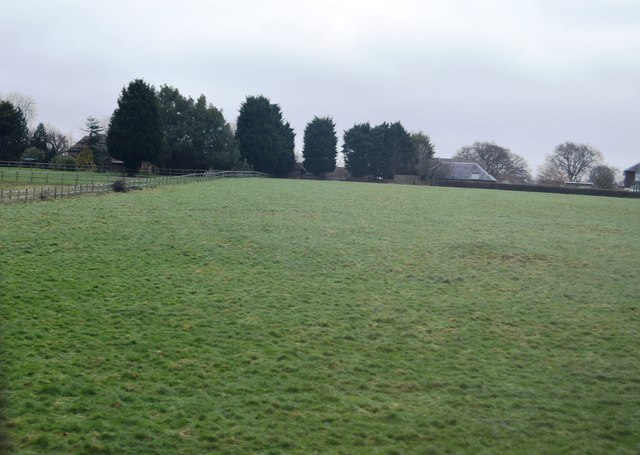
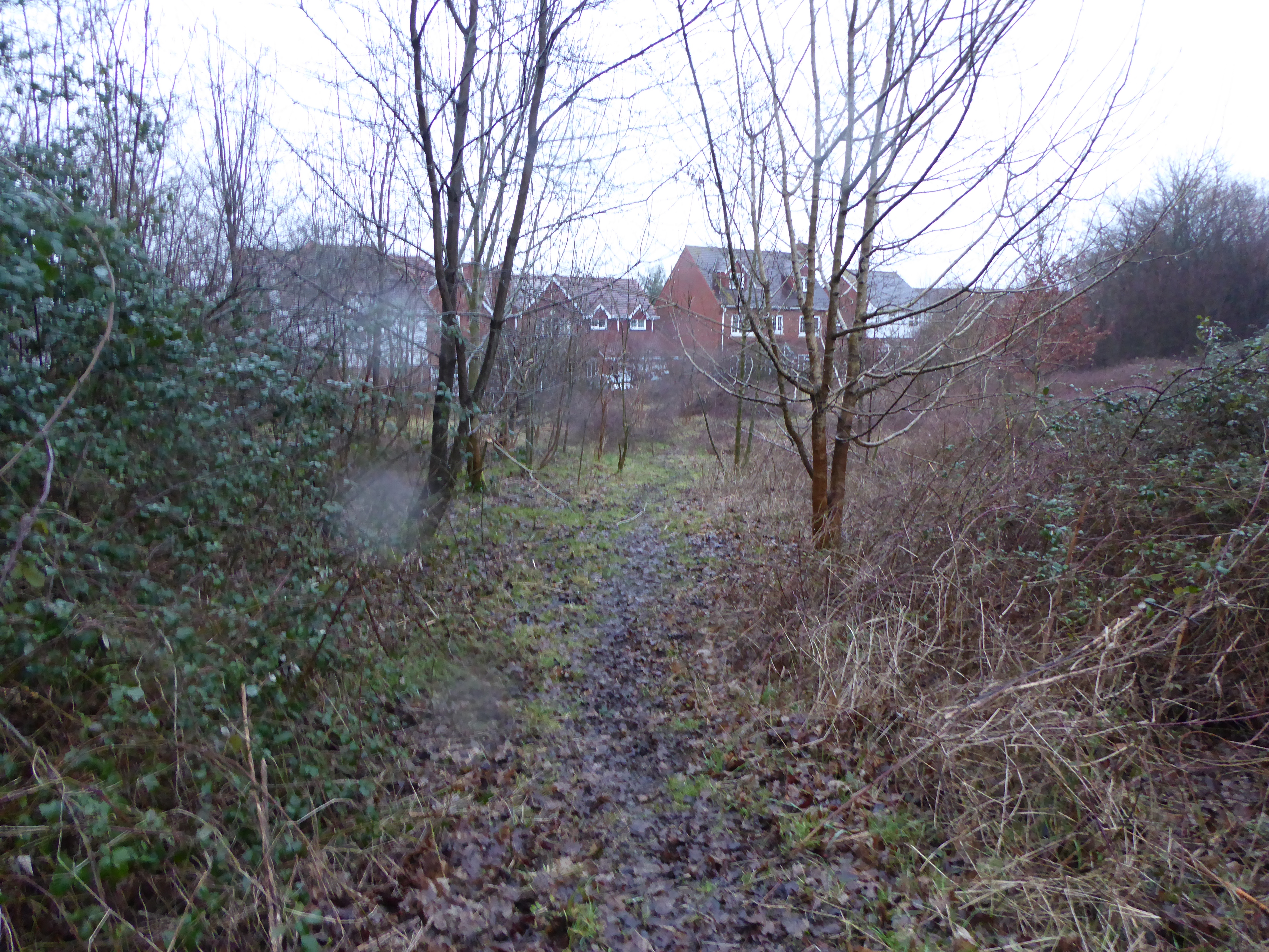
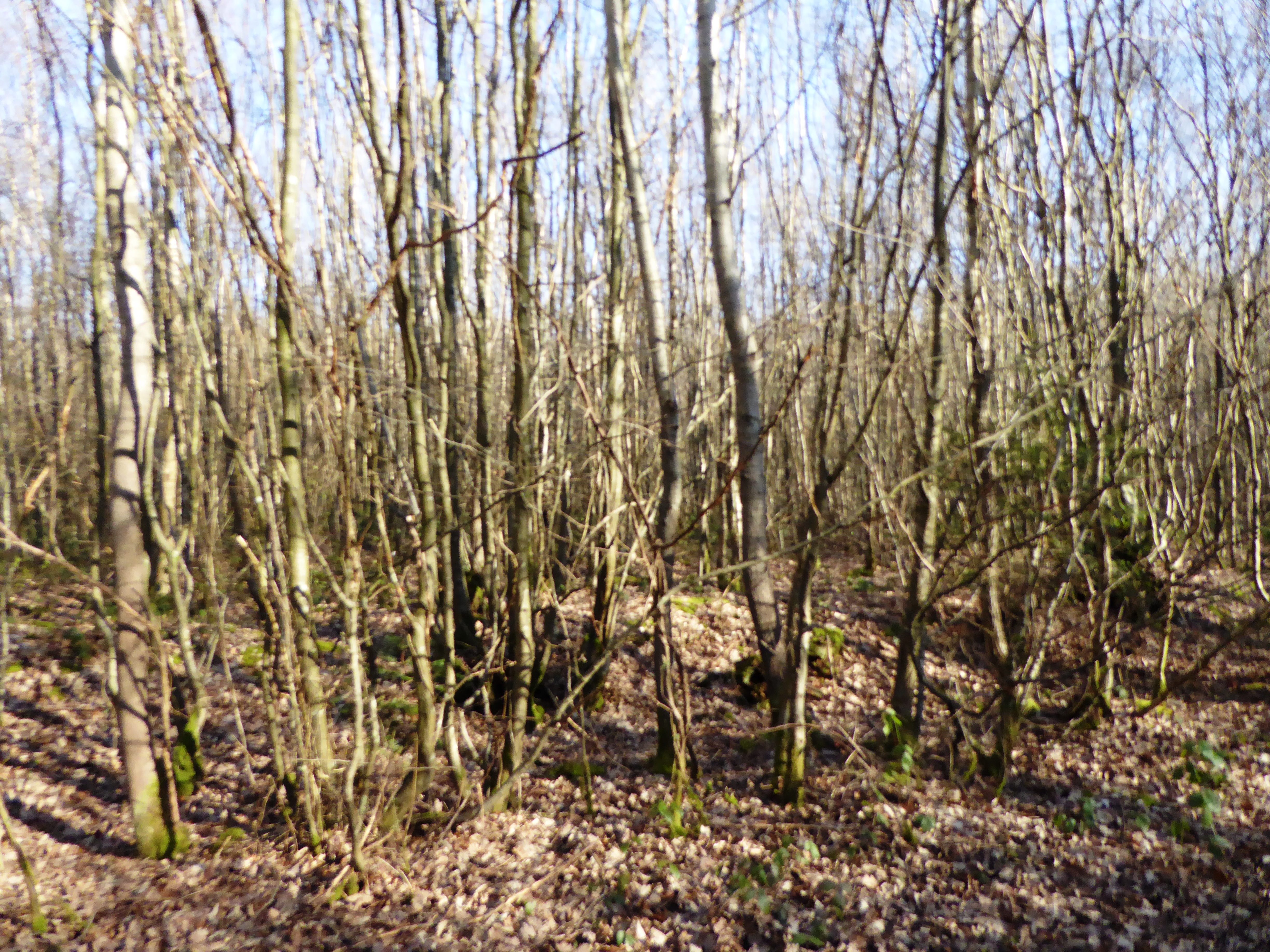
The wood is characterized by a dense canopy of towering oak, beech, and ash trees, which provide ample shade and create a serene atmosphere. The forest floor is covered with a thick layer of fallen leaves, creating a vibrant carpet of colors during the autumn months. Snails Wood is also home to a variety of wildflowers, including bluebells and primroses, which bloom in abundance during the springtime.

The forest is teeming with wildlife, offering a haven for numerous species. Visitors may spot deer, foxes, and squirrels roaming freely amidst the trees. Birdwatchers can enjoy the melodious tunes of songbirds such as thrushes, robins, and finches, as well as marvel at the occasional sight of woodpeckers and owls.

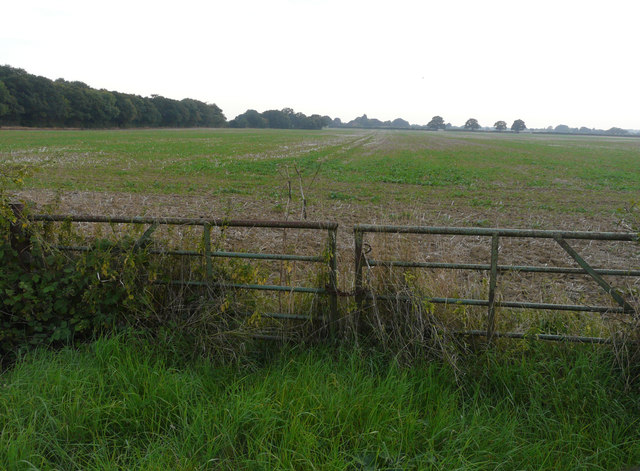
Snails Wood is crisscrossed by a network of well-maintained trails, allowing visitors to explore the forest at their own pace. These pathways offer breathtaking views of the surrounding countryside, with glimpses of rolling hills and meandering streams.

The wood is easily accessible, located just a short drive from the town of Kent. Amenities such as parking facilities, picnic areas, and public toilets are available nearby. Snails Wood is a perfect destination for those seeking tranquility and a connection with nature in the heart of Kent.

If you have any feedback on the listing, please let us know in the comments section below.

Snails Wood Images

Images are sourced within 2km of 51.117527/0.82323855 or Grid Reference TQ9739. Thanks to Geograph Open Source API. All images are credited.

Looking north-northwest along Church Lane The white-painted, weather-boarded house, in the distance, is Quince Cottage -  a grade II listed building dating from the 18th century
<span class="nowrap"><a title="http://www.britishlistedbuildings.co.uk/en-181144-quince-cottage-shadoxhurst-kent#.VdIaTxuFPcc" rel="nofollow ugc noopener" href="http://www.britishlistedbuildings.co.uk/en-181144-quince-cottage-shadoxhurst-kent#.VdIaTxuFPcc">Link</a><img style="margin-left:2px;" alt="External link" title="External link - shift click to open in new window" src="https://s1.geograph.org.uk/img/external.png" width="10" height="10"/></span>
Looking north-northwest along Church Lane
The white-painted, weather-boarded house, in the distance, is Quince Cottage - a grade II listed building dating from the 18th century LinkExternal link
Wymondham, Woodchurch Road Planning permission was granted by Ashford Borough Council under application number 15/00373/AS for the “demolition of existing dwelling and erection of four new dwellings and four double garages with access and fencing to road frontage”.

By July 2017, the site of the house had become a <a href="https://www.geograph.org.uk/photo/5486007">TQ9738 : Building site, Woodchurch Road</a>.
Wymondham, Woodchurch Road
Planning permission was granted by Ashford Borough Council under application number 15/00373/AS for the “demolition of existing dwelling and erection of four new dwellings and four double garages with access and fencing to road frontage”. By July 2017, the site of the house had become a TQ9738 : Building site, Woodchurch Road.
Grazing by Ashford Rd
Bevenden House
Bevenden House
Barn Conversion, Lodge Place
Flat farmland by Ashford Rd
Shed and field near Frightsbridge Farm
Oak Fields, Woodchurch Road Compared with <a href="https://www.geograph.org.uk/photo/4607836">TQ9638 : Development of Shadoxhurst Garage site, Woodchurch Road</a>, the development, which was described in Ashford Borough Council’s planning application 14/00254/AS as the “erection of 17 new dwellings together with roads, access, sewers and external works”, is nearing completion.
Oak Fields, Woodchurch Road
Compared with TQ9638 : Development of Shadoxhurst Garage site, Woodchurch Road, the development, which was described in Ashford Borough Council’s planning application 14/00254/AS as the “erection of 17 new dwellings together with roads, access, sewers and external works”, is nearing completion.
Oak View Compared with <a href="https://www.geograph.org.uk/photo/4607836">TQ9638 : Development of Shadoxhurst Garage site, Woodchurch Road</a>, this is now the road into the development called Oak Fields, which was described in Ashford Borough Council’s planning application 14/00254/AS as the “erection of 17 new dwellings together with roads, access, sewers and external works”, is nearing completion.
Oak View
Compared with TQ9638 : Development of Shadoxhurst Garage site, Woodchurch Road, this is now the road into the development called Oak Fields, which was described in Ashford Borough Council’s planning application 14/00254/AS as the “erection of 17 new dwellings together with roads, access, sewers and external works”, is nearing completion.
Building site, Woodchurch Road This is where <a href="https://www.geograph.org.uk/photo/4884290">TQ9738 : Wymondham, Woodchurch Road</a> once stood. Planning permission was granted by Ashford Borough Council under application number 15/00373/AS for the “demolition of existing dwelling and erection of four new dwellings and four double garages with access and fencing to road frontage”.
Building site, Woodchurch Road
This is where TQ9738 : Wymondham, Woodchurch Road once stood. Planning permission was granted by Ashford Borough Council under application number 15/00373/AS for the “demolition of existing dwelling and erection of four new dwellings and four double garages with access and fencing to road frontage”.
Farmland, Chilmington Green Road This will form part of a vast development, to be known as Chilmington Green, for which planning permission has been granted by Ashford Borough Council under application number 12/00400/AS. This is  an “outline application for a Comprehensive Mixed Use Development comprising: up to 5,750 residential units, in a mix of sizes, types and tenures; up to 10,000 m² (gross external floor space) of Class Bl use; up to 9,000 m² (gross external floor space) of Class Al to A5 uses; Education (including a secondary school of up to 8 ha and up to four primary schools of up to 2.1 ha each); Community Uses (class Dl) up to 7,000 m² (gross external floor space); Leisure Uses (class D2) up to 6,000 m² (gross external floor space); Provision of local recycling facilities; Provision of areas of formal and informal open space; Installation of appropriate utilities infrastructure as required to serve the development, including flood attenuation works, SUDS, water supply and wastewater infrastructure, gas supply, electricity supply (including substations), telecommunications infrastructure and renewable energy infrastructure (including CHP in the District Centre); Transport infrastructure, including provision of three accesses on to the A28, an access on to Coulter Road/Cuckoo Lane, other connections on to the local road network, and a network of internal roads, footpaths and cycle routes; New planting and landscaping, both within the Proposed Development and on its boundaries, and ecological enhancement works; and associated ground works where appearance, landscaping, layout and scale are reserved for future approval and where access is reserved for future approval with the exception of the three accesses on to the A28 and the access on to Coulter Road/Cuckoo Lane”.

Here, there is a footpath crossing a harvested field.
Farmland, Chilmington Green Road
This will form part of a vast development, to be known as Chilmington Green, for which planning permission has been granted by Ashford Borough Council under application number 12/00400/AS. This is an “outline application for a Comprehensive Mixed Use Development comprising: up to 5,750 residential units, in a mix of sizes, types and tenures; up to 10,000 m² (gross external floor space) of Class Bl use; up to 9,000 m² (gross external floor space) of Class Al to A5 uses; Education (including a secondary school of up to 8 ha and up to four primary schools of up to 2.1 ha each); Community Uses (class Dl) up to 7,000 m² (gross external floor space); Leisure Uses (class D2) up to 6,000 m² (gross external floor space); Provision of local recycling facilities; Provision of areas of formal and informal open space; Installation of appropriate utilities infrastructure as required to serve the development, including flood attenuation works, SUDS, water supply and wastewater infrastructure, gas supply, electricity supply (including substations), telecommunications infrastructure and renewable energy infrastructure (including CHP in the District Centre); Transport infrastructure, including provision of three accesses on to the A28, an access on to Coulter Road/Cuckoo Lane, other connections on to the local road network, and a network of internal roads, footpaths and cycle routes; New planting and landscaping, both within the Proposed Development and on its boundaries, and ecological enhancement works; and associated ground works where appearance, landscaping, layout and scale are reserved for future approval and where access is reserved for future approval with the exception of the three accesses on to the A28 and the access on to Coulter Road/Cuckoo Lane”. Here, there is a footpath crossing a harvested field.
Farmland, Chilmington Green Road This will form part of a vast development, to be known as Chilmington Green, for which planning permission has been granted by Ashford Borough Council under application number 12/00400/AS. This is  an “outline application for a Comprehensive Mixed Use Development comprising: up to 5,750 residential units, in a mix of sizes, types and tenures; up to 10,000 m² (gross external floor space) of Class Bl use; up to 9,000 m² (gross external floor space) of Class Al to A5 uses; Education (including a secondary school of up to 8 ha and up to four primary schools of up to 2.1 ha each); Community Uses (class Dl) up to 7,000 m² (gross external floor space); Leisure Uses (class D2) up to 6,000 m² (gross external floor space); Provision of local recycling facilities; Provision of areas of formal and informal open space; Installation of appropriate utilities infrastructure as required to serve the development, including flood attenuation works, SUDS, water supply and wastewater infrastructure, gas supply, electricity supply (including substations), telecommunications infrastructure and renewable energy infrastructure (including CHP in the District Centre); Transport infrastructure, including provision of three accesses on to the A28, an access on to Coulter Road/Cuckoo Lane, other connections on to the local road network, and a network of internal roads, footpaths and cycle routes; New planting and landscaping, both within the Proposed Development and on its boundaries, and ecological enhancement works; and associated ground works where appearance, landscaping, layout and scale are reserved for future approval and where access is reserved for future approval with the exception of the three accesses on to the A28 and the access on to Coulter Road/Cuckoo Lane”.

Here, Stubbscross Wood lies to the left of the field.
Farmland, Chilmington Green Road
This will form part of a vast development, to be known as Chilmington Green, for which planning permission has been granted by Ashford Borough Council under application number 12/00400/AS. This is an “outline application for a Comprehensive Mixed Use Development comprising: up to 5,750 residential units, in a mix of sizes, types and tenures; up to 10,000 m² (gross external floor space) of Class Bl use; up to 9,000 m² (gross external floor space) of Class Al to A5 uses; Education (including a secondary school of up to 8 ha and up to four primary schools of up to 2.1 ha each); Community Uses (class Dl) up to 7,000 m² (gross external floor space); Leisure Uses (class D2) up to 6,000 m² (gross external floor space); Provision of local recycling facilities; Provision of areas of formal and informal open space; Installation of appropriate utilities infrastructure as required to serve the development, including flood attenuation works, SUDS, water supply and wastewater infrastructure, gas supply, electricity supply (including substations), telecommunications infrastructure and renewable energy infrastructure (including CHP in the District Centre); Transport infrastructure, including provision of three accesses on to the A28, an access on to Coulter Road/Cuckoo Lane, other connections on to the local road network, and a network of internal roads, footpaths and cycle routes; New planting and landscaping, both within the Proposed Development and on its boundaries, and ecological enhancement works; and associated ground works where appearance, landscaping, layout and scale are reserved for future approval and where access is reserved for future approval with the exception of the three accesses on to the A28 and the access on to Coulter Road/Cuckoo Lane”. Here, Stubbscross Wood lies to the left of the field.
Farmland, Chilmington Green Road This will form part of a vast development, to be known as Chilmington Green, for which planning permission has been granted by Ashford Borough Council under application number 12/00400/AS. This is  an “outline application for a Comprehensive Mixed Use Development comprising: up to 5,750 residential units, in a mix of sizes, types and tenures; up to 10,000 m² (gross external floor space) of Class Bl use; up to 9,000 m² (gross external floor space) of Class Al to A5 uses; Education (including a secondary school of up to 8 ha and up to four primary schools of up to 2.1 ha each); Community Uses (class Dl) up to 7,000 m² (gross external floor space); Leisure Uses (class D2) up to 6,000 m² (gross external floor space); Provision of local recycling facilities; Provision of areas of formal and informal open space; Installation of appropriate utilities infrastructure as required to serve the development, including flood attenuation works, SUDS, water supply and wastewater infrastructure, gas supply, electricity supply (including substations), telecommunications infrastructure and renewable energy infrastructure (including CHP in the District Centre); Transport infrastructure, including provision of three accesses on to the A28, an access on to Coulter Road/Cuckoo Lane, other connections on to the local road network, and a network of internal roads, footpaths and cycle routes; New planting and landscaping, both within the Proposed Development and on its boundaries, and ecological enhancement works; and associated ground works where appearance, landscaping, layout and scale are reserved for future approval and where access is reserved for future approval with the exception of the three accesses on to the A28 and the access on to Coulter Road/Cuckoo Lane”.

Here, the hedge, on the far side of the field, runs along the road called Long Length.
Farmland, Chilmington Green Road
This will form part of a vast development, to be known as Chilmington Green, for which planning permission has been granted by Ashford Borough Council under application number 12/00400/AS. This is an “outline application for a Comprehensive Mixed Use Development comprising: up to 5,750 residential units, in a mix of sizes, types and tenures; up to 10,000 m² (gross external floor space) of Class Bl use; up to 9,000 m² (gross external floor space) of Class Al to A5 uses; Education (including a secondary school of up to 8 ha and up to four primary schools of up to 2.1 ha each); Community Uses (class Dl) up to 7,000 m² (gross external floor space); Leisure Uses (class D2) up to 6,000 m² (gross external floor space); Provision of local recycling facilities; Provision of areas of formal and informal open space; Installation of appropriate utilities infrastructure as required to serve the development, including flood attenuation works, SUDS, water supply and wastewater infrastructure, gas supply, electricity supply (including substations), telecommunications infrastructure and renewable energy infrastructure (including CHP in the District Centre); Transport infrastructure, including provision of three accesses on to the A28, an access on to Coulter Road/Cuckoo Lane, other connections on to the local road network, and a network of internal roads, footpaths and cycle routes; New planting and landscaping, both within the Proposed Development and on its boundaries, and ecological enhancement works; and associated ground works where appearance, landscaping, layout and scale are reserved for future approval and where access is reserved for future approval with the exception of the three accesses on to the A28 and the access on to Coulter Road/Cuckoo Lane”. Here, the hedge, on the far side of the field, runs along the road called Long Length.
Farmland, Chilmington Green Road This will form part of a vast development, to be known as Chilmington Green, for which planning permission has been granted by Ashford Borough Council under application number 12/00400/AS. This is  an “outline application for a Comprehensive Mixed Use Development comprising: up to 5,750 residential units, in a mix of sizes, types and tenures; up to 10,000 m² (gross external floor space) of Class Bl use; up to 9,000 m² (gross external floor space) of Class Al to A5 uses; Education (including a secondary school of up to 8 ha and up to four primary schools of up to 2.1 ha each); Community Uses (class Dl) up to 7,000 m² (gross external floor space); Leisure Uses (class D2) up to 6,000 m² (gross external floor space); Provision of local recycling facilities; Provision of areas of formal and informal open space; Installation of appropriate utilities infrastructure as required to serve the development, including flood attenuation works, SUDS, water supply and wastewater infrastructure, gas supply, electricity supply (including substations), telecommunications infrastructure and renewable energy infrastructure (including CHP in the District Centre); Transport infrastructure, including provision of three accesses on to the A28, an access on to Coulter Road/Cuckoo Lane, other connections on to the local road network, and a network of internal roads, footpaths and cycle routes; New planting and landscaping, both within the Proposed Development and on its boundaries, and ecological enhancement works; and associated ground works where appearance, landscaping, layout and scale are reserved for future approval and where access is reserved for future approval with the exception of the three accesses on to the A28 and the access on to Coulter Road/Cuckoo Lane”.
Farmland, Chilmington Green Road
This will form part of a vast development, to be known as Chilmington Green, for which planning permission has been granted by Ashford Borough Council under application number 12/00400/AS. This is an “outline application for a Comprehensive Mixed Use Development comprising: up to 5,750 residential units, in a mix of sizes, types and tenures; up to 10,000 m² (gross external floor space) of Class Bl use; up to 9,000 m² (gross external floor space) of Class Al to A5 uses; Education (including a secondary school of up to 8 ha and up to four primary schools of up to 2.1 ha each); Community Uses (class Dl) up to 7,000 m² (gross external floor space); Leisure Uses (class D2) up to 6,000 m² (gross external floor space); Provision of local recycling facilities; Provision of areas of formal and informal open space; Installation of appropriate utilities infrastructure as required to serve the development, including flood attenuation works, SUDS, water supply and wastewater infrastructure, gas supply, electricity supply (including substations), telecommunications infrastructure and renewable energy infrastructure (including CHP in the District Centre); Transport infrastructure, including provision of three accesses on to the A28, an access on to Coulter Road/Cuckoo Lane, other connections on to the local road network, and a network of internal roads, footpaths and cycle routes; New planting and landscaping, both within the Proposed Development and on its boundaries, and ecological enhancement works; and associated ground works where appearance, landscaping, layout and scale are reserved for future approval and where access is reserved for future approval with the exception of the three accesses on to the A28 and the access on to Coulter Road/Cuckoo Lane”.
Land behind the King’s Head, Woodchurch Road Planning permission has been granted by Ashford Borough Council under application number 15/01496/AS for “residential development comprising 19 dwellings including 15 x 2 storey dwellings and  4 x 1 bedroom flats with associated infrastructure and services including garaging/provision for parking, open space, landscaping and a sustainable urban drainage system”. 

Two footpaths converge here and their routes, through the grass, have been marked out by the lengths of polythene affixed to small, wooden posts. The King’s Head is out of sight, as it is hidden by the two, large trees on the left.
Land behind the King’s Head, Woodchurch Road
Planning permission has been granted by Ashford Borough Council under application number 15/01496/AS for “residential development comprising 19 dwellings including 15 x 2 storey dwellings and 4 x 1 bedroom flats with associated infrastructure and services including garaging/provision for parking, open space, landscaping and a sustainable urban drainage system”. Two footpaths converge here and their routes, through the grass, have been marked out by the lengths of polythene affixed to small, wooden posts. The King’s Head is out of sight, as it is hidden by the two, large trees on the left.
Land behind the King’s Head, Woodchurch Road Planning permission has been granted by Ashford Borough Council under application number 15/01496/AS for “residential development comprising 19 dwellings including 15 x 2 storey dwellings and  4 x 1 bedroom flats with associated infrastructure and services including garaging/provision for parking, open space, landscaping and a sustainable urban drainage system”. 

A footpath has been marked out, through the grass, by lengths of polythene affixed to small, wooden posts. The King’s Head is out of sight, as it is hidden by the two, large trees to the left of the distant houses, at the end of the footpath.
Land behind the King’s Head, Woodchurch Road
Planning permission has been granted by Ashford Borough Council under application number 15/01496/AS for “residential development comprising 19 dwellings including 15 x 2 storey dwellings and 4 x 1 bedroom flats with associated infrastructure and services including garaging/provision for parking, open space, landscaping and a sustainable urban drainage system”. A footpath has been marked out, through the grass, by lengths of polythene affixed to small, wooden posts. The King’s Head is out of sight, as it is hidden by the two, large trees to the left of the distant houses, at the end of the footpath.
Farmland, Bethersden Road
Show me another place!

Snails Wood is located at Grid Ref: TQ9739 (Lat: 51.117527, Lng: 0.82323855)

Administrative County: Kent

District: Ashford

Police Authority: Kent

What 3 Words

///sweetened.actor.slugs. Near Shadoxhurst, Kent

Related Wikis

Stubbs Cross

Stubbs Cross is a hamlet in the civil parish of Kingsnorth near Ashford in Kent, England. The area runs from a cross road at Ashford Road that leads to...

RAF Ashford

Royal Air Force Ashford or more simply RAF Ashford is a former Royal Air Force Advanced Landing Ground in Kent, England. The landing ground is located...

Shadoxhurst

Shadoxhurst () is a civil parish and a village on the remnant forest the Kent Weald, near Ashford in Kent, England between the Greensand Ridge and Romney...

Chilmington Green

Chilmington Green was a hamlet on the edge of the Kentish Weald comprising 10 listed buildings. It is south-west of the town of Ashford. The population...

Ashford Community Woodland

Ashford Community Woodland is a 13.8-hectare (34-acre) Local Nature Reserve on the western outskirts of Ashford in Kent. It is owned and managed by Ashford...

Stone Wood

Stone Wood is a nature reserve south-west of Shadoxhurst in Kent. It is managed by Kent Wildlife Trust (KWT).This site was clear felled in 1992 and left...

John Wallis Academy

The John Wallis Church of England Academy is a mixed all-through school with academy status in Ashford, Kent. It was known as Christ Church Church of England...

Ashford (UK Parliament constituency)

Ashford is a constituency in Kent created in 1885 and represented in the House of Commons of the UK Parliament since 1997 by Damian Green, a Conservative...

Nearby Amenities

Located within 500m of 51.117527,0.82323855
The data included in this document is from www.openstreetmap.org. The data is made available under ODbL.

Have you been to Snails Wood?

Leave your review of Snails Wood below (or comments, questions and feedback).