Barker's Plantation

Wood, Forest in Norfolk Breckland

England

Barker's Plantation

Forest Track Junction Forest track junction in the forest known as Hills And Holes near to Great Hockham, Norfolk.
Forest Track Junction Credit: Keith Evans

Barker's Plantation, located in Norfolk, is a vast woodland area known for its dense forests and diverse plant life. Spanning over several acres, this plantation is a haven for nature enthusiasts and researchers alike.

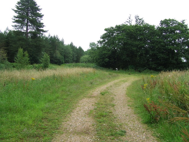
The plantation is characterized by its towering trees, predominantly consisting of oak, beech, and pine. These trees create a lush canopy, providing shade and shelter for a wide variety of flora and fauna. The forest floor is adorned with an array of plants, including ferns, wildflowers, and mosses, creating a vibrant and picturesque landscape.

The plantation is home to numerous species of wildlife, making it a popular spot for birdwatching and animal observation. Bird species such as woodpeckers, owls, and songbirds can be spotted perched on the branches, while mammals like deer, foxes, and rabbits roam freely through the undergrowth.

Several walking trails and nature paths wind their way through Barker's Plantation, allowing visitors to explore the beauty of the woodland at their own pace. These trails offer a chance to immerse oneself in the tranquility of nature, away from the hustle and bustle of city life.

Barker's Plantation also serves as an important research site for botanists and ecologists. The diverse range of plant species provides an opportunity for studying ecological interactions and conducting conservation efforts.

In conclusion, Barker's Plantation in Norfolk offers a captivating natural setting with its dense forests, diverse plant life, and abundant wildlife. Whether it be for leisurely walks, birdwatching, or scientific research, this woodland sanctuary promises a truly immersive and enriching experience.

If you have any feedback on the listing, please let us know in the comments section below.

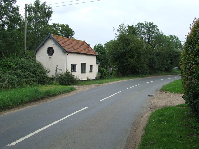
Barker's Plantation Images

Images are sourced within 2km of 52.471927/0.90031709 or Grid Reference TL9789. Thanks to Geograph Open Source API. All images are credited.

Forest Track Junction Forest track junction in the forest known as Hills And Holes near to Great Hockham, Norfolk.
Forest Track Junction
Forest track junction in the forest known as Hills And Holes near to Great Hockham, Norfolk.
Dense Forest Dense forest Hills And Holes near to Great Hockham, Norfolk.
Dense Forest
Dense forest Hills And Holes near to Great Hockham, Norfolk.
Forest Track Forest track Hills And Holes near to Great Hockham, Norfolk.
Forest Track
Forest track Hills And Holes near to Great Hockham, Norfolk.
Water Filled Pingos Water filled pingos in the forest of Hills And Holes near to Great Hockham, Norfolk.
Water Filled Pingos
Water filled pingos in the forest of Hills And Holes near to Great Hockham, Norfolk.
Water Filled Pingos Water filled pingos in the forest of Hills And Holes near to Great Hockham, Norfolk.
Water Filled Pingos
Water filled pingos in the forest of Hills And Holes near to Great Hockham, Norfolk.
Five Bar Gate Five bar metal gate near to Great Hockham, Norfolk.
Five Bar Gate
Five bar metal gate near to Great Hockham, Norfolk.
Open Grassland Open Grassland near to Great Hockham, Norfolk.
Open Grassland
Open Grassland near to Great Hockham, Norfolk.
Hill House Hill House as seen from the public footpath near to Great Hockham, Norfolk.
Hill House
Hill House as seen from the public footpath near to Great Hockham, Norfolk.
Road And Footpath Sign The B1111 looking south and footpath sign near to Great Hockham, Norfolk.
Road And Footpath Sign
The B1111 looking south and footpath sign near to Great Hockham, Norfolk.
Slow Warning sign on the B1111 near to Great Hockham, Norfolk.
Slow
Warning sign on the B1111 near to Great Hockham, Norfolk.
Both Ways Slow warning in both directions on the B1111 near to Larling, Norfolk.
Both Ways
Slow warning in both directions on the B1111 near to Larling, Norfolk.
Church Road Church Road Of the Watton Road at Larling, Norfolk.
Church Road
Church Road Of the Watton Road at Larling, Norfolk.
Entering Larling Entering Larling, Norfolk on the B1111.
Entering Larling
Entering Larling, Norfolk on the B1111.
Former Methodist Chapel Former Methodist chapel next to the Watton Road at Larling, Norfolk.
Former Methodist Chapel
Former Methodist chapel next to the Watton Road at Larling, Norfolk.
Combine Graveyard Two old and rusting combine harvesters near to Larling, Norfolk.
Combine Graveyard
Two old and rusting combine harvesters near to Larling, Norfolk.
Heater Plantation Path through Heater Plantation near to Larling, Norfolk.
Heater Plantation
Path through Heater Plantation near to Larling, Norfolk.
After The Flowers Field of rape waiting to be harvested near to Snetterton, Norfolk.
After The Flowers
Field of rape waiting to be harvested near to Snetterton, Norfolk.
Bradcar Road Bradcar Road as seen from Church Road near to Snetterton, Norfolk.
Bradcar Road
Bradcar Road as seen from Church Road near to Snetterton, Norfolk.
Show me another place!

Barker's Plantation is located at Grid Ref: TL9789 (Lat: 52.471927, Lng: 0.90031709)

Administrative County: Norfolk

District: Breckland

Police Authority: Norfolk

What 3 Words

///humidity.unpainted.wake. Near East Harling, Norfolk

Related Wikis

Have you been to Barker's Plantation?

Leave your review of Barker's Plantation below (or comments, questions and feedback).