Bill's Wood

Wood, Forest in Norfolk North Norfolk

England

Bill's Wood

River Stiffkey, Stiffkey A view across the River Stiffkey from the Wells Road outside the Red Lion pub at the beginning of May. In the distance can be seen Home Hill.
River Stiffkey, Stiffkey Credit: Adam Smith

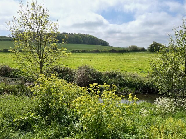
Bill's Wood is a picturesque woodland located in Norfolk, England. Spread across an area of approximately 50 acres, it is a thriving forest that offers a serene and tranquil escape for nature enthusiasts and outdoor lovers. The woodland is situated in a rural area, surrounded by rolling hills and meadows, adding to its natural charm.

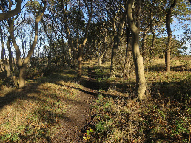
Bill's Wood is predominantly composed of deciduous trees, including oak, birch, and beech, which create a rich and diverse habitat for a variety of wildlife. The forest floor is covered in a carpet of lush green vegetation, with a wide range of wildflowers and ferns adding pops of color to the landscape. The wood is also home to several species of birds, such as woodpeckers, owls, and warblers, providing a delightful symphony of sounds for visitors.

Known for its well-maintained walking trails, Bill's Wood offers a range of paths that wind through the forest, allowing visitors to explore its beauty at their own pace. These trails are suitable for all levels of fitness, making it an ideal destination for families, hikers, and nature enthusiasts alike. Additionally, the wood features several picnic areas and benches, providing the perfect spot for a leisurely lunch while enjoying the peaceful surroundings.

Bill's Wood is managed by the local forestry commission, ensuring its preservation and conservation for future generations. Regular maintenance work is carried out to enhance the woodland's biodiversity and protect its unique ecosystem. With its idyllic setting and abundance of natural beauty, Bill's Wood is a hidden gem in Norfolk, inviting visitors to immerse themselves in the wonders of nature.

If you have any feedback on the listing, please let us know in the comments section below.

Bill's Wood Images

Images are sourced within 2km of 52.951761/0.92584506 or Grid Reference TF9643. Thanks to Geograph Open Source API. All images are credited.

River Stiffkey, Stiffkey A view across the River Stiffkey from the Wells Road outside the Red Lion pub at the beginning of May. In the distance can be seen Home Hill.
River Stiffkey, Stiffkey
A view across the River Stiffkey from the Wells Road outside the Red Lion pub at the beginning of May. In the distance can be seen Home Hill.
Stiffkey village sign - one of four The sign is surmounted by a representation of a Stiffkey Blue or Stiffkey Blew, the  blue shelled cockles found locally. The main subject depicts a tern which are common in the area.
<a title="https://www.geograph.org.uk/photo/6707610" href="https://www.geograph.org.uk/photo/6707610">Link</a> <a title="https://www.geograph.org.uk/photo/6707614" href="https://www.geograph.org.uk/photo/6707614">Link</a> <a title="https://www.geograph.org.uk/photo/6707619" href="https://www.geograph.org.uk/photo/6707619">Link</a>
Stiffkey village sign - one of four
The sign is surmounted by a representation of a Stiffkey Blue or Stiffkey Blew, the blue shelled cockles found locally. The main subject depicts a tern which are common in the area. Link Link Link
Stiffkey village sign - one of four The sign is surmounted by a representation of a Stiffkey Blue or Stiffkey Blew, the  blue shelled cockles found locally. The main subject depicts a tern which are common in the area. Close-up <a href="https://www.geograph.org.uk/photo/7162206">TF9742 : Stiffkey village sign - one of four</a>
<a title="https://www.geograph.org.uk/photo/6707610" href="https://www.geograph.org.uk/photo/6707610">Link</a> <a title="https://www.geograph.org.uk/photo/6707614" href="https://www.geograph.org.uk/photo/6707614">Link</a> <a title="https://www.geograph.org.uk/photo/6707619" href="https://www.geograph.org.uk/photo/6707619">Link</a>
Stiffkey village sign - one of four
The sign is surmounted by a representation of a Stiffkey Blue or Stiffkey Blew, the blue shelled cockles found locally. The main subject depicts a tern which are common in the area. Close-up TF9742 : Stiffkey village sign - one of four Link Link Link
Warham Salt Marshes
Warham Salt Marshes
Circular track around whirlygig See <a href="https://www.geograph.org.uk/photo/952401">TF9543 : Whirlygig and circular track</a> for an explanation.
Circular track around whirlygig
See TF9543 : Whirlygig and circular track for an explanation.
Stiffkey Salt Marshes from Norfolk coast path
Static caravans by Highsands Creek camp site
Stiffkey Wood (Coneyford Plantation)
Hollow Lane towards the coast path
Hollow Lane
Hollow Lane
Path through Coneyford Plantation
St John the Baptist and St Mary's Church, Stiffkey See; <span class="nowrap"><a title="https://en.wikipedia.org/wiki/St_John_and_St_Mary,_Stiffkey" rel="nofollow ugc noopener" href="https://en.wikipedia.org/wiki/St_John_and_St_Mary,_Stiffkey">Link</a><img style="margin-left:2px;" alt="External link" title="External link - shift click to open in new window" src="https://s1.geograph.org.uk/img/external.png" width="10" height="10"/></span>
St John the Baptist and St Mary's Church, Stiffkey
See; LinkExternal link
Church Street, Stiffkey Old school behind the village sign - Stewkey
Church Street, Stiffkey
Old school behind the village sign - Stewkey
Stiffkey Meals Wetlands between Stewkey and the sea.
Stiffkey Meals
Wetlands between Stewkey and the sea.
Peddars Way and Norfolk Coastal Path at Stiffkey
Peddars Way and Norfolk Coastal Path Looking out towards the Holkham National Nature Reserve
Peddars Way and Norfolk Coastal Path
Looking out towards the Holkham National Nature Reserve
Marshland by the River Stiffkey
Stiffkey village sign Approaching Stiffkey from the west on Wells Road
Stiffkey village sign
Approaching Stiffkey from the west on Wells Road
Show me another place!

Bill's Wood is located at Grid Ref: TF9643 (Lat: 52.951761, Lng: 0.92584506)

Administrative County: Norfolk

District: North Norfolk

Police Authority: Norfolk

What 3 Words

///showcases.jumps.dish. Near Wells-next-the-Sea, Norfolk

Related Wikis

Stiffkey

Stiffkey () is a village and civil parish on the north coast of the English county of Norfolk. It is situated on the A149 coast road, some 6 km (3.7 mi...

St John and St Mary, Stiffkey

St John the Baptist and St Mary's Church is the parish church of Stiffkey in the English county of Norfolk. It is dedicated to St John the Baptist and...

Cockthorpe

Cockthorpe is a village and former civil parish, now in the parish of Binham, in the North Norfolk district, in the county of Norfolk, England. It is 5...

Stiffkey Valley

Stiffkey Valley is a 44.4-hectare (110-acre) biological Site of Special Scientific Interest east of Wells-next-the-Sea in Norfolk. It is in the Norfolk...

Cockthorpe Common, Stiffkey

Cockthorpe Common, Stiffkey is a 7.1-hectare (18-acre) biological Site of Special Scientific Interest east of Wells-next-the-Sea in Norfolk. It is in the...

Morston Cliff

Morston Cliff is a 1-hectare (2.5-acre) geological Site of Special Scientific Interest east of Wells-next-the-Sea in Norfolk. It is a Geological Conservation...

River Stiffkey

The River Stiffkey is a chalk stream running through an area of north Norfolk, England from its source near Swanton Novers to flow out into the North Sea...
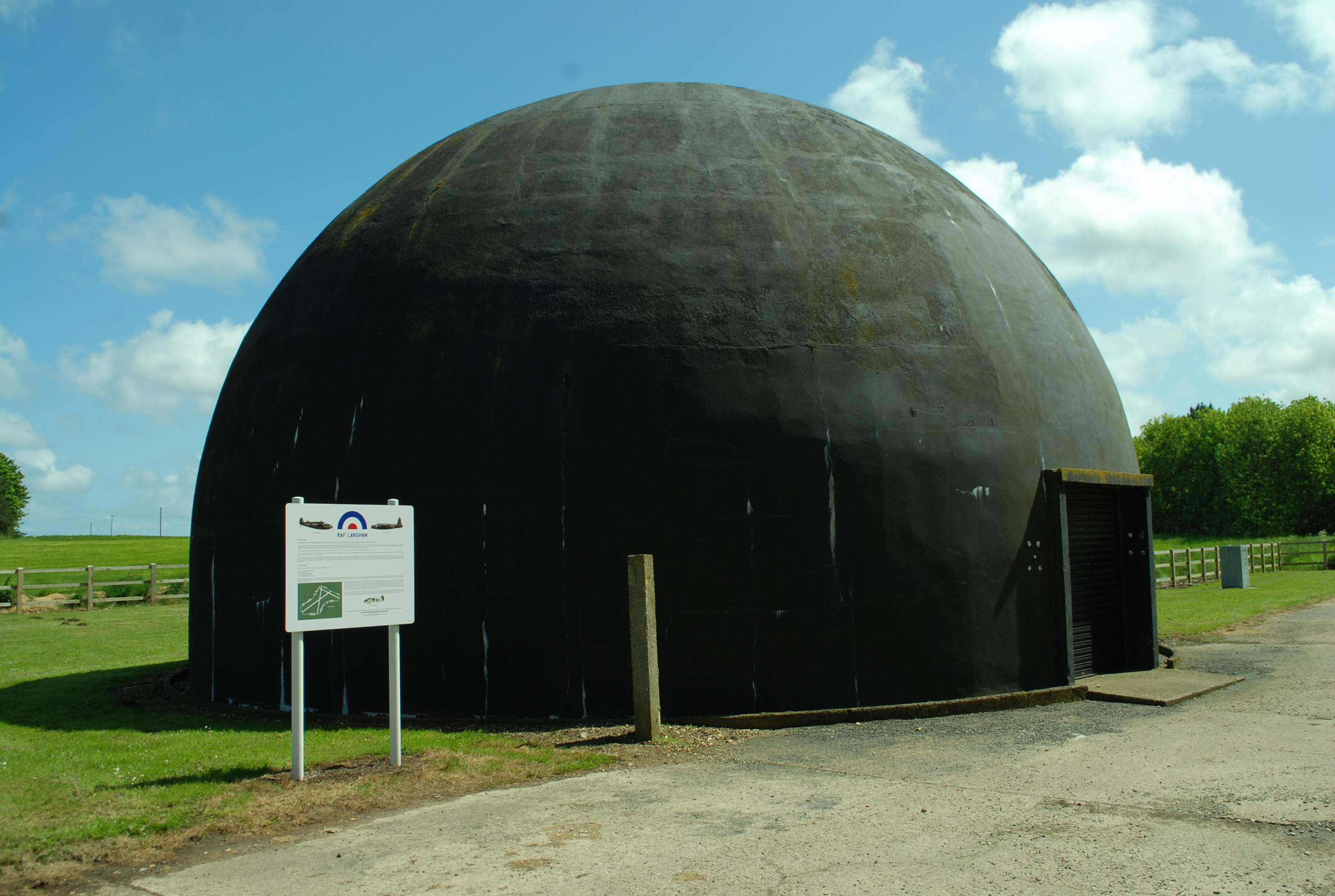
RAF Langham

Royal Air Force Langham or more simply RAF Langham is a former Royal Air Force station, located at Langham, 27.2 miles (43.8 km) northwest of Norwich in...

Nearby Amenities

Located within 500m of 52.951761,0.92584506
Booth: K6
Covered: booth
Disused Amenity: telephone
Man Made: telephone_box
Lat/Long: 52.9498122/0.9309835
Stores, adj
Naptan AtcoCode: 2900S451
Naptan Bearing: NW
Naptan BusStopType: CUS
Naptan CommonName: Stores
Naptan Indicator: adj
Naptan Locality: Stiffkey
Naptan NaptanCode: nfodtwmw
Naptan Street: A149
Naptan Verified: no
Source: naptan_import
Lat/Long: 52.9493449/0.931968
Bus Stop
Greenway, adj
Naptan AtcoCode: 2900S453
Naptan Bearing: E
Naptan CommonName: Greenway
Naptan Indicator: adj
Naptan Landmark: Greenway
Naptan Locality: Stiffkey
Naptan NaptanCode: nfodtwpd
Naptan Street: Wells Road
Naptan Verified: no
Source: naptan_import
Lat/Long: 52.9521823/0.9247771
Bus Stop
No 69, adj
Kerb: raised
Naptan AtcoCode: 2900S456
Naptan Bearing: W
Naptan CommonName: No 69
Naptan Indicator: adj
Naptan Landmark: No. 69
Naptan Locality: Stiffkey
Naptan NaptanCode: nfodtwpm
Naptan Street: Wells Road
Naptan Verified: no
Source: naptan_import
Tactile Paving: yes
Timetable: yes
Lat/Long: 52.9520285/0.9237606
Toilets
Designation: destination
Lat/Long: 52.956229/0.9253385
The Saltings
Addr Housename: The Saltings
Addr Housenumber: 68
Addr Street: Wells Road
Tourism: guest_house
Lat/Long: 52.9521082/0.9257133
Stiffkey Bed & Breakfast
Addr Housenumber: 10
Addr Street: Greenway
Tourism: guest_house
Website: www.stiffkeybedandbreakfast.com
Lat/Long: 52.9532684/0.9245012
Tourism: picnic_site
Lat/Long: 52.9515523/0.9321482
Information: board
Tourism: information
Lat/Long: 52.9522071/0.9247607
Tourism: picnic_site
Lat/Long: 52.9514666/0.9320838
Stiffkey Antique & Lamp Shop
Shop: antiques
Lat/Long: 52.9499557/0.9307716
Addr Housenumber: 7
Addr Street: Greenway
Lat/Long: 52.9526578/0.9245868
Post Office
Stiffkey Post Office
Addr City: Wells Next The Sea
Addr Housename: The Stores
Addr Postcode: NR23 1QH
Addr Street: Wells Road
Addr Village: Stiffkey
Brand: Post Office
Brand Wikidata: Q1783168
Contact Website: https://www.postoffice.co.uk/branch-finder/368136x/stiffkey
Opening Hours: Mo,Tu,Th,Fr 08:00-17:00; We 08:00-12:30; Sa 08:00-16:30
Operator: Post Office Ltd
Ref Pol Id: 13920
Source Addr: pol_branch_list_2018-02
Source Opening Hours: pol_branch_list_2018-02
Lat/Long: 52.9493094/0.9318604
Barrier: stile
Step Count: 2
Lat/Long: 52.947909/0.9263654
Barrier: stile
Step Count: 2
Lat/Long: 52.9487388/0.9300076
Barrier: stile
Step Count: 2
Lat/Long: 52.949738/0.9283422
Traffic Calming: bump
Lat/Long: 52.953591/0.9239789
Post Box
Collection Times: Mo-Fr 09:00; Sa 07:00
Operator: Royal Mail
Post Box Mounting: pier
Post Box Type: lamp
Ref: NR23 2319D
Royal Cypher: EIIR
Royal Cypher Wikidata: Q33102113
Source: survey
Survey Date: 2019-09-16
Lat/Long: 52.95219/0.924768
Tourism: viewpoint
Lat/Long: 52.9482452/0.9278941
Note: The definitive statements says FP1 should continue in a southerly direction for a bit before joining FP12 again but I couldn't find the way on the ground
Lat/Long: 52.9484625/0.9228046
Barrier: stile
Step Count: 2
Lat/Long: 52.9485091/0.9227435
Barrier: stile
Step Count: 2
Lat/Long: 52.9489245/0.9221199
Barrier: stile
Step Count: 2
Lat/Long: 52.9484088/0.9306876
Bench
Backrest: yes
Colour: brown
Inscription: Summer 2009 / This seat was kindly donated to / the village of Stiffkey by / My & Mrs Peter Stoner
Material: wood
Lat/Long: 52.9510858/0.9282763
The data included in this document is from www.openstreetmap.org. The data is made available under ODbL.

Have you been to Bill's Wood?

Leave your review of Bill's Wood below (or comments, questions and feedback).