Bayley Wood

Wood, Forest in Kent Ashford

England

Bayley Wood

Flat farmland by Ashford Rd
Flat farmland by Ashford Rd Credit: N Chadwick

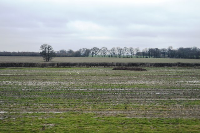
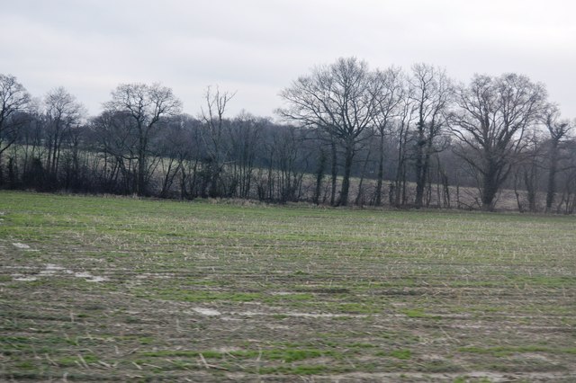
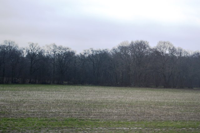
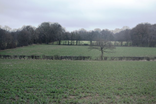
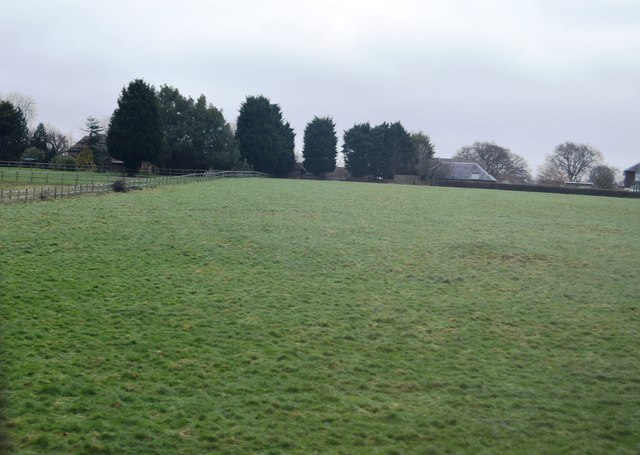
Bayley Wood, located in Kent, is a beautiful forest with a rich history and diverse ecosystem. Covering an area of approximately 100 hectares, it is known for its tranquil atmosphere and stunning natural beauty. The woodland is part of the larger Bayley Wood complex, which also includes the adjacent Blean Woods and Thornden Woods.

The forest is home to a wide variety of tree species, including oak, ash, beech, and birch, as well as an array of native wildlife. Visitors can spot numerous bird species, such as woodpeckers, owls, and warblers, making it a popular destination for birdwatching enthusiasts. Additionally, the forest is inhabited by mammals like deer, foxes, and badgers, adding to the biodiversity of the area.

Bayley Wood has a long history, dating back to medieval times when it was used as a hunting ground for local nobility. The forest was also a crucial resource for timber production during the industrial revolution. Today, it is managed by the Forestry Commission, ensuring its preservation and sustainability for future generations.

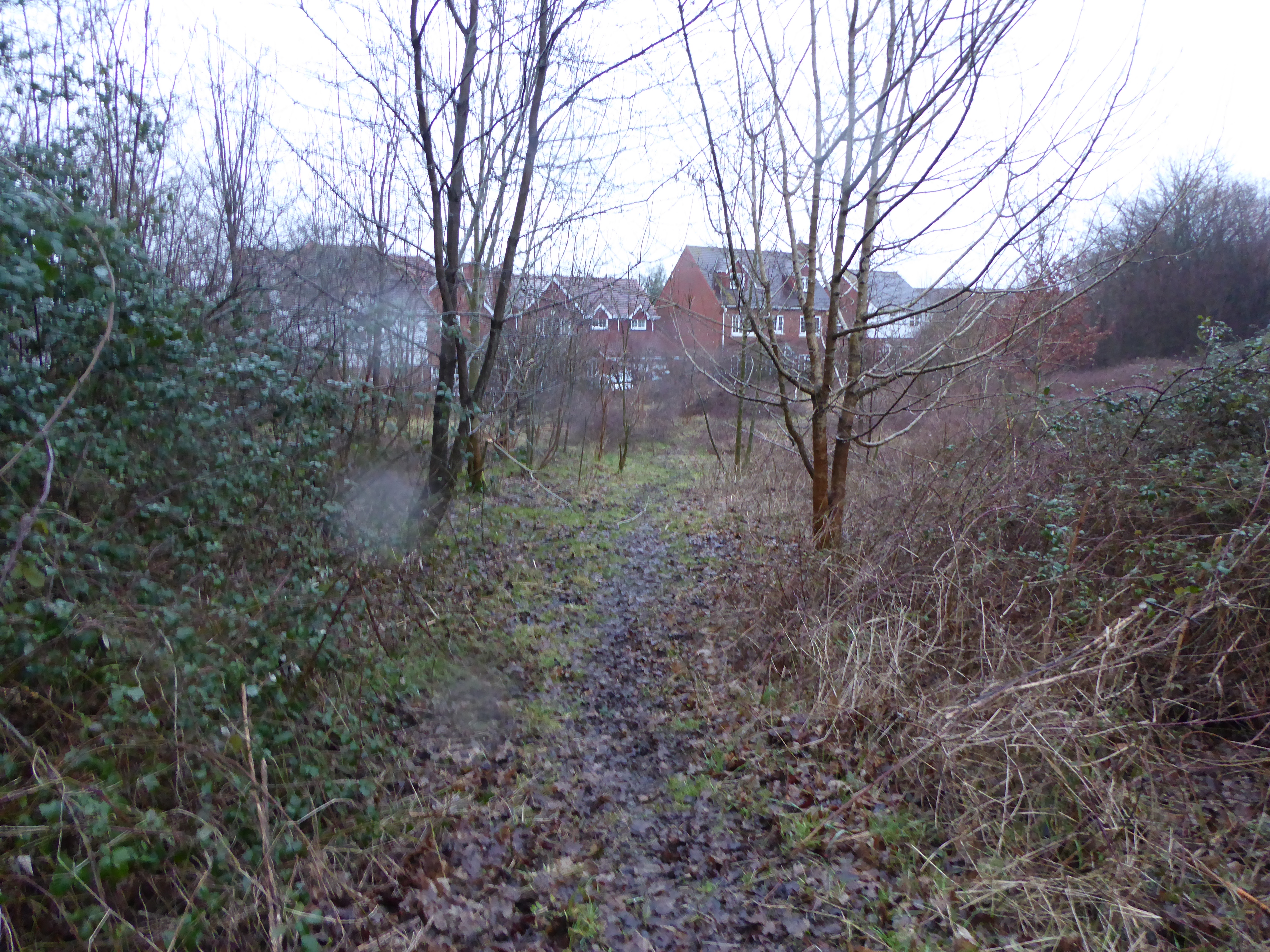
The woodland offers a range of recreational activities for visitors to enjoy. There are several walking trails and paths that wind through the forest, providing opportunities for peaceful walks and exploration. Picnic areas are available for those looking to relax amidst nature, and designated camping spots cater to overnight visitors.

Overall, Bayley Wood is a picturesque forest in Kent that offers a serene escape from the hustle and bustle of everyday life. Its combination of natural beauty, wildlife diversity, and historical significance make it an ideal destination for nature lovers and history enthusiasts alike.

If you have any feedback on the listing, please let us know in the comments section below.

Bayley Wood Images

Images are sourced within 2km of 51.127932/0.80499126 or Grid Reference TQ9640. Thanks to Geograph Open Source API. All images are credited.

Flat farmland by Ashford Rd
Two trees in a hedge
Trees along a small stream
Wetland Wood
Wetland Wood
Tree in a hedge
Tree in a hedge
Two trees in a hedge
Grazing by Ashford Rd
Bevenden House
Bevenden House
Barn Conversion, Lodge Place
Flat farmland by Ashford Rd
Farmland, Chilmington Green Road This will form part of a vast development, to be known as Chilmington Green, for which planning permission has been granted by Ashford Borough Council under application number 12/00400/AS. This is  an “outline application for a Comprehensive Mixed Use Development comprising: up to 5,750 residential units, in a mix of sizes, types and tenures; up to 10,000 m² (gross external floor space) of Class Bl use; up to 9,000 m² (gross external floor space) of Class Al to A5 uses; Education (including a secondary school of up to 8 ha and up to four primary schools of up to 2.1 ha each); Community Uses (class Dl) up to 7,000 m² (gross external floor space); Leisure Uses (class D2) up to 6,000 m² (gross external floor space); Provision of local recycling facilities; Provision of areas of formal and informal open space; Installation of appropriate utilities infrastructure as required to serve the development, including flood attenuation works, SUDS, water supply and wastewater infrastructure, gas supply, electricity supply (including substations), telecommunications infrastructure and renewable energy infrastructure (including CHP in the District Centre); Transport infrastructure, including provision of three accesses on to the A28, an access on to Coulter Road/Cuckoo Lane, other connections on to the local road network, and a network of internal roads, footpaths and cycle routes; New planting and landscaping, both within the Proposed Development and on its boundaries, and ecological enhancement works; and associated ground works where appearance, landscaping, layout and scale are reserved for future approval and where access is reserved for future approval with the exception of the three accesses on to the A28 and the access on to Coulter Road/Cuckoo Lane”.

Here, there is a footpath crossing a harvested field.
Farmland, Chilmington Green Road
This will form part of a vast development, to be known as Chilmington Green, for which planning permission has been granted by Ashford Borough Council under application number 12/00400/AS. This is an “outline application for a Comprehensive Mixed Use Development comprising: up to 5,750 residential units, in a mix of sizes, types and tenures; up to 10,000 m² (gross external floor space) of Class Bl use; up to 9,000 m² (gross external floor space) of Class Al to A5 uses; Education (including a secondary school of up to 8 ha and up to four primary schools of up to 2.1 ha each); Community Uses (class Dl) up to 7,000 m² (gross external floor space); Leisure Uses (class D2) up to 6,000 m² (gross external floor space); Provision of local recycling facilities; Provision of areas of formal and informal open space; Installation of appropriate utilities infrastructure as required to serve the development, including flood attenuation works, SUDS, water supply and wastewater infrastructure, gas supply, electricity supply (including substations), telecommunications infrastructure and renewable energy infrastructure (including CHP in the District Centre); Transport infrastructure, including provision of three accesses on to the A28, an access on to Coulter Road/Cuckoo Lane, other connections on to the local road network, and a network of internal roads, footpaths and cycle routes; New planting and landscaping, both within the Proposed Development and on its boundaries, and ecological enhancement works; and associated ground works where appearance, landscaping, layout and scale are reserved for future approval and where access is reserved for future approval with the exception of the three accesses on to the A28 and the access on to Coulter Road/Cuckoo Lane”. Here, there is a footpath crossing a harvested field.
Farmland, Bethersden Road
Farmland, Criol Lane This will eventually form part of a vast development, to be known as Chilmington Green, for which planning permission has been granted by Ashford Borough Council under application number 12/00400/AS. This is  an “outline application for a Comprehensive Mixed Use Development comprising: up to 5,750 residential units, in a mix of sizes, types and tenures; up to 10,000 m² (gross external floor space) of Class Bl use; up to 9,000 m² (gross external floor space) of Class Al to A5 uses; Education (including a secondary school of up to 8 ha and up to four primary schools of up to 2.1 ha each); Community Uses (class Dl) up to 7,000 m² (gross external floor space); Leisure Uses (class D2) up to 6,000 m² (gross external floor space); Provision of local recycling facilities; Provision of areas of formal and informal open space; Installation of appropriate utilities infrastructure as required to serve the development, including flood attenuation works, SUDS, water supply and wastewater infrastructure, gas supply, electricity supply (including substations), telecommunications infrastructure and renewable energy infrastructure (including CHP in the District Centre); Transport infrastructure, including provision of three accesses on to the A28, an access on to Coulter Road/Cuckoo Lane, other connections on to the local road network, and a network of internal roads, footpaths and cycle routes; New planting and landscaping, both within the Proposed Development and on its boundaries, and ecological enhancement works; and associated ground works where appearance, landscaping, layout and scale are reserved for future approval and where access is reserved for future approval with the exception of the three accesses on to the A28 and the access on to Coulter Road/Cuckoo Lane”.
Farmland, Criol Lane
This will eventually form part of a vast development, to be known as Chilmington Green, for which planning permission has been granted by Ashford Borough Council under application number 12/00400/AS. This is an “outline application for a Comprehensive Mixed Use Development comprising: up to 5,750 residential units, in a mix of sizes, types and tenures; up to 10,000 m² (gross external floor space) of Class Bl use; up to 9,000 m² (gross external floor space) of Class Al to A5 uses; Education (including a secondary school of up to 8 ha and up to four primary schools of up to 2.1 ha each); Community Uses (class Dl) up to 7,000 m² (gross external floor space); Leisure Uses (class D2) up to 6,000 m² (gross external floor space); Provision of local recycling facilities; Provision of areas of formal and informal open space; Installation of appropriate utilities infrastructure as required to serve the development, including flood attenuation works, SUDS, water supply and wastewater infrastructure, gas supply, electricity supply (including substations), telecommunications infrastructure and renewable energy infrastructure (including CHP in the District Centre); Transport infrastructure, including provision of three accesses on to the A28, an access on to Coulter Road/Cuckoo Lane, other connections on to the local road network, and a network of internal roads, footpaths and cycle routes; New planting and landscaping, both within the Proposed Development and on its boundaries, and ecological enhancement works; and associated ground works where appearance, landscaping, layout and scale are reserved for future approval and where access is reserved for future approval with the exception of the three accesses on to the A28 and the access on to Coulter Road/Cuckoo Lane”.
Criol Lane looking northeast On the left is the gate overlooking <a href="https://www.geograph.org.uk/photo/5603679">TQ9739 : Farmland, Criol Lane</a> and on the right, the gate overlooking <a href="https://www.geograph.org.uk/photo/5603685">TQ9739 : Farmland, Criol Lane</a>. Eventually, the land beyond will form part of a vast development, to be known as Chilmington Green, for which planning permission has been granted by Ashford Borough Council under application number 12/00400/AS. This is  an “outline application for a Comprehensive Mixed Use Development comprising: up to 5,750 residential units, in a mix of sizes, types and tenures; up to 10,000 m² (gross external floor space) of Class Bl use; up to 9,000 m² (gross external floor space) of Class Al to A5 uses; Education (including a secondary school of up to 8 ha and up to four primary schools of up to 2.1 ha each); Community Uses (class Dl) up to 7,000 m² (gross external floor space); Leisure Uses (class D2) up to 6,000 m² (gross external floor space); Provision of local recycling facilities; Provision of areas of formal and informal open space; Installation of appropriate utilities infrastructure as required to serve the development, including flood attenuation works, SUDS, water supply and wastewater infrastructure, gas supply, electricity supply (including substations), telecommunications infrastructure and renewable energy infrastructure (including CHP in the District Centre); Transport infrastructure, including provision of three accesses on to the A28, an access on to Coulter Road/Cuckoo Lane, other connections on to the local road network, and a network of internal roads, footpaths and cycle routes; New planting and landscaping, both within the Proposed Development and on its boundaries, and ecological enhancement works; and associated ground works where appearance, landscaping, layout and scale are reserved for future approval and where access is reserved for future approval with the exception of the three accesses on to the A28 and the access on to Coulter Road/Cuckoo Lane”.
Criol Lane looking northeast
On the left is the gate overlooking TQ9739 : Farmland, Criol Lane and on the right, the gate overlooking TQ9739 : Farmland, Criol Lane. Eventually, the land beyond will form part of a vast development, to be known as Chilmington Green, for which planning permission has been granted by Ashford Borough Council under application number 12/00400/AS. This is an “outline application for a Comprehensive Mixed Use Development comprising: up to 5,750 residential units, in a mix of sizes, types and tenures; up to 10,000 m² (gross external floor space) of Class Bl use; up to 9,000 m² (gross external floor space) of Class Al to A5 uses; Education (including a secondary school of up to 8 ha and up to four primary schools of up to 2.1 ha each); Community Uses (class Dl) up to 7,000 m² (gross external floor space); Leisure Uses (class D2) up to 6,000 m² (gross external floor space); Provision of local recycling facilities; Provision of areas of formal and informal open space; Installation of appropriate utilities infrastructure as required to serve the development, including flood attenuation works, SUDS, water supply and wastewater infrastructure, gas supply, electricity supply (including substations), telecommunications infrastructure and renewable energy infrastructure (including CHP in the District Centre); Transport infrastructure, including provision of three accesses on to the A28, an access on to Coulter Road/Cuckoo Lane, other connections on to the local road network, and a network of internal roads, footpaths and cycle routes; New planting and landscaping, both within the Proposed Development and on its boundaries, and ecological enhancement works; and associated ground works where appearance, landscaping, layout and scale are reserved for future approval and where access is reserved for future approval with the exception of the three accesses on to the A28 and the access on to Coulter Road/Cuckoo Lane”.
Farmland, Criol Lane
Show me another place!

Bayley Wood is located at Grid Ref: TQ9640 (Lat: 51.127932, Lng: 0.80499126)

Administrative County: Kent

District: Ashford

Police Authority: Kent

What 3 Words

///yards.hungry.bounding. Near Shadoxhurst, Kent

Nearby Locations

Bayley Wood

Related Wikis

RAF Ashford

Royal Air Force Ashford or more simply RAF Ashford is a former Royal Air Force Advanced Landing Ground in Kent, England. The landing ground is located...

Chilmington Green

Chilmington Green was a hamlet on the edge of the Kentish Weald comprising 10 listed buildings. It is south-west of the town of Ashford. The population...

Ashford Community Woodland

Ashford Community Woodland is a 13.8-hectare (34-acre) Local Nature Reserve on the western outskirts of Ashford in Kent. It is owned and managed by Ashford...

Shadoxhurst

Shadoxhurst () is a civil parish and a village on the remnant forest the Kent Weald, near Ashford in Kent, England between the Greensand Ridge and Romney...

Hoad's Wood

Hoad's Wood is an 80.5-hectare (199-acre) biological Site of Special Scientific Interest west of Ashford in Kent.Natural England described the woodland...

Stubbs Cross

Stubbs Cross is a hamlet in the civil parish of Kingsnorth near Ashford in Kent, England. The area runs from a cross road at Ashford Road that leads to...

Great Chart

Great Chart is a village and former civil parish, now in the parish of Great Chart with Singleton, in the Ashford borough of Kent, England. The parish...

Great Chart with Singleton

Great Chart with Singleton is a civil parish in the Ashford district of Kent, England. The parish population is mostly concentrated in the ancient village...

Have you been to Bayley Wood?

Leave your review of Bayley Wood below (or comments, questions and feedback).