Forebridge

Settlement in Staffordshire Stafford

England

Forebridge

Entrance to St Chad's House Phlebotomy and Spiritual Centre is an unusual combination.
Entrance to St Chad's House Credit: Jonathan Hutchins

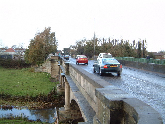
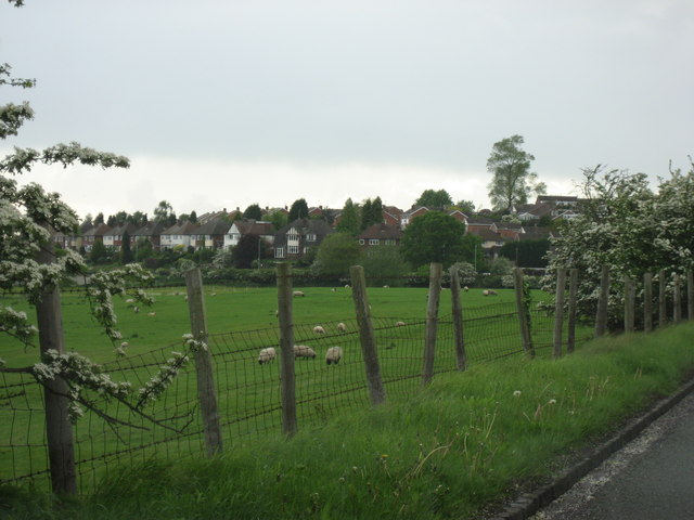
Forebridge is a small suburban area located in the county of Staffordshire, England. It is situated on the northern side of the town of Stafford, which lies approximately 26 miles north of Birmingham. The area is bounded by the River Sow to the east and the West Coast Main Line railway to the west.

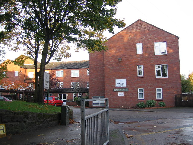
Forebridge is primarily a residential area, characterized by a mix of housing types, including terraced houses, semi-detached properties, and some larger detached homes. The architecture is predominantly Victorian and Edwardian, giving the area a charming and historic feel. The streets are lined with trees, providing a pleasant and green environment for residents.

The area benefits from excellent transport links, with the Stafford train station just a short walk away. This allows for easy access to major cities such as Birmingham, Manchester, and London. Forebridge is also well-served by local bus routes, providing convenient connections to other areas of Stafford.

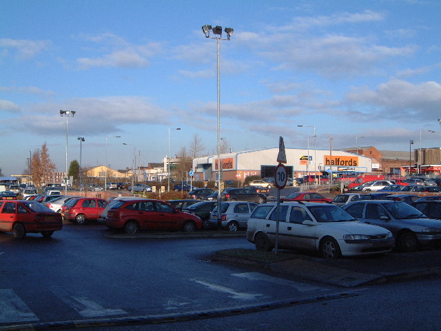
There are a number of amenities within close proximity to Forebridge, including shops, supermarkets, and local schools. The town center of Stafford is just a short distance away, offering a wider range of retail, dining, and entertainment options.

Overall, Forebridge offers a peaceful and picturesque suburban lifestyle, with its attractive housing, convenient location, and access to amenities. It is an ideal place for families, professionals, and retirees looking for a quieter residential neighborhood within easy reach of larger towns and cities.

If you have any feedback on the listing, please let us know in the comments section below.
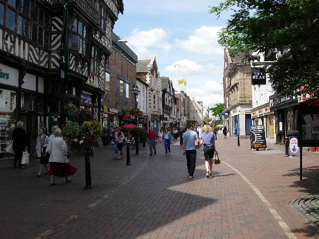
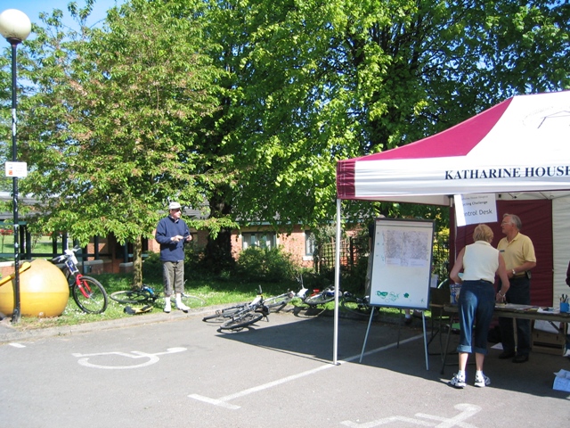
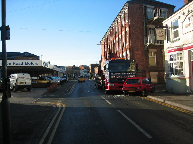
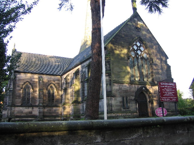
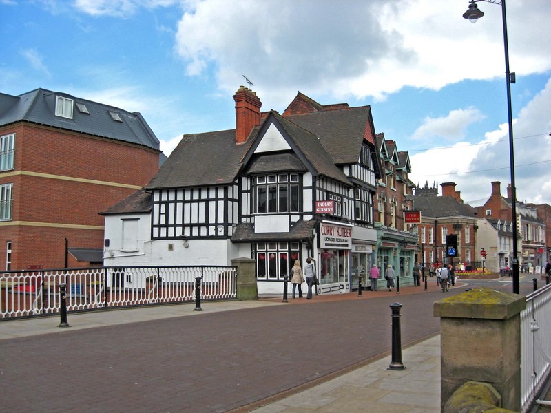
Forebridge Images

Images are sourced within 2km of 52.800893/-2.110678 or Grid Reference SJ9222. Thanks to Geograph Open Source API. All images are credited.

Entrance to St Chad's House Phlebotomy and Spiritual Centre is an unusual combination.
Entrance to St Chad's House
Phlebotomy and Spiritual Centre is an unusual combination.
Early Christmas house in Stafford The date is 24th November, but this household is illuminated and ready to go.
Early Christmas house in Stafford
The date is 24th November, but this household is illuminated and ready to go.
Flooded car park in Stafford Only the area of car park behind the photographer, and nearer to the Kingsmead retail stores, was usable. The rest, about 1.5 acres, was well under water and populated only by abandoned shopping trolleys.
Flooded car park in Stafford
Only the area of car park behind the photographer, and nearer to the Kingsmead retail stores, was usable. The rest, about 1.5 acres, was well under water and populated only by abandoned shopping trolleys.
Town centre, Stafford Built in 1596 using local oak by John Dorrington the building in the left foreground is said to be the largest timber framed town house in England.
Town centre, Stafford
Built in 1596 using local oak by John Dorrington the building in the left foreground is said to be the largest timber framed town house in England.
Katherine House Hospice Hospice in Stafford, preparing for charity bike ride.
Katherine House Hospice
Hospice in Stafford, preparing for charity bike ride.
The Hop Pole Sandon Road, Stafford
The Hop Pole
Sandon Road, Stafford
Broad Eye Mill Looking west with River Sow in foreground.  According to the information point the mill dates from 1795 and at 60ft high was (is?) the tallest in Staffordshire.
Broad Eye Mill
Looking west with River Sow in foreground. According to the information point the mill dates from 1795 and at 60ft high was (is?) the tallest in Staffordshire.
St. Paul's Church, Forebridge, Stafford This church is sited on the busy A34.
St. Paul's Church, Forebridge, Stafford
This church is sited on the busy A34.
Compton Close, near Stafford This development is one of many being used to fill in small unused spaces. It is not far from the large electrical works which used to be GEC.
Compton Close, near Stafford
This development is one of many being used to fill in small unused spaces. It is not far from the large electrical works which used to be GEC.
Bridge over the River Penk at Radford Bank A34 looking NW towards Stafford. The entire area is a flood plain and waters frequently reach the hedge in the distance.
Bridge over the River Penk at Radford Bank
A34 looking NW towards Stafford. The entire area is a flood plain and waters frequently reach the hedge in the distance.
Retail Park This is on the site of the old Stafford hospital
Retail Park
This is on the site of the old Stafford hospital
Rugby ground at Castlefields
Looking towards Castletown roundabout From beside the rugby ground
Looking towards Castletown roundabout
From beside the rugby ground
Rowley Park Stadium Rowley stadium, benefited greatly from lottery money
Rowley Park Stadium
Rowley stadium, benefited greatly from lottery money
Housing Typical picture of the area
Housing
Typical picture of the area
Holy Trinity, Baswich <span class="nowrap"><a title="http://www.achurchnearyou.com/berkswich-holy-trinity/" rel="nofollow ugc noopener" href="http://www.achurchnearyou.com/berkswich-holy-trinity/">Link</a><img style="margin-left:2px;" alt="External link" title="External link - shift click to open in new window" src="https://s1.geograph.org.uk/img/external.png" width="10" height="10"/></span>
Holy Trinity, Baswich
Looking across the fields to the Houses At the edge of Stafford
Looking across the fields to the Houses
At the edge of Stafford
Chetwynd Centre, Stafford In its first incarnation, it was the King Edward VI Grammar School, Stafford
Chetwynd Centre, Stafford
In its first incarnation, it was the King Edward VI Grammar School, Stafford
Show me another place!

Forebridge is located at Grid Ref: SJ9222 (Lat: 52.800893, Lng: -2.110678)

Administrative County: Staffordshire

District: Stafford

Police Authority: Staffordshire

What 3 Words

///maker.pools.skin. Near Stafford, Staffordshire

Nearby Locations

Forebridge

Related Wikis

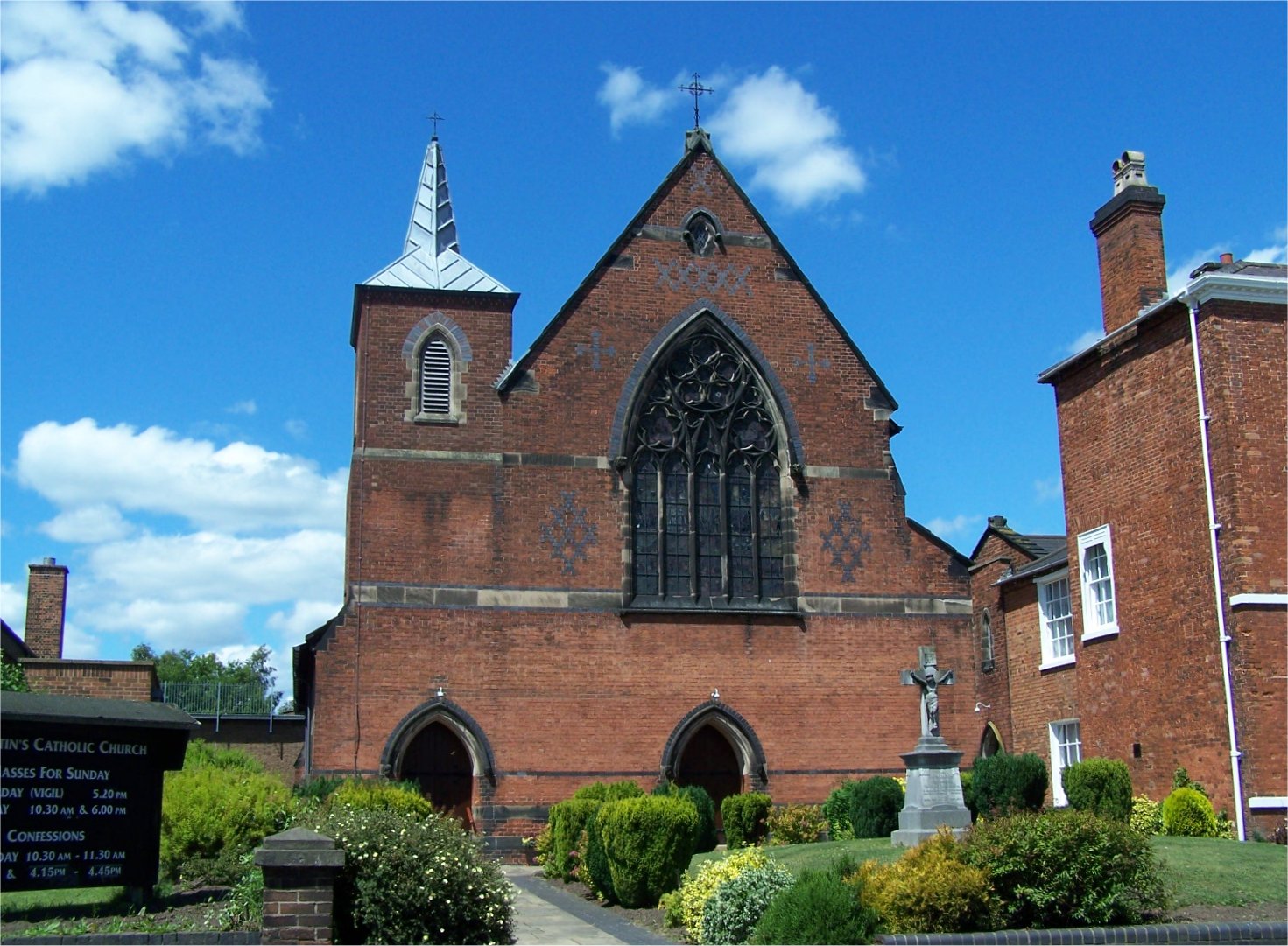
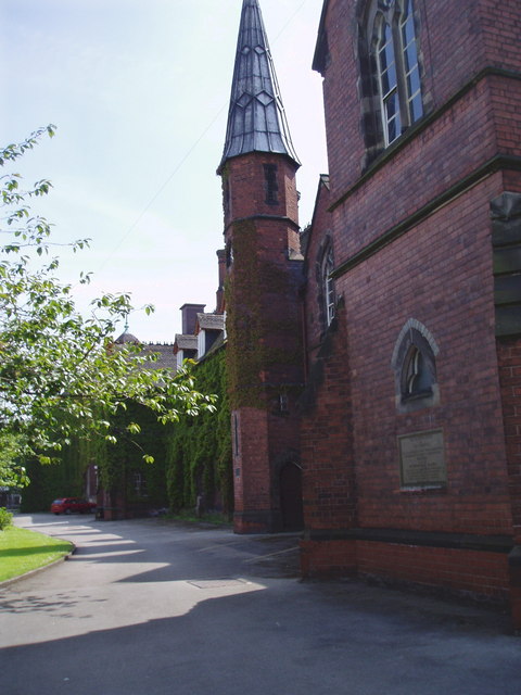
St Austin's Church, Stafford

St Austin's Church is a Roman Catholic parish church in Stafford, Staffordshire, England. It was built from 1861 to 1862 and designed by E. W. Pugin in...

Friars' Walk drill hall, Stafford

The Friars' Walk drill hall is a former military installation in Stafford. == History == The building was designed by Hanley, architects, as the headquarters...

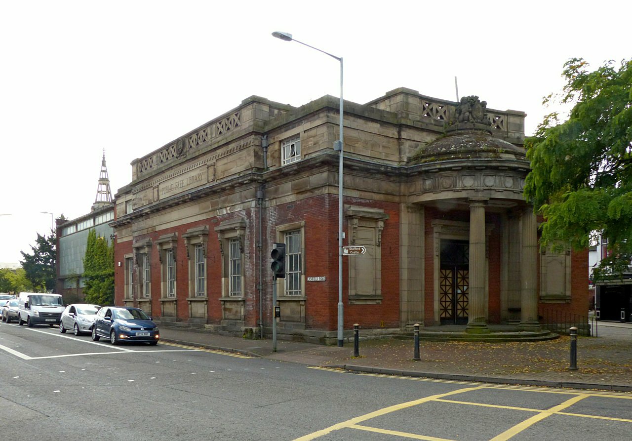
Old Borough Library, Stafford

The Old Borough Library is a former public library in Stafford, Staffordshire, England, opened in 1914. It is a Grade II listed building. == History... ==

Chetwynd Centre

The Chetwynd Centre is an extension of the six Stafford high schools and Stafford College. The Centre provides a range of courses not otherwise offered...

Picture House, Stafford

The Picture House is a pub and former cinema in Stafford, Staffordshire, England. It was built in 1913, and is a Grade II listed building; it is described...

Borough of Stafford

The Borough of Stafford is a local government district with borough status in Staffordshire, England. It is named after the town of Stafford. It also includes...

St Chad's Church, Stafford

St Chad's Church, on Greengate Street in the centre of Stafford, is a Grade II* listed Anglican church. Saint Chad, who died in 672, was the first Bishop...

William Salt Library

The William Salt Library is a library and archive, in Stafford, Staffordshire, England. Supported by Staffordshire County Council, it is a registered charity...

Nearby Amenities

Located within 500m of 52.800893,-2.110678
Crossing: traffic_signals
Lat/Long: 52.8011817/-2.1143512
Traffic Signals
Lat/Long: 52.8027761/-2.1138692
Traffic Signals
Lat/Long: 52.8035136/-2.113849
Traffic Signals
Lat/Long: 52.8036909/-2.1122082
Traffic Signals
Lat/Long: 52.8026871/-2.1129833
Traffic Signals
Lat/Long: 52.8039253/-2.115378
Traffic Signals
Traffic Signals: signal,traffic_lights
Lat/Long: 52.7996743/-2.1049996
Post Box
Brand: Royal Mail
Brand Wikidata: Q638098
Brand Wikipedia: en:Royal Mail
Collection Times: Mo-Fr 17:00; Sa 09:00
Description: ASDA INDOOR PILLAR BOX
Operator: Royal Mail
Operator Wikidata: Q638098
Ref: ST16 1601
Lat/Long: 52.8052762/-2.1098839
Pharmacy
Asda
Addr City: Stafford
Addr Country: GB
Addr Housename: ASDA
Addr Postcode: ST16 3TA
Addr Street: Queensway
Brand: Asda
Brand Wikidata: Q297410
Brand Wikipedia: en:Asda
Contact Phone: +44 1785 782000
Contact Website: https://storelocator.asda.com/west-midlands/stafford/queensway/pharmacy
Dispensing: yes
Healthcare: pharmacy
Opening Hours: Mo 08:00-23:00; Tu-Fr 07:00-23:00; Sa 07:00-10:00; Su 10:00-16:00
Operator: Asda Stores Ltd
Lat/Long: 52.8053303/-2.1097794
Atm
Source: extrapolation
Lat/Long: 52.804933/-2.1101299
Bus Stop
The Green
Bus: yes
Naptan AtcoCode: 3800C709201
Naptan Bearing: NW
Naptan CommonName: The Green
Naptan Indicator: Adj
Naptan Landmark: Friary Retail Park
Naptan PlusbusZoneRef: STAFFRD
Naptan Street: Lichfield Road
Naptan Verified: no
Public Transport: platform
Source: naptan_import
Lat/Long: 52.8030539/-2.1144751
Bus Stop
The Sun PH
Bench: yes
Bin: yes
Bus: yes
Naptan AtcoCode: 3800C709202
Naptan Bearing: SE
Naptan CommonName: The Sun PH
Naptan Indicator: Adj
Naptan Landmark: The Sun PH
Naptan PlusbusZoneRef: STAFFRD
Naptan Street: Lichfield Road
Naptan Verified: no
Public Transport: platform
Shelter: yes
Source: naptan_import
Tactile Paving: no
Lat/Long: 52.8036735/-2.1143968
Bus Stop
Alstom Works
Bus: yes
Naptan AtcoCode: 3800C718000
Naptan Bearing: NE
Naptan CommonName: Alstom Works
Naptan Indicator: Adj
Naptan Landmark: Alstom Works
Naptan PlusbusZoneRef: STAFFRD
Naptan Street: Lichfield Rd
Naptan Verified: no
Public Transport: platform
Source: naptan_import
Lat/Long: 52.7993901/-2.1083523
Bus Stop
Alexandra Road
Bus: yes
Naptan AtcoCode: 3800C725801
Naptan Bearing: SW
Naptan CommonName: Alexandra Road
Naptan Indicator: Adj
Naptan Landmark: Alexandra Road
Naptan PlusbusZoneRef: STAFFRD
Naptan Street: Wolverhampton Road
Naptan Verified: no
Public Transport: platform
Source: naptan_import
Lat/Long: 52.799852/-2.1152767
Bus Stop
Alexandra Road
Bus: yes
Naptan AtcoCode: 3800C725802
Naptan Bearing: NE
Naptan CommonName: St Austins Church
Naptan Indicator: Adj
Naptan Landmark: St Austins Church
Naptan PlusbusZoneRef: STAFFRD
Naptan Street: Wolverhampton Road
Naptan Verified: no
Public Transport: platform
Source: naptan_import
Lat/Long: 52.8000497/-2.1153217
Bus Stop
Pilgrim Street
Bus: yes
Naptan AtcoCode: 3800C726001
Naptan Bearing: NE
Naptan CommonName: Pilgrim Street
Naptan Indicator: Adj
Naptan Landmark: Pilgrim Street
Naptan PlusbusZoneRef: STAFFRD
Naptan Street: Newport Road
Naptan Verified: no
Public Transport: platform
Source: naptan_import
Lat/Long: 52.8037526/-2.1162512
Bus Stop
St Leonards Avenue
Bus: yes
Naptan AtcoCode: 3800C741401
Naptan Bearing: NW
Naptan CommonName: St Leonards Avenue
Naptan Indicator: Opp
Naptan Landmark: St Leonards Avenue
Naptan PlusbusZoneRef: STAFFRD
Naptan Street: Lichfield Rd
Naptan Verified: no
Public Transport: platform
Source: naptan_import
Lat/Long: 52.800094/-2.1063928
Bus Stop
St Leonards Avenue
Bench: yes
Bin: yes
Bus: yes
Naptan AtcoCode: 3800C741402
Naptan Bearing: SE
Naptan CommonName: St Leonards Avenue
Naptan Indicator: Adj
Naptan Landmark: Compton Close
Naptan PlusbusZoneRef: STAFFRD
Naptan Street: Lichfield Road
Naptan Verified: no
Public Transport: platform
Shelter: yes
Source: naptan_import
Lat/Long: 52.7997178/-2.1049086
Bus Stop
The Oval
Bench: no
Bin: yes
Bus: yes
Naptan AtcoCode: 3800C741501
Naptan Bearing: NW
Naptan CommonName: The Oval
Naptan Indicator: Opp
Naptan Landmark: The Oval
Naptan PlusbusZoneRef: STAFFRD
Naptan Street: Lichfield Road
Naptan Verified: no
Public Transport: platform
Shelter: no
Source: naptan_import
Tactile Paving: no
Lat/Long: 52.8020767/-2.1108327
Bus Stop
St Pauls Church
Bench: yes
Bin: yes
Bus: yes
Naptan AtcoCode: 3800C741502
Naptan Bearing: SE
Naptan CommonName: St Pauls Church
Naptan Indicator: Adj
Naptan Landmark: St Pauls Church
Naptan PlusbusZoneRef: STAFFRD
Naptan Street: Lichfield Road
Naptan Verified: no
Public Transport: platform
Shelter: yes
Source: naptan_import
Tactile Paving: no
Lat/Long: 52.8015355/-2.1094956
Bus Stop
Kwik Fit
Bus: yes
Naptan AtcoCode: 3800C753401
Naptan Bearing: NE
Naptan CommonName: Kwik Fit
Naptan Indicator: opp
Naptan Street: Queensway
Naptan Verified: no
Public Transport: platform
Source: naptan_import
Lat/Long: 52.8038449/-2.1137297
Bensons for Beds
Brand: Bensons for Beds
Brand Wikidata: Q4890299
Brand Wikipedia: en:Bensons for Beds
Contact Website: https://stores.bensonsforbeds.co.uk/stafford/unit-3a-the-hough-retail-park
Shop: bed
Lat/Long: 52.7989802/-2.1068269
ScS
Brand: ScS
Brand Wikidata: Q19654399
Brand Wikipedia: en:ScS
Shop: furniture
Lat/Long: 52.7989764/-2.1071287
Barrier: bollard
Lat/Long: 52.8035472/-2.1153244
Home Bargains
Addr Postcode: ST17 4LU
Addr Street: Lichfield Road
Brand: Home Bargains
Brand Wikidata: Q5888229
Brand Wikipedia: en:Home Bargains
Contact Website: https://storelocator.homebargains.co.uk/store/A411/Hough+Retail+&+Leisure+Park,+Stafford
Fhrs Id: 1195089
Shop: variety_store
Source Addr: FHRS Open Data
Lat/Long: 52.7989812/-2.1064376
B&Q
Brand: B&Q
Brand Wikidata: Q707602
Brand Wikipedia: en:B&Q
Contact Website: https://www.diy.com/store/1169
Shop: doityourself
Lat/Long: 52.7989867/-2.1052125
Post Box Type: pillar
Ref: ST17 4DA
Royal Cypher: GR
Lat/Long: 52.7998115/-2.115329
Traffic Signals
Lat/Long: 52.8049275/-2.1114215
Traffic Signals
Lat/Long: 52.8048459/-2.1114779
Mini Roundabout
Direction: clockwise
Lat/Long: 52.8046887/-2.1106225
Man Made: pumping_station
Pumping Station: wastewater
Lat/Long: 52.7992038/-2.1040941
Access: yes
Entrance: yes
Lat/Long: 52.8042401/-2.1145408
Access: yes
Entrance: yes
Lat/Long: 52.8042277/-2.1144563
Crossing
Crossing: unmarked
Crossing Island: no
Tactile Paving: yes
Lat/Long: 52.8040217/-2.1135091
Traffic Signals
Lat/Long: 52.8048966/-2.1116626
Fuel
Asda
Brand: Asda
Brand Wikidata: Q297410
Brand Wikipedia: en:Asda
Contact Facebook: https://www.facebook.com/asda/
Contact Twitter: asda
Contact Website: https://storelocator.asda.com/west-midlands/stafford/queensway
Opening Hours: 24/7
Operator: Asda Stores Ltd
Source: extrapolation
Lat/Long: 52.8045149/-2.1112104
Crossing
Button Operated: yes
Check Date Crossing: 2021-11-13
Crossing: traffic_signals
Crossing Ref: pelican
Tactile Paving: yes
Traffic Signals Vibration: yes
Lat/Long: 52.8028743/-2.1124616
Place Of Worship
Stafford Baptist Church
Addr Postcode: ST17 4BG
Addr Street: The Green
Denomination: baptist
Fhrs Id: 1196092
Religion: christian
Source Addr: FHRS Open Data
Lat/Long: 52.8034038/-2.1143687
Post Box
Collection Times: Mo-Fr 09:00; Sa 07:00
Description: THE GREEN BAILEY STREET
Post Box Type: pillar
Ref: ST16 122
Royal Cypher: GVIR
Royal Cypher Wikidata: Q33102169
Lat/Long: 52.8032052/-2.1144663
Doctors
Woverhampton Road Surgery
Healthcare: doctor
Lat/Long: 52.8025867/-2.1125186
Barrier: bollard
Lat/Long: 52.8036951/-2.115313
The Oval
Power: substation
Ref: 45313
Lat/Long: 52.8028562/-2.1105366
Pub
The Star and Garter
Addr Housenumber: 87
Addr Postcode: ST17 4AW
Addr Street: Wolverhampton Road
Fhrs Id: 1195854
Website: https://www.dorbiere.co.uk/the-star-and-garter/
Lat/Long: 52.8007729/-2.1148827
Telephone
Booth: KX300
Covered: booth
Mapillary: 971833103659719
Survey Date: 2021-06-24
Lat/Long: 52.799954/-2.1151322
Recycling
Lat/Long: 52.8010574/-2.1177119
Shop: motorcycle
Lat/Long: 52.798753/-2.1163778
Pub
The Bear and Pheasant
Addr Housenumber: 15-16
Addr Postcode: ST17 4AU
Addr Street: Friars Terrace
Fhrs Id: 1195864
Internet Access: wlan
Internet Access Fee: no
Source: Local Knowledge
Website: https://www.bearandpheasant.co.uk/
Lat/Long: 52.8013996/-2.1164885
Crossing
Button Operated: yes
Crossing: traffic_signals
Crossing Island: no
Crossing Ref: pelican
Tactile Paving: yes
Traffic Signals Vibration: yes
Lat/Long: 52.802795/-2.1128709
Crossing
Crossing: uncontrolled
Crossing Ref: zebra
Lat/Long: 52.8017254/-2.1179775
Crossing
Crossing: uncontrolled
Crossing Ref: zebra
Lat/Long: 52.8021354/-2.11725
Trafalgar Group
Business: Uk Business Energy
Lat/Long: 52.8012575/-2.1148439
Entrance: yes
Lat/Long: 52.8042945/-2.1133474
Entrance: yes
Lat/Long: 52.8043669/-2.1133519
Entrance: yes
Lat/Long: 52.8045276/-2.1132952
Entrance: yes
Lat/Long: 52.8042898/-2.113316
Entrance: yes
Lat/Long: 52.8047259/-2.1143927
Entrance: yes
Lat/Long: 52.8042072/-2.1133687
Railway: switch
Lat/Long: 52.7977765/-2.1158779
Bicycle Parking
Bicycle Parking: stands
Capacity: 2
Covered: no
Lat/Long: 52.8028804/-2.1155519
Bicycle Parking
Bicycle Parking: stands
Capacity: 3
Covered: no
Lat/Long: 52.8030976/-2.1154208
Entrance: main
Lat/Long: 52.8028824/-2.1150195
Street Lamp
Lat/Long: 52.8026982/-2.1139314
Street Lamp
Lat/Long: 52.8030087/-2.1148004
Street Lamp
Lat/Long: 52.8029601/-2.1146536
Street Lamp
Lat/Long: 52.8024797/-2.1143813
Street Lamp
Lat/Long: 52.8023812/-2.1142741
Street Lamp
Lat/Long: 52.8028474/-2.1140213
Street Lamp
Lat/Long: 52.8028174/-2.1142781
Street Lamp
Lat/Long: 52.8027067/-2.1143384
Street Lamp
Lat/Long: 52.8027553/-2.1145644
Street Lamp
Lat/Long: 52.8028105/-2.1148112
Street Lamp
Lat/Long: 52.8026661/-2.1151444
Street Lamp
Lat/Long: 52.8026143/-2.1149111
Street Lamp
Lat/Long: 52.8025636/-2.1146844
Entrance: main
Lat/Long: 52.8024558/-2.1149211
Entrance: main
Lat/Long: 52.8024752/-2.1150093
Entrance: main
Lat/Long: 52.8024162/-2.1146358
Entrance: exit
Lat/Long: 52.8023925/-2.1145236
Crossing
Crossing: zebra
Lat/Long: 52.8024989/-2.1147405
Crossing
Crossing: zebra
Lat/Long: 52.802624/-2.1146657
Crossing
Crossing: zebra
Lat/Long: 52.8028838/-2.1145029
Crossing
Crossing: unmarked
Crossing Island: no
Tactile Paving: yes
Lat/Long: 52.8001991/-2.1087387
Crossing: marked
Crossing Island: no
Not Crossing Ref: zebra
Tactile Paving: yes
Lat/Long: 52.7998038/-2.1092071
Crossing
Crossing: unmarked
Crossing Island: no
Tactile Paving: yes
Lat/Long: 52.7999919/-2.1089637
Give Way
Direction: forward
Lat/Long: 52.8000211/-2.1088497
Give Way
Direction: forward
Lat/Long: 52.8001995/-2.1087561
Crossing
Button Operated: yes
Crossing: traffic_signals
Crossing Island: no
Tactile Paving: yes
Traffic Signals Sound: yes
Traffic Signals Vibration: yes
Lat/Long: 52.8007599/-2.1082937
Crossing
Button Operated: yes
Crossing: traffic_signals
Crossing Island: no
Tactile Paving: yes
Traffic Signals Sound: yes
Traffic Signals Vibration: yes
Lat/Long: 52.8008016/-2.1079825
Crossing
Button Operated: yes
Crossing: traffic_signals
Crossing Island: no
Tactile Paving: yes
Traffic Signals Sound: yes
Traffic Signals Vibration: yes
Lat/Long: 52.800961/-2.1080525
Crossing
Button Operated: yes
Crossing: traffic_signals
Crossing Island: no
Tactile Paving: yes
Traffic Signals Sound: yes
Traffic Signals Vibration: yes
Lat/Long: 52.8009612/-2.1083185
Cycleway: asl
Direction: backward
Lat/Long: 52.8007814/-2.10794
Cycleway: asl
Direction: backward
Lat/Long: 52.8007293/-2.1083304
Cycleway: asl
Direction: forward
Lat/Long: 52.8009833/-2.1080257
Cycleway: asl
Direction: forward
Lat/Long: 52.8009793/-2.1083567
Traffic Signals
Crossing: no
Traffic Signals Direction: backward
Lat/Long: 52.8006997/-2.108366
Traffic Signals
Crossing: no
Traffic Signals Direction: forward
Lat/Long: 52.8010205/-2.1079811
Traffic Signals
Crossing: no
Traffic Signals Direction: backward
Lat/Long: 52.8007552/-2.1078848
Traffic Signals
Crossing: no
Traffic Signals Direction: forward
Lat/Long: 52.8010073/-2.1084156
Crossing
Crossing: unmarked
Crossing Island: no
Tactile Paving: yes
Lat/Long: 52.8039628/-2.113632
Barrier: kerb
Kerb: flush
Tactile Paving: yes
Lat/Long: 52.8039317/-2.1136925
Barrier: kerb
Kerb: flush
Tactile Paving: yes
Lat/Long: 52.8040366/-2.1134808
Crossing
Crossing: marked
Crossing Island: no
Crossing Ref: pelican
Tactile Paving: yes
Lat/Long: 52.8034679/-2.1141046
Barrier: kerb
Kerb: flush
Tactile Paving: yes
Lat/Long: 52.8039691/-2.1136189
Barrier: kerb
Kerb: flush
Tactile Paving: yes
Lat/Long: 52.8039974/-2.1135597
W R Davies Stafford
Brand: Toyota
Shop: car;car_repair
Lat/Long: 52.8021873/-2.1121254
Post Box
Collection Times: Mo-Fr 17:15; Sa 12:00
Description: WOLVERHAMPTON ROAD
Mapillary: 573510007421204
Post Box Type: pillar
Lat/Long: 52.7998356/-2.1153017
Traffic Signals
Traffic Signals: signal,traffic_lights,pedestrian_crossing
Lat/Long: 52.7999704/-2.1059002
Traffic Signals
Traffic Signals: signal,traffic_lights,pedestrian_crossing
Lat/Long: 52.799889/-2.1059647
Traffic Signals
Traffic Signals: signal,traffic_lights,pedestrian_crossing
Lat/Long: 52.7997945/-2.1058521
Waste Basket
Lat/Long: 52.7996204/-2.1051453
Information: map
Map Size: city
Map Type: citymap
Tourism: information
Lat/Long: 52.8046377/-2.1101528
New Look
Brand: New Look
Brand Wikidata: Q12063852
Shop: clothes
Lat/Long: 52.8050302/-2.1123766
River Island
Brand: River Island
Brand Wikidata: Q2670328
Shop: clothes
Lat/Long: 52.8051694/-2.1122852
Marks & Spencer
Brand: Marks & Spencer
Brand Wikidata: Q714491
Shop: department_store
Lat/Long: 52.8047072/-2.1124542
The data included in this document is from www.openstreetmap.org. The data is made available under ODbL.

Have you been to Forebridge?

Leave your review of Forebridge below (or comments, questions and feedback).