Gol Grove

Wood, Forest in Essex Colchester

England

Gol Grove

Layer de la Haye and Abberton Reservoir from the air Former RAF Bradwell <a href="https://www.geograph.org.uk/photo/2358320">TL9909 : Former RAF Bradwell Bay from the air</a> is visible in the distance. Viewed from a Prague bound flight from Heathrow.
Layer de la Haye and Abberton Reservoir from the air Credit: Thomas Nugent

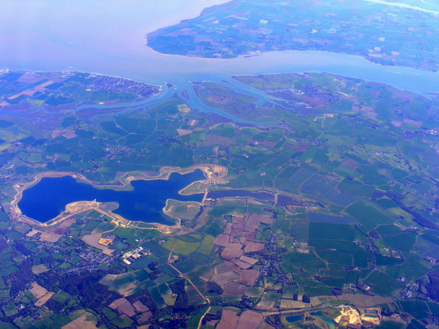
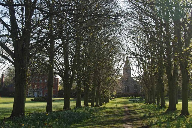
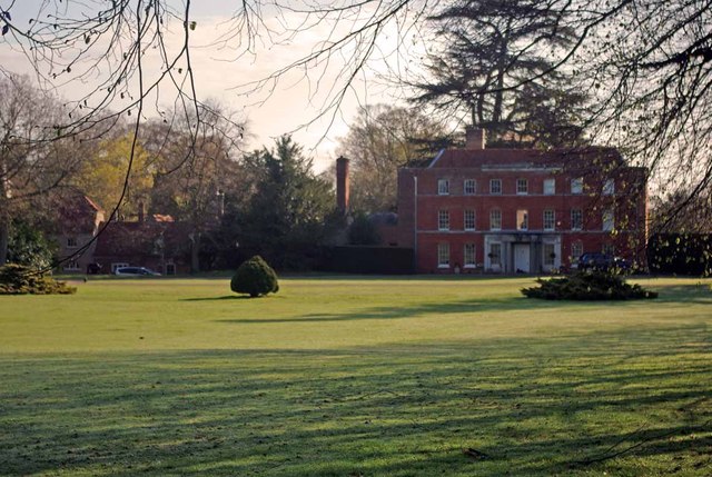
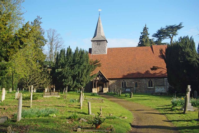
Gol Grove, located in Essex, England, is a picturesque wooded area known for its enchanting forest scenery and natural beauty. Situated within close proximity to the town of Epping, this tranquil woodland is a popular destination for nature enthusiasts and outdoor lovers alike.

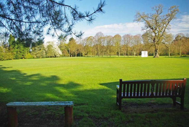
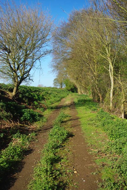
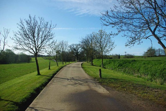
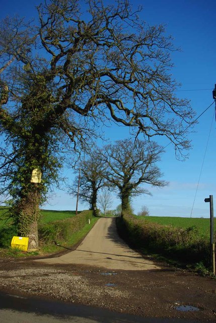
Covering an expansive area, Gol Grove boasts a diverse range of tree species, including oak, beech, and birch. The dense canopy created by these towering trees provides a cool and shaded atmosphere, making it an ideal spot for leisurely walks and peaceful picnics.

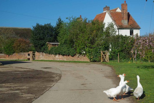
The forest floor is adorned with a rich variety of flora, including wildflowers, ferns, and mosses. This lush undergrowth provides a habitat for numerous animal species, such as squirrels, rabbits, and a variety of bird species, making Gol Grove a prime location for wildlife spotting.

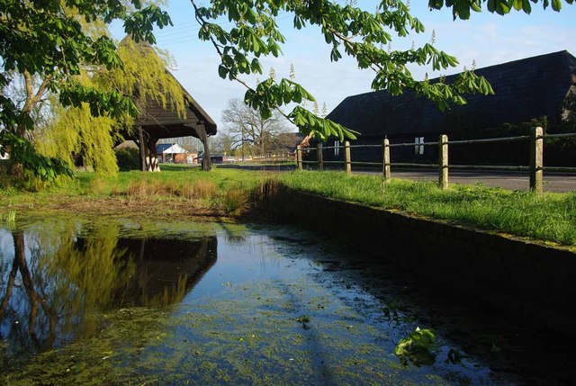
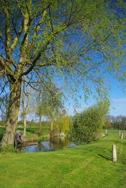
Gol Grove is crisscrossed by a network of well-maintained footpaths, ensuring that visitors can navigate the forest with ease. These pathways lead to hidden gems within the woodland, such as enchanting glades and serene ponds. There are also several designated picnic areas and benches scattered throughout the grove, offering visitors the opportunity to relax and take in the natural surroundings.

The forest is managed by the local authorities and offers ample parking facilities, making it easily accessible to visitors from near and far. Whether one seeks solitude in nature, a family outing, or simply a peaceful escape from the hustle and bustle of everyday life, Gol Grove in Essex provides a serene and captivating experience for all.

If you have any feedback on the listing, please let us know in the comments section below.
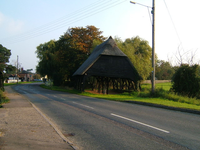
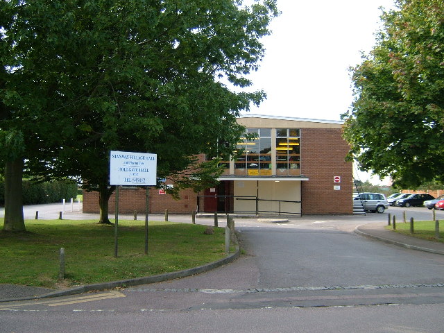
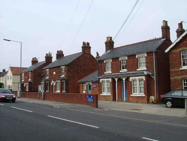
Gol Grove Images

Images are sourced within 2km of 51.863001/0.82234018 or Grid Reference TL9422. Thanks to Geograph Open Source API. All images are credited.

Layer de la Haye and Abberton Reservoir from the air Former RAF Bradwell <a href="https://www.geograph.org.uk/photo/2358320">TL9909 : Former RAF Bradwell Bay from the air</a> is visible in the distance. Viewed from a Prague bound flight from Heathrow.
Layer de la Haye and Abberton Reservoir from the air
Former RAF Bradwell TL9909 : Former RAF Bradwell Bay from the air is visible in the distance. Viewed from a Prague bound flight from Heathrow.
A Copford Green Pond & Cart Lodge I strongly suspect that the pond was used for washing down the carts that were once stored in the 17 Century cart lodge.
A Copford Green Pond & Cart Lodge
I strongly suspect that the pond was used for washing down the carts that were once stored in the 17 Century cart lodge.
Copford Green A quiet Sunday morning in Copford Green
Copford Green
A quiet Sunday morning in Copford Green
School Rd Copford Green A pair of cyclists pass the Junction of School Rd and Church Rd Copford Green.
School Rd Copford Green
A pair of cyclists pass the Junction of School Rd and Church Rd Copford Green.
St Michaels and Copford Hall Looking along an avenue of trees towards <a href="https://www.geograph.org.uk/photo/2911552">TL9322 : Copford Hall</a> and the church 
see <a href="https://www.geograph.org.uk/photo/2911561">TL9322 : No Parishioners Yet!</a>
St Michaels and Copford Hall
Looking along an avenue of trees towards TL9322 : Copford Hall and the church see TL9322 : No Parishioners Yet!
Copford Hall Copford Hall was built around 1760  for more info see <span class="nowrap"><a title="http://www.britishlistedbuildings.co.uk/en-416466-copford-hall-copford" rel="nofollow ugc noopener" href="http://www.britishlistedbuildings.co.uk/en-416466-copford-hall-copford">Link</a><img style="margin-left:2px;" alt="External link" title="External link - shift click to open in new window" src="https://s1.geograph.org.uk/img/external.png" width="10" height="10"/></span>
Copford Hall
Copford Hall was built around 1760 for more info see LinkExternal link
No Parishioners Yet! No sign of any congregation arriving at St Michael & All Saints this early on a sunny Sunday morning.
No Parishioners Yet!
No sign of any congregation arriving at St Michael & All Saints this early on a sunny Sunday morning.
Copford Cricket Club Copford Cricket Club have played here since 1972. The Oak tree on the left is on the playing area. Read more at <span class="nowrap"><a title="http://www.copfordcc.org.uk/contactus.html" rel="nofollow ugc noopener" href="http://www.copfordcc.org.uk/contactus.html">Link</a><img style="margin-left:2px;" alt="External link" title="External link - shift click to open in new window" src="https://s1.geograph.org.uk/img/external.png" width="10" height="10"/></span>
Copford Cricket Club
Copford Cricket Club have played here since 1972. The Oak tree on the left is on the playing area. Read more at LinkExternal link
Copford Cricket Pitch Seats just waiting a few more days for the start of the season. Copford Cricket Club have played here since 1972 read more at <span class="nowrap"><a title="http://www.copfordcc.org.uk/contactus.html" rel="nofollow ugc noopener" href="http://www.copfordcc.org.uk/contactus.html">Link</a><img style="margin-left:2px;" alt="External link" title="External link - shift click to open in new window" src="https://s1.geograph.org.uk/img/external.png" width="10" height="10"/></span>
Copford Cricket Pitch
Seats just waiting a few more days for the start of the season. Copford Cricket Club have played here since 1972 read more at LinkExternal link
Footpath to Aldercar Road This is the footpath from Upper Hill Farm to Aldercar Rd
Footpath to Aldercar Road
This is the footpath from Upper Hill Farm to Aldercar Rd
Guard Geese & Upper Hill Farm Geese have been used as "guard dogs" since at least Roman times. 
The lane is the <a href="https://www.geograph.org.uk/photo/2911582">TL9322 : Footpath to Aldercar Road</a>
Guard Geese & Upper Hill Farm
Geese have been used as "guard dogs" since at least Roman times. The lane is the TL9322 : Footpath to Aldercar Road
Upper Hill Farm Pond A small pond beside a footpath.
Upper Hill Farm Pond
A small pond beside a footpath.
Footpath to Fountain Lane The farm drive to Upper Hill Farm is a footpath that come out on Fountain Lane.
Footpath to Fountain Lane
The farm drive to Upper Hill Farm is a footpath that come out on Fountain Lane.
Footpath to Upper Hill farm Clear proof that Geographers think alike! I must have stood on Robert's wheel tracks however. I clearly got the better weather! see <a href="https://www.geograph.org.uk/photo/706823">TL9422 : The road to Upper Hill Farm</a>
Footpath to Upper Hill farm
Clear proof that Geographers think alike! I must have stood on Robert's wheel tracks however. I clearly got the better weather! see TL9422 : The road to Upper Hill Farm
Copford Hall, Copford Green A plain but attractive facade in warm red brick. Stone stringcourses and a later Tuscan porch (1919). The listing says the house was rebuilt c1760, but I wouldn't be surprised if it were a little earlier. Grade II listed.
The date of the photo is uncertain.
Copford Hall, Copford Green
A plain but attractive facade in warm red brick. Stone stringcourses and a later Tuscan porch (1919). The listing says the house was rebuilt c1760, but I wouldn't be surprised if it were a little earlier. Grade II listed. The date of the photo is uncertain.
Elephant enclosure at Colchester Zoo A mother and baby, just some of the elephants at this modern zoo.
Elephant enclosure at Colchester Zoo
A mother and baby, just some of the elephants at this modern zoo.
Cart Lodge with Hayloft at Copford Green Farm, Copford Green, Essex This 17th century cart lodge leans to one side and stands opposite the farm on the approach to the village of Copford Green. Located west of the village road which leads south from the B1408.
Cart Lodge with Hayloft at Copford Green Farm, Copford Green, Essex
This 17th century cart lodge leans to one side and stands opposite the farm on the approach to the village of Copford Green. Located west of the village road which leads south from the B1408.
Church Lane Stanway This is church lane Stanway the Church in question is St Albrights <a href="https://www.geograph.org.uk/gridref/TL9424">TL9424</a> the footpath to the right end goes to Bell House Farm.
Church Lane Stanway
This is church lane Stanway the Church in question is St Albrights TL9424 the footpath to the right end goes to Bell House Farm.
Show me another place!

Gol Grove is located at Grid Ref: TL9422 (Lat: 51.863001, Lng: 0.82234018)

Administrative County: Essex

District: Colchester

Police Authority: Essex

What 3 Words

///curtail.commoners.combines. Near Layer de la Haye, Essex

Nearby Locations

Hanging Wood Gol Grove

Related Wikis

Heckfordbridge

Heckfordbridge or Heckford is a hamlet in the civil parish of Birch, in the county of Essex, England. The settlement is on the B1022 road, between Colchester...
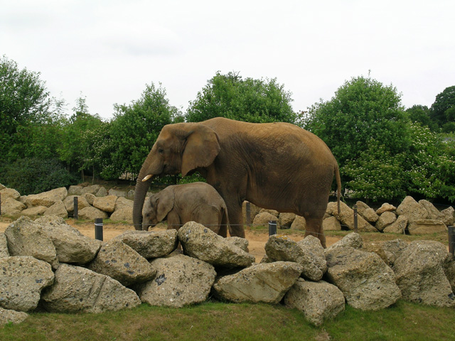
Colchester Zoo

Colchester Zoo is a zoological garden situated near Colchester, England. The zoo opened in 1963 and celebrated its 60th anniversary on 2 June 2023. It...
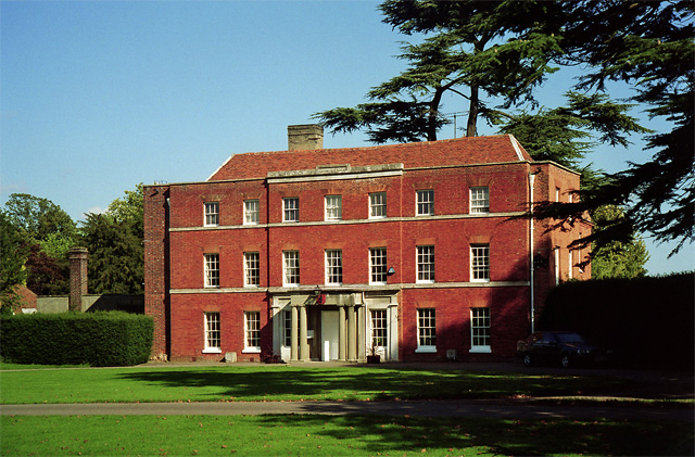
Copford Hall

Copford Hall is a manorial seat and Grade II listed country house, with gardens by Capability Brown, in the village of Copford, Essex, England, 46 miles...

Copford Green

Copford Green is a hamlet within the civil parish of Copford and the district of Colchester in Essex, England. It is near the A12 and A120 roads, and is...

Hardy's Green

Hardy's Green is a hamlet in civil parish of Birch in the Colchester district, in the county of Essex, England. Nearby settlements include the large town...

Birch, Essex

Birch is a village and civil parish in the City of Colchester district of Essex, England. It is located approximately 5 miles (8 km) south-west of Colchester...

Stanway, Essex

Stanway is a village and civil parish in Essex, England near Colchester and within Colchester Borough. 'Stanway' is an Anglo-Saxon name for the 'stone...

Copford

Copford is a village and civil parish in the City of Colchester district of Essex, England. It is 3 kilometres (2 mi) west of Colchester, and the hamlet...

Nearby Amenities

Located within 500m of 51.863001,0.82234018
Post Box
Operator: Royal Mail
Post Box Type: wall
Ref: CO3 77
Royal Cypher: VR
Royal Cypher Wikidata: Q33102356
Lat/Long: 51.8604222/0.8243245
Bus Stop
The Angel
Naptan AtcoCode: 150014011001
Naptan Bearing: NE
Naptan BusStopType: CUS
Naptan CommonName: The Angel
Naptan Indicator: o/s
Naptan Landmark: The Angel
Naptan NaptanCode: esxdajap
Naptan Street: Maldon Road
Naptan Verified: no
Public Transport: platform
Source: naptan_import
Lat/Long: 51.8607018/0.824912
Bus Stop
The Angel
Naptan AtcoCode: 150014011Y01
Naptan Bearing: S
Naptan BusStopType: CUS
Naptan CommonName: The Angel
Naptan Indicator: Opp
Naptan Landmark: The Angel
Naptan NaptanCode: esxjadgw
Naptan Street: Maldon Road
Naptan Verified: no
Public Transport: platform
Source: naptan_import
Lat/Long: 51.8609282/0.8253232
Heckfordbridge
Place: hamlet
Lat/Long: 51.8602872/0.8235436
The data included in this document is from www.openstreetmap.org. The data is made available under ODbL.

Have you been to Gol Grove?

Leave your review of Gol Grove below (or comments, questions and feedback).