Baker's Wood

Wood, Forest in Norfolk Breckland

England

Baker's Wood

Ford at Bushy Common This ford in full flood is found at Bushy Common close to the A47 at Dereham.
Ford at Bushy Common Credit: John Walton

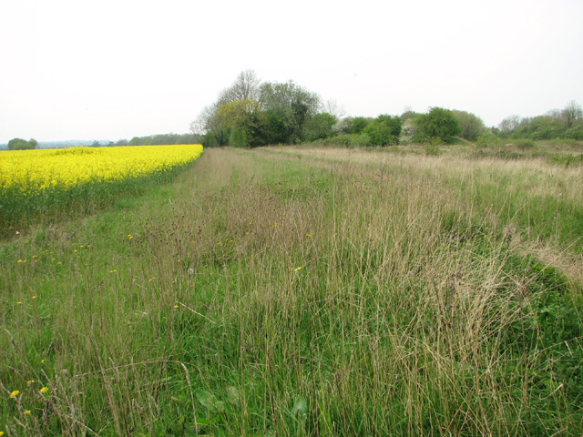
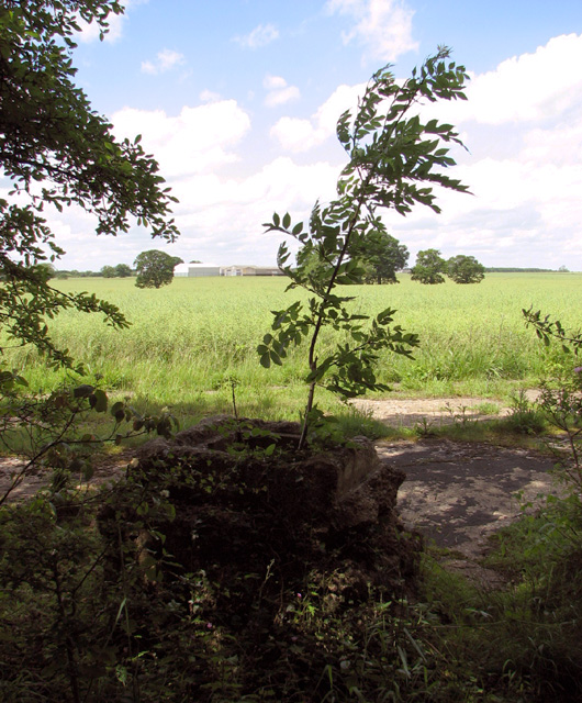
Baker's Wood is a picturesque woodland located in Norfolk, England. Spread over an area of approximately 100 acres, the wood is known for its natural beauty and diverse ecosystem. Situated near the village of Norfolk, it attracts nature enthusiasts, hikers, and photographers alike.

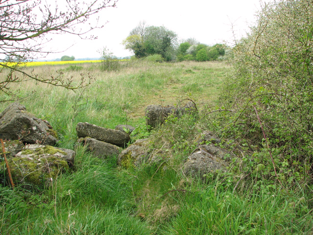
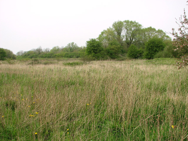
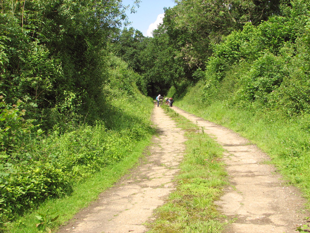
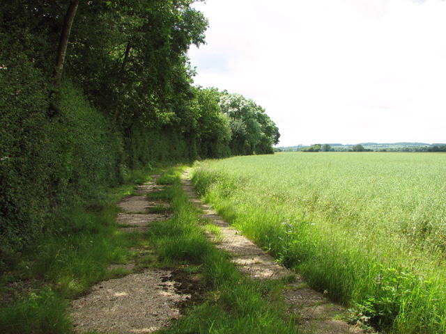
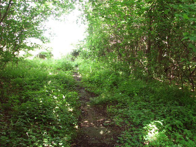
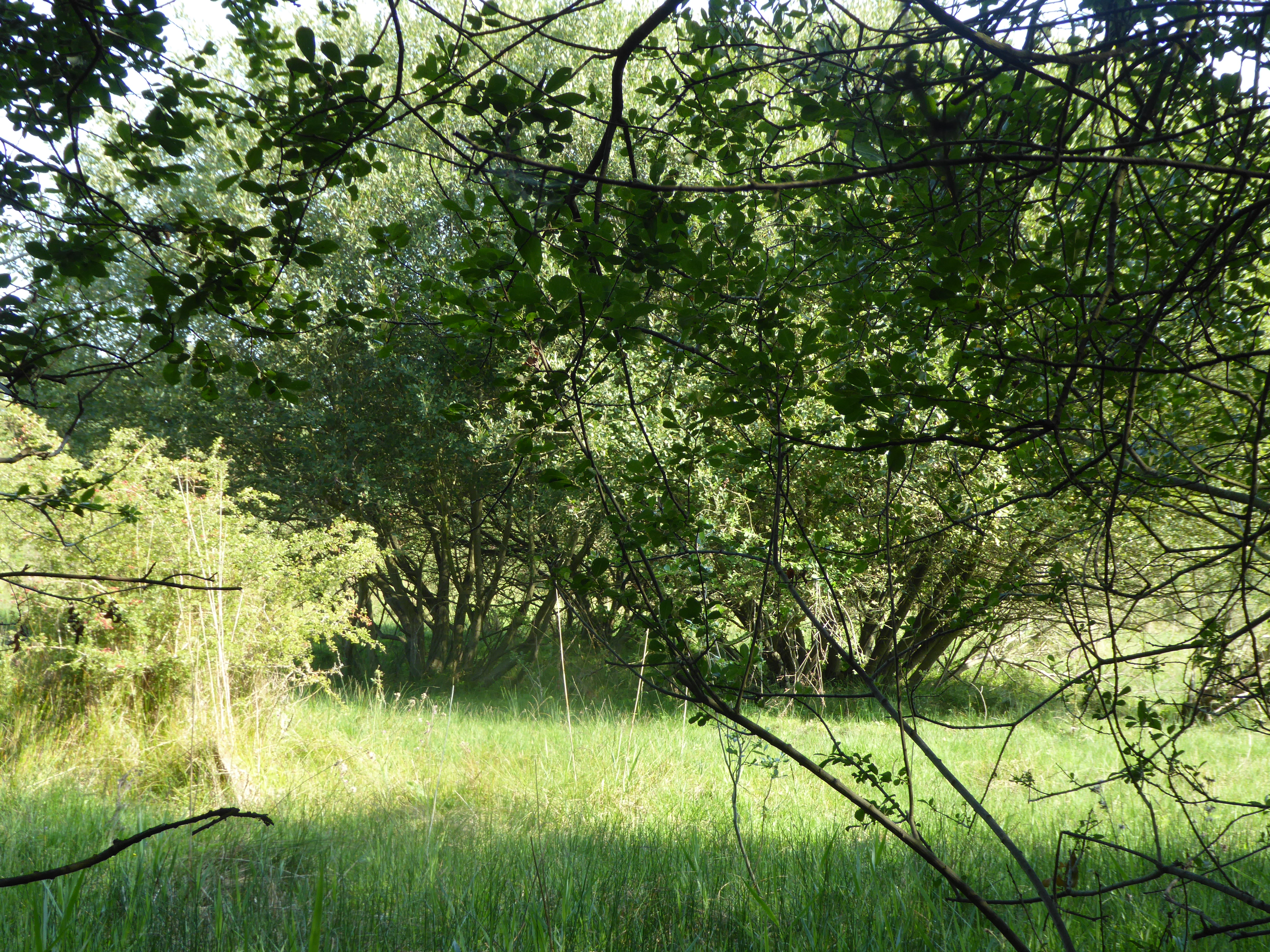
The wood is primarily composed of deciduous trees, including oak, beech, and birch, which provide a stunning display of colors during the autumn months. It is also home to a variety of wildlife, including deer, rabbits, squirrels, and a wide range of bird species. The wood features several marked trails, allowing visitors to explore its different sections and enjoy its scenic views.

One of the key attractions of Baker's Wood is its tranquil atmosphere. The dense tree cover creates a sense of seclusion and offers a peaceful retreat from the hustle and bustle of daily life. The wood is also a popular spot for picnics and family outings, with designated areas for relaxation and recreation.

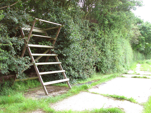
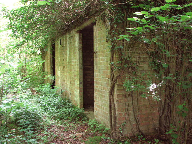
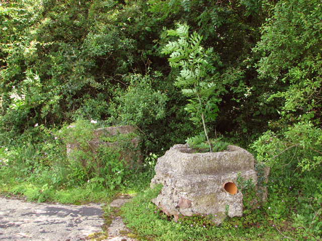
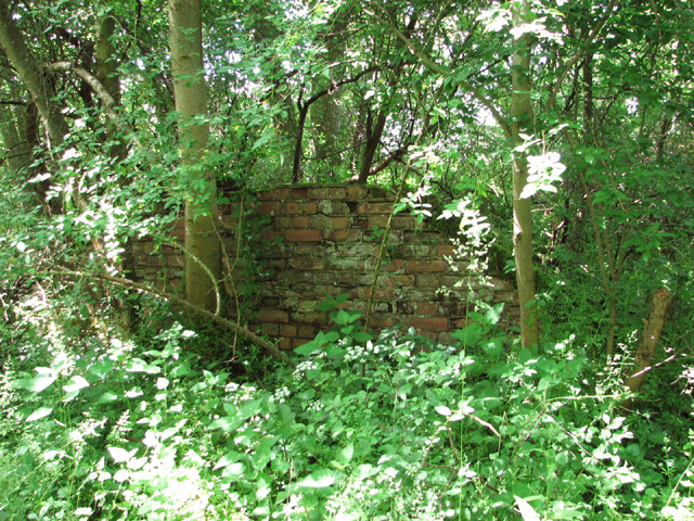
In addition to its natural beauty, Baker's Wood holds historical significance as well. It is believed to have been used as a hunting ground during medieval times and remnants of old structures can still be found within the wood, adding to its charm and intrigue.

Overall, Baker's Wood is a captivating destination that offers a unique blend of natural wonders and historical significance. Whether one seeks a peaceful stroll amidst nature or wishes to delve into the area's rich history, this woodland in Norfolk provides an enriching experience for all who visit.

If you have any feedback on the listing, please let us know in the comments section below.
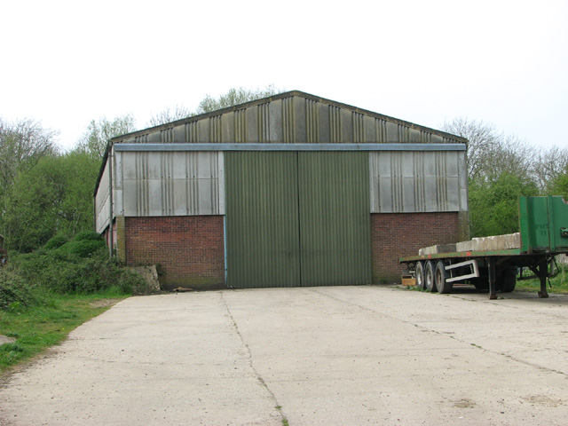
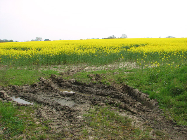
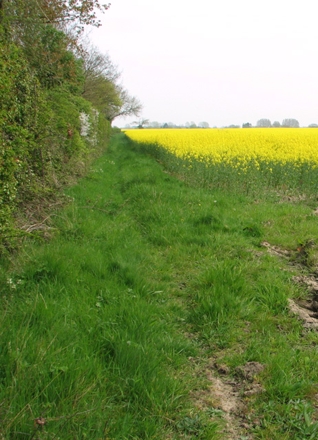
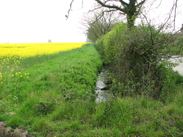
Baker's Wood Images

Images are sourced within 2km of 52.693573/0.87449944 or Grid Reference TF9414. Thanks to Geograph Open Source API. All images are credited.

Ford at Bushy Common This ford in full flood is found at Bushy Common close to the A47 at Dereham.
Ford at Bushy Common
This ford in full flood is found at Bushy Common close to the A47 at Dereham.
Shed by the Old Rectory
Flowering oilseed rape by Hall Green
Field boundary hedge by the Old Rectory
Field boundary ditch and hedge
Track into Honeypot Wood The wood was used by the 392nd Bombing Group  for the storage of munitions, using the natural camouflage of the woods.
Track into Honeypot Wood
The wood was used by the 392nd Bombing Group for the storage of munitions, using the natural camouflage of the woods.
Oilseed rape crop by Honeypot Wood
Honeypot Wood The wood was used by the 392nd Bombing Group  for the storage of munitions, using the natural camouflage of the woods.
Honeypot Wood
The wood was used by the 392nd Bombing Group for the storage of munitions, using the natural camouflage of the woods.
View along High Street
Old RAF service road through Honeypot Wood The four people seen in the distance were crouched around a clump of sedges they were trying to identify and then record, armed with a magnifying glass, scissors, tweezers and little plastic bags for collecting samples.

Honeypot Wood, an SSSI in the care of the Norfolk Wildlife Trust, is believed to be a remnant of a wild wood dating back to the retreat of the last ice age.  The main track follows the course of the old concrete service roads which in the more overgrown areas are no wider than narrow trails.   In WW2 the wood was used by the 392nd Bombardment Group based at RAF Wendling (USAAF Station 118) > <a title="https://www.geograph.org.uk/photo/3943063" href="https://www.geograph.org.uk/photo/3943063">Link</a> for the storage of bombs and munitions.
Old RAF service road through Honeypot Wood
The four people seen in the distance were crouched around a clump of sedges they were trying to identify and then record, armed with a magnifying glass, scissors, tweezers and little plastic bags for collecting samples. Honeypot Wood, an SSSI in the care of the Norfolk Wildlife Trust, is believed to be a remnant of a wild wood dating back to the retreat of the last ice age. The main track follows the course of the old concrete service roads which in the more overgrown areas are no wider than narrow trails. In WW2 the wood was used by the 392nd Bombardment Group based at RAF Wendling (USAAF Station 118) > Link for the storage of bombs and munitions.
High seat on the western edge of Honeypot Wood This was the road leading from the airfield to the bomb dump. 

Honeypot Wood, an SSSI in the care of the Norfolk Wildlife Trust, is believed to be a remnant of a wild wood dating back to the retreat of the last ice age.  The main track follows the course of the old concrete service roads which in the more overgrown areas are no wider than narrow trails.   In WW2 the wood was used by the 392nd Bombardment Group based at RAF Wendling (USAAF Station 118) > <a title="https://www.geograph.org.uk/photo/3943063" href="https://www.geograph.org.uk/photo/3943063">Link</a> for the storage of bombs and munitions.
High seat on the western edge of Honeypot Wood
This was the road leading from the airfield to the bomb dump. Honeypot Wood, an SSSI in the care of the Norfolk Wildlife Trust, is believed to be a remnant of a wild wood dating back to the retreat of the last ice age. The main track follows the course of the old concrete service roads which in the more overgrown areas are no wider than narrow trails. In WW2 the wood was used by the 392nd Bombardment Group based at RAF Wendling (USAAF Station 118) > Link for the storage of bombs and munitions.
Oilseed rape crops west of Honeypot Wood
Old RAF service road on the western edge of Honeypot Wood This was the road leading from the airfield to the bomb dump.

Honeypot Wood, an SSSI in the care of the Norfolk Wildlife Trust, is believed to be a remnant of a wild wood dating back to the retreat of the last ice age.  The main track follows the course of the old concrete service roads which in the more overgrown areas are no wider than narrow trails.   In WW2 the wood was used by the 392nd Bombardment Group based at RAF Wendling (USAAF Station 118) > <a title="https://www.geograph.org.uk/photo/3943063" href="https://www.geograph.org.uk/photo/3943063">Link</a> for the storage of bombs and munitions.
Old RAF service road on the western edge of Honeypot Wood
This was the road leading from the airfield to the bomb dump. Honeypot Wood, an SSSI in the care of the Norfolk Wildlife Trust, is believed to be a remnant of a wild wood dating back to the retreat of the last ice age. The main track follows the course of the old concrete service roads which in the more overgrown areas are no wider than narrow trails. In WW2 the wood was used by the 392nd Bombardment Group based at RAF Wendling (USAAF Station 118) > Link for the storage of bombs and munitions.
Ex RAF/USAAF building  in Honeypot Wood This was the SAA (Small Arms Ammunition)  store.

Honeypot Wood, an SSSI in the care of the Norfolk Wildlife Trust, is believed to be a remnant of a wild wood dating back to the retreat of the last ice age.  The main track follows the course of the old concrete service roads which in the more overgrown areas are no wider than narrow trails.   In WW2 the wood was used by the 392nd Bombardment Group based at RAF Wendling (USAAF Station 118) > <a title="https://www.geograph.org.uk/photo/3943063" href="https://www.geograph.org.uk/photo/3943063">Link</a> for the storage of bombs and munitions.
Ex RAF/USAAF building in Honeypot Wood
This was the SAA (Small Arms Ammunition) store. Honeypot Wood, an SSSI in the care of the Norfolk Wildlife Trust, is believed to be a remnant of a wild wood dating back to the retreat of the last ice age. The main track follows the course of the old concrete service roads which in the more overgrown areas are no wider than narrow trails. In WW2 the wood was used by the 392nd Bombardment Group based at RAF Wendling (USAAF Station 118) > Link for the storage of bombs and munitions.
Track into Honeypot Wood Two displaced air vents from air raid shelters flank the entrance into the wood.

Honeypot Wood, an SSSI in the care of the Norfolk Wildlife Trust, is believed to be a remnant of a wild wood dating back to the retreat of the last ice age.  The main track follows the course of the old concrete service roads which in the more overgrown areas are no wider than narrow trails.   In WW2 the wood was used by the 392nd Bombardment Group based at RAF Wendling (USAAF Station 118) > <a title="https://www.geograph.org.uk/photo/3943063" href="https://www.geograph.org.uk/photo/3943063">Link</a> for the storage of bombs and munitions.
Track into Honeypot Wood
Two displaced air vents from air raid shelters flank the entrance into the wood. Honeypot Wood, an SSSI in the care of the Norfolk Wildlife Trust, is believed to be a remnant of a wild wood dating back to the retreat of the last ice age. The main track follows the course of the old concrete service roads which in the more overgrown areas are no wider than narrow trails. In WW2 the wood was used by the 392nd Bombardment Group based at RAF Wendling (USAAF Station 118) > Link for the storage of bombs and munitions.
Fields west of Honeypot Wood An ash sapling is growing in the displaced air vent of a WW2 air raid shelter.

Honeypot Wood, an SSSI in the care of the Norfolk Wildlife Trust, is believed to be a remnant of a wild wood dating back to the retreat of the last ice age.  The main track follows the course of the old concrete service roads which in the more overgrown areas are no wider than narrow trails.   In WW2 the wood was used by the 392nd Bombardment Group based at RAF Wendling (USAAF Station 118) > <a title="https://www.geograph.org.uk/photo/3943063" href="https://www.geograph.org.uk/photo/3943063">Link</a> for the storage of bombs and munitions.
Fields west of Honeypot Wood
An ash sapling is growing in the displaced air vent of a WW2 air raid shelter. Honeypot Wood, an SSSI in the care of the Norfolk Wildlife Trust, is believed to be a remnant of a wild wood dating back to the retreat of the last ice age. The main track follows the course of the old concrete service roads which in the more overgrown areas are no wider than narrow trails. In WW2 the wood was used by the 392nd Bombardment Group based at RAF Wendling (USAAF Station 118) > Link for the storage of bombs and munitions.
Narrow track in Honeypot Wood The concrete service road here is so overgrown that only a narrow track remains.

Honeypot Wood, an SSSI in the care of the Norfolk Wildlife Trust, is believed to be a remnant of a wild wood dating back to the retreat of the last ice age.  The main track follows the course of the old concrete service roads which in the more overgrown areas are no wider than narrow trails.   In WW2 the wood was used by the 392nd Bombardment Group based at RAF Wendling (USAAF Station 118) > <a title="https://www.geograph.org.uk/photo/3943063" href="https://www.geograph.org.uk/photo/3943063">Link</a> for the storage of bombs and munitions.
Narrow track in Honeypot Wood
The concrete service road here is so overgrown that only a narrow track remains. Honeypot Wood, an SSSI in the care of the Norfolk Wildlife Trust, is believed to be a remnant of a wild wood dating back to the retreat of the last ice age. The main track follows the course of the old concrete service roads which in the more overgrown areas are no wider than narrow trails. In WW2 the wood was used by the 392nd Bombardment Group based at RAF Wendling (USAAF Station 118) > Link for the storage of bombs and munitions.
Remains of  bomb storage in Honeypot Wood Honeypot Wood, an SSSI in the care of the Norfolk Wildlife Trust, is believed to be a remnant of a wild wood dating back to the retreat of the last ice age.  The main track follows the course of the old concrete service roads which in the more overgrown areas are no wider than narrow trails.   In WW2 the wood was used by the 392nd Bombardment Group based at RAF Wendling (USAAF Station 118) > <a title="https://www.geograph.org.uk/photo/3943063" href="https://www.geograph.org.uk/photo/3943063">Link</a> for the storage of bombs and munitions.
Remains of bomb storage in Honeypot Wood
Honeypot Wood, an SSSI in the care of the Norfolk Wildlife Trust, is believed to be a remnant of a wild wood dating back to the retreat of the last ice age. The main track follows the course of the old concrete service roads which in the more overgrown areas are no wider than narrow trails. In WW2 the wood was used by the 392nd Bombardment Group based at RAF Wendling (USAAF Station 118) > Link for the storage of bombs and munitions.
Show me another place!

Baker's Wood is located at Grid Ref: TF9414 (Lat: 52.693573, Lng: 0.87449944)

Administrative County: Norfolk

District: Breckland

Police Authority: Norfolk

What 3 Words

///halt.nagging.artichoke. Near East Dereham, Norfolk

Nearby Locations

Baker's Wood

Related Wikis

Honeypot Wood

Honeypot Wood is a 9.5-hectare (23-acre) biological Site of Special Scientific Interest west of Dereham in Norfolk. It is managed by the Norfolk Wildlife...

Longham

Longham is a village situated in the Breckland District of Norfolk and covers an area of 540 hectares (2.1 square miles) with a population of 219 in 100...

Holly Farm Meadow, Wendling

Holly Farm Meadow, Wendling is a 2.6-hectare (6.4-acre) biological Site of Special Scientific Interest west of Dereham in Norfolk, England.This meadow...

Mitford and Launditch Rural District

Mitford and Launditch Rural District was a rural district in Norfolk, England from 1894 to 1974.It was formed under the Local Government Act 1894 based...

Wendling Abbey

Wendling Abbey was monastic house in Norfolk, England. The Abbey once stood on marshy ground near a small rivulet (small stream) which runs to the south...

Wendling railway station

Wendling railway station was a railway station in Wendling, Norfolk on the Great Eastern line between Dereham and King's Lynn. It closed in 1968. This...

Gressenhall

Gressenhall is a village and civil parish in the English county of Norfolk. The villages name origin is uncertain possibly 'Grassy nook of land' or 'gravelly...

Wendling, Norfolk

Wendling is a village and civil parish in the English county of Norfolk. It covers an area of 5.25 km2 (2.03 sq mi) and had a population of 323 in 140...

Related Videos

Car Dangerously Overtakes into Oncoming Traffic | UK Dash Cam | Norfolk | Dangerous Driving

A car Dangerously Overtakes 2 vehicles into oncoming traffic at high speed narrowly missing the oncoming car. This footage was ...

Have you been to Baker's Wood?

Leave your review of Baker's Wood below (or comments, questions and feedback).