Choat's Wood

Wood, Forest in Essex Colchester

England

Choat's Wood

Layby on the A12, Stanway
Layby on the A12, Stanway Credit: David Howard

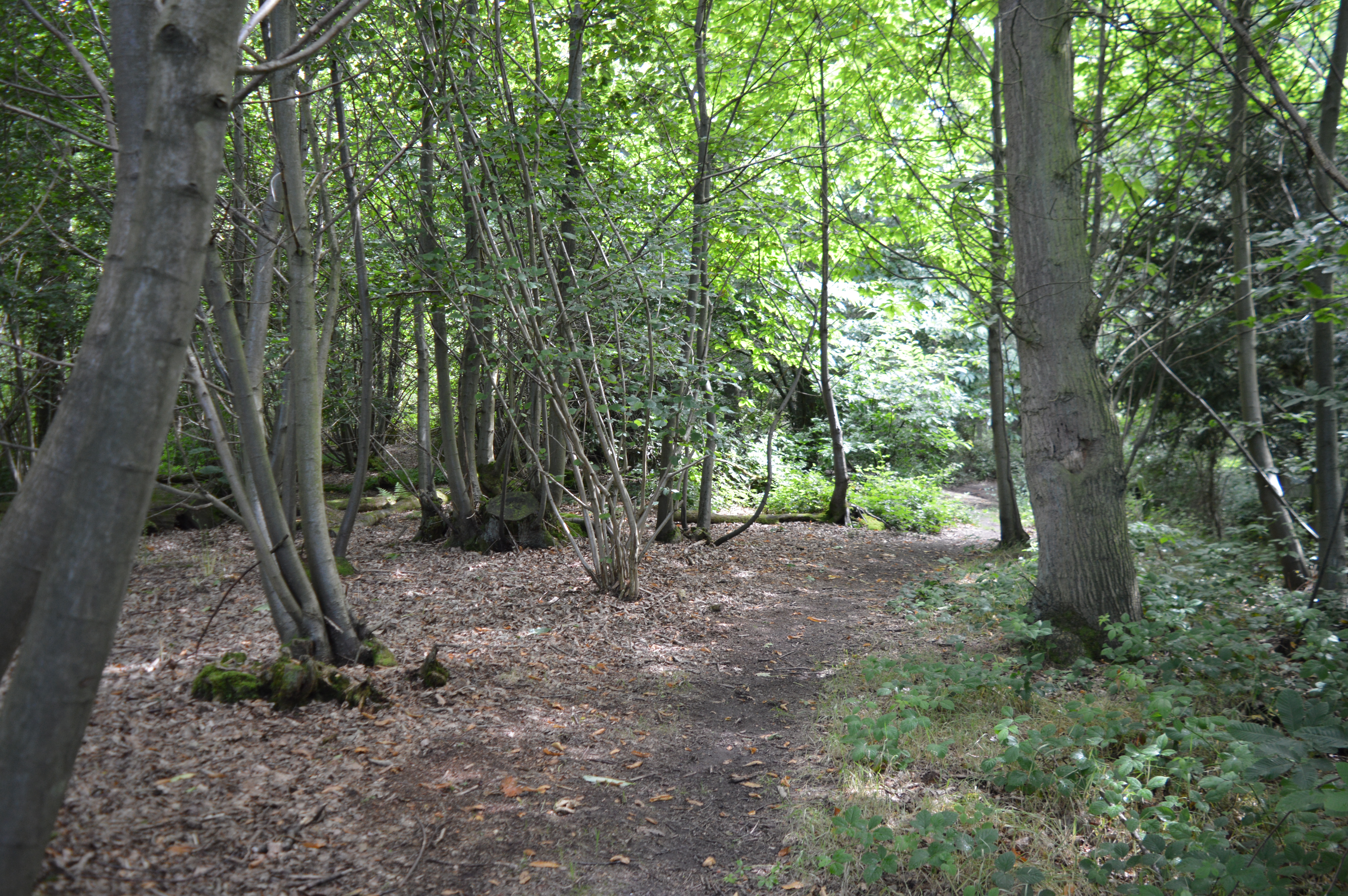
Choat's Wood is a charming woodland located in Essex, England. Covering an area of approximately 50 hectares, it is nestled in the picturesque countryside, making it a popular destination for nature enthusiasts and hikers alike. The wood is known for its rich biodiversity and is home to a variety of plant and animal species.

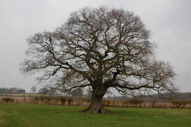
The woodland is predominantly made up of broadleaf trees, including oak, beech, and birch. These towering trees create a dense canopy, providing shade and shelter for the smaller plants below. In the spring, the forest floor comes alive with a vibrant display of bluebells, adding a touch of color to the otherwise green landscape.

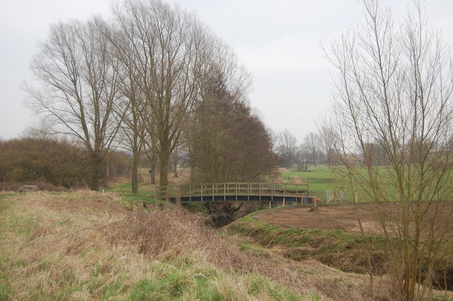
Choat's Wood boasts several well-marked trails, allowing visitors to explore the area at their own pace. These paths wind through the wood, leading visitors to tranquil ponds and peaceful meadows. Along the way, one may encounter a range of wildlife, including deer, foxes, and various bird species.

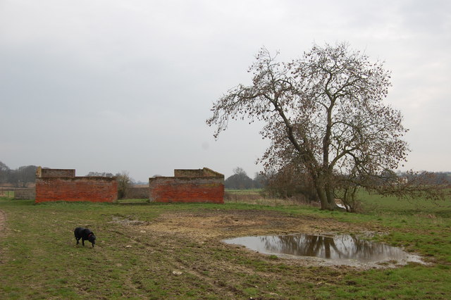
For those looking to delve deeper into the woodland's history, Choat's Wood has a fascinating past. It is believed to have been part of the ancient Hatfield Forest, which dates back over a thousand years. The wood has seen its fair share of human activity, evidenced by the remnants of old charcoal kilns and saw pits scattered throughout.

Overall, Choat's Wood offers a serene escape from the hustle and bustle of everyday life. Whether one is seeking a peaceful stroll, a picnic spot, or simply the chance to connect with nature, this beautiful woodland is sure to provide a memorable experience.

If you have any feedback on the listing, please let us know in the comments section below.

Choat's Wood Images

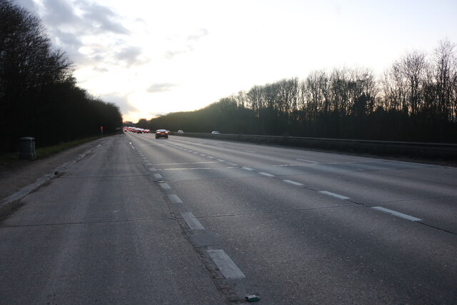
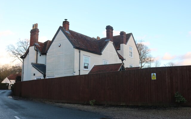
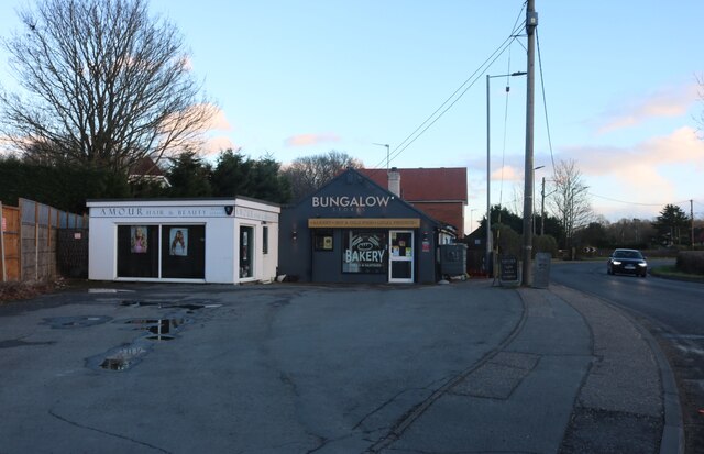
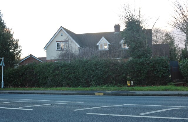
Images are sourced within 2km of 51.899676/0.81597478 or Grid Reference TL9326. Thanks to Geograph Open Source API. All images are credited.

Layby on the A12, Stanway
House on New Road, Fordstreet
Houses on Halstead Road, Eight Ash Green
Shops on Halstead Road, Eight Ash Green
House on Halstead Road, Eight Ash Green
Roundabout on Halstead Road, Eight Ash Green
The Essex Way 111 - footbridge This bridge over the River Colne carries a footpath which crosses the Essex Way path.
The Essex Way 111 - footbridge
This bridge over the River Colne carries a footpath which crosses the Essex Way path.
The Essex Way 112 - oak tree A magnificent field oak close by the footpath.
The Essex Way 112 - oak tree
A magnificent field oak close by the footpath.
The Essex Way 113 - ruined barn This roofless barn is on the Essex Way as it approaches West Bergholt.
The Essex Way 113 - ruined barn
This roofless barn is on the Essex Way as it approaches West Bergholt.
Bridge over the A12, Eight Ash Green The A12 is a 129 mile long trunk road from London to Great Yarmouth. It runs through Greater London, Essex, Suffolk and Norfolk. It passes by Brentwood, Colchester and Ipswich as well as passing through Lowestoft.
<span class="nowrap"><a title="http://www.sabre-roads.org.uk/wiki/index.php?title=A12" rel="nofollow ugc noopener" href="http://www.sabre-roads.org.uk/wiki/index.php?title=A12">Link</a><img style="margin-left:2px;" alt="External link" title="External link - shift click to open in new window" src="https://s1.geograph.org.uk/img/external.png" width="10" height="10"/></span> 
Wikipedia: <span class="nowrap"><a title="http://en.wikipedia.org/wiki/A12_road_(England)" rel="nofollow ugc noopener" href="http://en.wikipedia.org/wiki/A12_road_(England)">Link</a><img style="margin-left:2px;" alt="External link" title="External link - shift click to open in new window" src="https://s1.geograph.org.uk/img/external.png" width="10" height="10"/></span>
Bridge over the A12, Eight Ash Green
The A12 is a 129 mile long trunk road from London to Great Yarmouth. It runs through Greater London, Essex, Suffolk and Norfolk. It passes by Brentwood, Colchester and Ipswich as well as passing through Lowestoft. LinkExternal link Wikipedia: LinkExternal link
A12 approaching Junction 26 The A12 is a 129 mile long trunk road from London to Great Yarmouth. It runs through Greater London, Essex, Suffolk and Norfolk. It passes by Brentwood, Colchester and Ipswich as well as passing through Lowestoft.
<span class="nowrap"><a title="http://www.sabre-roads.org.uk/wiki/index.php?title=A12" rel="nofollow ugc noopener" href="http://www.sabre-roads.org.uk/wiki/index.php?title=A12">Link</a><img style="margin-left:2px;" alt="External link" title="External link - shift click to open in new window" src="https://s1.geograph.org.uk/img/external.png" width="10" height="10"/></span> 
Wikipedia: <span class="nowrap"><a title="http://en.wikipedia.org/wiki/A12_road_(England)" rel="nofollow ugc noopener" href="http://en.wikipedia.org/wiki/A12_road_(England)">Link</a><img style="margin-left:2px;" alt="External link" title="External link - shift click to open in new window" src="https://s1.geograph.org.uk/img/external.png" width="10" height="10"/></span>
A12 approaching Junction 26
The A12 is a 129 mile long trunk road from London to Great Yarmouth. It runs through Greater London, Essex, Suffolk and Norfolk. It passes by Brentwood, Colchester and Ipswich as well as passing through Lowestoft. LinkExternal link Wikipedia: LinkExternal link
A12, Junction 26 The A12 is a 129 mile long trunk road from London to Great Yarmouth. It runs through Greater London, Essex, Suffolk and Norfolk. It passes by Brentwood, Colchester and Ipswich as well as passing through Lowestoft.
<span class="nowrap"><a title="http://www.sabre-roads.org.uk/wiki/index.php?title=A12" rel="nofollow ugc noopener" href="http://www.sabre-roads.org.uk/wiki/index.php?title=A12">Link</a><img style="margin-left:2px;" alt="External link" title="External link - shift click to open in new window" src="https://s1.geograph.org.uk/img/external.png" width="10" height="10"/></span> 
Wikipedia: <span class="nowrap"><a title="http://en.wikipedia.org/wiki/A12_road_(England)" rel="nofollow ugc noopener" href="http://en.wikipedia.org/wiki/A12_road_(England)">Link</a><img style="margin-left:2px;" alt="External link" title="External link - shift click to open in new window" src="https://s1.geograph.org.uk/img/external.png" width="10" height="10"/></span>
A12, Junction 26
The A12 is a 129 mile long trunk road from London to Great Yarmouth. It runs through Greater London, Essex, Suffolk and Norfolk. It passes by Brentwood, Colchester and Ipswich as well as passing through Lowestoft. LinkExternal link Wikipedia: LinkExternal link
A12, Junction 26 overbridges The A12 is a 129 mile long trunk road from London to Great Yarmouth. It runs through Greater London, Essex, Suffolk and Norfolk. It passes by Brentwood, Colchester and Ipswich as well as passing through Lowestoft.
<span class="nowrap"><a title="http://www.sabre-roads.org.uk/wiki/index.php?title=A12" rel="nofollow ugc noopener" href="http://www.sabre-roads.org.uk/wiki/index.php?title=A12">Link</a><img style="margin-left:2px;" alt="External link" title="External link - shift click to open in new window" src="https://s1.geograph.org.uk/img/external.png" width="10" height="10"/></span> 
Wikipedia: <span class="nowrap"><a title="http://en.wikipedia.org/wiki/A12_road_(England)" rel="nofollow ugc noopener" href="http://en.wikipedia.org/wiki/A12_road_(England)">Link</a><img style="margin-left:2px;" alt="External link" title="External link - shift click to open in new window" src="https://s1.geograph.org.uk/img/external.png" width="10" height="10"/></span>
A12, Junction 26 overbridges
The A12 is a 129 mile long trunk road from London to Great Yarmouth. It runs through Greater London, Essex, Suffolk and Norfolk. It passes by Brentwood, Colchester and Ipswich as well as passing through Lowestoft. LinkExternal link Wikipedia: LinkExternal link
Gantry, A12 The A12 is a 129 mile long trunk road from London to Great Yarmouth. It runs through Greater London, Essex, Suffolk and Norfolk. It passes by Brentwood, Colchester and Ipswich as well as passing through Lowestoft.
<span class="nowrap"><a title="http://www.sabre-roads.org.uk/wiki/index.php?title=A12" rel="nofollow ugc noopener" href="http://www.sabre-roads.org.uk/wiki/index.php?title=A12">Link</a><img style="margin-left:2px;" alt="External link" title="External link - shift click to open in new window" src="https://s1.geograph.org.uk/img/external.png" width="10" height="10"/></span> 
Wikipedia: <span class="nowrap"><a title="http://en.wikipedia.org/wiki/A12_road_(England)" rel="nofollow ugc noopener" href="http://en.wikipedia.org/wiki/A12_road_(England)">Link</a><img style="margin-left:2px;" alt="External link" title="External link - shift click to open in new window" src="https://s1.geograph.org.uk/img/external.png" width="10" height="10"/></span>
Gantry, A12
The A12 is a 129 mile long trunk road from London to Great Yarmouth. It runs through Greater London, Essex, Suffolk and Norfolk. It passes by Brentwood, Colchester and Ipswich as well as passing through Lowestoft. LinkExternal link Wikipedia: LinkExternal link
St Albright, Stanway
St Albright, Stanway - East end
St Albright, Stanway - Font
Meadow Grass Close
Meadow Grass Close
Show me another place!

Choat's Wood is located at Grid Ref: TL9326 (Lat: 51.899676, Lng: 0.81597478)

Administrative County: Essex

District: Colchester

Police Authority: Essex

What 3 Words

///logic.obstinate.dressing. Near Eight Ash Green, Essex

Related Wikis

Fordham Heath

Fordham Heath is a hamlet near the A1124 road, in the Colchester district, in the English county of Essex. It is near the large town of Colchester and...

Eight Ash Green

Eight Ash Green is a village and civil parish in the City of Colchester district of Essex, England. It is on the A1124 road, near Junction 26 (Eight Ash...

Iron Latch

Iron Latch is a 4.3-hectare (11-acre) nature reserve in Eight Ash Green, west of Colchester in Essex.The site consists of areas of species-rich grassland...

Fordstreet

Fordstreet or Ford Street is a village on the A1124 road, in the civil parish of Aldham in the Colchester district in Essex, England. It is located on...

Nearby Amenities

Located within 500m of 51.899676,0.81597478
Eight Ash Green
Is In: Essex, England, UK
Place: village
Source: gps survey
Lat/Long: 51.8984854/0.8213793
Bus Stop
Wood Corner
Naptan AtcoCode: 150027005007
Naptan Bearing: E
Naptan CommonName: Wood Corner
Naptan Crossing: Wood Lane
Naptan Indicator: E-bound
Naptan Landmark: Wood Corner
Naptan NaptanCode: esxdjmta
Naptan Street: Halstead Road
Naptan Verified: no
Public Transport: platform
Source: naptan_import
Lat/Long: 51.9000724/0.8124559
Wood Corner
Naptan AtcoCode: 150027005Y07
Naptan Bearing: W
Naptan BusStopType: CUS
Naptan CommonName: Wood Corner
Naptan Crossing: Wood Lane
Naptan Indicator: W-bound
Naptan Landmark: Wood Corner
Naptan NaptanCode: esxjajtp
Naptan Street: Halstead Road
Naptan Verified: no
Public Transport: platform
Source: naptan_import
Lat/Long: 51.9000295/0.812366
Wood Lane
Naptan AtcoCode: 150029080012
Naptan Bearing: W
Naptan BusStopType: CUS
Naptan CommonName: Wood Lane
Naptan Indicator: From
Naptan Landmark: Wood Lane
Naptan NaptanCode: esxgdwgj
Naptan Street: Heath Road
Naptan Verified: no
Public Transport: platform
Source: naptan_import
Lat/Long: 51.9025684/0.8137605
Bus Stop
Fiddlers Folly
Naptan AtcoCode: 150029080013
Naptan Bearing: W
Naptan BusStopType: CUS
Naptan CommonName: Fiddlers Folly
Naptan Indicator: Opp
Naptan Landmark: Fiddlers Folly
Naptan NaptanCode: esxgdwgm
Naptan Street: Wood Lane
Naptan Verified: no
Public Transport: platform
Source: naptan_import
Lat/Long: 51.9030425/0.8119873
Wood Lane
Naptan AtcoCode: 150029080Y12
Naptan Bearing: E
Naptan BusStopType: CUS
Naptan CommonName: Wood Lane
Naptan Indicator: Towards
Naptan Landmark: Wood Lane
Naptan NaptanCode: esxjadgm
Naptan Street: Heath Road
Naptan Verified: no
Public Transport: platform
Source: naptan_import
Lat/Long: 51.9026015/0.8138789
Bus Stop
Jubilee Meadow
Naptan AtcoCode: 1500IM1361AA
Naptan Bearing: NW
Naptan BusStopType: CUS
Naptan CommonName: Brick and Tile
Naptan Crossing: Spring Lane
Naptan Indicator: Opp
Naptan Landmark: Brick and Tile
Naptan NaptanCode: esxgwmgp
Naptan Street: Halstead Road A1124
Naptan Verified: no
Public Transport: platform
Source: naptan_import
Lat/Long: 51.8966419/0.8212547
Bus Stop
Fiddlers Folly
Naptan AtcoCode: 1500IM1363
Naptan Bearing: E
Naptan CommonName: Fiddlers Folly
Naptan Indicator: Adj
Naptan Landmark: Fiddlers Folly
Naptan NaptanCode: esxdjmpm
Naptan Street: Wood Lane
Naptan Verified: no
Public Transport: platform
Source: naptan_import
Lat/Long: 51.9031348/0.8115133
Barrier: bollard
Lat/Long: 51.9005936/0.82256
Heath Cottages
Naptan AtcoCode: 1500HNR2703Y
Naptan BusStopType: HAR
Naptan NaptanCode: esxjmtwm
Public Transport: platform
Source: naptan
Lat/Long: 51.9025159/0.8176209
Heath Cottages
Naptan AtcoCode: 1500HNR2703
Naptan BusStopType: HAR
Naptan NaptanCode: esxjgtgp
Public Transport: platform
Source: naptan
Lat/Long: 51.9025601/0.8176528
Bus Stop
Turkey Cock Lane
Naptan AtcoCode: 150027005100
Naptan NaptanCode: esxjgpap
Public Transport: platform
Source: naptan
Lat/Long: 51.8981279/0.8168374
Bus Stop
Turkey Cock Lane
Naptan AtcoCode: 1500270051Y0
Naptan NaptanCode: esxjgpaw
Public Transport: platform
Source: naptan
Lat/Long: 51.897902/0.8172594
Bus Stop
Beech Grove
Naptan AtcoCode: 1500HNR2702Y
Naptan BusStopType: HAR
Naptan NaptanCode: esxjmtwp
Naptan Verified: no
Public Transport: platform
Source: naptan
Lat/Long: 51.9013578/0.813405
Beech Grove
Naptan AtcoCode: 1500HNR2702
Naptan BusStopType: HAR
Naptan NaptanCode: esxjgtgm
Naptan Verified: no
Public Transport: platform
Source: naptan
Lat/Long: 51.9013868/0.8133196
Generator Method: photovoltaic
Generator Output Electricity: yes
Generator Source: solar
Generator Type: solar_photovoltaic_panel
Location: roof
Power: generator
Lat/Long: 51.9037146/0.813048
Generator Method: photovoltaic
Generator Output Electricity: yes
Generator Source: solar
Generator Type: solar_photovoltaic_panel
Location: roof
Power: generator
Lat/Long: 51.9036641/0.8129869
Generator Method: photovoltaic
Generator Output Electricity: yes
Generator Source: solar
Generator Type: solar_photovoltaic_panel
Location: roof
Power: generator
Lat/Long: 51.9036604/0.8130453
Generator Method: photovoltaic
Generator Output Electricity: yes
Generator Source: solar
Generator Type: solar_photovoltaic_panel
Location: roof
Power: generator
Lat/Long: 51.9033559/0.813107
Generator Method: photovoltaic
Generator Output Electricity: yes
Generator Source: solar
Generator Type: solar_photovoltaic_panel
Location: roof
Power: generator
Lat/Long: 51.9033207/0.8131733
Generator Method: photovoltaic
Generator Output Electricity: yes
Generator Source: solar
Generator Type: solar_photovoltaic_panel
Location: roof
Power: generator
Lat/Long: 51.903267/0.8130043
Generator Method: photovoltaic
Generator Output Electricity: yes
Generator Source: solar
Generator Type: solar_photovoltaic_panel
Location: roof
Power: generator
Lat/Long: 51.9032004/0.8127837
Generator Method: photovoltaic
Generator Output Electricity: yes
Generator Source: solar
Generator Type: solar_photovoltaic_panel
Location: roof
Power: generator
Lat/Long: 51.9032078/0.812655
Generator Method: photovoltaic
Generator Output Electricity: yes
Generator Source: solar
Generator Type: solar_photovoltaic_panel
Location: roof
Power: generator
Lat/Long: 51.9032392/0.8124592
Generator Method: photovoltaic
Generator Output Electricity: yes
Generator Source: solar
Generator Type: solar_photovoltaic_panel
Location: roof
Power: generator
Lat/Long: 51.9032463/0.8123379
Generator Method: photovoltaic
Generator Output Electricity: yes
Generator Source: solar
Generator Type: solar_photovoltaic_panel
Location: roof
Power: generator
Lat/Long: 51.9032843/0.8116861
Generator Method: photovoltaic
Generator Output Electricity: yes
Generator Source: solar
Generator Type: solar_photovoltaic_panel
Location: roof
Power: generator
Lat/Long: 51.9029285/0.8118249
Generator Method: photovoltaic
Generator Output Electricity: yes
Generator Source: solar
Generator Type: solar_photovoltaic_panel
Location: roof
Power: generator
Lat/Long: 51.902931/0.811735
Generator Method: photovoltaic
Generator Output Electricity: yes
Generator Source: solar
Generator Type: solar_photovoltaic_panel
Location: roof
Power: generator
Lat/Long: 51.9029662/0.8111342
Generator Method: photovoltaic
Generator Output Electricity: yes
Generator Source: solar
Generator Type: solar_photovoltaic_panel
Location: roof
Power: generator
Lat/Long: 51.9026806/0.810988
Generator Method: photovoltaic
Generator Output Electricity: yes
Generator Source: solar
Generator Type: solar_photovoltaic_panel
Location: roof
Power: generator
Lat/Long: 51.9026728/0.8110457
Generator Method: photovoltaic
Generator Output Electricity: yes
Generator Source: solar
Generator Type: solar_photovoltaic_panel
Location: roof
Power: generator
Lat/Long: 51.901943/0.8107325
Generator Method: photovoltaic
Generator Output Electricity: yes
Generator Source: solar
Generator Type: solar_photovoltaic_panel
Location: roof
Power: generator
Lat/Long: 51.9016166/0.8116097
Generator Method: photovoltaic
Generator Output Electricity: yes
Generator Source: solar
Generator Type: solar_photovoltaic_panel
Location: roof
Power: generator
Lat/Long: 51.9016103/0.8117478
Generator Method: photovoltaic
Generator Output Electricity: yes
Generator Source: solar
Generator Type: solar_photovoltaic_panel
Location: roof
Power: generator
Lat/Long: 51.9016054/0.8118584
Generator Method: photovoltaic
Generator Output Electricity: yes
Generator Source: solar
Generator Type: solar_photovoltaic_panel
Location: roof
Power: generator
Lat/Long: 51.901559/0.8119416
Generator Method: photovoltaic
Generator Output Electricity: yes
Generator Source: solar
Generator Type: solar_photovoltaic_panel
Location: roof
Power: generator
Lat/Long: 51.9015545/0.8119985
Generator Method: photovoltaic
Generator Output Electricity: yes
Generator Source: solar
Generator Type: solar_photovoltaic_panel
Location: roof
Power: generator
Lat/Long: 51.9012757/0.8118074
Generator Method: photovoltaic
Generator Output Electricity: yes
Generator Source: solar
Generator Type: solar_photovoltaic_panel
Location: roof
Power: generator
Lat/Long: 51.9011056/0.811682
Generator Method: photovoltaic
Generator Output Electricity: yes
Generator Source: solar
Generator Type: solar_photovoltaic_panel
Location: roof
Power: generator
Lat/Long: 51.9010493/0.8116579
Generator Method: photovoltaic
Generator Output Electricity: yes
Generator Source: solar
Generator Type: solar_photovoltaic_panel
Location: roof
Power: generator
Lat/Long: 51.9009454/0.8113856
Generator Method: photovoltaic
Generator Output Electricity: yes
Generator Source: solar
Generator Type: solar_photovoltaic_panel
Location: roof
Power: generator
Lat/Long: 51.9009616/0.811214
Generator Method: photovoltaic
Generator Output Electricity: yes
Generator Source: solar
Generator Type: solar_photovoltaic_panel
Location: roof
Power: generator
Lat/Long: 51.9011018/0.8105897
Generator Method: photovoltaic
Generator Output Electricity: yes
Generator Source: solar
Generator Type: solar_photovoltaic_panel
Location: roof
Power: generator
Lat/Long: 51.9009931/0.8108807
Generator Method: photovoltaic
Generator Output Electricity: yes
Generator Source: solar
Generator Type: solar_photovoltaic_panel
Location: roof
Power: generator
Lat/Long: 51.9010021/0.8107949
Generator Method: photovoltaic
Generator Output Electricity: yes
Generator Source: solar
Generator Type: solar_photovoltaic_panel
Location: roof
Power: generator
Lat/Long: 51.8998329/0.822022
Barrier: bollard
Lat/Long: 51.9012811/0.8226802
Fuel
Brand: Esso
Lat/Long: 51.8998966/0.8124078
Defibrillator
Access: yes
Defibrillator Location: on road end of service station building
Emergency: defibrillator
Indoor: no
Ref GB The Circuit: 11879921-7081-45FC-A5FC-AE19010E5F4A
Lat/Long: 51.8999589/0.8123197
The data included in this document is from www.openstreetmap.org. The data is made available under ODbL.

Have you been to Choat's Wood?

Leave your review of Choat's Wood below (or comments, questions and feedback).