Ford Houses

Settlement in Staffordshire

England

Ford Houses

M54 motorway at Coven Lane bridge
M54 motorway at Coven Lane bridge Credit: Peter Whatley

Ford Houses is a small village located in the county of Staffordshire, England. Situated in the West Midlands region, it lies approximately 4 miles south of the county town of Stafford. Ford Houses is part of the civil parish of Seighford.

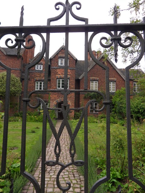
The village is known for its picturesque countryside surroundings and peaceful atmosphere. It is primarily a residential area, characterized by a mix of traditional and modern houses. The architecture in Ford Houses is predominantly made up of brick and stone structures, reflecting the historical charm of the region.

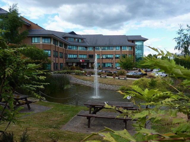
Despite its small size, the village offers a range of amenities to its residents. These include a primary school, a village hall, and a local pub, providing a sense of community and meeting places for social gatherings. Additionally, the nearby town of Stafford provides further amenities, such as supermarkets, shops, and leisure facilities.

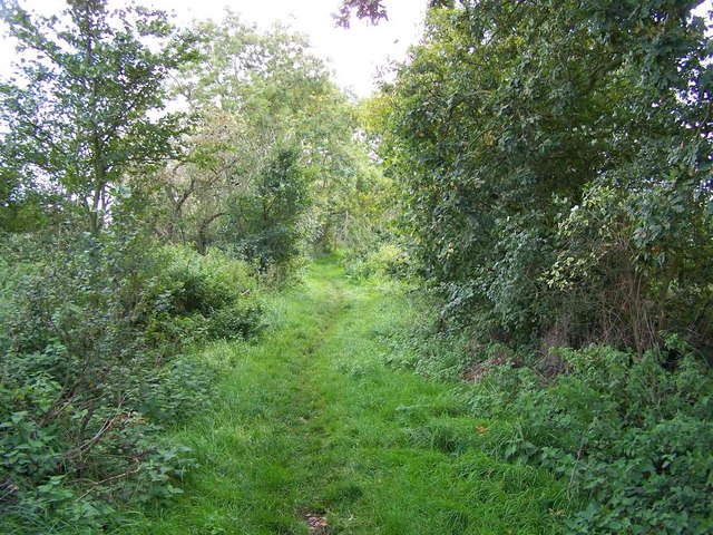
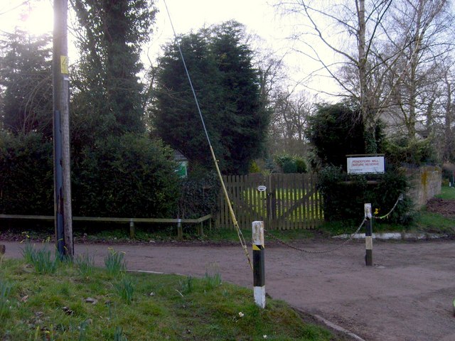
Ford Houses benefits from its proximity to the beautiful Staffordshire countryside, offering residents ample opportunities for outdoor activities. The village is surrounded by scenic walking trails and nature reserves, allowing for peaceful strolls and opportunities to observe local wildlife.

Transport links in Ford Houses are well-connected, with regular bus services to nearby towns and villages. The village is also conveniently located near major road networks, such as the A518 and M6 motorway, providing easy access to other parts of Staffordshire and beyond.

Overall, Ford Houses provides a tranquil and idyllic place to live, combining the charm of rural living with the convenience of nearby amenities and transport links.

If you have any feedback on the listing, please let us know in the comments section below.

Ford Houses Images

Images are sourced within 2km of 52.631407/-2.12925 or Grid Reference SJ9103. Thanks to Geograph Open Source API. All images are credited.

M54 motorway at Coven Lane bridge
M54 approaches Lawn Lane overbridge
Public Land in Pendeford This area of land forms part of the Black Country Urban Forest, and is maturing year on year
Public Land in Pendeford
This area of land forms part of the Black Country Urban Forest, and is maturing year on year
Monarch's Way, Pendeford
Daff's for the Monarch The Monarch's Way near Pendeford Mill.
Daff's for the Monarch
The Monarch's Way near Pendeford Mill.
Pendeford Mill The Nature Reserve near Bilbrook.
Pendeford Mill
The Nature Reserve near Bilbrook.
Middle Lane A part of the Monarch's Way near Pendeford Mill.
Middle Lane
A part of the Monarch's Way near Pendeford Mill.
Middle Lane View A part of the Monarch's Way near Bilbrook.
Middle Lane View
A part of the Monarch's Way near Bilbrook.
The Birmingham Midshires offices, Pendeford The modern offices of the B'ham Midshires building society, nowadays a part of the Lloyds Banking group.
The Birmingham Midshires offices, Pendeford
The modern offices of the B'ham Midshires building society, nowadays a part of the Lloyds Banking group.
Road works near Pendeford Hall
M54 Motorway approaching Coven Lane overbridge
Rakegate Methodist Church, Oxley Methodist Church on Renton Road in Oxley
Rakegate Methodist Church, Oxley
Methodist Church on Renton Road in Oxley
Oxley Parish Church of the Epiphany, Lymer Road
Cat and Kittens Lane, Featherstone This road runs between the former ordnance site near Featherstone and the M54, hence the road sign.
Cat and Kittens Lane, Featherstone
This road runs between the former ordnance site near Featherstone and the M54, hence the road sign.
Moseley Gate The front gated entrance to Moseley Old Hall.
Moseley Gate
The front gated entrance to Moseley Old Hall.
Moseley Wall Moseley Old Hall front elevation viewed from Moseley Old Hall Lane.
Moseley Wall
Moseley Old Hall front elevation viewed from Moseley Old Hall Lane.
Show me another place!

Ford Houses is located at Grid Ref: SJ9103 (Lat: 52.631407, Lng: -2.12925)

Unitary Authority: Wolverhampton

Police Authority: West Midlands

What 3 Words

///voter.skill.lanes. Near Featherstone, Staffordshire

Nearby Locations

Ford Houses Fordhouses

Related Wikis

Goodrich F.C.

Goodrich F.C. was a football club based in Wolverhampton, West Midlands, England. The team joined the West Midlands (Regional) League Division One North...

Fordhouses

Fordhouses is a suburb of Wolverhampton, West Midlands, England. It is situated to the north of the city centre, adjacent to the border with Staffordshire...
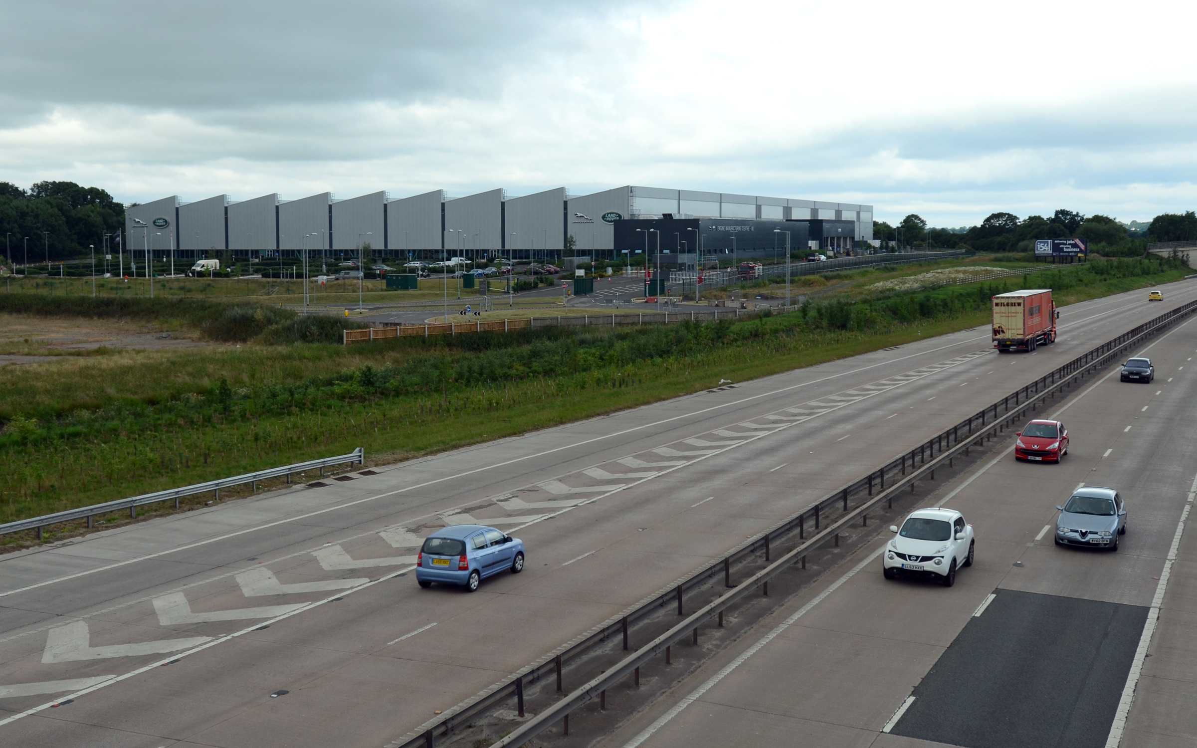
I54

i54 South Staffordshire is a 98-hectare (240-acre) UK technology-based business park located at Junction 2 on the M54 Motorway in the West Midlands, on...

Ormiston NEW Academy

Ormiston NEW Academy (formerly North East Wolverhampton Academy) is a mixed secondary school and sixth form located in the Fordhouses area of Wolverhampton...

Nearby Amenities

Located within 500m of 52.631407,-2.12925
Crossing
Crossing: traffic_signals
Crossing Ref: toucan
Source: OpenStreetCam survey
Lat/Long: 52.6303482/-2.1254995
Crossing
Crossing: traffic_signals
Crossing Ref: toucan
Source: OpenStreetCam survey
Lat/Long: 52.635076/-2.1251932
Crossing
Crossing: traffic_signals
Crossing Ref: toucan
Source: OpenStreetCam survey
Lat/Long: 52.630265/-2.1257277
Crossing
Crossing: traffic_signals
Crossing Ref: toucan
Kerb: lowered
Source: bing
Tactile Paving: yes
Lat/Long: 52.6272777/-2.127007
Give Way
Lat/Long: 52.6277665/-2.1269557
Bus Stop
Stafford Rd / Springfield Lane
NaPTANAreaCode: 43000755401
Bus: yes
Naptan AtcoCode: 43000755401
Naptan Bearing: N
Naptan BusStopType: MKD
Naptan CommonName: Springfield Lane
Naptan Indicator: opp
Naptan Landmark: The Morton Arms
Naptan NaptanCode: nwmjmpjm
Naptan PlusbusZoneRef: BHAMNWS
Naptan Status: ACT
Naptan StopType: BCT
Naptan Street: STAFFORD RD
Naptan Towards: Stafford
Naptan Verified: no
Public Transport: platform
Route Ref: 3;876;877;878
Shelter: yes
Shelter Ref: 101118
Source: WMCA
Lat/Long: 52.6325107/-2.1252725
Bus Stop
Stafford Rd / Springfield Lane
NaPTANAreaCode: 43000755402
Bus: yes
Naptan AtcoCode: 43000755402
Naptan Bearing: S
Naptan BusStopType: MKD
Naptan CommonName: Springfield Lane
Naptan Indicator: adj
Naptan Landmark: The Moreton Arms
Naptan NaptanCode: nwmjmpjp
Naptan PlusbusZoneRef: BHAMNWS
Naptan Status: ACT
Naptan StopType: BCT
Naptan Street: STAFFORD RD
Naptan Towards: Wolverhampton
Naptan Verified: no
Public Transport: platform
Route Ref: 3;76A;876;877;878
Shelter: yes
Shelter Ref: 101102
Source: WMCA
Lat/Long: 52.6315971/-2.1249846
Bus Stop
Stafford Rd / Greenfield Lane
NaPTANAreaCode: 43000755502
Bus: yes
Naptan AtcoCode: 43000755502
Naptan Bearing: N
Naptan BusStopType: MKD
Naptan CommonName: Greenfield Lane
Naptan Indicator: opp
Naptan NaptanCode: nwmjmpjw
Naptan PlusbusZoneRef: BHAMNWS
Naptan Status: ACT
Naptan StopType: BCT
Naptan Street: STAFFORD RD
Naptan Towards: Stafford
Naptan Verified: no
Public Transport: platform
Route Ref: 3;876;877;878
Shelter: yes
Shelter Ref: 101117
Source: WMCA
Lat/Long: 52.6349058/-2.1252324
Bus Stop
Wobaston Rd / Stafford Rd
Bus: yes
Naptan AtcoCode: 43000755701
Naptan Bearing: SE
Naptan BusStopType: MKD
Naptan CommonName: Stafford Rd
Naptan Indicator: bef
Naptan NaptanCode: nwmjmpma
Naptan PlusbusZoneRef: BHAMNWS
Naptan Status: ACT
Naptan StopType: BCT
Naptan Street: WOBASTON RD
Naptan Towards: Towards Wolverhampton
Naptan Verified: no
Public Transport: platform
Route Ref: 3;54;154
Source: WMCA
Lat/Long: 52.6284524/-2.1280662
Bus Stop
Wobaston Rd / Stafford Rd
NaPTANAreaCode: 43000755702
Bus: yes
Naptan AtcoCode: 43000755702
Naptan Bearing: W
Naptan BusStopType: MKD
Naptan CommonName: Stafford Rd
Naptan Indicator: bey
Naptan NaptanCode: nwmjmpmd
Naptan PlusbusZoneRef: BHAMNWS
Naptan Status: ACT
Naptan StopType: BCT
Naptan Street: WOBASTON RD
Naptan Towards: Towards i54
Naptan Verified: no
Public Transport: platform
Route Ref: 3;54;154
Shelter: yes
Shelter Ref: 0755702
Source: WMCA
Lat/Long: 52.628358/-2.1284884
Bus Stop
Wobaston Rd / Patshull Ave
Bus: yes
Naptan AtcoCode: 43000756402
Naptan Bearing: E
Naptan BusStopType: MKD
Naptan CommonName: Patshull Ave
Naptan Indicator: opp
Naptan NaptanCode: nwmjmptd
Naptan PlusbusZoneRef: BHAMNWS
Naptan Status: ACT
Naptan StopType: BCT
Naptan Street: WOBASTON RD
Naptan Towards: Towards Wolverhampton
Naptan Verified: no
Public Transport: platform
Route Ref: 6;6A;25;54;154
Source: WMCA
Lat/Long: 52.6291603/-2.1335766
Bus Stop
Wobaston Rd / Patshull Ave
Bus: yes
Naptan AtcoCode: 43000756403
Naptan Bearing: W
Naptan BusStopType: MKD
Naptan CommonName: Patshull Ave
Naptan Indicator: opp
Naptan NaptanCode: nwmjmptg
Naptan PlusbusZoneRef: BHAMNWS
Naptan Status: ACT
Naptan StopType: BCT
Naptan Street: WOBASTON RD
Naptan Towards: Towards i54
Naptan Verified: no
Public Transport: platform
Route Ref: 3;54;154
Source: WMCA
Lat/Long: 52.6290025/-2.1335728
Bus Stop
Patshull Ave / Redhurst Drive
Asset Ref: 7600501
Bus: yes
Naptan AtcoCode: 43007600501
Naptan Bearing: NE
Naptan BusStopType: MKD
Naptan CommonName: Redhurst Drive
Naptan Indicator: adj
Naptan NaptanCode: nwmpmgtg
Naptan PlusbusZoneRef: BHAMNWS
Naptan Status: ACT
Naptan StopType: BCT
Naptan Street: PATSHULL AVE
Naptan Towards: Fordhouses
Naptan Verified: no
Public Transport: platform
Route Ref: 3;6;25
Source: WMCA
Timetable Case: yes
Lat/Long: 52.6288279/-2.1333244
Bus Stop
Patshull Ave / Redhurst Drive
NaPTANAreaCode: 43007600504
Asset Ref: 101103
Bus: yes
Bus Shelter: yes
Naptan AtcoCode: 43007600504
Naptan Bearing: S
Naptan BusStopType: MKD
Naptan CommonName: Redhurst Drive
Naptan Indicator: opp
Naptan NaptanCode: nwmpmgtj
Naptan PlusbusZoneRef: BHAMNWS
Naptan Status: ACT
Naptan StopType: BCT
Naptan Street: PATSHULL AVE
Naptan Towards: Wolverhampton
Public Transport: platform
Route Ref: 3;6;6A;25
Shelter: yes
Shelter Ref: 101103
Source: WMCA
Timetable Case: yes
Lat/Long: 52.6284182/-2.1332942
Turning Circle
Lat/Long: 52.627703/-2.1299755
Traffic Signals
Source: bing
Lat/Long: 52.6319373/-2.1248721
Fast Food
Fordhouses Chippy
Addr Housenumber: 774
Addr Street: Stafford Road
Cuisine: fish_and_chips
Lat/Long: 52.6299104/-2.1253093
Waste Basket
Lat/Long: 52.6296352/-2.1255517
K3
Shop: hairdresser
Lat/Long: 52.6300125/-2.125249
The Wine Cellar
Addr City: Wolverhampton
Addr Housenumber: 764
Addr Postcode: WV10 6NR
Addr Street: Stafford Road
Shop: alcohol
Lat/Long: 52.6296549/-2.1254602
Fast Food
Perfect Pizza
Addr City: Wolverhampton
Addr Housenumber: 776
Addr Postcode: WV10 6NR
Addr Street: Stafford Road
Cuisine: pizza
Lat/Long: 52.6299614/-2.1252791
Waste Basket
Lat/Long: 52.6299331/-2.1253801
Newsagent
Addr City: Wolverhampton
Addr Housenumber: 766
Addr Postcode: WV10 6NR
Addr Street: Stafford Road
Shop: newsagent
Lat/Long: 52.629706/-2.12543
Waste Basket
Lat/Long: 52.6311536/-2.1220131
Your Coop Food
Addr Housenumber: 657
Addr Street: Stafford Road
Brand: Your Coop Food
Brand Wikidata: Q121084548
Operator: Midcounties Co-operative
Operator Wikidata: Q6841138
Shop: convenience
Lat/Long: 52.6275842/-2.1273222
Post Box
Ref: WV10 62
Lat/Long: 52.6275878/-2.1272249
Post Box
Collection Times: Mo-Fr 16:45; Sa 12:00
Ref: WV10 496
Lat/Long: 52.6295412/-2.1255938
Crossing
Crossing: traffic_signals
Crossing Ref: toucan
Kerb: lowered
Source: bing
Tactile Paving: yes
Lat/Long: 52.6273122/-2.12685
Fordhouses
Place: suburb
Lat/Long: 52.628478/-2.1267246
Parking Entrance
Lat/Long: 52.631515/-2.1227824
Entrance: main
Lat/Long: 52.6313755/-2.1224816
Fast Food
Pete's Plaice
Cuisine: fish_and_chips
Lat/Long: 52.6274947/-2.1272586
Fuel
BP
Brand: BP
Brand Wikidata: Q152057
Brand Wikipedia: en:BP
Fuel HGV Diesel: yes
Fuel Diesel: yes
Fuel Octane 98: yes
Operator: Motor Fuel Group
Operator Website: https://www.motorfuelgroup.com/locations/fordhouses-fs570/
Operator Wikidata: Q107271358
Website: https://map.bp.com/en-GB/GB/petrol-station/wolverhampton/fordhouses-s-stn-fs570/28412
Lat/Long: 52.6299502/-2.1263526
Cafe
The Brook Coffee House
Addr City: Wolverhampton
Addr Housenumber: 772
Addr Postcode: WV10 6NR
Addr Street: Stafford Road
Cuisine: coffee_shop
Lat/Long: 52.6298593/-2.1253395
Olive Grove
Addr City: Wolverhampton
Addr Housenumber: 768
Addr Postcode: WV10 6NR
Addr Street: Stafford Road
Shop: gift
Lat/Long: 52.6297571/-2.1253999
Jimmy Trims
Shop: hairdresser
Lat/Long: 52.6274328/-2.1272264
DW Windows
Addr City: Wolverhampton
Addr Housenumber: 762
Addr Postcode: WV10 6NR
Addr Street: Stafford Road
Craft: window_construction
Email: sales@dwwindows.co.uk
Phone: +441902661779
Product: windows;doors;conservatories;roofline;porches
Website: https://www.dwwindows.co.uk/
Lat/Long: 52.6296039/-2.1254904
Crossing
Crossing: unmarked
Tactile Paving: yes
Lat/Long: 52.6274481/-2.1266238
Crossing
Crossing: unmarked
Crossing Island: yes
Tactile Paving: yes
Lat/Long: 52.6275079/-2.1265673
Traffic Signals
Source: bing
Lat/Long: 52.6317825/-2.1252746
Traffic Signals
Source: bing
Lat/Long: 52.632195/-2.1250066
Give Way
Lat/Long: 52.6274456/-2.1267402
Give Way
Lat/Long: 52.6281827/-2.1266408
Give Way
Lat/Long: 52.6281952/-2.1272876
Vending Machine
Patshull Ave
Category: Stop
Mode: Bus
Naptan: 43007600504
Operator: TfWM
Payment: no
Postal Code: WV10 6
Public Transport Ticket: Swift Card
Shelter: 101103
Source: TfWM
Top Up: yes
Vending: public_transport_tickets
Lat/Long: 52.6284117/-2.1332962
Post Office
Fordhouses Post Office
Addr City: Wolverhampton
Addr Postcode: WV10 6QG
Addr Street: Stafford Road
Addr Village: Fordhouses
Brand: Post Office
Brand Wikidata: Q1783168
Opening Hours: Mo-Fr 08:00-19:00; Sa 08:00-15:00
Ref Pol Id: 5202
Website: https://www.postoffice.co.uk/branch-finder/1792466/fordhouses
Lat/Long: 52.6275625/-2.1272974
Bus Stop
Stafford Rd / Farnbrook Ave
Bus: yes
Naptan AtcoCode: 43007600101
Naptan Bearing: NE
Naptan BusStopType: CUS
Naptan CommonName: Farnbrook Ave
Naptan NaptanCode: nwmpwmwa
Naptan Status: ACT
Naptan StopType: BCT
Naptan Street: STAFFORD RD
Public Transport: platform
Route Ref: 877
Source: WMCA
Lat/Long: 52.6291096/-2.1264232
Man Made: surveillance
Source: OpenStreetCam survey
Lat/Long: 52.6280048/-2.1268979
Operator: Wolverhampton City Council
Source: survey
Traffic Sign: variable_message
Variable Message Information: traffic
Lat/Long: 52.6298119/-2.1257579
Crossing
Crossing: traffic_signals
Crossing Ref: toucan
Lat/Long: 52.6319385/-2.1249694
Crossing
Crossing: unmarked
Crossing Island: no
Tactile Paving: yes
Lat/Long: 52.6340493/-2.1248875
Generator Method: photovoltaic
Generator Output Electricity: yes
Generator Source: solar
Generator Type: solar_photovoltaic_panel
Location: roof
Power: generator
Lat/Long: 52.6293186/-2.1243712
Generator Method: photovoltaic
Generator Output Electricity: yes
Generator Source: solar
Generator Type: solar_photovoltaic_panel
Location: roof
Power: generator
Lat/Long: 52.6294293/-2.1251571
Generator Method: photovoltaic
Generator Output Electricity: yes
Generator Source: solar
Generator Type: solar_photovoltaic_panel
Location: roof
Power: generator
Lat/Long: 52.6276564/-2.1315864
Generator Method: photovoltaic
Generator Output Electricity: yes
Generator Source: solar
Generator Type: solar_photovoltaic_panel
Location: roof
Power: generator
Lat/Long: 52.6279771/-2.1318559
Generator Method: photovoltaic
Generator Output Electricity: yes
Generator Source: solar
Generator Type: solar_photovoltaic_panel
Location: roof
Power: generator
Lat/Long: 52.6282588/-2.1311224
Generator Method: photovoltaic
Generator Output Electricity: yes
Generator Source: solar
Generator Type: solar_photovoltaic_panel
Location: roof
Power: generator
Lat/Long: 52.6283638/-2.1323012
Generator Method: photovoltaic
Generator Output Electricity: yes
Generator Source: solar
Generator Type: solar_photovoltaic_panel
Location: roof
Power: generator
Lat/Long: 52.6283719/-2.1325211
Crossing
Crossing: traffic_signals
Source: bing
Lat/Long: 52.628327/-2.1278012
Crossing
Crossing: traffic_signals
Source: bing
Lat/Long: 52.6282024/-2.1278085
Traffic Signals
Traffic Signals: signal
Lat/Long: 52.631782/-2.1251934
Traffic Signals
Traffic Signals: signal
Lat/Long: 52.6321974/-2.1250992
Crossing
Crossing: unmarked
Crossing Island: no
Tactile Paving: yes
Lat/Long: 52.6352459/-2.1254472
Crossing
Crossing: traffic_signals
Crossing Ref: toucan
Lat/Long: 52.6350036/-2.1253489
Crossing
Crossing: unmarked
Crossing Island: no
Tactile Paving: yes
Lat/Long: 52.6346053/-2.1254147
Crossing
Crossing: unmarked
Crossing Island: no
Tactile Paving: yes
Lat/Long: 52.6343583/-2.1253874
Crossing
Crossing: unmarked
Crossing Island: no
Tactile Paving: yes
Lat/Long: 52.6341963/-2.1253785
Crossing
Crossing: unmarked
Crossing Island: no
Tactile Paving: yes
Lat/Long: 52.6337233/-2.125363
Crossing
Crossing: traffic_signals
Crossing Ref: toucan
Lat/Long: 52.6320933/-2.1252426
Crossing
Crossing: traffic_signals
Crossing Ref: toucan
Lat/Long: 52.6321341/-2.1251081
Crossing
Crossing: traffic_signals
Crossing Ref: toucan
Lat/Long: 52.6321314/-2.1250179
Crossing
Crossing: unmarked
Crossing Island: no
Tactile Paving: yes
Lat/Long: 52.6296365/-2.1258604
Fast Food
Sandwich King
Addr Housenumber: 770
Addr Street: Stafford Road
Cuisine: sandwich
Lat/Long: 52.6298082/-2.1253697
The data included in this document is from www.openstreetmap.org. The data is made available under ODbL.

Have you been to Ford Houses?

Leave your review of Ford Houses below (or comments, questions and feedback).