Parliament Wood

Wood, Forest in Kent Ashford

England

Parliament Wood

Stocks Mill, Wittersham Isle of Oxney, Kent The Isle of Oxney was once an island in medieval times, a high spot surrounded by sea and marsh. On top of the island is Stocks Mill, a post mill with a roundhouse of tarred brick under a sloping wooden felted roof. It is the tallest of the county’s remaining post mills. The centre post of the mill has the date 1781 and the initials RV carved on it - this is either the date of the mill’s construction or the date it was moved to Wittersham. (Information from Kent County Council who now own the mill.)
Stocks Mill, Wittersham Isle of Oxney, Kent Credit: Ron Strutt

Parliament Wood is a picturesque woodland located in the county of Kent, England. Situated near the village of Wrotham, this enchanting forest covers an area of approximately 52 acres. It is renowned for its stunning natural beauty and diverse range of wildlife.

The wood is predominantly composed of broadleaf trees, including oak, beech, and sweet chestnut, which create a dense canopy overhead, providing shade and shelter for the many species that call the forest home. The forest floor is adorned with a rich tapestry of colorful wildflowers, such as bluebells and primroses, which bloom during the spring months, creating a breathtaking carpet of vibrant hues.

Parliament Wood boasts several well-maintained walking trails and footpaths, allowing visitors to explore its serene surroundings at their own pace. These paths wind through the woodland, offering glimpses of sunlight filtering through the tree branches and the gentle rustle of leaves underfoot.

As a designated Site of Special Scientific Interest, Parliament Wood is not only a haven for nature enthusiasts but also serves as an important habitat for various wildlife species. Deer, badgers, foxes, and an array of bird species can often be spotted in the forest, adding to the sense of tranquility and natural harmony.

Whether you are seeking a peaceful stroll in nature, a chance to observe wildlife, or simply a moment of solitude away from the hustle and bustle of daily life, Parliament Wood in Kent is a perfect destination to immerse yourself in the beauty of the natural world.

If you have any feedback on the listing, please let us know in the comments section below.

Parliament Wood Images

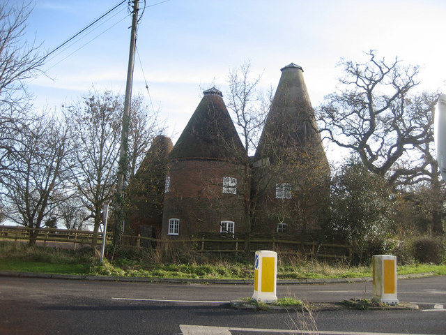
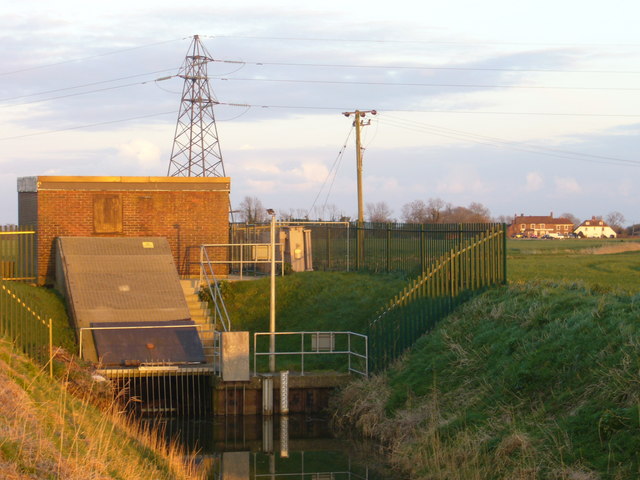
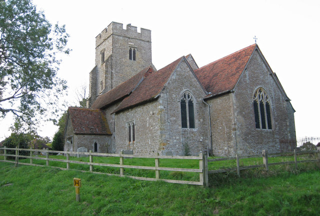
Images are sourced within 2km of 51.015869/0.74601791 or Grid Reference TQ9227. Thanks to Geograph Open Source API. All images are credited.

Stocks Mill, Wittersham Isle of Oxney, Kent The Isle of Oxney was once an island in medieval times, a high spot surrounded by sea and marsh. On top of the island is Stocks Mill, a post mill with a roundhouse of tarred brick under a sloping wooden felted roof. It is the tallest of the county’s remaining post mills. The centre post of the mill has the date 1781 and the initials RV carved on it - this is either the date of the mill’s construction or the date it was moved to Wittersham. (Information from Kent County Council who now own the mill.)
Stocks Mill, Wittersham Isle of Oxney, Kent
The Isle of Oxney was once an island in medieval times, a high spot surrounded by sea and marsh. On top of the island is Stocks Mill, a post mill with a roundhouse of tarred brick under a sloping wooden felted roof. It is the tallest of the county’s remaining post mills. The centre post of the mill has the date 1781 and the initials RV carved on it - this is either the date of the mill’s construction or the date it was moved to Wittersham. (Information from Kent County Council who now own the mill.)
Rye Road, Underhill, B2082. Typical approach road to Wittersham, showing old coastline for the Isle of Oxney.
Rye Road, Underhill, B2082.
Typical approach road to Wittersham, showing old coastline for the Isle of Oxney.
Harvest time on the Rother Levels Typical farmland for the area, looking out towards Romney Marsh
Harvest time on the Rother Levels
Typical farmland for the area, looking out towards Romney Marsh
High Bank in the snow High Bank is in the hamlet of Underhill on the B2082 between Iden and Wittersham
High Bank in the snow
High Bank is in the hamlet of Underhill on the B2082 between Iden and Wittersham
View towards Stone Cliff from Underhill Showing the old sea cliffs now about 10 miles inland.
View towards Stone Cliff from Underhill
Showing the old sea cliffs now about 10 miles inland.
Stone Church from Knock Hill Stone Church on the Isle of Oxney in the Weald of Kent countryside
Stone Church from Knock Hill
Stone Church on the Isle of Oxney in the Weald of Kent countryside
Oast House at Stocks Farm, Wittersham Road, Wittersham, Kent Triple round kiln oast house, missing cowls. The kilns are of various sizes and heights, suggesting each was added at a different time or was modified due to ineffective or over-effective draughting through the roofs.
Oast House at Stocks Farm, Wittersham Road, Wittersham, Kent
Triple round kiln oast house, missing cowls. The kilns are of various sizes and heights, suggesting each was added at a different time or was modified due to ineffective or over-effective draughting through the roofs.
The Roundel, Stocks Road, Wittersham, Kent The roundel roof is actually brick built, but has been covered in tile during conversion. It would have looked more akin to this oast <a title="https://www.geograph.org.uk/photo/338791" href="https://www.geograph.org.uk/photo/338791">Link</a>
The Roundel, Stocks Road, Wittersham, Kent
The roundel roof is actually brick built, but has been covered in tile during conversion. It would have looked more akin to this oast Link
Oat Barn House Lower Road. "Late mediaeval timber framed hall-house". Grade II listed: <span class="nowrap"><a title="http://www.imagesofengland.org.uk/search/details.aspx?pid=2&id=180441" rel="nofollow ugc noopener" href="http://www.imagesofengland.org.uk/search/details.aspx?pid=2&id=180441">Link</a><img style="margin-left:2px;" alt="External link" title="External link - shift click to open in new window" src="https://s1.geograph.org.uk/img/external.png" width="10" height="10"/></span>
Oat Barn House
Lower Road. "Late mediaeval timber framed hall-house". Grade II listed: LinkExternal link
Crown Inn at the junction of The Street, Catt's Hill and Church Hill. Looks like a private house but still open as a pub.
Crown Inn
at the junction of The Street, Catt's Hill and Church Hill. Looks like a private house but still open as a pub.
The Ferry Inn The road is Appledore Road, the principal road into the Isle of Oxney from the north. The watercourse is called the Reading Sewer. Originally it was much wider and part of the River Rother which flowed north of Oxney. However, according to this <span class="nowrap"><a title="http://www.villagenet.co.uk/history/0000-romneymarsh.html" rel="nofollow ugc noopener" href="http://www.villagenet.co.uk/history/0000-romneymarsh.html">Link</a><img style="margin-left:2px;" alt="External link" title="External link - shift click to open in new window" src="https://s1.geograph.org.uk/img/external.png" width="10" height="10"/></span> the Rother was flowing south of Oxney as early as 1750. The pub is called the Ferry Inn and outside it is a board headed "Oxney Ferry, List of Tolls" and including "Motor coach or Char-a-banc - 1s 6d" suggesting that it was still a ferry in the age of the motor car. Given the narrowness of the river why did nobody build a bridge sooner? Or was it in fact a toll bridge?


(e-mailed information from a visitor to the site follows)

I noticed your note about the Ferry. The Ferry is located at the last land spit on the Isle of Oxney, which used to be surrounded by sea and rivers, and much of the surrounding area became marshland in around 1650, when the sea level changed. The ferry used to carry people from the Isle of Oxney to the mainland at Appledore, a journey of over a mile.

The river Rother used to run past the pub, but was later diverted to the other side of the island. This was a major transport route for shipping, as it used to run from Newenden past Smallhythe (both major ship-building ports in Henry VIII's day) to the port at Rye. Currently, the waterway that runs past the Ferry is called Reading Sewer.
More info is available on the ferry website at <span class="nowrap"><a title="www.oxneyferry.com" rel="nofollow ugc noopener" href="http://www.oxneyferry.com">Link</a><img style="margin-left:2px;" alt="External link" title="External link - shift click to open in new window" src="https://s1.geograph.org.uk/img/external.png" width="10" height="10"/></span>
The Ferry Inn
The road is Appledore Road, the principal road into the Isle of Oxney from the north. The watercourse is called the Reading Sewer. Originally it was much wider and part of the River Rother which flowed north of Oxney. However, according to this LinkExternal link the Rother was flowing south of Oxney as early as 1750. The pub is called the Ferry Inn and outside it is a board headed "Oxney Ferry, List of Tolls" and including "Motor coach or Char-a-banc - 1s 6d" suggesting that it was still a ferry in the age of the motor car. Given the narrowness of the river why did nobody build a bridge sooner? Or was it in fact a toll bridge? (e-mailed information from a visitor to the site follows) I noticed your note about the Ferry. The Ferry is located at the last land spit on the Isle of Oxney, which used to be surrounded by sea and rivers, and much of the surrounding area became marshland in around 1650, when the sea level changed. The ferry used to carry people from the Isle of Oxney to the mainland at Appledore, a journey of over a mile. The river Rother used to run past the pub, but was later diverted to the other side of the island. This was a major transport route for shipping, as it used to run from Newenden past Smallhythe (both major ship-building ports in Henry VIII's day) to the port at Rye. Currently, the waterway that runs past the Ferry is called Reading Sewer. More info is available on the ferry website at LinkExternal link
Ebony Pumping Station more than a mile from the centre of <a href="https://www.geograph.org.uk/photo/388587">TQ9129 : Ebony</a>, it takes this name because it pumps the drainage from the Ebony area into the Reading Sewer. <a href="https://www.geograph.org.uk/photo/388580">TQ9428 : The Ferry Inn</a> is in the background.
Ebony Pumping Station
more than a mile from the centre of TQ9129 : Ebony, it takes this name because it pumps the drainage from the Ebony area into the Reading Sewer. TQ9428 : The Ferry Inn is in the background.
Orchard near Stemps Wood Taken from the footpath that leads from Acton Lane to The Stocks.
Orchard near Stemps Wood
Taken from the footpath that leads from Acton Lane to The Stocks.
Ebony Cottages, Stone Corner, Ebony Part of the parish of Stone-cum-Ebony these few cottages are on the junction of lanes from Wittersham to Reading Street and The Stocks.
Ebony Cottages, Stone Corner, Ebony
Part of the parish of Stone-cum-Ebony these few cottages are on the junction of lanes from Wittersham to Reading Street and The Stocks.
Unconverted barn at Coldharbour Farm on the Isle of Oxney This is the unconverted barn at Coldharbour Farm, next to Coldharbour Farm Cottage.

In the distance is Cliff Barn.
Unconverted barn at Coldharbour Farm on the Isle of Oxney
This is the unconverted barn at Coldharbour Farm, next to Coldharbour Farm Cottage. In the distance is Cliff Barn.
Stone Cliff on the Isle of Oxney, overlooking the Rother Levels The line of trees in the background marks the Royal Military Canal and the <a href="https://www.geograph.org.uk/photo/421904">TQ9325 : Cliff Marsh</a> photo was taken looking towards this point from a viewpoint off this picture to the right.
Stone Cliff on the Isle of Oxney, overlooking the Rother Levels
The line of trees in the background marks the Royal Military Canal and the TQ9325 : Cliff Marsh photo was taken looking towards this point from a viewpoint off this picture to the right.
Stone in Oxney, as seen from the churchyard on Church Hill
Trees marking a field boundary near Stemps Wood and orchards on Acton Farm
Show me another place!

Parliament Wood is located at Grid Ref: TQ9227 (Lat: 51.015869, Lng: 0.74601791)

Administrative County: Kent

District: Ashford

Police Authority: Kent

What 3 Words

///playfully.touchy.stickler. Near Stone, Kent

Related Wikis

Isle of Oxney

Isle of Oxney is an area in Kent, England, close to the boundary with East Sussex. Up to the 13th century, the island was part of the coastline bordering...

Stone-cum-Ebony

Stone-cum-Ebony is a large mostly rural and marshland civil parish centred 7 miles (11 km) SSW of Ashford in Kent, South East England. It includes the...

Ebony, Kent

Ebony is a hamlet south of Ashford in Kent, South East England, in the civil parish of Stone-cum-Ebony, on the Isle of Oxney in the Ashford district of...

Stone in Oxney

Stone in Oxney is a village in the civil parish of Stone-cum-Ebony, in the Ashford district, in the county of Kent, England. It is south of Ashford, near...

Nearby Amenities

Located within 500m of 51.015869,0.74601791
Power: tower
Lat/Long: 51.0159808/0.7502446
Power: tower
Lat/Long: 51.0122658/0.7465786
Power: tower
Lat/Long: 51.0141263/0.748425
Twelve Acre Wood
Natural: wood
Lat/Long: 51.0158429/0.7405655
Moneypenny's Wood
Natural: wood
Lat/Long: 51.0159506/0.7422972
Scrubs Wood
Natural: wood
Lat/Long: 51.014507/0.7438357
Four Acre Wood
Natural: wood
Lat/Long: 51.0132824/0.7416131
Curteis Wood
Natural: wood
Lat/Long: 51.0173391/0.746936
The data included in this document is from www.openstreetmap.org. The data is made available under ODbL.

Have you been to Parliament Wood?

Leave your review of Parliament Wood below (or comments, questions and feedback).