Galley Hill

Wood, Forest in Norfolk Breckland

England

Galley Hill

Forest Track Forest track near to Stonebridge, Norfolk.
Forest Track Credit: Keith Evans

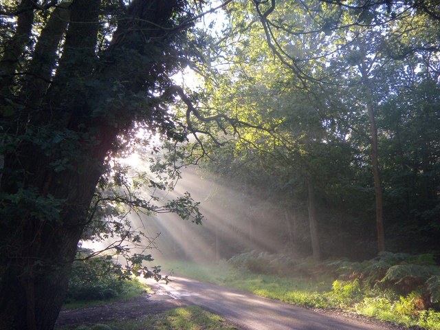
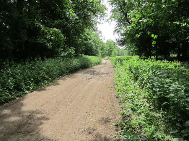
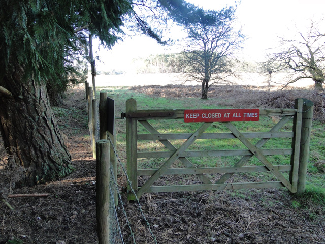
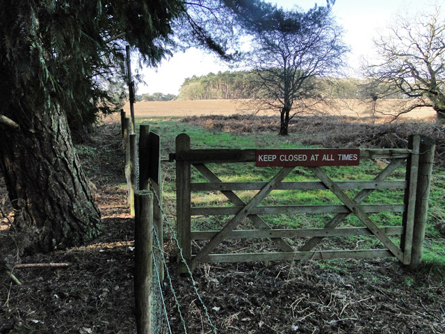
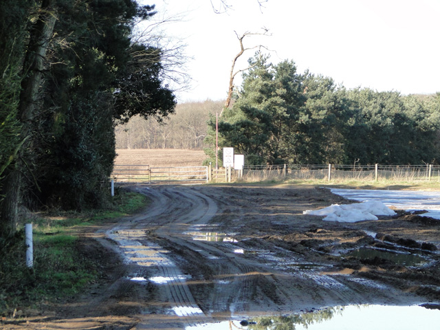
Galley Hill, located in Norfolk, England, is a picturesque wood or forest area that offers a serene and natural retreat for visitors. The site is nestled in the heart of the countryside, surrounded by rolling hills and lush greenery.

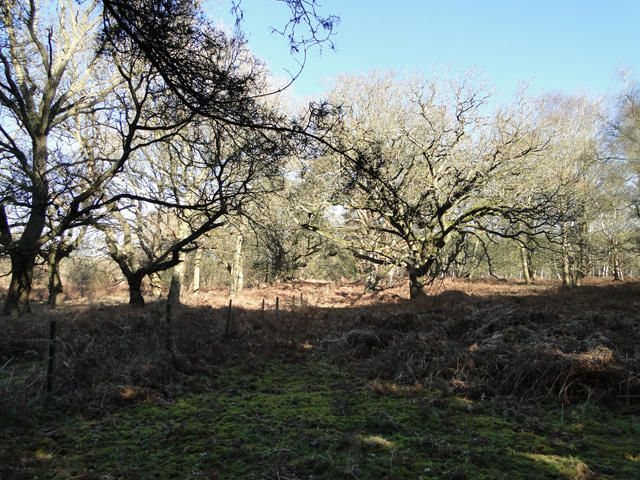
Covering an area of approximately 100 hectares, Galley Hill is known for its diverse range of woodland habitats, including broadleaf and coniferous trees. The wood is home to a variety of wildlife, such as songbirds, deer, and various small mammals. Visitors can enjoy the peaceful atmosphere while observing and appreciating the natural beauty that surrounds them.

The wood offers several well-marked walking trails, allowing visitors to explore and wander through the enchanting forest. These trails cater to all levels of fitness and offer opportunities for both short walks and longer hikes. Along the way, visitors may come across charming streams, tranquil ponds, and vibrant wildflowers, enhancing the overall experience.

Galley Hill is also a popular destination for nature enthusiasts and photographers, as it provides ample opportunities to capture stunning landscapes and wildlife shots. The wood's natural beauty changes with the seasons, offering a different experience throughout the year. In the spring, the forest is alive with blossoms and vibrant green foliage, while in autumn, it becomes a tapestry of rich reds, oranges, and yellows.

Overall, Galley Hill, Norfolk is a haven for nature lovers, offering a peaceful and idyllic environment where visitors can immerse themselves in the beauty of the natural world.

If you have any feedback on the listing, please let us know in the comments section below.

Galley Hill Images

Images are sourced within 2km of 52.497798/0.83099861 or Grid Reference TL9292. Thanks to Geograph Open Source API. All images are credited.

Forest Track Forest track near to Stonebridge, Norfolk.
Forest Track
Forest track near to Stonebridge, Norfolk.
Green Road Country Road near to Stonebridge, Norfolk.
Green Road
Country Road near to Stonebridge, Norfolk.
Country Lane Country lane and forest track entrance near to Stonebridge, Norfolk.
Country Lane
Country lane and forest track entrance near to Stonebridge, Norfolk.
Poor's Allotment This open land is marked on the map as Poor's Allotment near to Breckles, Norfolk.
Poor's Allotment
This open land is marked on the map as Poor's Allotment near to Breckles, Norfolk.
Green Track Green forest track near to Breckles, Norfolk.
Green Track
Green forest track near to Breckles, Norfolk.
Forest Track Forest track looking north towards Frost's Common near to Breckles, Norfolk.
Forest Track
Forest track looking north towards Frost's Common near to Breckles, Norfolk.
Country lane in the woods near to Great Hockham Early morning sun beams through the trees in the woods near Great Hockham, close to part of the Peddars Way.
Country lane in the woods near to Great Hockham
Early morning sun beams through the trees in the woods near Great Hockham, close to part of the Peddars Way.
Morning sunlight through the trees at Stonebridge Taken in Hockham woods near to Stonebridge and part of the Peddars Way
Morning sunlight through the trees at Stonebridge
Taken in Hockham woods near to Stonebridge and part of the Peddars Way
Woodland track, Hockham woods Woodland track in Hockham woods near to The Peddars Way.Hockham Heath is to the right of the track.
Woodland track, Hockham woods
Woodland track in Hockham woods near to The Peddars Way.Hockham Heath is to the right of the track.
Peddars Way A section of the Peddars Way & Norfolk Coast Path, also the NCR 13 follows this section of the Peddars Way.
Peddars Way
A section of the Peddars Way & Norfolk Coast Path, also the NCR 13 follows this section of the Peddars Way.
Square Covert, Thetford Forest, near  Great Hockham, Frosty morning at Square Covert,with disused wildlife hide in the distance.
Square Covert, Thetford Forest, near Great Hockham,
Frosty morning at Square Covert,with disused wildlife hide in the distance.
Agricultural crop under plastic next to the firing range STANTA stands for STANford Training Area situated roughly TL 8495. 
The area was established in 1942 when a battle training area was required and a 'Nazi village' established. Military exercises were already taking place in the area; tanks had deployed to Thetford in the First World War. The complete takeover involved the complete evacuation of the villages of Buckenham Tofts, Langford, Stanford, Sturston, Tottington and West Tofts. The occupants of the houses were all rehoused in the belief that they would be allowed to return after the war. However the site was so valuable to the military that they have taken up permanent occupancy.  
The area was used during the run-up to the D-Day invasion and since then has hosted many exercises. 
The battle area includes four historic churches; the one at West Tofts was restored by Pugin and a new "church" forms part of the specially constructed village of Eastmere. Eastmere was originally built to give soldiers experience of fighting on the northern European plains.
There is a short landing strip for Harrier aircraft at TL 8332 9704
As a live firing area, access is not allowed without special permission from the Army. In the main this is limited to a number of tours a year and compassionate grounds for former residents of the villages or their relatives.
The area forms part of the distinctive Breckland landscape region, a gorse-covered sandy heath which offers poor agricultural opportunities but farms are still active and sheep graze within its confines. Arguably, its use as a military training area has safeguarded a substantial archaeological landscape. It is the home of a wealth of rare species of flora and fauna already lost in other parts of the country. Parts of the training area are designated Site of Special Scientific Interest (SSSI).
The battle area was used in the filming of many of the episodes of the TV comedy series, Dad's Army.
Agricultural crop under plastic next to the firing range
STANTA stands for STANford Training Area situated roughly TL 8495. The area was established in 1942 when a battle training area was required and a 'Nazi village' established. Military exercises were already taking place in the area; tanks had deployed to Thetford in the First World War. The complete takeover involved the complete evacuation of the villages of Buckenham Tofts, Langford, Stanford, Sturston, Tottington and West Tofts. The occupants of the houses were all rehoused in the belief that they would be allowed to return after the war. However the site was so valuable to the military that they have taken up permanent occupancy. The area was used during the run-up to the D-Day invasion and since then has hosted many exercises. The battle area includes four historic churches; the one at West Tofts was restored by Pugin and a new "church" forms part of the specially constructed village of Eastmere. Eastmere was originally built to give soldiers experience of fighting on the northern European plains. There is a short landing strip for Harrier aircraft at TL 8332 9704 As a live firing area, access is not allowed without special permission from the Army. In the main this is limited to a number of tours a year and compassionate grounds for former residents of the villages or their relatives. The area forms part of the distinctive Breckland landscape region, a gorse-covered sandy heath which offers poor agricultural opportunities but farms are still active and sheep graze within its confines. Arguably, its use as a military training area has safeguarded a substantial archaeological landscape. It is the home of a wealth of rare species of flora and fauna already lost in other parts of the country. Parts of the training area are designated Site of Special Scientific Interest (SSSI). The battle area was used in the filming of many of the episodes of the TV comedy series, Dad's Army.
Gate to and from the firing range STANTA stands for STANford Training Area situated roughly TL 8495. 
The area was established in 1942 when a battle training area was required and a 'Nazi village' established. Military exercises were already taking place in the area; tanks had deployed to Thetford in the First World War. The complete takeover involved the complete evacuation of the villages of Buckenham Tofts, Langford, Stanford, Sturston, Tottington and West Tofts. The occupants of the houses were all rehoused in the belief that they would be allowed to return after the war. However the site was so valuable to the military that they have taken up permanent occupancy.  
The area was used during the run-up to the D-Day invasion and since then has hosted many exercises. 
The battle area includes four historic churches; the one at West Tofts was restored by Pugin and a new "church" forms part of the specially constructed village of Eastmere. Eastmere was originally built to give soldiers experience of fighting on the northern European plains.
There is a short landing strip for Harrier aircraft at TL 8332 9704
As a live firing area, access is not allowed without special permission from the Army. In the main this is limited to a number of tours a year and compassionate grounds for former residents of the villages or their relatives.
The area forms part of the distinctive Breckland landscape region, a gorse-covered sandy heath which offers poor agricultural opportunities but farms are still active and sheep graze within its confines. Arguably, its use as a military training area has safeguarded a substantial archaeological landscape. It is the home of a wealth of rare species of flora and fauna already lost in other parts of the country. Parts of the training area are designated Site of Special Scientific Interest (SSSI).
The battle area was used in the filming of many of the episodes of the TV comedy series, Dad's Army.
Gate to and from the firing range
STANTA stands for STANford Training Area situated roughly TL 8495. The area was established in 1942 when a battle training area was required and a 'Nazi village' established. Military exercises were already taking place in the area; tanks had deployed to Thetford in the First World War. The complete takeover involved the complete evacuation of the villages of Buckenham Tofts, Langford, Stanford, Sturston, Tottington and West Tofts. The occupants of the houses were all rehoused in the belief that they would be allowed to return after the war. However the site was so valuable to the military that they have taken up permanent occupancy. The area was used during the run-up to the D-Day invasion and since then has hosted many exercises. The battle area includes four historic churches; the one at West Tofts was restored by Pugin and a new "church" forms part of the specially constructed village of Eastmere. Eastmere was originally built to give soldiers experience of fighting on the northern European plains. There is a short landing strip for Harrier aircraft at TL 8332 9704 As a live firing area, access is not allowed without special permission from the Army. In the main this is limited to a number of tours a year and compassionate grounds for former residents of the villages or their relatives. The area forms part of the distinctive Breckland landscape region, a gorse-covered sandy heath which offers poor agricultural opportunities but farms are still active and sheep graze within its confines. Arguably, its use as a military training area has safeguarded a substantial archaeological landscape. It is the home of a wealth of rare species of flora and fauna already lost in other parts of the country. Parts of the training area are designated Site of Special Scientific Interest (SSSI). The battle area was used in the filming of many of the episodes of the TV comedy series, Dad's Army.
Fence surrounding the firing range STANTA stands for STANford Training Area situated roughly TL 8495. 
The area was established in 1942 when a battle training area was required and a 'Nazi village' established. Military exercises were already taking place in the area; tanks had deployed to Thetford in the First World War. The complete takeover involved the complete evacuation of the villages of Buckenham Tofts, Langford, Stanford, Sturston, Tottington and West Tofts. The occupants of the houses were all rehoused in the belief that they would be allowed to return after the war. However the site was so valuable to the military that they have taken up permanent occupancy.  
The area was used during the run-up to the D-Day invasion and since then has hosted many exercises. 
The battle area includes four historic churches; the one at West Tofts was restored by Pugin and a new "church" forms part of the specially constructed village of Eastmere. Eastmere was originally built to give soldiers experience of fighting on the northern European plains.
There is a short landing strip for Harrier aircraft at TL 8332 9704
As a live firing area, access is not allowed without special permission from the Army. In the main this is limited to a number of tours a year and compassionate grounds for former residents of the villages or their relatives.
The area forms part of the distinctive Breckland landscape region, a gorse-covered sandy heath which offers poor agricultural opportunities but farms are still active and sheep graze within its confines. Arguably, its use as a military training area has safeguarded a substantial archaeological landscape. It is the home of a wealth of rare species of flora and fauna already lost in other parts of the country. Parts of the training area are designated Site of Special Scientific Interest (SSSI).
The battle area was used in the filming of many of the episodes of the TV comedy series, Dad's Army.
Fence surrounding the firing range
STANTA stands for STANford Training Area situated roughly TL 8495. The area was established in 1942 when a battle training area was required and a 'Nazi village' established. Military exercises were already taking place in the area; tanks had deployed to Thetford in the First World War. The complete takeover involved the complete evacuation of the villages of Buckenham Tofts, Langford, Stanford, Sturston, Tottington and West Tofts. The occupants of the houses were all rehoused in the belief that they would be allowed to return after the war. However the site was so valuable to the military that they have taken up permanent occupancy. The area was used during the run-up to the D-Day invasion and since then has hosted many exercises. The battle area includes four historic churches; the one at West Tofts was restored by Pugin and a new "church" forms part of the specially constructed village of Eastmere. Eastmere was originally built to give soldiers experience of fighting on the northern European plains. There is a short landing strip for Harrier aircraft at TL 8332 9704 As a live firing area, access is not allowed without special permission from the Army. In the main this is limited to a number of tours a year and compassionate grounds for former residents of the villages or their relatives. The area forms part of the distinctive Breckland landscape region, a gorse-covered sandy heath which offers poor agricultural opportunities but farms are still active and sheep graze within its confines. Arguably, its use as a military training area has safeguarded a substantial archaeological landscape. It is the home of a wealth of rare species of flora and fauna already lost in other parts of the country. Parts of the training area are designated Site of Special Scientific Interest (SSSI). The battle area was used in the filming of many of the episodes of the TV comedy series, Dad's Army.
One of the many entrances to STANTA STANTA stands for STANford Training Area situated roughly TL 8495. 
The area was established in 1942 when a battle training area was required and a 'Nazi village' established. Military exercises were already taking place in the area; tanks had deployed to Thetford in the First World War. The complete takeover involved the complete evacuation of the villages of Buckenham Tofts, Langford, Stanford, Sturston, Tottington and West Tofts. The occupants of the houses were all rehoused in the belief that they would be allowed to return after the war. However the site was so valuable to the military that they have taken up permanent occupancy.  
The area was used during the run-up to the D-Day invasion and since then has hosted many exercises. 
The battle area includes four historic churches; the one at West Tofts was restored by Pugin and a new "church" forms part of the specially constructed village of Eastmere. Eastmere was originally built to give soldiers experience of fighting on the northern European plains.
There is a short landing strip for Harrier aircraft at TL 8332 9704
As a live firing area, access is not allowed without special permission from the Army. In the main this is limited to a number of tours a year and compassionate grounds for former residents of the villages or their relatives.
The area forms part of the distinctive Breckland landscape region, a gorse-covered sandy heath which offers poor agricultural opportunities but farms are still active and sheep graze within its confines. Arguably, its use as a military training area has safeguarded a substantial archaeological landscape. It is the home of a wealth of rare species of flora and fauna already lost in other parts of the country. Parts of the training area are designated Site of Special Scientific Interest (SSSI).
The battle area was used in the filming of many of the episodes of the TV comedy series, Dad's Army.
One of the many entrances to STANTA
STANTA stands for STANford Training Area situated roughly TL 8495. The area was established in 1942 when a battle training area was required and a 'Nazi village' established. Military exercises were already taking place in the area; tanks had deployed to Thetford in the First World War. The complete takeover involved the complete evacuation of the villages of Buckenham Tofts, Langford, Stanford, Sturston, Tottington and West Tofts. The occupants of the houses were all rehoused in the belief that they would be allowed to return after the war. However the site was so valuable to the military that they have taken up permanent occupancy. The area was used during the run-up to the D-Day invasion and since then has hosted many exercises. The battle area includes four historic churches; the one at West Tofts was restored by Pugin and a new "church" forms part of the specially constructed village of Eastmere. Eastmere was originally built to give soldiers experience of fighting on the northern European plains. There is a short landing strip for Harrier aircraft at TL 8332 9704 As a live firing area, access is not allowed without special permission from the Army. In the main this is limited to a number of tours a year and compassionate grounds for former residents of the villages or their relatives. The area forms part of the distinctive Breckland landscape region, a gorse-covered sandy heath which offers poor agricultural opportunities but farms are still active and sheep graze within its confines. Arguably, its use as a military training area has safeguarded a substantial archaeological landscape. It is the home of a wealth of rare species of flora and fauna already lost in other parts of the country. Parts of the training area are designated Site of Special Scientific Interest (SSSI). The battle area was used in the filming of many of the episodes of the TV comedy series, Dad's Army.
Field off Dunford Lane
Show me another place!

Galley Hill is located at Grid Ref: TL9292 (Lat: 52.497798, Lng: 0.83099861)

Administrative County: Norfolk

District: Breckland

Police Authority: Norfolk

What 3 Words

///climate.escapes.tinny. Near Griston, Norfolk

Related Wikis

Great Eastern Pingo Trail

Great Eastern Pingo Trail is a 9.2 kilometres (5.7 miles) long footpath along a disused railway line north of Thetford in Norfolk. It is a 4.2-hectare...

Thompson Water, Carr and Common

Thompson Water, Carr and Common is a 154.7-hectare (382-acre) biological Site of Special Scientific Interest north of Thetford in Norfolk. Most of it is...

Cranberry Rough, Hockham

Cranberry Rough is an 81.1-hectare (200-acre) biological and geological Site of Special Scientific Interest in the parish of Hockham, east of Attleborough...

Wretham and Hockham railway station

Wretham and Hockham railway station was a station in Norfolk serving the villages of Wretham and Hockham. It was on the Great Eastern Railway branch line...

Wretham Park Meres

Wretham Park Meres is a 30-hectare (74-acre) biological Site of Special Scientific Interest north of Thetford in Norfolk.This site consists of four natural...

East Wretham Windmill

East Wretham Mill is a tower mill at East Wretham, Norfolk, England which has been converted to residential accommodation. == History == East Wretham...

Stonebridge, Norfolk

Stonebridge is a village in the English county of Norfolk. It is situated on the A1075 road, some 6 miles (9.7 km) north east of the town of Thetford and...

Wretham

Wretham is a civil parish in the Breckland district of Norfolk, England. The parish includes the village of East Wretham, which is about 6 miles (10 km...

Nearby Amenities

Located within 500m of 52.497798,0.83099861
Fixme: incomplete
Note: Not present in March 2024
Ref: TL99016
Type: gas
Was Pipeline: marker
Lat/Long: 52.4986744/0.8324611
Barrier: bar
Lat/Long: 52.4986539/0.8331211
Fixme: incomplete
Lat/Long: 52.496068/0.8295075
Pingo Trail
Barrier: entrance
Foot: permissive
Hiking: yes
Information: route_marker
Inscription: Breaking New Ground / Supported by The Heritage Lottery Fund
Material: wood
Tourism: information
Lat/Long: 52.4968584/0.837711
Galley Hill
Ele: 46
Natural: peak
Source: OS New Popular Edition historic
Lat/Long: 52.4982554/0.8332339
Give Way
Lat/Long: 52.498505/0.8328707
Give Way
Lat/Long: 52.4983542/0.8326127
Give Way
Lat/Long: 52.498822/0.8322921
National Cycle Network
Bicycle: yes
Direction: 10
Information: route_marker
Material: o
Ref: 13
Tourism: information
Lat/Long: 52.5003581/0.8307251
Inscription: 89
Man Made: traffic_sign
Material: wood
Lat/Long: 52.5003757/0.8307867
Bicycle: yes
Hiking: yes
Information: route_marker
Inscription: Pingo Trail / Breaking New Ground / Supported by The Heritage Lottery Fund / Wildlife Trail / Rock Up & Run / Peddars Way Cycle Route / National Cycle Network / www.sustrans.org.uk
Material: wood
Operator: Norfolk Trails
Ref: 13
Tourism: information
Lat/Long: 52.500341/0.8308035
Inscription: National Cycle Network / www.sustrans.org.uk
Material: steel
Ref: 13
Traffic Sign: noexit
Traffic Sign Direction: SSE
Lat/Long: 52.4989224/0.8321379
Peddars Way Cycle Route
Bicycle: yes
Information: guidepost
Material: wood
Operator: Norfolk Trails
Pole Material: steel
Tourism: information
Lat/Long: 52.4987187/0.8324075
Hiking: yes
Information: route_marker
Material: wood
Tourism: information
Lat/Long: 52.4986559/0.8324705
Bicycle: yes
Information: route_marker
Material: wood
Ref: 13
Tourism: information
Lat/Long: 52.4985758/0.8324893
Power: pole
Lat/Long: 52.4967384/0.8299043
Power: pole
Lat/Long: 52.4961313/0.8290849
Power: pole
Lat/Long: 52.4973141/0.830725
Power: pole
Lat/Long: 52.4955619/0.828297
Power: pole
Lat/Long: 52.4948531/0.8273368
Power: pole
Lat/Long: 52.4980688/0.8318613
Power: pole
Lat/Long: 52.4977574/0.8313909
Power: pole
Lat/Long: 52.4983677/0.8323652
Material: wood
Power: pole
Ref: 139439
Lat/Long: 52.4985465/0.8327018
Material: wood
Power: pole
Ref: 139440
Lat/Long: 52.4986038/0.8327702
Material: wood
Power: pole
Ref: 139441
Lat/Long: 52.4979852/0.8339504
Material: wood
Power: pole
Ref: 139442
Lat/Long: 52.4974169/0.8352285
Barrier: height_restrictor
Lat/Long: 52.4968979/0.8363154
Power: pole
Ref: 139443
Lat/Long: 52.4968821/0.836491
Pingo Trail / Circular Walk
Hiking: yes
Information: guidepost
Inscription: To Peddars Way / Breaking New Ground / Supported by The Heritage Lottery Fund / Rock Up & Run
Material: wood
Operator: Norfolk Trails
Tourism: information
Lat/Long: 52.4967942/0.8368132
Material: wood
Power: pole
Ref: 139444
Lat/Long: 52.4967872/0.8376945
Barrier: width_restrictor
Material: wood
Maxwidth: 1 m
Lat/Long: 52.4968477/0.8378402
Pingo Trail
Hiking: yes
Information: route_marker
Inscription: Breaking New Ground / HLF Landscape Parternship / Supported by The Heritage Lottery Fund / Rock up & Run
Material: wood
Operator: Norfolk Trails
Tourism: information
Lat/Long: 52.4969059/0.8378325
The data included in this document is from www.openstreetmap.org. The data is made available under ODbL.

Have you been to Galley Hill?

Leave your review of Galley Hill below (or comments, questions and feedback).