Broomhill Wood
Wood, Forest in Kent Maidstone
England
Broomhill Wood

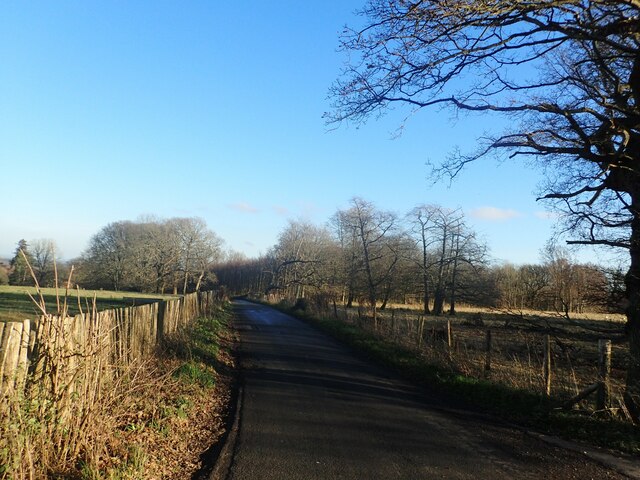
Broomhill Wood, located in Kent, England, is a picturesque and enchanting woodland area that covers a vast expanse of approximately 500 acres. This ancient woodland is nestled within the larger Blean Woods, which collectively form the largest area of continuously wooded landscape in the county.
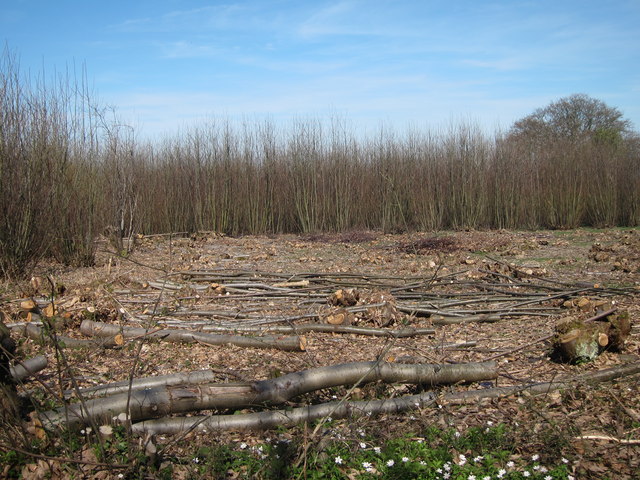
The wood is predominantly made up of oak trees, with other native species such as beech, ash, and birch also present. The dense canopy of these magnificent trees creates a cool and serene atmosphere, making it a popular destination for nature enthusiasts and walkers seeking refuge from the hustle and bustle of urban life.
Broomhill Wood is not only aesthetically pleasing but also rich in biodiversity. It is home to a wide variety of flora and fauna, including rare species such as the lesser spotted woodpecker and the dormouse. The wood provides a suitable habitat for these creatures, with its mix of mature trees, shrubs, and wildflowers.
Visitors to Broomhill Wood can explore its numerous well-maintained trails and footpaths, allowing them to immerse themselves in the natural beauty of the surroundings. The wood offers a tranquil setting for leisurely walks, picnics, and wildlife spotting. Additionally, several organized events and educational programs are conducted throughout the year, providing an opportunity for visitors to learn more about the woodland ecosystem and its conservation.
Overall, Broomhill Wood in Kent is a captivating destination that offers a peaceful retreat and a chance to connect with nature. Its ancient trees, diverse wildlife, and well-preserved trails make it a must-visit for anyone seeking a slice of natural beauty in the heart of Kent.
If you have any feedback on the listing, please let us know in the comments section below.
Broomhill Wood Images
Images are sourced within 2km of 51.263947/0.74527297 or Grid Reference TQ9155. Thanks to Geograph Open Source API. All images are credited.


Broomhill Wood is located at Grid Ref: TQ9155 (Lat: 51.263947, Lng: 0.74527297)
Administrative County: Kent
District: Maidstone
Police Authority: Kent
What 3 Words
///version.snooty.superhero. Near Lenham, Kent
Nearby Locations
Related Wikis

Wichling
Wichling (otherwise Wychling) is a village and civil parish within the local government district of Maidstone, in England. The parish lies approximately...

Torry Hill Railway
The Torry Hill Railway is a private miniature railway with the unusual gauge of 9 inches (229 mm) at Torry Hill near Frinsted in the Borough of Maidstone...
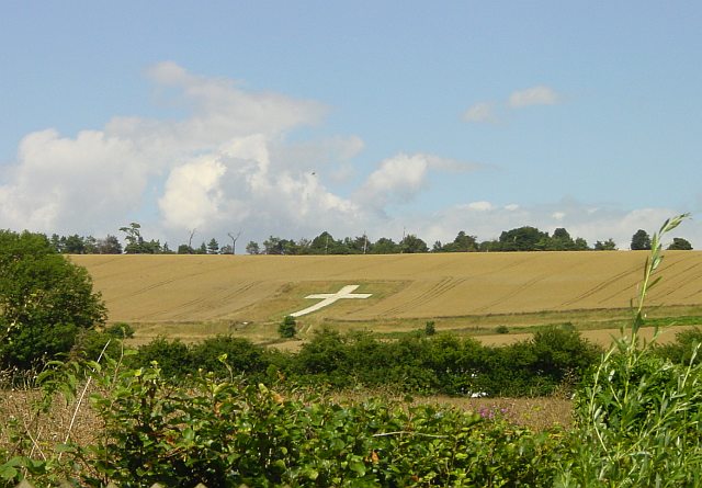
Lenham Cross
The Lenham Cross is a chalk cross carved into the hillside to the north of Lenham in Kent, in England. The Latin cross is 200 ft (61 m) high with arms...

Lenham Quarry
Lenham Quarry is a 4-hectare (9.9-acre) geological Site of Special Scientific Interest east of Lenham in Kent. It is a Geological Conservation Review site...

Doddington, Kent
Doddington is a village and civil parish in the district of Swale in Kent, England. The Syndale Valley shelters the central part in the Kent Downs Area...

Bunce Court School
The Bunce Court School was an independent, private boarding school in the village of Otterden, in Kent, England. It was founded in 1933 by Anna Essinger...

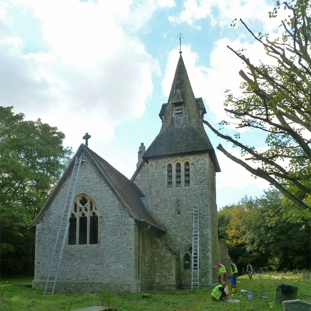
St Mary's Church, Lenham
St Mary's is a parish church in Lenham, Kent begun in the 12th century with additions in the next three centuries. It is a Grade I listed building. �...
Lenham
Lenham is a market village and civil parish in Kent situated on the southern edge of the North Downs, 9 miles (14 km) east of Maidstone. The picturesque...
Nearby Amenities
Located within 500m of 51.263947,0.74527297Have you been to Broomhill Wood?
Leave your review of Broomhill Wood below (or comments, questions and feedback).