Colville's Grove
Wood, Forest in Suffolk West Suffolk
England
Colville's Grove

Colville's Grove is a picturesque woodland located in the county of Suffolk, England. Nestled in the heart of the countryside, this enchanting grove offers a tranquil escape from the hustle and bustle of everyday life. Stretching over an area of approximately 50 acres, it is a haven for nature lovers and outdoor enthusiasts.
The grove is characterized by its dense canopy of towering oak, beech, and pine trees, which provide a stunning display of colors throughout the year. The forest floor is adorned with a rich carpet of wildflowers, adding to the area's natural beauty. A network of well-maintained footpaths winds through the grove, allowing visitors to explore its hidden corners and discover its many delights.
Colville's Grove is home to a diverse range of wildlife, making it a haven for nature enthusiasts. Deer, foxes, and badgers can often be spotted wandering through the undergrowth, while a variety of bird species can be heard singing from the treetops. The grove also boasts a small pond, attracting an array of aquatic creatures, including frogs, newts, and dragonflies.
For those seeking outdoor activities, Colville's Grove offers ample opportunities for walking, hiking, and birdwatching. The well-marked trails cater to all abilities, from leisurely strolls to more challenging hikes. Families can also enjoy picnics and nature-themed scavenger hunts, making it a perfect day out for all ages.
Colville's Grove truly embodies the beauty and tranquility of Suffolk's woodlands. Its natural charm and diverse ecosystem make it a must-visit destination for anyone looking to connect with nature and experience the serenity of the countryside.
If you have any feedback on the listing, please let us know in the comments section below.
Colville's Grove Images
Images are sourced within 2km of 52.214374/0.80023989 or Grid Reference TL9161. Thanks to Geograph Open Source API. All images are credited.


Colville's Grove is located at Grid Ref: TL9161 (Lat: 52.214374, Lng: 0.80023989)
Administrative County: Suffolk
District: West Suffolk
Police Authority: Suffolk
What 3 Words
///stored.keyboard.connected. Near Thurston, Suffolk
Nearby Locations
Related Wikis

Bradfield St George
Bradfield St. George is a village and civil parish in the West Suffolk district of Suffolk, England, about 6 miles (9.7 km) south of Bury St Edmunds. According...

Rougham, Suffolk
Rougham is a village and former civil parish 19 miles (31 km) north west of Ipswich, now in the parish of Rushbrooke with Rougham, in the West Suffolk...
Rushbrooke with Rougham
Rushbrooke with Rougham is a large civil parish in the West Suffolk district of Suffolk in eastern England covering the villages of Blackthorpe, Rougham...
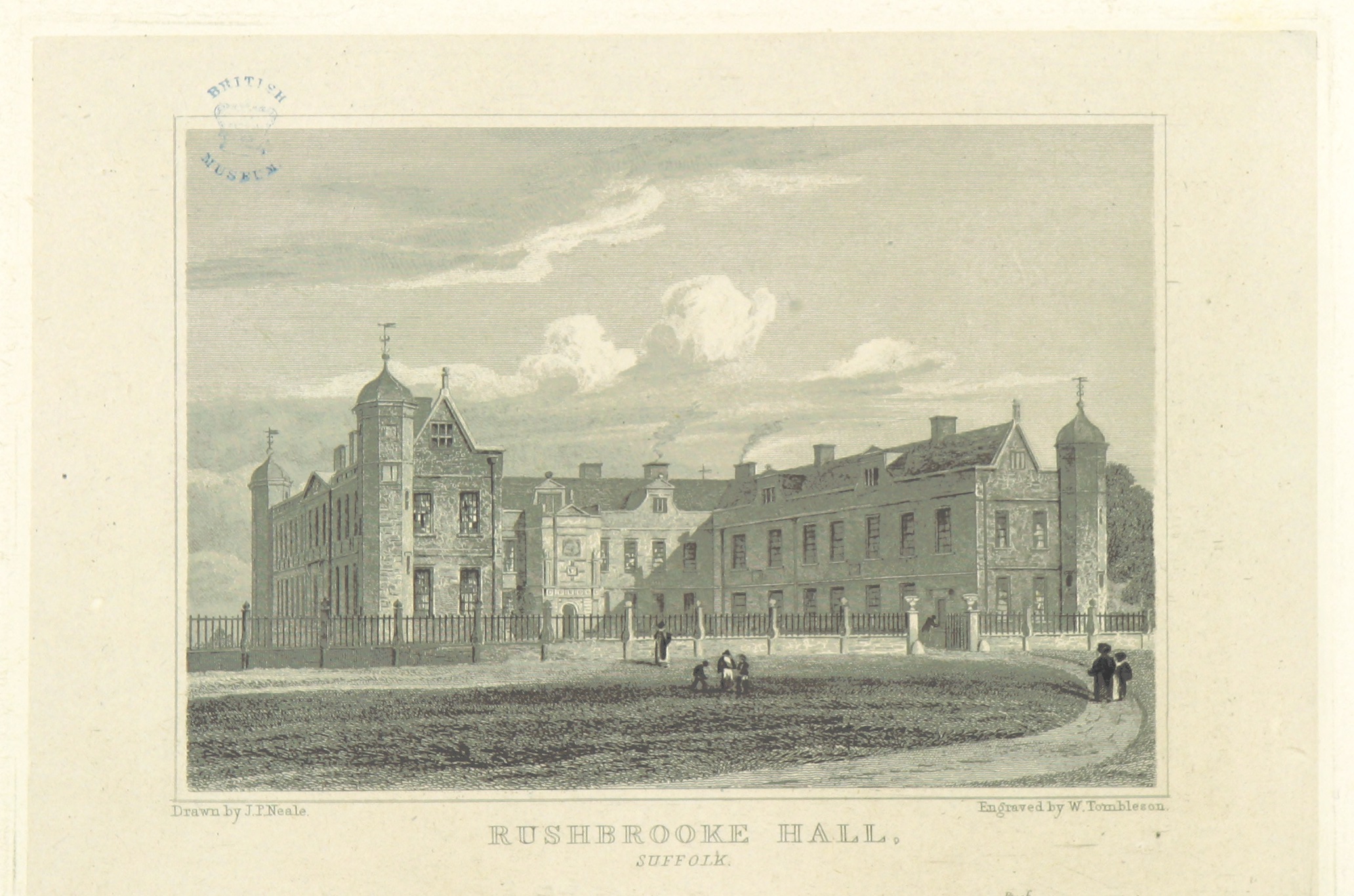
Rushbrooke Hall
Rushbrooke Hall was a British stately home in Rushbrooke, Suffolk. For several hundred years it was the family seat of the Jermyn family. It was demolished...
Nearby Amenities
Located within 500m of 52.214374,0.80023989Have you been to Colville's Grove?
Leave your review of Colville's Grove below (or comments, questions and feedback).