Mainey Wood

Wood, Forest in Kent Ashford

England

Mainey Wood

Romden Bridge Viewed from the potholed Romden Road. Pluckley is left, Bethersden is right.
Romden Bridge Credit: Robin Webster

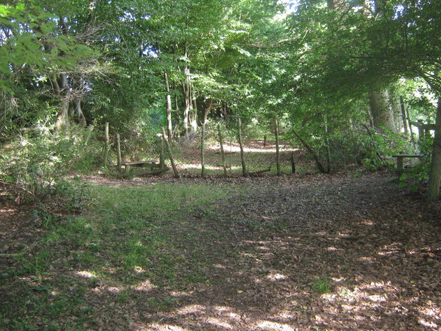
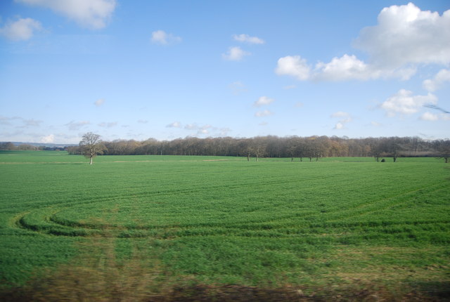
Mainey Wood is a pristine forest located in Kent, England. It is situated in the picturesque countryside, encompassing an area of approximately 500 acres. The wood is well-known for its rich biodiversity and stunning natural beauty, making it a popular destination for nature enthusiasts and hikers.

The forest is primarily composed of a variety of broadleaf trees, including oak, ash, and beech. These trees create a dense canopy, providing a sheltered habitat for numerous species of birds, insects, and mammals. Mainey Wood is home to a diverse range of wildlife, including deer, foxes, badgers, and various bird species, such as woodpeckers and owls.

The wood features a network of well-maintained walking trails, allowing visitors to explore its scenic surroundings. The paths wind through ancient woodland areas, where visitors can admire the towering trees, vibrant wildflowers, and tranquil streams. Mainey Wood offers a peaceful and serene environment, providing an excellent opportunity for relaxation and contemplation.

In addition to its natural beauty, Mainey Wood has historical significance. It is believed to have been used as a source of timber during medieval times. Some remnants of charcoal burning pits can still be found within the forest, serving as a reminder of its past.

Overall, Mainey Wood is a cherished natural treasure in Kent, offering a harmonious blend of breathtaking scenery, diverse wildlife, and historical importance. It is a haven for nature lovers and a place where one can escape the hustle and bustle of everyday life, immersing themselves in the tranquility of the forest.

If you have any feedback on the listing, please let us know in the comments section below.

Mainey Wood Images

Images are sourced within 2km of 51.15174/0.72820891 or Grid Reference TQ9042. Thanks to Geograph Open Source API. All images are credited.

Romden Bridge Viewed from the potholed Romden Road. Pluckley is left, Bethersden is right.
Romden Bridge
Viewed from the potholed Romden Road. Pluckley is left, Bethersden is right.
Dering Wood This Woodland Trust wood is open access and has many more paths, including waymarked routes, than are shown on the 1:50000 map.
Dering Wood
This Woodland Trust wood is open access and has many more paths, including waymarked routes, than are shown on the 1:50000 map.
Dering Wood - waymarked path A Woodland Trust free access wood.
Dering Wood - waymarked path
A Woodland Trust free access wood.
Wealden Hall House at Crowbridge Cottage, Romden Road, Smarden, Kent A group of historic buildings relocated from others sites. Two buildings Romden Hall House and Crowbridge Cottage were relocated and formed into one adjoined dwelling in 2000, whilst a large aisled barn unseen to the right was constructed around 2001.

Romden House was originally built in the 15th century, and had later alterations. In the 19th century it was even used as an oast house. In 1987 is was largely damaged by the great storm and was later to be relocated from its site near Tunbridge Wells to Smarden. For more information about Romden Hall House <span class="nowrap"><a title="http://www.canterburytrust.co.uk/buildrec/romden.htm" rel="nofollow ugc noopener" href="http://www.canterburytrust.co.uk/buildrec/romden.htm">Link</a><img style="margin-left:2px;" alt="External link" title="External link - shift click to open in new window" src="https://s1.geograph.org.uk/img/external.png" width="10" height="10"/></span>
Wealden Hall House at Crowbridge Cottage, Romden Road, Smarden, Kent
A group of historic buildings relocated from others sites. Two buildings Romden Hall House and Crowbridge Cottage were relocated and formed into one adjoined dwelling in 2000, whilst a large aisled barn unseen to the right was constructed around 2001. Romden House was originally built in the 15th century, and had later alterations. In the 19th century it was even used as an oast house. In 1987 is was largely damaged by the great storm and was later to be relocated from its site near Tunbridge Wells to Smarden. For more information about Romden Hall House LinkExternal link
Romden Road
Romden Road
Farm track to Berry Court
The Oasthouse, Dering Barn, Pluckley Road, Smarden, Kent Missing round kiln.
The Oasthouse, Dering Barn, Pluckley Road, Smarden, Kent
Missing round kiln.
The Gain Bridge This bridge is on a footpath from Smarden to Romden. It passes over the River Beult.
The Gain Bridge
This bridge is on a footpath from Smarden to Romden. It passes over the River Beult.
Unconverted Barn, Romden This unconverted barn is seen from a footpath from High Street, Smarden to Romden Road.
Unconverted Barn, Romden
This unconverted barn is seen from a footpath from High Street, Smarden to Romden Road.
Romden Farm Barn This newly converted barn is on Romden Road, within the farm.
Romden Farm Barn
This newly converted barn is on Romden Road, within the farm.
Footpath near Romden Wood This path leads from Romden Road, beside Romden Wood, then another field to Cook Wood and the River Beult, before heading to Bethersden Road.
Footpath near Romden Wood
This path leads from Romden Road, beside Romden Wood, then another field to Cook Wood and the River Beult, before heading to Bethersden Road.
Footpath junction in Mainey Wood A path from Pluckley Road leads straight on past Mainey Wood to a level crossing before heading into Dering Wood. Another path heads right to Pluckey Road, near Maltman's Hill.
Footpath junction in Mainey Wood
A path from Pluckley Road leads straight on past Mainey Wood to a level crossing before heading into Dering Wood. Another path heads right to Pluckey Road, near Maltman's Hill.
Level Crossing near Dering  Wood and Mainey Wood This crossing is on a path from Pluckey Road, it leads past Mainey Wood, across the railway heading right to Ashford from Pluckley. Then the path enters the very large Dering Wood.
Level Crossing near Dering Wood and Mainey Wood
This crossing is on a path from Pluckey Road, it leads past Mainey Wood, across the railway heading right to Ashford from Pluckley. Then the path enters the very large Dering Wood.
Footpath crossroads near Mainey Wood A footpath from Pluckey Road, near Tolhurst Farm leads straight on over the stile to Berry Court and a level crossing to Dering Wood. Another path crosses right over a stile, past Mainey Wood, over another level crossing to Dering Wood, from Pluckey Road, near Baker's Bridge.
Footpath crossroads near Mainey Wood
A footpath from Pluckey Road, near Tolhurst Farm leads straight on over the stile to Berry Court and a level crossing to Dering Wood. Another path crosses right over a stile, past Mainey Wood, over another level crossing to Dering Wood, from Pluckey Road, near Baker's Bridge.
King George Star, Dering Wood This footpath junction is the meeting of six paths within the wood. King George was a visitor to the wood. The bench on the left is for visitors on the Surrenden Walk, marked by the Woodland Trust.
King George Star, Dering Wood
This footpath junction is the meeting of six paths within the wood. King George was a visitor to the wood. The bench on the left is for visitors on the Surrenden Walk, marked by the Woodland Trust.
Oilseed Rape near Dering Wood Rapeseed (Brassica napus), also known as rape, oilseed rape and canola, is a bright yellow flowering member of the family Brassicaceae (mustard or cabbage family).
Rapeseed is grown for the production of animal feed, vegetable oil for human consumption, and increasingly biodiesel; leading producers include the European Union, Canada, the United States, Australia, China and India.
Oilseed Rape near Dering Wood
Rapeseed (Brassica napus), also known as rape, oilseed rape and canola, is a bright yellow flowering member of the family Brassicaceae (mustard or cabbage family). Rapeseed is grown for the production of animal feed, vegetable oil for human consumption, and increasingly biodiesel; leading producers include the European Union, Canada, the United States, Australia, China and India.
Farmland by Dering Wood
Pluckley Road
Pluckley Road
Show me another place!

Mainey Wood is located at Grid Ref: TQ9042 (Lat: 51.15174, Lng: 0.72820891)

Administrative County: Kent

District: Ashford

Police Authority: Kent

What 3 Words

///early.budgeted.nuggets. Near High Halden, Kent

Related Wikis

Pluckley railway station

Pluckley railway station is on the South Eastern Main Line in England, serving the village of Pluckley, Kent, which is approximately 1.2 miles (2 km) to...

Bethersden

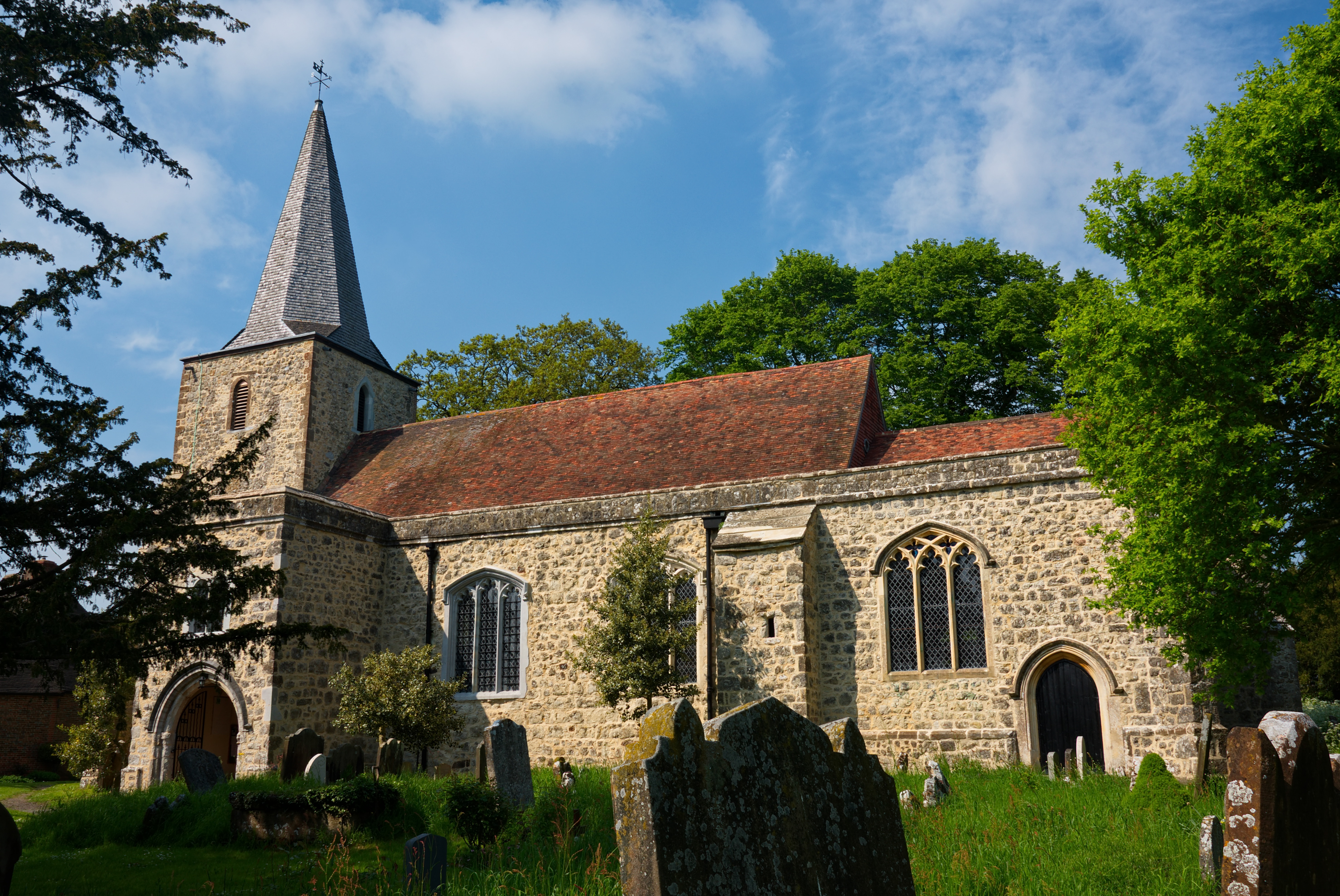
Bethersden is a village and civil parish in the borough of Ashford in Kent, England, 5 miles (8 km) west of the town of Ashford. Located on the main road...

Pluckley

Pluckley is a village and civil parish in the Ashford district of Kent, England. The civil parish includes the adjacent hamlet of Pluckley Thorne. �...

Smarden

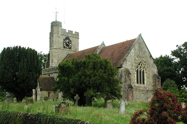
Smarden is a civil parish and village, west of Ashford in Kent, South East England. The village has the Anglican parish church of St Michael the Archangel...
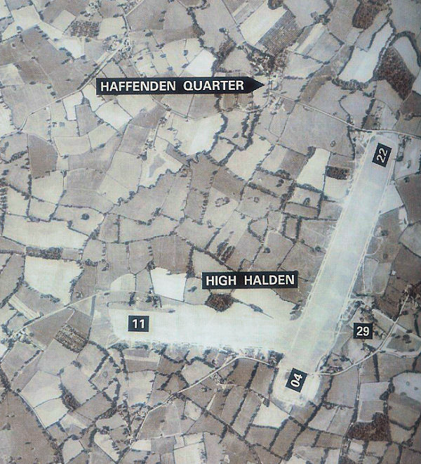
RAF High Halden

Royal Air Force High Halden or more simply RAF High Halden is a former Royal Air Force Advanced Landing Ground in Kent, England. The airfield is located...

Volvo World Match Play Championship

The Volvo World Match Play Championship was an annual match play men's professional golf tournament which was staged from 1964 to 2014. The World Match...

2014 Volvo World Match Play Championship

The 2014 Volvo World Match Play Championship was the 49th Volvo World Match Play Championship to be played. It was held 15–19 October, with the champion...

List of local nature reserves in Kent

Kent is a county in the south-eastern corner of England. It is bounded to the north by Greater London and the Thames Estuary, to the west by Sussex and...

Nearby Amenities

Located within 500m of 51.15174,0.72820891
The data included in this document is from www.openstreetmap.org. The data is made available under ODbL.

Have you been to Mainey Wood?

Leave your review of Mainey Wood below (or comments, questions and feedback).