Fan Wood

Wood, Forest in Essex Colchester

England

Fan Wood

Pond at Messing Lodge The Lodge itself can be glimpsed through the trees ahead. Taken on Lodge Road.
Pond at Messing Lodge Credit: Trevor Harris

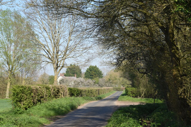
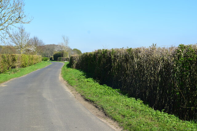
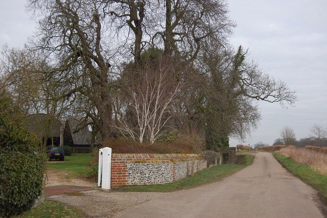
Fan Wood is a picturesque woodland area located in the county of Essex, England. Covering an area of approximately 100 acres, this forested region is renowned for its natural beauty and tranquil atmosphere. Situated near the town of Epping, Fan Wood is easily accessible for visitors and locals alike.

The woodland is predominantly made up of a diverse range of trees, including oak, beech, and birch, which provide a striking canopy of greenery throughout the year. These tall and majestic trees create a sense of serenity and seclusion, making it an ideal destination for nature lovers and those seeking a peaceful retreat.

Wandering through Fan Wood, visitors can enjoy the enchanting sights and sounds of nature. The forest is home to a variety of wildlife, such as deer, squirrels, and numerous bird species. Birdwatchers will be delighted by the opportunity to spot species like woodpeckers and owls in their natural habitat.

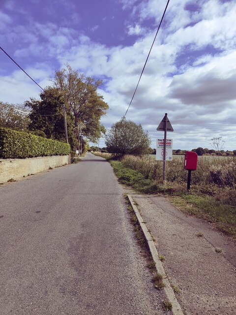
Several walking trails wind their way through the woodland, offering visitors the chance to explore its hidden corners and discover its many delights. These paths are well-maintained, making them suitable for people of all ages and abilities.

Fan Wood is also a popular spot for outdoor activities such as picnicking, camping, and photography. Its idyllic setting provides a picturesque backdrop for capturing stunning images of nature.

Overall, Fan Wood is a tranquil and scenic destination that offers visitors a chance to escape the hustle and bustle of everyday life and immerse themselves in the beauty of nature.

If you have any feedback on the listing, please let us know in the comments section below.
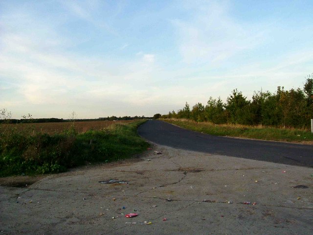
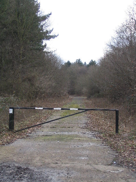
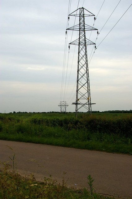
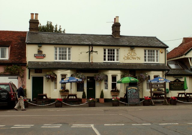
Fan Wood Images

Images are sourced within 2km of 51.847876/0.76510995 or Grid Reference TL9020. Thanks to Geograph Open Source API. All images are credited.

Pond at Messing Lodge The Lodge itself can be glimpsed through the trees ahead. Taken on Lodge Road.
Pond at Messing Lodge
The Lodge itself can be glimpsed through the trees ahead. Taken on Lodge Road.
Barn, Messing The barn stands beside the private drive to Bouchiers Hall.
Barn, Messing
The barn stands beside the private drive to Bouchiers Hall.
Domsey Brook Taken from the footbridge which carries the path to Scottie's Farm. The brook is a tributary of the River Blackwater which it joins at Kelvedon.
Domsey Brook
Taken from the footbridge which carries the path to Scottie's Farm. The brook is a tributary of the River Blackwater which it joins at Kelvedon.
On the footpath to Scottie's Farm It looks like a field of wheat, or maybe barley.
On the footpath to Scottie's Farm
It looks like a field of wheat, or maybe barley.
Beside a patch of woodland on Easthorpe Road Part of Cantfield's Farm farmhouse can be seen ahead.
Beside a patch of woodland on Easthorpe Road
Part of Cantfield's Farm farmhouse can be seen ahead.
Easthorpe Road A stretch of the road north east of Messing.
Easthorpe Road
A stretch of the road north east of Messing.
Easthorpe Road, Eastthorpe
Road to Great Domsey Farm This road is called Domsey Chase and this is the view from the busy A.12 near Marks Tey.  The buildings featured are nothing to do with the farm, which is out of view.
Road to Great Domsey Farm
This road is called Domsey Chase and this is the view from the busy A.12 near Marks Tey. The buildings featured are nothing to do with the farm, which is out of view.
View over to Badcock's Farm Looking north east towards Badcock's Farm near Marks Tey, Essex. This farm's part of a dead end road from Scottie's Farm.
View over to Badcock's Farm
Looking north east towards Badcock's Farm near Marks Tey, Essex. This farm's part of a dead end road from Scottie's Farm.
Public Footpath near Kelvedon An impossible Public Footpath to walk on as crops have been planted over its course. An enthgusiastic new sign points the way southwards.
Public Footpath near Kelvedon
An impossible Public Footpath to walk on as crops have been planted over its course. An enthgusiastic new sign points the way southwards.
Lodge Road The road beside Messing Lodge which gives it its name. The finger post for the footpath to Scottie's Farm can be seen in the distance beside the road.
Lodge Road
The road beside Messing Lodge which gives it its name. The finger post for the footpath to Scottie's Farm can be seen in the distance beside the road.
Layer Wood, Layer Marney Layer Wood is managed by the Forestry Commission.
Layer Wood, Layer Marney
Layer Wood is managed by the Forestry Commission.
Blind Lane Birch This is a shot of Blind lane Birch. The lane was closed from late 1942 until after WW2 as it became one of the two 1400 yard secondary runways of Birch Airfield, the last East Anglian aerodrome to be built by the USAAF in WW2. Blind lane is surfaced in tarmac the concrete in the picture is the end of the 2000 yard main runway. It is interesting to note that Blind Lane and the airfield are not marked on the 1940’s O.S map.
Blind Lane Birch
This is a shot of Blind lane Birch. The lane was closed from late 1942 until after WW2 as it became one of the two 1400 yard secondary runways of Birch Airfield, the last East Anglian aerodrome to be built by the USAAF in WW2. Blind lane is surfaced in tarmac the concrete in the picture is the end of the 2000 yard main runway. It is interesting to note that Blind Lane and the airfield are not marked on the 1940’s O.S map.
Layer Wood Track taken from B1022
Layer Wood
Track taken from B1022
The Old School House Messing This building in Messing has had a multitude of uses in four different centuries. Built in 1748 as Alms Houses, converted 51 years later into a workhouse, in 1836 its use changed again as it became the village school and finally transmogrified into the village hall in 1911.
The Old School House Messing
This building in Messing has had a multitude of uses in four different centuries. Built in 1748 as Alms Houses, converted 51 years later into a workhouse, in 1836 its use changed again as it became the village school and finally transmogrified into the village hall in 1911.
Underground Lines The 1940’s map shows this transmission line going underground at this point off Lodge Rd. It is almost certainly because of the construction of Birch Aerodrome that the area needed to be cleared of power lines. The cables reappear near Roundbush Corner see <a href="https://www.geograph.org.uk/photo/188431">TL9219 : Roundbush Not Evident</a>
Underground Lines
The 1940’s map shows this transmission line going underground at this point off Lodge Rd. It is almost certainly because of the construction of Birch Aerodrome that the area needed to be cleared of power lines. The cables reappear near Roundbush Corner see TL9219 : Roundbush Not Evident
'The Old Crown', inn at Messing, Essex At one time there were five inns/public houses in Messing, now there is just this one.
'The Old Crown', inn at Messing, Essex
At one time there were five inns/public houses in Messing, now there is just this one.
Lodge Road, Messing, Essex This is the approach to Messing village from the north.
Lodge Road, Messing, Essex
This is the approach to Messing village from the north.
Show me another place!

Fan Wood is located at Grid Ref: TL9020 (Lat: 51.847876, Lng: 0.76510995)

Administrative County: Essex

District: Colchester

Police Authority: Essex

What 3 Words

///forks.slack.clotting. Near Marks Tey, Essex

Nearby Locations

Fan Wood Long Grove

Related Wikis

Easthorpe, Essex

Easthorpe is a small village and former civil parish, now in the parish of Copford, in the Colchester district, in the county of Essex, England. Easthorpe...

RAF Birch

Royal Air Force Birch or more simply RAF Birch is a former Royal Air Force station in Essex, England. The airfield is located 2 mi (3.2 km) northeast...

Messing, Essex

Messing is a village and former civil parish, 14 miles (23 km) north east of Chelmsford, now in the parish of Messing-cum-Inworth, in the Colchester district...

Smythe's Green

Smythe's Green is a hamlet on the B1022 road, in the Colchester district, in the county of Essex, England. It is located in between the villages of Tiptree...
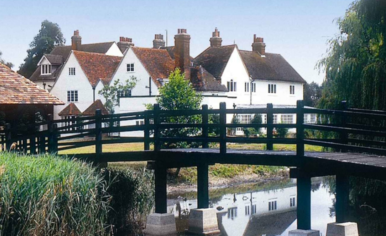
Prested Hall

Prested Hall is a country house in Feering, Essex. It was built in the fourteenth century for the Weston family and passed through several notable families...

Messing-cum-Inworth

Messing-cum-Inworth is a civil parish in the Colchester district, in north-east Essex, 8.5 miles west of Colchester, and 15 miles east of Chelmsford. The...

Hardy's Green

Hardy's Green is a hamlet in civil parish of Birch in the Colchester district, in the county of Essex, England. Nearby settlements include the large town...

Marks Tey

Marks Tey is a large village and electoral ward in Essex, England; it is located six miles west of Colchester. == Facilities == Marks Tey is one of a...

Nearby Amenities

Located within 500m of 51.847876,0.76510995
Power: tower
Lat/Long: 51.8460706/0.7592143
Power: tower
Lat/Long: 51.8454091/0.7619781
Power: tower
Lat/Long: 51.844738/0.7647086
Power: pole
Lat/Long: 51.8463839/0.7590534
Power: pole
Lat/Long: 51.8472061/0.7595248
Power: pole
Lat/Long: 51.8480074/0.7600239
Power: pole
Lat/Long: 51.8486888/0.7608435
Power: pole
Lat/Long: 51.849256/0.7615151
Power: pole
Lat/Long: 51.8496652/0.7625627
Power: pole
Lat/Long: 51.8500782/0.7635548
Power: pole
Lat/Long: 51.8505597/0.7647441
Power: pole
Lat/Long: 51.8510336/0.7658748
Power: pole
Lat/Long: 51.8515341/0.7670733
The data included in this document is from www.openstreetmap.org. The data is made available under ODbL.

Have you been to Fan Wood?

Leave your review of Fan Wood below (or comments, questions and feedback).