Wellham Wood

Wood, Forest in Kent Ashford

England

Wellham Wood

High Speed One from Bowley Lane This view from Bowley Lane, which here crosses High Speed 1 and the M20 (which is just beyond the trees on the left), looks in the direction of Ebbsfleet International and St Pancras International.
High Speed One from Bowley Lane Credit: Marathon

Wellham Wood is a picturesque forest located in the county of Kent, England. Spanning over a vast area, it is known for its dense vegetation and diverse wildlife. The wood is situated near the village of Wellham, providing a tranquil and peaceful escape from the hustle and bustle of city life.

The forest is primarily composed of deciduous trees, including oak, ash, and beech, which create a stunning canopy of foliage during the summer months. In the autumn, the woodland transforms into a vibrant display of red, orange, and gold as the leaves change color.

Wellham Wood is home to a wide range of wildlife species, making it a popular destination for nature enthusiasts and birdwatchers. Visitors may spot various bird species such as woodpeckers, owls, and thrushes, as well as small mammals like squirrels and rabbits. The forest also provides a habitat for deer and foxes, adding to its natural beauty and allure.

The wood offers a network of walking trails, allowing visitors to explore its enchanting surroundings. These paths wind through the forest, taking hikers past babbling brooks, hidden clearings, and ancient trees. It is a great spot for nature walks, picnics, and photography, with plenty of opportunities to capture the beauty of the woodland.

Overall, Wellham Wood in Kent is a haven of tranquility and natural beauty. With its diverse flora and fauna, it offers a splendid escape for those seeking solace in nature. Whether it's a leisurely stroll or a more adventurous hike, this forest provides a delightful experience for all who visit.

If you have any feedback on the listing, please let us know in the comments section below.

Wellham Wood Images

Images are sourced within 2km of 51.207327/0.71610194 or Grid Reference TQ8948. Thanks to Geograph Open Source API. All images are credited.

High Speed One from Bowley Lane This view from Bowley Lane, which here crosses High Speed 1 and the M20 (which is just beyond the trees on the left), looks in the direction of Ebbsfleet International and St Pancras International.
High Speed One from Bowley Lane
This view from Bowley Lane, which here crosses High Speed 1 and the M20 (which is just beyond the trees on the left), looks in the direction of Ebbsfleet International and St Pancras International.
High Speed One from Bowley Lane This view from Bowley Lane, which here crosses High Speed 1 and the M20 (which is just beyond the trees on the right), looks in the direction of Ashford International and the Channel Tunnel.
High Speed One from Bowley Lane
This view from Bowley Lane, which here crosses High Speed 1 and the M20 (which is just beyond the trees on the right), looks in the direction of Ashford International and the Channel Tunnel.
Northbound M20, Bowley Lane Bridge Bowley Lane crosses the M20 at Lenham Heath.
Northbound M20, Bowley Lane Bridge
Bowley Lane crosses the M20 at Lenham Heath.
M20 bridge carries Bowley Lane The lane links Chapel Farm to the north of the motorway with Bowley Farm to the south.
M20 bridge carries Bowley Lane
The lane links Chapel Farm to the north of the motorway with Bowley Farm to the south.
After the rain This is the view from the track to the north of Chapel Farm on the way to Lenham. Earlier sunlight was rapidly followed by dismal grey skies, then squally rain before the sun came out again at 3.30 to give this rainbow and bright sunshine.
After the rain
This is the view from the track to the north of Chapel Farm on the way to Lenham. Earlier sunlight was rapidly followed by dismal grey skies, then squally rain before the sun came out again at 3.30 to give this rainbow and bright sunshine.
Footpath near Mount Castle Farm This footpath near Mount Castle Farm leads down the field ahead and on to either East Lenham or Lenham itself.
Footpath near Mount Castle Farm
This footpath near Mount Castle Farm leads down the field ahead and on to either East Lenham or Lenham itself.
Oast houses at Chapel Farm This is the view from the track to the west of Chapel Farm on the way to Lenham.
Oast houses at Chapel Farm
This is the view from the track to the west of Chapel Farm on the way to Lenham.
Track to the west of Chapel Farm This is the view from the track to the west of Chapel Farm on the way to Lenham. Within three minutes of taking this photograph the sun came out to give a clear rainbow - see <a title="https://www.geograph.org.uk/photo/3726927" href="https://www.geograph.org.uk/photo/3726927">Link</a>
Track to the west of Chapel Farm
This is the view from the track to the west of Chapel Farm on the way to Lenham. Within three minutes of taking this photograph the sun came out to give a clear rainbow - see Link
The rain has just stopped This is the view from the track to the north of Chapel Farm on the way to Lenham. Earlier sunlight was rapidly followed by dismal grey skies, then squally rain before the sun came out again at 3.30 to give a rainbow and bright sunshine - see also <a title="https://www.geograph.org.uk/photo/3726927" href="https://www.geograph.org.uk/photo/3726927">Link</a>
The rain has just stopped
This is the view from the track to the north of Chapel Farm on the way to Lenham. Earlier sunlight was rapidly followed by dismal grey skies, then squally rain before the sun came out again at 3.30 to give a rainbow and bright sunshine - see also Link
Rainbow after the rain This is the view from the track to the north of Chapel Farm on the way to Lenham. Earlier sunlight was rapidly followed by dismal grey skies, then squally rain before the sun came out again at 3.30 to give this rainbow and bright sunshine - see also <a title="https://www.geograph.org.uk/photo/3726927" href="https://www.geograph.org.uk/photo/3726927">Link</a>  and <a title="https://www.geograph.org.uk/photo/3729937" href="https://www.geograph.org.uk/photo/3729937">Link</a>  The heavy shower can be seen receding into the distance.
Rainbow after the rain
This is the view from the track to the north of Chapel Farm on the way to Lenham. Earlier sunlight was rapidly followed by dismal grey skies, then squally rain before the sun came out again at 3.30 to give this rainbow and bright sunshine - see also Link and Link The heavy shower can be seen receding into the distance.
Bowley Lane goes over the M20
Bowley Lane Bridge, M20 The M20 is a 51 mile motorway running between the M25 motorway near Swanley and Folkestone in Kent. It was constructed from 1960. It is a key route for lorries connecting to mainland Europe via the Channel Tunnel and Ferries.
Bowley Lane Bridge, M20
The M20 is a 51 mile motorway running between the M25 motorway near Swanley and Folkestone in Kent. It was constructed from 1960. It is a key route for lorries connecting to mainland Europe via the Channel Tunnel and Ferries.
Lewsome Oast, Boughton Road, Sandway, Kent Single square kiln oast house.
Lewsome Oast, Boughton Road, Sandway, Kent
Single square kiln oast house.
Footpath near Lewsome Farm Footpath through cropfields between Boughton Road and Headcorn Road.
Footpath near Lewsome Farm
Footpath through cropfields between Boughton Road and Headcorn Road.
Woods off Boughton Road
Chilston Park This is a Grade I listed building from the late 15th or early 16th C. It has English Heritage Building ID: 174227. Each century since has seen alterations or additions and at one stage it was owned by the Millers Antiques business. It now functions as a hotel. For more detail see: <span class="nowrap"><a title="http://www.britishlistedbuildings.co.uk/en-174227-chilston-park-boughton-malherbe-kent" rel="nofollow ugc noopener" href="http://www.britishlistedbuildings.co.uk/en-174227-chilston-park-boughton-malherbe-kent">Link</a><img style="margin-left:2px;" alt="External link" title="External link - shift click to open in new window" src="https://s1.geograph.org.uk/img/external.png" width="10" height="10"/></span>
Chilston Park
This is a Grade I listed building from the late 15th or early 16th C. It has English Heritage Building ID: 174227. Each century since has seen alterations or additions and at one stage it was owned by the Millers Antiques business. It now functions as a hotel. For more detail see: LinkExternal link
Chilston Park, Boughton Malherbe Built, or at least remodelled, in 1728 (elsewhere there is work from the C16th, C17th and C19th). The gables over the projecting ends neatly relate to the central pediment producing a series of three triangles. Grade I listed.
The house is now a hotel.
The date of the picture is uncertain.
Chilston Park, Boughton Malherbe
Built, or at least remodelled, in 1728 (elsewhere there is work from the C16th, C17th and C19th). The gables over the projecting ends neatly relate to the central pediment producing a series of three triangles. Grade I listed. The house is now a hotel. The date of the picture is uncertain.
Land alongside the M20 looking up to the CTRL
Show me another place!

Wellham Wood is located at Grid Ref: TQ8948 (Lat: 51.207327, Lng: 0.71610194)

Administrative County: Kent

District: Ashford

Police Authority: Kent

What 3 Words

///fells.behave.lifetimes. Near Lenham, Kent

Related Wikis

Rivers of Kent

Four major rivers drain the county of Kent, England. == River Medway == The catchment area of the Medway covers almost 25% of the county. The detailed...

Kent

Kent is a county in the South East England region, the closest county to continental Europe. It borders Essex across the entire estuary of the River Thames...
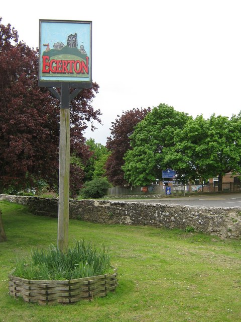
Egerton, Kent

Egerton is a village and civil parish in the Ashford District of Kent, England. The village is on the Greensand Ridge 9 miles (14.4 km) north of Ashford...

Boughton Malherbe

Boughton Malherbe ( BAW-tən MAL-ər-bee) is a village and civil parish in the Maidstone district of Kent, England, equidistant between Maidstone and Ashford...

Stonebridge Green

Stonebridge Green is a settlement adjacent to, and within the civil parish of, Egerton in the Ashford District of Kent, England. It lies immediately north...

Lenham Heath

Lenham Heath is a hamlet in Kent situated on the southern edge of the North Downs, halfway between Maidstone and Ashford. grid reference TQ910500. The...

Volvo World Match Play Championship

The Volvo World Match Play Championship was an annual match play men's professional golf tournament which was staged from 1964 to 2014. The World Match...

2014 Volvo World Match Play Championship

The 2014 Volvo World Match Play Championship was the 49th Volvo World Match Play Championship to be played. It was held 15–19 October, with the champion...

Nearby Amenities

Located within 500m of 51.207327,0.71610194
The data included in this document is from www.openstreetmap.org. The data is made available under ODbL.

Have you been to Wellham Wood?

Leave your review of Wellham Wood below (or comments, questions and feedback).