Callowhill Covert

Wood, Forest in Suffolk West Suffolk

England

Callowhill Covert

Field by Brand Road, Puttockshill
Field by Brand Road, Puttockshill Credit: David Howard

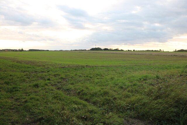
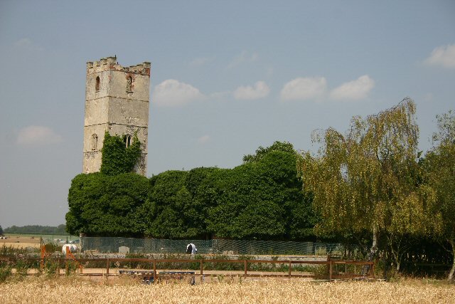
Callowhill Covert is a picturesque woodland located in Suffolk, England. It is situated in the heart of the county, near the village of Callowhill. The covert covers an area of approximately 100 acres and is known for its diverse range of flora and fauna.

The woodland is predominantly made up of ancient oak and beech trees, creating a majestic canopy that provides shelter for a variety of wildlife. The forest floor is carpeted with bluebells and other wildflowers during the spring, creating a vibrant and colorful display.

Callowhill Covert is home to a wide range of bird species, including woodpeckers, owls, and warblers. The tranquil setting and abundance of food sources make it an ideal habitat for these feathered residents. Additionally, the woodland is frequented by deer, foxes, and other mammals, adding to its natural charm.

The woodland is a popular destination for nature lovers and walkers who enjoy exploring the numerous trails that wind through the trees. Visitors can experience the tranquility of the forest and immerse themselves in the sights and sounds of nature. There are designated picnic areas where visitors can relax and enjoy a meal amidst the peaceful surroundings.

Callowhill Covert is managed by the local council and is open to the public throughout the year. The woodland is protected to ensure the preservation of its natural beauty and biodiversity. It is a cherished local asset that offers a sanctuary for both wildlife and visitors seeking a tranquil escape in the heart of Suffolk.

If you have any feedback on the listing, please let us know in the comments section below.

Callowhill Covert Images

Images are sourced within 2km of 52.305996/0.77233685 or Grid Reference TL8971. Thanks to Geograph Open Source API. All images are credited.

Field by Brand Road, Puttockshill
Troston, St Mary
Troston, St Mary
Troston, St. Mary's Church: Southern aspect
Troston, St. Mary's Church: Late c14th wall painting of St. George and the Dragon 1
Troston, St. Mary's Church: Late c14th wall painting of St. George and the Dragon 2 (detail)
Troston, St. Mary's Church: Late c14th wall painting of St. George and the Dragon 3 (detail)
Troston, St. Mary's Church: Late c14th wall painting of St. George and the Dragon 4 (detail)
Troston, St. Mary's Church: Late c14th wall paintings on the north nave wall
Troston, St. Mary's Church: Late c14th wall painting of The Martyrdom of St. Edmund 1
Troston, St. Mary's Church: Late c14th wall painting of The Martyrdom of St. Edmund 2 (detail)
Troston, St. Mary's Church: Late c14th wall painting of St. Christopher 1
Troston, St. Mary's Church: Late c14th wall painting of St. Christopher (detail)
Troston, St. Mary's Church: Small, crude wall painting of St. George and the Dragon The earliest wall painting (1350-1370).
Troston, St. Mary's Church: Small, crude wall painting of St. George and the Dragon
The earliest wall painting (1350-1370).
Troston, St. Mary's Church: Remains of a late medieval Doom painting over the chancel arch
Troston, St. Mary's Church: Remains of a late medieval Doom painting over the chancel arch The figure of Christ.
Troston, St. Mary's Church: Remains of a late medieval Doom painting over the chancel arch
The figure of Christ.
Troston, St. Mary's Church: The medieval screen
Troston, St. Mary's Church: The Lofft memorial
Show me another place!

Callowhill Covert is located at Grid Ref: TL8971 (Lat: 52.305996, Lng: 0.77233685)

Administrative County: Suffolk

District: West Suffolk

Police Authority: Suffolk

What 3 Words

///scarcely.reboot.samplers. Near Great Barton, Suffolk

Nearby Locations

Callowhill Covert

Related Wikis

Great Livermere

Great Livermere is a village and civil parish in the West Suffolk district of Suffolk in eastern England. It is located around four miles north-east of...

Edward Capell

Edward Capell (11 June 1713 – 24 February 1781) was an English Shakespearian critic. == Biography == He was born at Troston Hall (TL901717) in Suffolk...

Troston

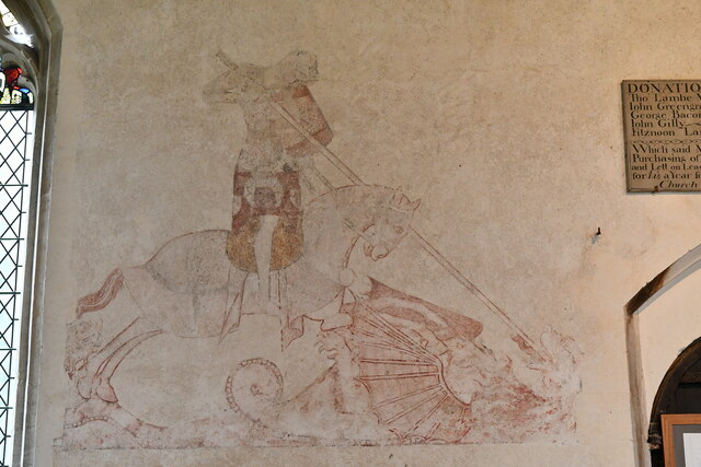
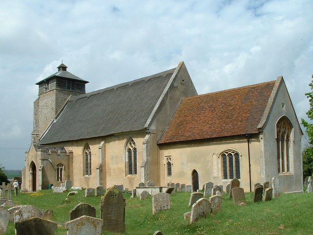
Troston is a village and civil parish in Suffolk, England, five miles north-east of Bury St Edmunds. Its parish church contains rare mediaeval wall paintings...
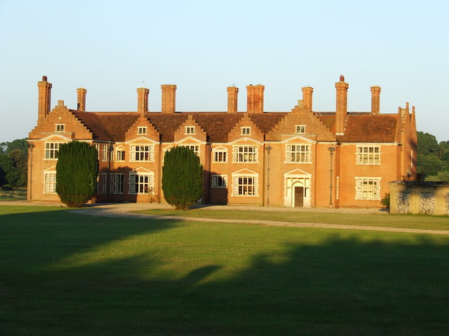
Ampton Hall

Ampton Hall is a Grade II-listed Jacobean style manor house in Ampton, Suffolk, England. Ampton Hall was the birthplace in 1805 of Robert FitzRoy, who...

Ampton

Ampton is a village and civil parish in the West Suffolk District of Suffolk, England, about five miles north of Bury St Edmunds. According to Eilert Ekwall...

Little Livermere

Little Livermere is a village and civil parish in England situated about 5 miles (8 km) north of Bury St Edmunds, in an area of Suffolk known as the Breckland...

Ixworth Thorpe

Ixworth Thorpe is a small village and civil parish in the West Suffolk district of the English county of Suffolk. The village is located on the A1088 road...

Conyer's Green

Conyer's Green is a village in the civil parish of Great Barton, in the West Suffolk district, in the county of Suffolk, England.

Nearby Amenities

Located within 500m of 52.305996,0.77233685
Great Livermere
Place: village
Wikidata: Q2441731
Lat/Long: 52.3076577/0.7677893
Bus Stop
Memorial Shelter
Naptan AtcoCode: 390050575
Naptan Bearing: N
Naptan CommonName: Memorial Shelter
Naptan Indicator: adj
Naptan Landmark: Memorial Shelter
Naptan NaptanCode: sufgjawa
Naptan Street: The Street
Route Ref: 332
Shelter: yes
Source: naptan_import;survey
Lat/Long: 52.3065312/0.7664882
Bus Stop
Memorial Shelter
Naptan AtcoCode: 390050576
Naptan Bearing: S
Naptan BusStopType: CUS
Naptan CommonName: Memorial Shelter
Naptan Indicator: opp
Naptan Landmark: Memorial Shelter
Naptan NaptanCode: sufgjawd
Naptan Street: The Street
Route Ref: 332
Source: naptan_import
Lat/Long: 52.3064799/0.766679
Public Bookcase
Great Livermere Book Exchange
Booth: K6
Covered: booth
Disused Amenity: telephone
Man Made: telephone_box
Public Bookcase Type: phone_box
Lat/Long: 52.3062523/0.7667202
Post Box
Collection Times: Mo-Fr 16:30; Sa 09:45
Post Box Type: lamp
Ref: IP31 2102
Royal Cypher: EIIR
Royal Cypher Wikidata: Q33102113
Lat/Long: 52.3065025/0.7665056
Historic: memorial
Lat/Long: 52.3068706/0.7663956
Pipeline: marker
Substance: oil
Lat/Long: 52.302352/0.7702534
Pipeline: marker
Substance: oil
Lat/Long: 52.3055765/0.7745585
Recycling
Recycling Glass: yes
Lat/Long: 52.3064335/0.7665574
Great Livermere
Man Made: village_sign
Lat/Long: 52.3069624/0.7665606
Grit Bin
Lat/Long: 52.306294/0.7666888
Great Livermere
Man Made: village_sign
Lat/Long: 52.3048674/0.7680052
The data included in this document is from www.openstreetmap.org. The data is made available under ODbL.

Have you been to Callowhill Covert?

Leave your review of Callowhill Covert below (or comments, questions and feedback).