Alder Wood

Wood, Forest in Kent Ashford

England

Alder Wood

Parish Church, Wittersham, Kent One of the many churches around the Isle of Oxney and Romney Marsh.
Parish Church, Wittersham, Kent Credit: Ronald G Nash

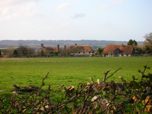
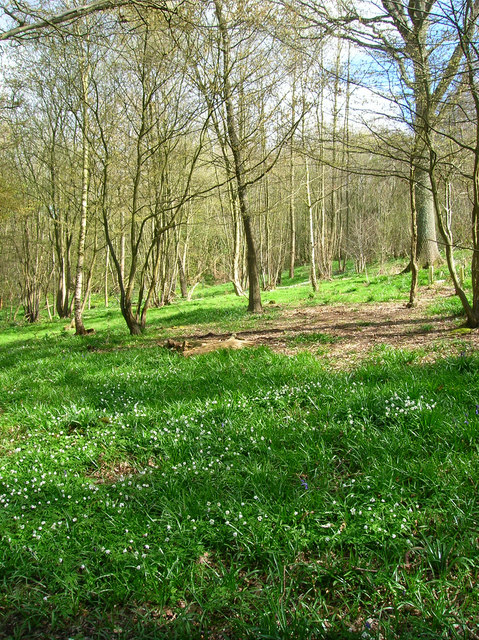
Alder Wood is a picturesque forest located in Kent, England. Covering an area of approximately 500 acres, it is known for its stunning natural beauty and diverse wildlife. The wood is primarily composed of alder trees, which give it its name and create a unique ecosystem.

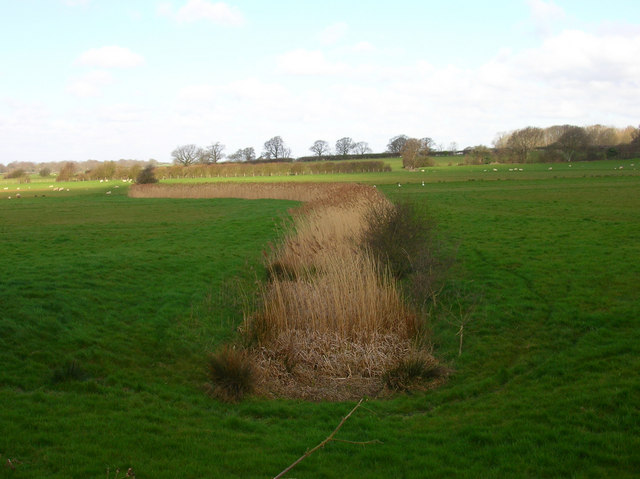
The forest is home to a variety of flora and fauna, making it a popular destination for nature enthusiasts and birdwatchers. The dense foliage provides shelter for a range of bird species, including woodpeckers, owls, and warblers. Visitors can often spot these colorful birds flitting among the branches or hear their melodic songs.

In addition to its avian inhabitants, Alder Wood is also home to several mammal species, such as deer, rabbits, and squirrels. These animals can be observed foraging for food or darting through the undergrowth.

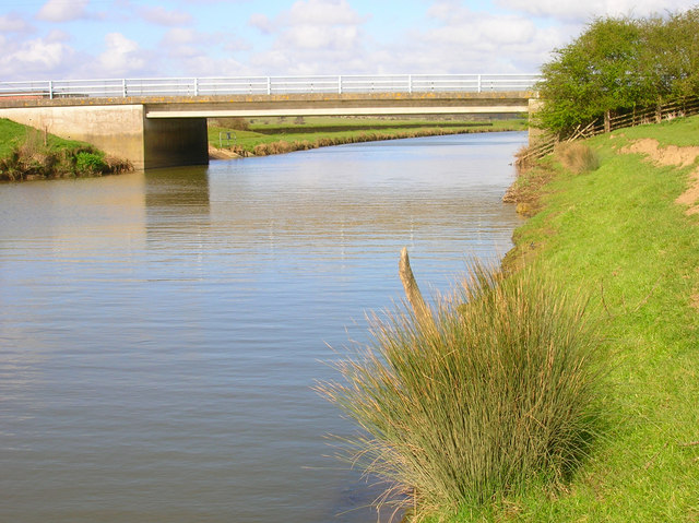
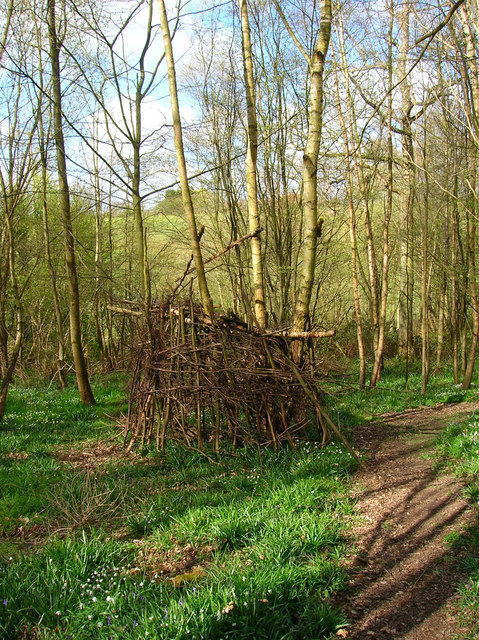
Walking trails wind through the forest, allowing visitors to explore its hidden nooks and crannies. The paths are well-maintained, making them suitable for leisurely strolls or more vigorous hikes. Along the way, visitors can enjoy the tranquil atmosphere and admire the natural beauty of the wood.

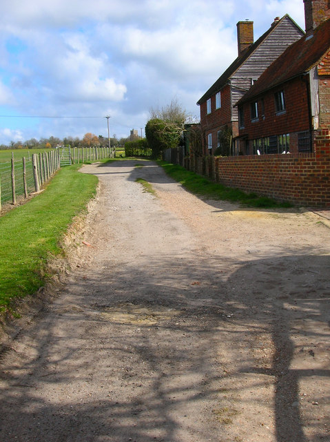
Alder Wood is conveniently located near several towns and villages, making it easily accessible for both locals and tourists. Its proximity to urban areas provides a peaceful retreat for those seeking a break from the hustle and bustle of city life.

Overall, Alder Wood offers a serene and enchanting experience, with its lush foliage, diverse wildlife, and well-maintained trails. Whether one is a nature lover or simply looking to escape into the tranquility of the forest, Alder Wood is a must-visit destination in Kent.

If you have any feedback on the listing, please let us know in the comments section below.
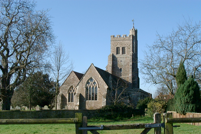
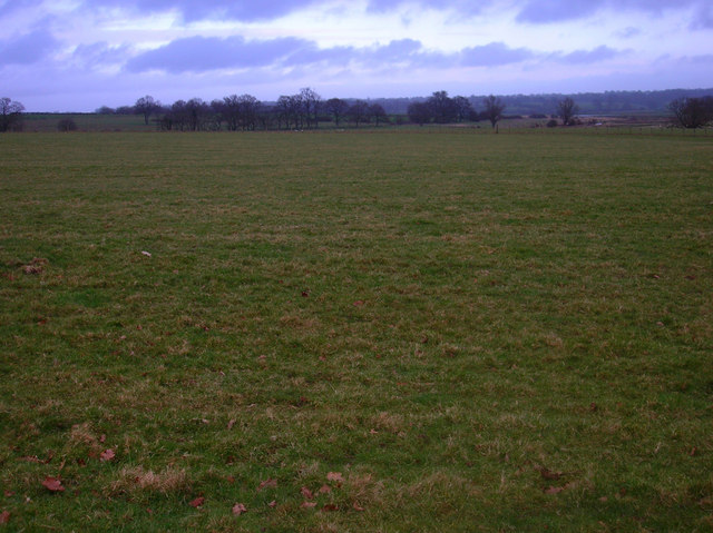
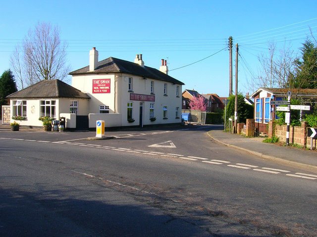
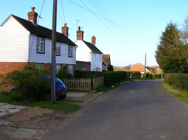
Alder Wood Images

Images are sourced within 2km of 51.008229/0.67958691 or Grid Reference TQ8826. Thanks to Geograph Open Source API. All images are credited.

Parish Church, Wittersham, Kent One of the many churches around the Isle of Oxney and Romney Marsh.
Parish Church, Wittersham, Kent
One of the many churches around the Isle of Oxney and Romney Marsh.
Over the Fields to Oxney The field is in the square, beyond is the Rother whilst the higher ground in the background is the Isle of Oxney.
Over the Fields to Oxney
The field is in the square, beyond is the Rother whilst the higher ground in the background is the Isle of Oxney.
The Swan On the junction of Poplar Road (B2082) and Swan Street. Wittersham is the chief village of the Isle of Oxney.
The Swan
On the junction of Poplar Road (B2082) and Swan Street. Wittersham is the chief village of the Isle of Oxney.
Swan Street Weatherboarded cottages along Swan Street. The street connects Wittersham to Moon's Green and Potman's Heath.
Swan Street
Weatherboarded cottages along Swan Street. The street connects Wittersham to Moon's Green and Potman's Heath.
Wittersham Manor Sixteenth Century manor building a mile out of the village. About as near as you can get to the front view without trespassing.
Wittersham Manor
Sixteenth Century manor building a mile out of the village. About as near as you can get to the front view without trespassing.
Hall Cottage Swan Street ends at the bend then an unnamed lane heads right towards Potman's Heath. The footpath to Blackwell Bridge is straight ahead.
Hall Cottage
Swan Street ends at the bend then an unnamed lane heads right towards Potman's Heath. The footpath to Blackwell Bridge is straight ahead.
Farm Outbuilding near Blackbrook Farm Appears to be three separate storage areas. Would like to know what it is. On the footpath from Moon's Green to Blackwell Bridge.
Farm Outbuilding near Blackbrook Farm
Appears to be three separate storage areas. Would like to know what it is. On the footpath from Moon's Green to Blackwell Bridge.
Behind Wittersham Manor In the medieval period the tide would have reached as far as this point from the sea. Here the Isle of Oxney rises abruptly out of the flat lands to the south. The roofs of Wittersham Manor buildings can be seen in the centre.
Behind Wittersham Manor
In the medieval period the tide would have reached as far as this point from the sea. Here the Isle of Oxney rises abruptly out of the flat lands to the south. The roofs of Wittersham Manor buildings can be seen in the centre.
Drain, Rother Levels Near to Blackwall Bridge.
Drain, Rother Levels
Near to Blackwall Bridge.
Blackwall Bridge Blackwall is the name of an old sea wall constructed in the 16th century to prevent the tidal waters of the Rother entering into this part of the Wittersham Levels. Between the twelfth and seventeenth centuries the Rother ran north of the Isle of Oxney but problems with silting caused the dam at the south western end of Oxney to be deliberately breacjed in 1635 and allow the river to follow its present course. The bridge takes the road from Wittersham to Flackly Ash over the river.
Blackwall Bridge
Blackwall is the name of an old sea wall constructed in the 16th century to prevent the tidal waters of the Rother entering into this part of the Wittersham Levels. Between the twelfth and seventeenth centuries the Rother ran north of the Isle of Oxney but problems with silting caused the dam at the south western end of Oxney to be deliberately breacjed in 1635 and allow the river to follow its present course. The bridge takes the road from Wittersham to Flackly Ash over the river.
River Rother Originally known as the Limene, Rother is actually an Old English word for river, effectively making this the 'river river'. Taken from the junction of the bridleway and footpath to Ham Green. A small pumping station is between the river and trees whilst an old WW2 pill box guards the approaches to Blackwall Bridge further upstream.
River Rother
Originally known as the Limene, Rother is actually an Old English word for river, effectively making this the 'river river'. Taken from the junction of the bridleway and footpath to Ham Green. A small pumping station is between the river and trees whilst an old WW2 pill box guards the approaches to Blackwall Bridge further upstream.
River Rother from Blackwall Bridge Sussex to the left and Kent to the right.
River Rother from Blackwall Bridge
Sussex to the left and Kent to the right.
Drain, Rother Levels Helps drain the land between the upland Isle of Oxney and the River Rother.
Drain, Rother Levels
Helps drain the land between the upland Isle of Oxney and the River Rother.
Sheep Pasture, Rother Levels The houses of Ham Green are in the background.
Sheep Pasture, Rother Levels
The houses of Ham Green are in the background.
Swans on the Rother Looking towards Sussex.
Swans on the Rother
Looking towards Sussex.
Ham Green Cottages Wittersham church tower can be seen beyond the stile in the background.
Ham Green Cottages
Wittersham church tower can be seen beyond the stile in the background.
College Wood The manor of Wittersham was once owned by the Master and Fellows of All Saints College, Maidstone which probably accounts for the name of the wood.
College Wood
The manor of Wittersham was once owned by the Master and Fellows of All Saints College, Maidstone which probably accounts for the name of the wood.
College Wood Would be very interested to know what is happening here. On the footpath through College Wood.
College Wood
Would be very interested to know what is happening here. On the footpath through College Wood.
Show me another place!

Alder Wood is located at Grid Ref: TQ8826 (Lat: 51.008229, Lng: 0.67958691)

Administrative County: Kent

District: Ashford

Police Authority: Kent

What 3 Words

///picnic.rehearsal.roving. Near Northiam, East Sussex

Nearby Locations

Fieldgate Wood Alder Wood

Related Wikis

Wittersham

Wittersham is a small village and civil parish in the borough of Ashford in Kent, England. It is part of the Isle of Oxney. == History == The Domesday...

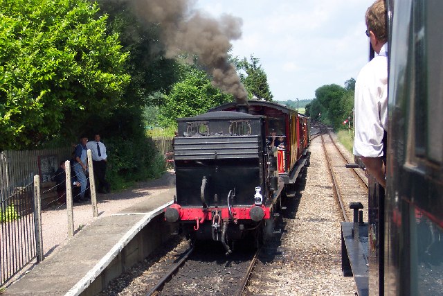
Wittersham Road railway station

Wittersham Road is a railway station on the Kent and East Sussex Railway. It is located to the north-east of the level crossing on Maytham Road which links...

Peasmarsh

Peasmarsh is a village and civil parish in the Rother district, in the county of East Sussex in England. It is located on the A268 road between Rye and...

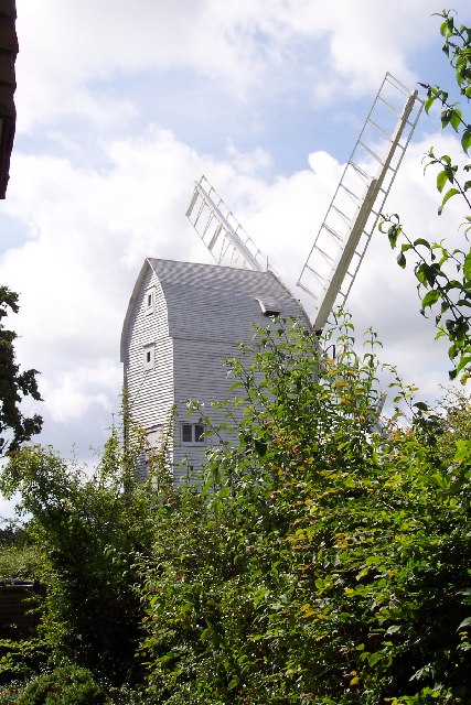
Stocks Mill, Wittersham

Stocks Mill is a Grade II* listed post mill in Wittersham on the Isle of Oxney, in Kent, England which has been preserved. == History == Probably built...

Beckley, East Sussex

Beckley is a village and civil parish in the Rother district of East Sussex, England. It is located on the B2088 minor road above the Rother Levels five...

Smallhythe Place

Smallhythe Place in Small Hythe, near Tenterden in Kent, is a half-timbered house built in the late 15th or early 16th century and since 1947 cared for...

Flatropers Wood

Flatropers Wood is a 38-hectare (94-acre) nature reserve in Rye in East Sussex. It is managed by the Sussex Wildlife Trust.The wood is mainly oak and...

Chapel Down

Chapel Down based in Tenterden in Kent, is an English vineyard and winemaker. It is the largest producer of English wine, with over 950 acres under vine...

Related Videos

Swallowtail Hill Farm - Rye, East Sussex - England, United Kingdom | Drone aerial view

Swallowtail Hill Farm - Rye, East Sussex - England, United Kingdom | Drone aerial view In 2019 my wife organised a special trip ...

Kent & East Sussex Railway's Grand May Steam Gala - Sunday 2nd May 2010

K&ESR ~KentandEastSussexRailway #SteamGala Video from the Sunday of the May Steam Gala. This year saw two visiting ...

Nearby Amenities

Located within 500m of 51.008229,0.67958691
Generator Method: photovoltaic
Generator Output Electricity: yes
Generator Source: solar
Generator Type: solar_photovoltaic_panel
Location: roof
Power: generator
Lat/Long: 51.0086143/0.685122
Generator Method: photovoltaic
Generator Output Electricity: yes
Generator Source: solar
Generator Type: solar_photovoltaic_panel
Location: roof
Power: generator
Lat/Long: 51.008654/0.6851837
Generator Method: photovoltaic
Generator Output Electricity: yes
Generator Source: solar
Generator Type: solar_photovoltaic_panel
Location: roof
Power: generator
Lat/Long: 51.0086962/0.6852414
Generator Method: photovoltaic
Generator Output Electricity: yes
Generator Source: solar
Generator Type: solar_photovoltaic_panel
Location: roof
Power: generator
Lat/Long: 51.0087198/0.6852977
The data included in this document is from www.openstreetmap.org. The data is made available under ODbL.

Have you been to Alder Wood?

Leave your review of Alder Wood below (or comments, questions and feedback).