Broom Plantation

Wood, Forest in Suffolk West Suffolk

England

Broom Plantation

The farmhouse at Bridge Farm
The farmhouse at Bridge Farm Credit: Robert Edwards

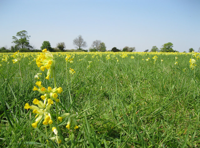
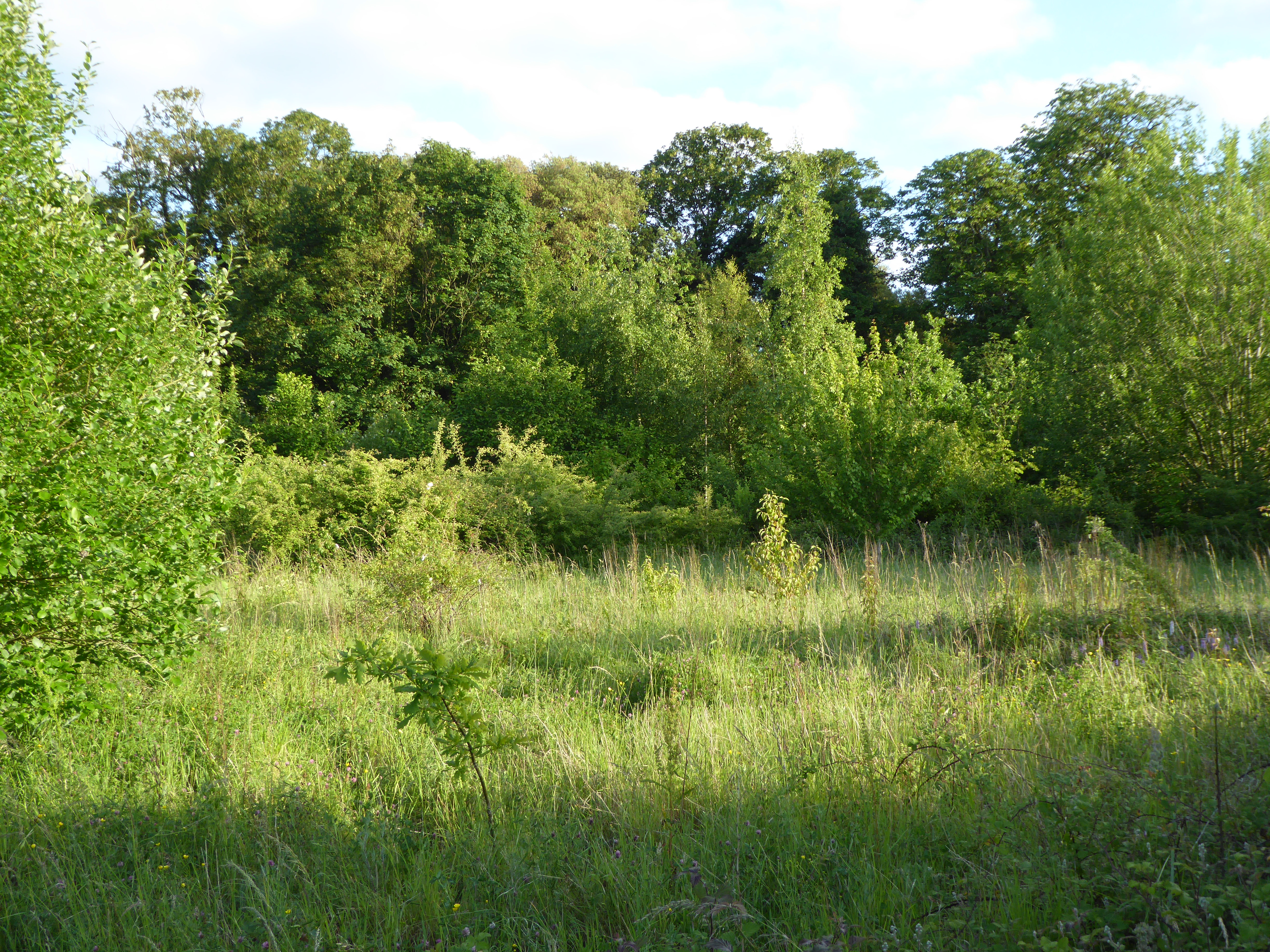
Broom Plantation is a picturesque woodland area located in Suffolk, England. Situated near the village of Broom, it covers an expansive area of lush greenery and diverse flora and fauna. This woodland plantation is known for its scenic beauty and offers a tranquil escape for nature enthusiasts and outdoor adventurers.

The plantation is predominantly covered by a variety of broadleaf trees, including oak, beech, and birch, which create a dense canopy overhead. The undergrowth is rich with ferns, bluebells, and wildflowers, adding a splash of color to the forest floor during the spring and summer months.

Broom Plantation is home to a wide range of wildlife, making it an ideal spot for birdwatching and nature photography. Visitors can expect to spot various species of birds, such as woodpeckers, owls, and finches, as well as small mammals like squirrels, rabbits, and foxes.

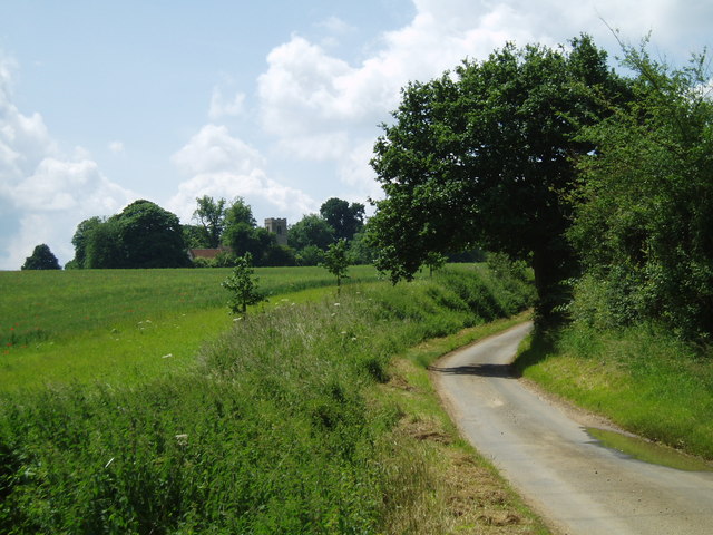
The woodland is crisscrossed by a network of well-maintained footpaths and trails, allowing visitors to explore the plantation at their own pace. These trails wind through the forest, passing by babbling brooks, charming ponds, and secluded picnic spots, creating an immersive experience for visitors.

Broom Plantation is a popular destination for nature walks, family outings, and dog walking. The peaceful ambiance and natural beauty of this woodland make it an ideal location for those seeking solace in nature or simply wishing to enjoy a leisurely stroll through Suffolk's stunning countryside.

If you have any feedback on the listing, please let us know in the comments section below.

Broom Plantation Images

Images are sourced within 2km of 52.233611/0.75204764 or Grid Reference TL8863. Thanks to Geograph Open Source API. All images are credited.

The farmhouse at Bridge Farm
A country road, just north of Rushbrooke Pig farming is big business in this area and this picture shows part of a pig farm in the distance.
A country road, just north of Rushbrooke
Pig farming is big business in this area and this picture shows part of a pig farm in the distance.
Bales of hay and pig shelters
Elderstub Lane, viewed from the footpath by Gorse Wood
Cowslip carpet This meadow west of Moreton Hall Preparatory School is covered with cowslips at this time of year. Permissive paths have been provided around this field.
Cowslip carpet
This meadow west of Moreton Hall Preparatory School is covered with cowslips at this time of year. Permissive paths have been provided around this field.
The edge of Moreton Hall estate A very large model of a Yak aerobatic aircraft makes an emergency landing, with smoke on, in front of Rougham airfield's famous row of trees. Behind that we see the Audi dealership and a few houses, neatly symbolising the mixed industrial and housing nature of the Moreton Hall estate.

The event was Bury Model Flying Club's "Flying At Its Best" model show.
The edge of Moreton Hall estate
A very large model of a Yak aerobatic aircraft makes an emergency landing, with smoke on, in front of Rougham airfield's famous row of trees. Behind that we see the Audi dealership and a few houses, neatly symbolising the mixed industrial and housing nature of the Moreton Hall estate. The event was Bury Model Flying Club's "Flying At Its Best" model show.
Old gatehouse, on Sicklesmere Road
View from Control Tower, Rougham airshow This second world war airfield hosts several events each year. This 4 picture panorama covers almost 180 degrees of the Warbird and Classic Car show. The main grass strip runs along the horizon, with a second strip on the left (west). The show itself is based on the grass area on the left, which is separated by a hedge and row of trees behind that central tree from the large field of harvested cereal used for the car park.
View from Control Tower, Rougham airshow
This second world war airfield hosts several events each year. This 4 picture panorama covers almost 180 degrees of the Warbird and Classic Car show. The main grass strip runs along the horizon, with a second strip on the left (west). The show itself is based on the grass area on the left, which is separated by a hedge and row of trees behind that central tree from the large field of harvested cereal used for the car park.
Car parking area, Rougham airshow A harvested cereal field forms the car park for an airshow on the Rougham Airfield. This is a 2 shot panorama. Dozens of aircraft can be seen parked along the runway on the left (north). To the centre-right a row of industrial buildings can be seen, built along the perimeter track. Behind the tall hedge on the right there are further industrial premises, some based on former wartime buildings. 

The photographs were taken from the top of the old control tower.
Car parking area, Rougham airshow
A harvested cereal field forms the car park for an airshow on the Rougham Airfield. This is a 2 shot panorama. Dozens of aircraft can be seen parked along the runway on the left (north). To the centre-right a row of industrial buildings can be seen, built along the perimeter track. Behind the tall hedge on the right there are further industrial premises, some based on former wartime buildings. The photographs were taken from the top of the old control tower.
View of airshow from control tower Photographed from the top of the control tower of this second world war airfield, Spitfires are featured over the display ring, which seems to be showing off Jaguars at this moment. At least 3 rows of other classics surround the ring. Situated right on the edge of Bury St. Edmunds, only a few houses can be seen in the background.
View of airshow from control tower
Photographed from the top of the control tower of this second world war airfield, Spitfires are featured over the display ring, which seems to be showing off Jaguars at this moment. At least 3 rows of other classics surround the ring. Situated right on the edge of Bury St. Edmunds, only a few houses can be seen in the background.
Car parking area for airshow, plus industrial buildings Very early in the day but the car park is already filling. Behind the cars we can see the industrial operations based on the second world war airfield sites. 

This is a two picture panorama.
Car parking area for airshow, plus industrial buildings
Very early in the day but the car park is already filling. Behind the cars we can see the industrial operations based on the second world war airfield sites. This is a two picture panorama.
View from No Man's Meadow towards Rougham Hill Across the valley of the River Lark.
View from No Man's Meadow towards Rougham Hill
Across the valley of the River Lark.
Waterway junction in No Man's Meadow These low lying meadows have a complex network of man-made waterways as part of the abbey fish farm and the water supply to the abbey watermill. This is just behind the rugby club.
Waterway junction in No Man's Meadow
These low lying meadows have a complex network of man-made waterways as part of the abbey fish farm and the water supply to the abbey watermill. This is just behind the rugby club.
Rugby Club A 3 picture panorama.
Rugby Club
A 3 picture panorama.
Look both ways before crossing. This is the old main road out of Bury St Edmunds towards Ipswich, now supplanted by the A14. I'd parked up at Bury St Edmunds truckstop and gone for a walk with my camera. This wasn't the most scenic location - it seems to be mostly used for flytipping these days - but I was interested to find the old cats' eyes in the road surface.
Look both ways before crossing.
This is the old main road out of Bury St Edmunds towards Ipswich, now supplanted by the A14. I'd parked up at Bury St Edmunds truckstop and gone for a walk with my camera. This wasn't the most scenic location - it seems to be mostly used for flytipping these days - but I was interested to find the old cats' eyes in the road surface.
Rushbrooke Church
Rushbrooke Church
Poppies at Bridge Farm
Rushbrooke Lane
Rushbrooke Lane
Show me another place!

Broom Plantation is located at Grid Ref: TL8863 (Lat: 52.233611, Lng: 0.75204764)

Administrative County: Suffolk

District: West Suffolk

Police Authority: Suffolk

What 3 Words

///adopters.cyber.maddening. Near Bury St Edmunds, Suffolk

Related Wikis

Thedwastre Hundred

Thedwastre (also Thedwestry) was a hundred of the county of Suffolk, England covering an area of 40,362 acres (163.34 km2). It formed part of the Liberty...
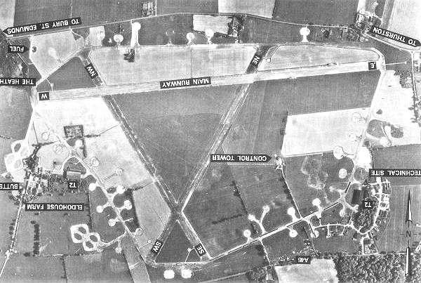
Rougham Airfield

Rougham Airfield, formerly Royal Air Force Bury St Edmunds or more simply RAF Bury St Edmunds is a former Royal Air Force station located 3 miles (4.8...

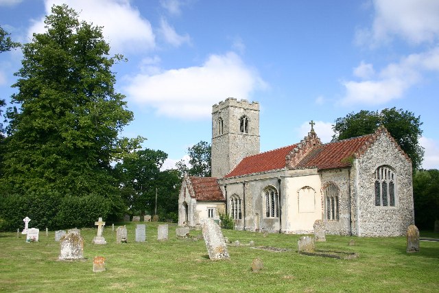
Rushbrooke, West Suffolk

Rushbrooke is a village and former civil parish on the River Lark, 20 miles (32 km) north west of Ipswich, now in the parish of Rushbrooke with Rougham...

Victory Ground, Bury St Edmunds

The Victory Ground is a cricket ground in Bury St Edmunds, Suffolk, England. The ground was established in 1935, when Suffolk played the Surrey Second...

Moreton Hall, Bury St Edmunds

Moreton Hall is a Grade II* listed building in Bury St Edmunds, a market town in the county of Suffolk, England. It was designed by the Scottish architect...

Nowton Park

Nowton Park is a park in Nowton, Suffolk, England. == History == The park and its manor house, Nowton Court, built in 1837, was owned by the Oakes family...

Moreton Hall Community Woods

Moreton Hall Community Woods is an 18.5 hectare local nature reserve in Bury St Edmunds in Suffolk. it is owned by West Suffolk Council and managed by...
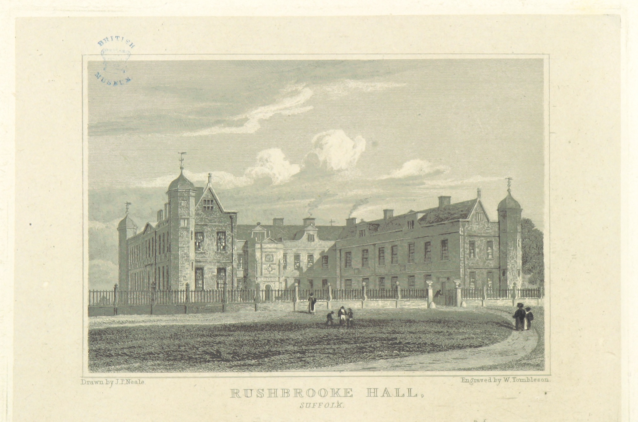
Rushbrooke Hall

Rushbrooke Hall was a British stately home in Rushbrooke, Suffolk. For several hundred years it was the family seat of the Jermyn family. It was demolished...

Nearby Amenities

Located within 500m of 52.233611,0.75204764
Power: pole
Lat/Long: 52.2368863/0.7477666
Power: pole
Lat/Long: 52.2366782/0.7494679
Power: pole
Lat/Long: 52.2362765/0.7526725
Power: pole
Lat/Long: 52.2364957/0.7509449
Power: tower
Lat/Long: 52.2295804/0.7493232
Power: tower
Lat/Long: 52.2328824/0.7588879
Power: tower
Lat/Long: 52.2305333/0.753089
Power: tower
Lat/Long: 52.231522/0.7569206
Power: tower
Lat/Long: 52.2350057/0.755181
Power: pole
Lat/Long: 52.2361381/0.7535729
Power: pole
Lat/Long: 52.2355451/0.7544141
Power: tower
Lat/Long: 52.2339527/0.7570193
The data included in this document is from www.openstreetmap.org. The data is made available under ODbL.

Have you been to Broom Plantation?

Leave your review of Broom Plantation below (or comments, questions and feedback).