Blackpit Wood

Wood, Forest in Kent Maidstone

England

Blackpit Wood

Signs in Egerton Forstal Turn right for the weekly farmers market, and left for local plums
Signs in Egerton Forstal Credit: John Brown

Located in the county of Kent, Blackpit Wood is a mesmerizing forest that covers an area of approximately 100 acres. This enchanting woodland is nestled in the heart of the picturesque Kent Downs, offering visitors a serene and tranquil environment to escape the hustle and bustle of everyday life.

Blackpit Wood boasts a diverse range of tree species, including oak, beech, and ash, which create a rich and vibrant canopy that provides shelter for a variety of wildlife. The forest floor is adorned with a carpet of bluebells during the spring months, creating a breathtaking sight and attracting nature enthusiasts from far and wide.

The wood is crisscrossed by a network of well-maintained footpaths, allowing visitors to explore and immerse themselves in the natural beauty of the area. These paths lead visitors through ancient woodlands, past babbling brooks, and to hidden clearings, offering ample opportunities for picnicking, wildlife spotting, and peaceful contemplation.

Blackpit Wood is also home to a plethora of wildlife, offering nature lovers the chance to observe an array of species in their natural habitat. From deer gracefully roaming through the undergrowth to birdsong filling the air, the forest provides a haven for both common and rare species alike.

With its idyllic setting, abundant wildlife, and tranquil atmosphere, Blackpit Wood is a true gem in the heart of Kent. Whether one seeks a peaceful walk, a spot of birdwatching, or simply a retreat into nature, this woodland is the perfect destination for nature enthusiasts and those looking to escape the stresses of modern life.

If you have any feedback on the listing, please let us know in the comments section below.

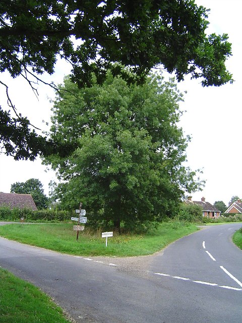
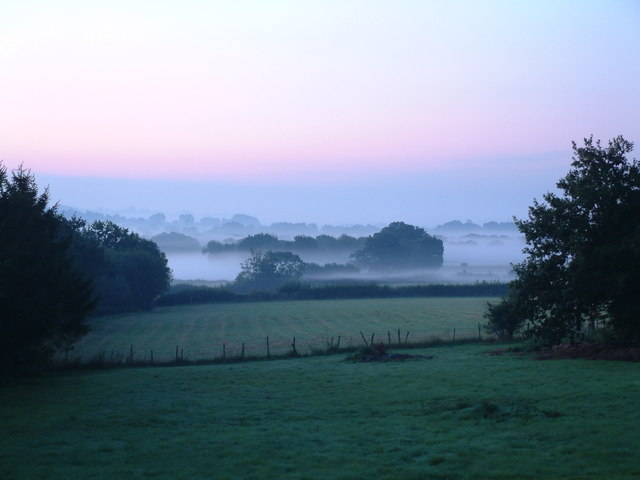
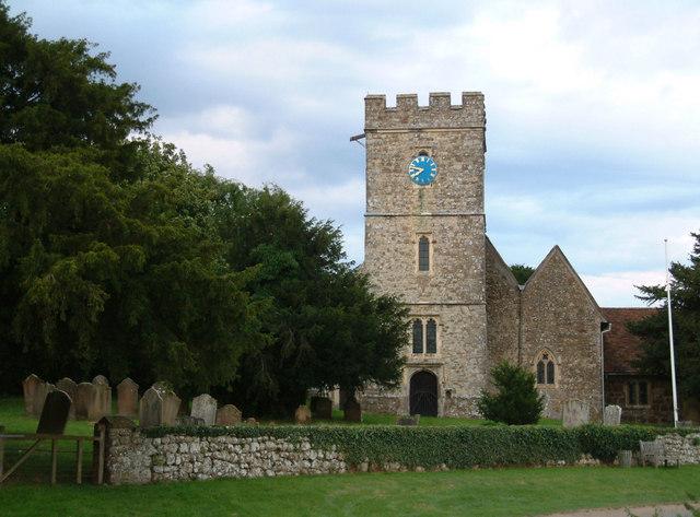
Blackpit Wood Images

Images are sourced within 2km of 51.198788/0.68901574 or Grid Reference TQ8747. Thanks to Geograph Open Source API. All images are credited.

Signs in Egerton Forstal Turn right for the weekly farmers market, and left for local plums
Signs in Egerton Forstal
Turn right for the weekly farmers market, and left for local plums
Link Hill Looking down the hill towards "Old Harrow"
Link Hill
Looking down the hill towards "Old Harrow"
Pasture Taken from land near Link Farm facing SW
Pasture
Taken from land near Link Farm facing SW
Pembles Cross Junction Situated between Pembles Cross and Potters Forstal
Pembles Cross Junction
Situated between Pembles Cross and Potters Forstal
Grafty Green The Village Store, Post Office and Telephone Box
Grafty Green
The Village Store, Post Office and Telephone Box
Boughton Malherbe Church Legend has it that there was a tunnel connecting the church to Coldbridge Farm - 2 Grid Squares to the South.
Boughton Malherbe Church
Legend has it that there was a tunnel connecting the church to Coldbridge Farm - 2 Grid Squares to the South.
The Bell House, Boughton Malherbe Standing next to the church of St Nicholas, this house is marked as a school on the 1875 map (but not on the 1940s OS). I gather it is/has been the home of "celebrities" in more recent times. In fact a correspondent, Bill Ireland, tells me his parents bought the house as a ruin in 1961, saving it from demolition. They converted it to a house and lived there until about 1985 when they sold it to one-time Dr Who, Tom Baker. He sold it to Vic Reeves in about 1990.
The Bell House, Boughton Malherbe
Standing next to the church of St Nicholas, this house is marked as a school on the 1875 map (but not on the 1940s OS). I gather it is/has been the home of "celebrities" in more recent times. In fact a correspondent, Bill Ireland, tells me his parents bought the house as a ruin in 1961, saving it from demolition. They converted it to a house and lived there until about 1985 when they sold it to one-time Dr Who, Tom Baker. He sold it to Vic Reeves in about 1990.
Lantern gate at Boughton Malherbe church This wrought iron lantern gate bears the date 1897 topped with a crown - possibly because Queen Elizabeth I once stayed at nearby Boughton Place.
Lantern gate at Boughton Malherbe church
This wrought iron lantern gate bears the date 1897 topped with a crown - possibly because Queen Elizabeth I once stayed at nearby Boughton Place.
King of the castle Tup surveys his flock from the top of what looks like a castle mound just south of Church Road, Boughton Malherbe.
King of the castle
Tup surveys his flock from the top of what looks like a castle mound just south of Church Road, Boughton Malherbe.
Earthwork, Boughton Malherbe Not marked on the map but this hillock on the south side of Church Road has the look of a castle mound about it and shaped stones are lying nearby and protrude from the grass in places.
Earthwork, Boughton Malherbe
Not marked on the map but this hillock on the south side of Church Road has the look of a castle mound about it and shaped stones are lying nearby and protrude from the grass in places.
Pasture, Boughton Malherbe Looking SE from Church Road, Coldbridge Wood in the distance.
Pasture, Boughton Malherbe
Looking SE from Church Road, Coldbridge Wood in the distance.
Park Shaw View south from Church Road across Park Shaw - the Weald disappearing in the haze.
Park Shaw
View south from Church Road across Park Shaw - the Weald disappearing in the haze.
Wellham Wood & Coldbridge Wood, Boughton Malherbe Wellham Wood is at the far end of the field and Coldbridge Wood is to the right. Taken from the Greensand Way as it crosses the lower elevations of the scarp slope of the Lower Greensand ridge.
Wellham Wood & Coldbridge Wood, Boughton Malherbe
Wellham Wood is at the far end of the field and Coldbridge Wood is to the right. Taken from the Greensand Way as it crosses the lower elevations of the scarp slope of the Lower Greensand ridge.
Greensand Way, Boughton Malherbe Here the Greensand Way cuts across a field of ripening crop. Coldbridge Wood (part of which is in <a href="https://www.geograph.org.uk/gridref/TQ8948">TQ8948</a>) is on the right.
Greensand Way, Boughton Malherbe
Here the Greensand Way cuts across a field of ripening crop. Coldbridge Wood (part of which is in TQ8948) is on the right.
The Kings Head Pub, Grafty Green
St.Nicholas Church, Boughton Malherbe
Dawn over Kentish Countryside, Grafty Green Picture taken at 5.15am just after dawn, A beautiful dawn mist.
Dawn over Kentish Countryside, Grafty Green
Picture taken at 5.15am just after dawn, A beautiful dawn mist.
Village Sign, Grafty Green & Boughton Malherbe Lovely sign on the village green, opposite the post office / shop. 
This sign was erected to mark the Millennium in 2000.
Village Sign, Grafty Green & Boughton Malherbe
Lovely sign on the village green, opposite the post office / shop. This sign was erected to mark the Millennium in 2000.
Show me another place!

Blackpit Wood is located at Grid Ref: TQ8747 (Lat: 51.198788, Lng: 0.68901574)

Administrative County: Kent

District: Maidstone

Police Authority: Kent

What 3 Words

///boarded.elect.unites. Near Lenham, Kent

Nearby Locations

Blackpit Wood

Related Wikis

Rivers of Kent

Four major rivers drain the county of Kent, England. == River Medway == The catchment area of the Medway covers almost 25% of the county. The detailed...

Kent

Kent is a county in the South East England region, the closest county to continental Europe. It borders Essex across the entire estuary of the River Thames...

Grafty Green

Grafty Green is a village in the Maidstone district of Kent, England, falling within the civil parish of Boughton Malherbe. It contains two public houses...

Boughton Malherbe

Boughton Malherbe ( BAW-tən MAL-ər-bee) is a village and civil parish in the Maidstone district of Kent, England, equidistant between Maidstone and Ashford...
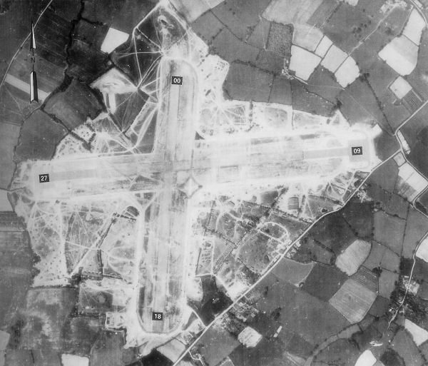
RAF Headcorn

Royal Air Force Headcorn or more commonly known as RAF Headcorn is a former Royal Air Force Advanced Landing Ground located 2 miles (3.2 km) northeast...

Platt's Heath

Platts Heath is a hamlet in the civil parish of Lenham, Kent, England. It is also the source of the River Len, which flows in a westerly direction to join...
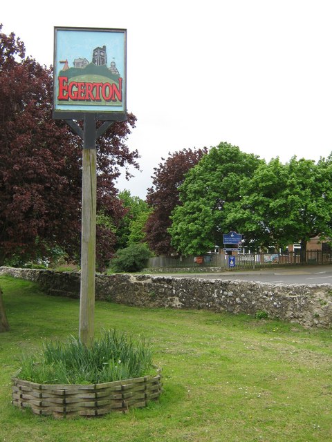
Egerton, Kent

Egerton is a village and civil parish in the Ashford District of Kent, England. The village is on the Greensand Ridge 9 miles (14.4 km) north of Ashford...

Volvo World Match Play Championship

The Volvo World Match Play Championship was an annual match play men's professional golf tournament which was staged from 1964 to 2014. The World Match...

Nearby Amenities

Located within 500m of 51.198788,0.68901574
The data included in this document is from www.openstreetmap.org. The data is made available under ODbL.

Have you been to Blackpit Wood?

Leave your review of Blackpit Wood below (or comments, questions and feedback).