Crowdale Wood

Wood, Forest in Norfolk King's Lynn and West Norfolk

England

Crowdale Wood

Creake Abbey Looking east along the nave <span class="nowrap"><a title="https://historicengland.org.uk/listing/the-list/list-entry/1015271?section=official-listing" rel="nofollow ugc noopener" href="https://historicengland.org.uk/listing/the-list/list-entry/1015271?section=official-listing">Link</a><img style="margin-left:2px;" alt="External link" title="External link - shift click to open in new window" src="https://s1.geograph.org.uk/img/external.png" width="10" height="10"/></span>
Creake Abbey Credit: Sandy Gerrard

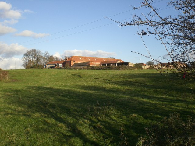
Crowdale Wood is a picturesque woodland located in the county of Norfolk, England. Stretching over an area of approximately 50 acres, it offers a serene and tranquil environment for nature lovers and outdoor enthusiasts alike.

The wood is predominantly composed of a mix of deciduous and coniferous trees, creating a diverse and vibrant ecosystem. Oak, beech, and birch trees dominate the landscape, providing a rich canopy that shelters a plethora of flora and fauna. The forest floor is adorned with an array of wildflowers, including bluebells, primroses, and wood anemones, adding bursts of color to the woodland.

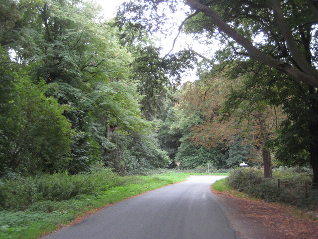
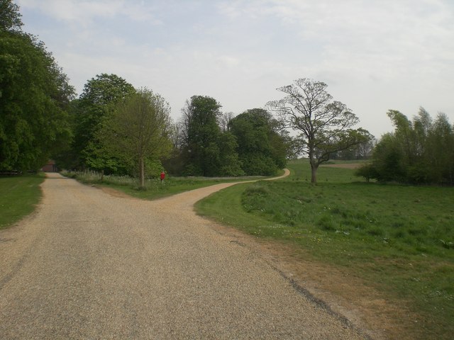
Numerous walking trails wind their way through Crowdale Wood, allowing visitors to explore and immerse themselves in its natural beauty. The paths vary in difficulty, catering to all levels of fitness and mobility. Along the way, hikers may encounter a variety of wildlife, including deer, rabbits, and a multitude of bird species, making it a haven for birdwatchers.

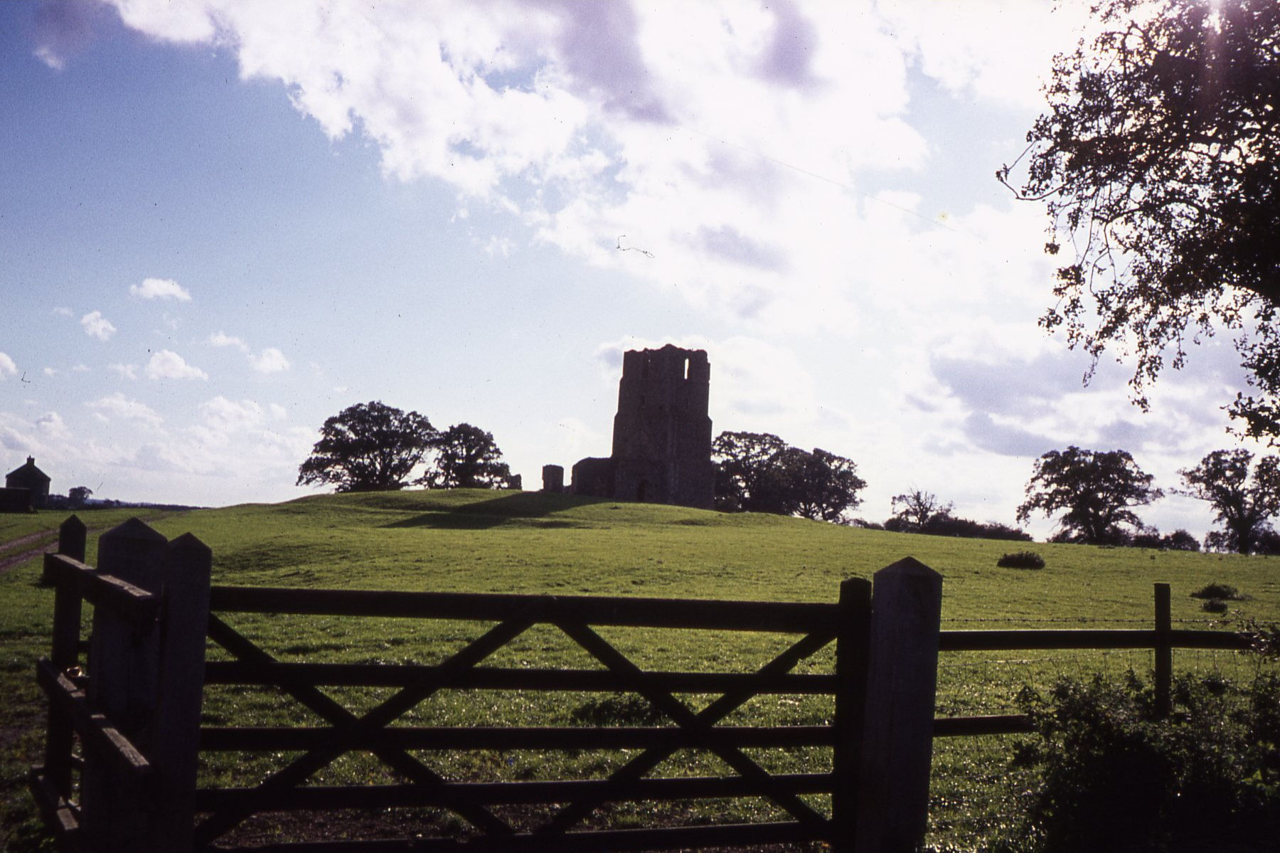
In addition to its natural beauty, Crowdale Wood also holds historical significance. It is believed to have been part of an ancient forest that covered much of Norfolk in medieval times. The remains of an ancient settlement, including a well-preserved moat, can still be found within the woodland, serving as a testament to its past.

Overall, Crowdale Wood is a gem of Norfolk, offering visitors a peaceful retreat where they can connect with nature, explore its trails, and appreciate the rich biodiversity it has to offer.

If you have any feedback on the listing, please let us know in the comments section below.

Crowdale Wood Images

Images are sourced within 2km of 52.913874/0.78073415 or Grid Reference TF8738. Thanks to Geograph Open Source API. All images are credited.

Creake Abbey Looking east along the nave <span class="nowrap"><a title="https://historicengland.org.uk/listing/the-list/list-entry/1015271?section=official-listing" rel="nofollow ugc noopener" href="https://historicengland.org.uk/listing/the-list/list-entry/1015271?section=official-listing">Link</a><img style="margin-left:2px;" alt="External link" title="External link - shift click to open in new window" src="https://s1.geograph.org.uk/img/external.png" width="10" height="10"/></span>
Creake Abbey
Looking east along the nave LinkExternal link
Creake Abbey North transept <span class="nowrap"><a title="https://historicengland.org.uk/listing/the-list/list-entry/1015271?section=official-listing" rel="nofollow ugc noopener" href="https://historicengland.org.uk/listing/the-list/list-entry/1015271?section=official-listing">Link</a><img style="margin-left:2px;" alt="External link" title="External link - shift click to open in new window" src="https://s1.geograph.org.uk/img/external.png" width="10" height="10"/></span>
Creake Abbey
North transept LinkExternal link
Creake Abbey
Creake Abbey
Creake Abbey Looking westwards towards the car park. The Abbey was a victim not of Henry VIII but of fire and plague.  The buildings were at one time owned by Christ's College, Cambridge, but the ruins are now in the care of English Heritage. <span class="nowrap"><a title="https://www.english-heritage.org.uk/visit/places/creake-abbey/history/" rel="nofollow ugc noopener" href="https://www.english-heritage.org.uk/visit/places/creake-abbey/history/">Link</a><img style="margin-left:2px;" alt="External link" title="External link - shift click to open in new window" src="https://s1.geograph.org.uk/img/external.png" width="10" height="10"/></span>
Creake Abbey
Looking westwards towards the car park. The Abbey was a victim not of Henry VIII but of fire and plague. The buildings were at one time owned by Christ's College, Cambridge, but the ruins are now in the care of English Heritage. LinkExternal link
Creake Abbey: Site of the nave and pulpitum
Creake Abbey: Site of the nave and pulpitum, later c13th work
Creake Abbey: Site of the nave and pulpitum, later c13th and c15th work under the arch
Creake Abbey: Site of the nave and pulpitum, later c13th and c15th work under the arch Detail of the c15th work.
Creake Abbey: Site of the nave and pulpitum, later c13th and c15th work under the arch
Detail of the c15th work.
Creake Abbey: The pulpitum wall
Creake Abbey: The pulpitum and choir walls
Creake Abbey: The choir north wall
Bridleway to Creake Abbey
Dilapidated farm buildings near New Holkham
Wells Road near New Holkham
Post box North Creake Post box at junction of Dunn's Lane and Burnham Road, North Creake
Post box North Creake
Post box at junction of Dunn's Lane and Burnham Road, North Creake
House in Church Street (B1355), North Creake with post box The post box seems unusual in colour. As it only says GR on it, I think it may be George V. The Post Office is located further down the road. The door on the left has number 24 above it.Might this building have originally been the post office?
House in Church Street (B1355), North Creake with post box
The post box seems unusual in colour. As it only says GR on it, I think it may be George V. The Post Office is located further down the road. The door on the left has number 24 above it.Might this building have originally been the post office?
Post box on house, Church Street, North Creake Close-up of presumed George V  post box on house 24, Church Street, North Creake.
Post box on house, Church Street, North Creake
Close-up of presumed George V post box on house 24, Church Street, North Creake.
The Post  Office, Church Street, North Creake On the same building is a faded Forge Smithy sign and also a nice Lyons Tea sign. It is all slightly confusing as there does not appear to be a post box, but there is one built into the wall of number 24,  somewhat further down the road - see my other submissions. Unfortunately, the post office was closed, so could not ask!
The Post Office, Church Street, North Creake
On the same building is a faded Forge Smithy sign and also a nice Lyons Tea sign. It is all slightly confusing as there does not appear to be a post box, but there is one built into the wall of number 24, somewhat further down the road - see my other submissions. Unfortunately, the post office was closed, so could not ask!
Show me another place!

Crowdale Wood is located at Grid Ref: TF8738 (Lat: 52.913874, Lng: 0.78073415)

Administrative County: Norfolk

District: King's Lynn and West Norfolk

Police Authority: Norfolk

What 3 Words

///info.tank.uppermost. Near Wells-next-the-Sea, Norfolk

Related Wikis

Quarles, Norfolk

Quarles is a hamlet and former civil parish, now in the civil parish of Holkham, in the North Norfolk district, in the county of Norfolk, England. The...
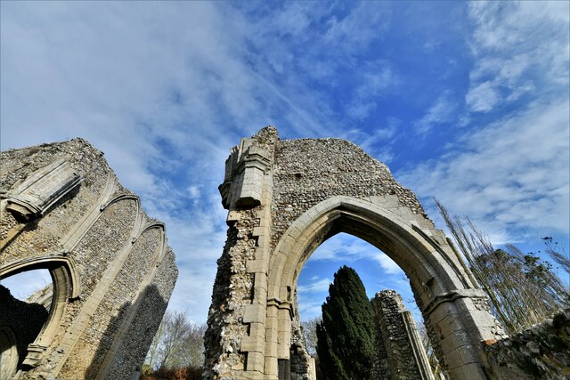
Creake Abbey

Creake Abbey is a ruined abbey in Norfolk, England, situated alongside the River Burn and a mile to the north of the village of North Creake. The abbey...

North Creake

North Creake is a village and civil parish in the north west of the English county of Norfolk. It covers an area of 14.99 km2 (5.79 sq mi) and had a population...

RAF North Creake

Royal Air Force North Creake or more simply RAF North Creake is a former Royal Air Force station located 3.3 miles (5.3 km) southwest of Wells-next-the...

Burnham Thorpe

Burnham Thorpe is a hamlet and civil parish on the River Burn and near the coast of Norfolk, England. It is famous for being the birthplace of Vice Admiral...

Egmere medieval settlement

Egmere medieval settlement is a deserted medieval village in Norfolk, England, about 2.5 miles (4.0 km) west of Walsingham. It is a Scheduled Monument...

Waterden medieval settlement

Waterden medieval settlement is a deserted medieval village in Norfolk, England, about 3 miles (4.8 km) west of Walsingham. It is a Scheduled Monument...

South Creake

South Creake is a village and civil parish in north west Norfolk, England. The village lies 1+1⁄2 miles (2.4 km) south of its twin village of North Creake...

Nearby Amenities

Located within 500m of 52.913874,0.78073415
Power: pole
Lat/Long: 52.9178044/0.7805282
Power: pole
Lat/Long: 52.9169052/0.7814214
Power: pole
Lat/Long: 52.9169133/0.7840607
The data included in this document is from www.openstreetmap.org. The data is made available under ODbL.

Have you been to Crowdale Wood?

Leave your review of Crowdale Wood below (or comments, questions and feedback).