Hoad's Wood

Wood, Forest in Sussex Rother

England

Hoad's Wood

Hastings Country Park A view looking south east over the eastern section of the 345 hectares of coast, cliffs, woodland, valleys and grassland which has been a country park since 1974.
<span class="nowrap"><a title="https://www.hastings.gov.uk/countryside-nature/naturereserves/naturereserves-hastings/hcp/" rel="nofollow ugc noopener" href="https://www.hastings.gov.uk/countryside-nature/naturereserves/naturereserves-hastings/hcp/">Link</a><img style="margin-left:2px;" alt="External link" title="External link - shift click to open in new window" src="https://s1.geograph.org.uk/img/external.png" width="10" height="10"/></span>
Hastings Country Park Credit: Des Blenkinsopp

Hoad's Wood is a picturesque woodland located in Sussex, England. Covering an area of approximately 100 acres, it is nestled within the beautiful countryside of the South Downs National Park. The wood is easily accessible, situated just a short distance from the village of Ditchling.

The woodland is predominantly composed of native broadleaf trees, including oak, beech, and ash. These tall and majestic trees create a dense canopy, providing a cool and shaded environment below. The forest floor is carpeted with a rich undergrowth of ferns, bluebells, and wildflowers, adding to the enchanting atmosphere.

Hoad's Wood is a haven for wildlife, with numerous species making it their home. Bird enthusiasts can spot a variety of avian inhabitants, such as woodpeckers, owls, and various songbirds. Squirrels scamper among the branches, while foxes and deer roam the forest floor.

The wood offers several walking trails, allowing visitors to explore its natural beauty. These paths meander through the trees, leading to a small pond where visitors can observe aquatic life and waterfowl. The tranquil surroundings make it an ideal spot for nature lovers, hikers, and photographers.

Hoad's Wood has a rich history, with evidence of human activity dating back centuries. It was once part of the wider Ditchling Common, a common land used for grazing livestock. Today, it is a protected area, managed by local authorities to preserve its ecological importance.

Whether seeking solitude in nature, enjoying a leisurely stroll, or simply immersing oneself in the beauty of the Sussex countryside, Hoad's Wood offers a serene and captivating experience for all who visit.

If you have any feedback on the listing, please let us know in the comments section below.
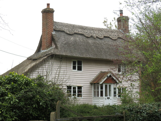
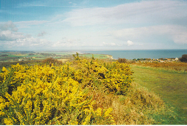
Hoad's Wood Images

Images are sourced within 2km of 50.881756/0.64783877 or Grid Reference TQ8612. Thanks to Geograph Open Source API. All images are credited.

Hastings Country Park A view looking south east over the eastern section of the 345 hectares of coast, cliffs, woodland, valleys and grassland which has been a country park since 1974.
<span class="nowrap"><a title="https://www.hastings.gov.uk/countryside-nature/naturereserves/naturereserves-hastings/hcp/" rel="nofollow ugc noopener" href="https://www.hastings.gov.uk/countryside-nature/naturereserves/naturereserves-hastings/hcp/">Link</a><img style="margin-left:2px;" alt="External link" title="External link - shift click to open in new window" src="https://s1.geograph.org.uk/img/external.png" width="10" height="10"/></span>
Hastings Country Park
A view looking south east over the eastern section of the 345 hectares of coast, cliffs, woodland, valleys and grassland which has been a country park since 1974. LinkExternal link
Sandstone in an Old Quarry A disused sand quarry in Hastings Country Park.
In production until the 1960s, the quarry produced a fine grained white sand which was used in high quality glass making.
Several sandstone outcrops are still to be seen among the largely overgrown former workings.
Sandstone in an Old Quarry
A disused sand quarry in Hastings Country Park. In production until the 1960s, the quarry produced a fine grained white sand which was used in high quality glass making. Several sandstone outcrops are still to be seen among the largely overgrown former workings.
In an Old Quarry A former sand quarry which ceased production in the 1960s has now been mostly reclaimed by tees and gorse. A few outcrops of sandstone can still be seen in places.
Now part of Hastings Country Park.
In an Old Quarry
A former sand quarry which ceased production in the 1960s has now been mostly reclaimed by tees and gorse. A few outcrops of sandstone can still be seen in places. Now part of Hastings Country Park.
Signpost in the Country Park Hastings Country Park was set up in 1974. <span class="nowrap"><a title="https://www.hastings.gov.uk/parks_gardens_allotments/parks/hastings-country/" rel="nofollow ugc noopener" href="https://www.hastings.gov.uk/parks_gardens_allotments/parks/hastings-country/">Link</a><img style="margin-left:2px;" alt="External link" title="External link - shift click to open in new window" src="https://s1.geograph.org.uk/img/external.png" width="10" height="10"/></span>
A series of mostly easy going trails with a few steep bits have been laid out through the park's 345 hectares.
Signpost in the Country Park
Hastings Country Park was set up in 1974. LinkExternal link A series of mostly easy going trails with a few steep bits have been laid out through the park's 345 hectares.
The Dripping Well Not exactly a well, more of a rather atmospheric sort of mossy grotto where water drips over an outcrop of sandstone.
The Dripping Well
Not exactly a well, more of a rather atmospheric sort of mossy grotto where water drips over an outcrop of sandstone.
The Bale House A new visitor centre and cafe in Hastings Country Park.
Straw bales have been used in its construction. <span class="nowrap"><a title="https://www.hastings.gov.uk/parks_gardens_allotments/parks/visitorcentre/about/" rel="nofollow ugc noopener" href="https://www.hastings.gov.uk/parks_gardens_allotments/parks/visitorcentre/about/">Link</a><img style="margin-left:2px;" alt="External link" title="External link - shift click to open in new window" src="https://s1.geograph.org.uk/img/external.png" width="10" height="10"/></span>
The Bale House
A new visitor centre and cafe in Hastings Country Park. Straw bales have been used in its construction. LinkExternal link
A Corner on the Route The 1066 Country Route and National Cycle Route 2 head off to the left, while an ordinary footpath carries on ahead to the Hastings Country Park visitor centre.
A Corner on the Route
The 1066 Country Route and National Cycle Route 2 head off to the left, while an ordinary footpath carries on ahead to the Hastings Country Park visitor centre.
Almost the Saxon Shore Way On open common like this there are tracks all over the place.
This one isn't the waymarked Saxon Shore Way, but it's going in the same direction and only a short distance away. 
Taken on a dismal wet afternoon when the world looks better in black & white.
Almost the Saxon Shore Way
On open common like this there are tracks all over the place. This one isn't the waymarked Saxon Shore Way, but it's going in the same direction and only a short distance away. Taken on a dismal wet afternoon when the world looks better in black & white.
Covehurst Bay
Covehurst Bay
Fairlight Hall Fairlight Hall from the 1066 path below North Hill, with houses on the road between Guestling Green and Pett in the distance
Fairlight Hall
Fairlight Hall from the 1066 path below North Hill, with houses on the road between Guestling Green and Pett in the distance
Fairlight Hall concert-goers Fairlight Hall provides fitting venue for classical concerts, attractive gardens and fine views
Fairlight Hall concert-goers
Fairlight Hall provides fitting venue for classical concerts, attractive gardens and fine views
Fairlight coastline This stretch of coastline to the east of Hastings is protected by Hastings Council as a country park, and provides a rewarding walk on the coastal path.
Fairlight coastline
This stretch of coastline to the east of Hastings is protected by Hastings Council as a country park, and provides a rewarding walk on the coastal path.
Church Farm at Pett Interesting mixture of materials.
Church Farm at Pett
Interesting mixture of materials.
Fairlight Cove Some of Fairlight's homes seem rather close to the sandstone cliffs. Taken from the National Trust land on the coastal path above Cliff End.
Fairlight Cove
Some of Fairlight's homes seem rather close to the sandstone cliffs. Taken from the National Trust land on the coastal path above Cliff End.
Stained glass window, St Mary & St Peter's church, Pett St Mary and St Peter by Heaton, Butler and Bayne 1902.
Stained glass window, St Mary & St Peter's church, Pett
St Mary and St Peter by Heaton, Butler and Bayne 1902.
Stained glass window, St Mary & St Peter's church, Pett Depicting The raising of Jairus' daughter, and  Christ with Martha & Mary.
Glass by Lavers, Barraud and Westlake, circa 1871.
Stained glass window, St Mary & St Peter's church, Pett
Depicting The raising of Jairus' daughter, and Christ with Martha & Mary. Glass by Lavers, Barraud and Westlake, circa 1871.
Hastings Country Park View across Warren Wood to Blakey Bank, with Beachy Head and Eastbourne in the far distance. Ref:MLHu
Hastings Country Park
View across Warren Wood to Blakey Bank, with Beachy Head and Eastbourne in the far distance. Ref:MLHu
Oakwood Cottage Thatched cottage where the 1066 Country Walk turns north to enter Guestling Wood.
Oakwood Cottage
Thatched cottage where the 1066 Country Walk turns north to enter Guestling Wood.
Show me another place!

Hoad's Wood is located at Grid Ref: TQ8612 (Lat: 50.881756, Lng: 0.64783877)

Administrative County: East Sussex

District: Rother

Police Authority: Sussex

What 3 Words

///showcase.merely.skinny. Near Fairlight, East Sussex

Related Wikis

Fairlight, East Sussex

Fairlight is a village in East Sussex, England within Rother district, three miles (5 km) to the east of Hastings. Fairlight is also the name of the civil...

Pett

Pett is a village and civil parish in the Rother district of East Sussex, England. The village is located 5 miles (8.0 km) north-east of Hastings on the...

Hastings Country Park

Hastings Country Park was formed in 1974 and covers 345 hectares (850 acres) east of Hastings in England. Sandstone cliffs, glens covered with gorse and...

Fairlight Glen

Fairlight Glen lies about 2 miles (3.2 km) east of the fishing port of Hastings and 1.5 miles (2.4 km) west of the small village of Fairlight Cove on the...

Nearby Amenities

Located within 500m of 50.881756,0.64783877
Post Box
Operator: Royal Mail
Operator Wikidata: Q638098
Post Box Type: lamp
Ref: TN35 215
Royal Cypher: EIIR
Royal Cypher Wikidata: Q33102113
Lat/Long: 50.8819186/0.6441858
Generator Method: photovoltaic
Generator Output Electricity: yes
Generator Source: solar
Generator Type: solar_photovoltaic_panel
Location: roof
Power: generator
Lat/Long: 50.8784472/0.6497142
The data included in this document is from www.openstreetmap.org. The data is made available under ODbL.

Have you been to Hoad's Wood?

Leave your review of Hoad's Wood below (or comments, questions and feedback).