Halden Wood

Wood, Forest in Kent Ashford

England

Halden Wood

Standen Oast, Smarden Road, Biddenden, Kent One round kiln and one square kiln oast house.
Standen Oast, Smarden Road, Biddenden, Kent Credit: Oast House Archive

Halden Wood is a charming forest located in the county of Kent, England. Covering an area of approximately 100 hectares, this woodland is nestled in the picturesque countryside, offering a tranquil and serene atmosphere for visitors to enjoy.

The wood is predominantly comprised of ancient broadleaf trees, such as oak, beech, and chestnut, which have thrived for centuries and provide a rich habitat for various wildlife species. Halden Wood is particularly renowned for its vibrant display of bluebells during the spring months, attracting nature enthusiasts and photographers alike.

The forest boasts a network of well-maintained footpaths and bridleways, allowing visitors to explore its natural beauty on foot or horseback. It also features a diverse range of flora, including ferns, mosses, and wildflowers, creating a visually stunning landscape throughout the year.

Halden Wood is a popular destination for outdoor activities, such as hiking, cycling, and birdwatching. The forest is home to a wide array of bird species, including woodpeckers, owls, and various songbirds, making it a haven for birdwatchers seeking to spot and identify different avian species.

Furthermore, the wood offers a peaceful escape from the bustling city life, providing a serene environment for relaxation and connecting with nature. It is a perfect spot for picnics, family outings, or simply unwinding amidst the tranquil surroundings.

In summary, Halden Wood, Kent, is a picturesque and diverse woodland that offers visitors the chance to immerse themselves in the beauty of nature. With its ancient trees, vibrant flora, and abundance of wildlife, it is a place of tranquility and natural wonder.

If you have any feedback on the listing, please let us know in the comments section below.

Halden Wood Images

Images are sourced within 2km of 51.122495/0.65937068 or Grid Reference TQ8639. Thanks to Geograph Open Source API. All images are credited.

Standen Oast, Smarden Road, Biddenden, Kent One round kiln and one square kiln oast house.
Standen Oast, Smarden Road, Biddenden, Kent
One round kiln and one square kiln oast house.
Little Standen Oast, Smarden Road, near Biddenden Early small round kilned oast house.
Little Standen Oast, Smarden Road, near Biddenden
Early small round kilned oast house.
Monks Hill Oast, Monks Hill, Smarden, Kent Single round kiln oast house.
Monks Hill Oast, Monks Hill, Smarden, Kent
Single round kiln oast house.
Oast Houses An Oast House is a building used to dry fresh hops before they are sent to the brewers, to be used for flavouring beer. A traditional Oast House consists of the 'oast' and the 'stowage'. The oast was a kiln, with a plenum chamber fired by charcoal at ground floor and the drying floor directly above. The steep pitched roof channelled the hot air through the hops to the top. The stowage, was the barn section, it had a cooling floor and press at first floor and storage area at ground floor. Read more <a title="https://www.geograph.org.uk/article/Oast-Houses" href="https://www.geograph.org.uk/article/Oast-Houses">Link</a>
Oast Houses
An Oast House is a building used to dry fresh hops before they are sent to the brewers, to be used for flavouring beer. A traditional Oast House consists of the 'oast' and the 'stowage'. The oast was a kiln, with a plenum chamber fired by charcoal at ground floor and the drying floor directly above. The steep pitched roof channelled the hot air through the hops to the top. The stowage, was the barn section, it had a cooling floor and press at first floor and storage area at ground floor. Read more Link
Kelsham Oast, Smarden, Kent Single square kiln oast house.
Kelsham Oast, Smarden, Kent
Single square kiln oast house.
The New Oast, Lashenden Farm, Headcorn Road, Biddenden, Kent Two oast houses at Lashenden Farm.
The New Oast, Lashenden Farm, Headcorn Road, Biddenden, Kent
Two oast houses at Lashenden Farm.
The New Oast, Lashenden Farm on the A274
Road to New Oast, Lashenden Farm off the A274
Oast House at Lashenden Farm, Headcorn Road, Biddenden, Kent One round and one square kiln oast house. One of two adjacent oast houses.

Also see <a href="https://www.geograph.org.uk/photo/1479932">TQ8440 : The New Oast, Lashenden Farm, Headcorn Road, Biddenden, Kent</a>
Oast House at Lashenden Farm, Headcorn Road, Biddenden, Kent
One round and one square kiln oast house. One of two adjacent oast houses. Also see TQ8440 : The New Oast, Lashenden Farm, Headcorn Road, Biddenden, Kent
The New Oast, Lashenden Farm, Headcorn Road, Biddenden, Kent Single square kiln oast house. One of two adjacent oast houses.
The New Oast, Lashenden Farm, Headcorn Road, Biddenden, Kent
Single square kiln oast house. One of two adjacent oast houses.
Footpath to Haffenden Barn This path leads from Wagstaff Farm on Wagstaff Lane, towards the barn on Pook Lane. Path not show on the ground except via post markers.
Footpath to Haffenden Barn
This path leads from Wagstaff Farm on Wagstaff Lane, towards the barn on Pook Lane. Path not show on the ground except via post markers.
Vane Court On Smarden Road.
Vane Court
On Smarden Road.
Standen Court Barn On Weeks Lane. Standen Oast is in the background.
Standen Court Barn
On Weeks Lane. Standen Oast is in the background.
Chart Hills Golf Clubhouse Seen from the car park of Weeks Lane. See <span class="nowrap"><a title="http://www.charthills.co.uk/" rel="nofollow ugc noopener" href="http://www.charthills.co.uk/">Link</a><img style="margin-left:2px;" alt="External link" title="External link - shift click to open in new window" src="https://s1.geograph.org.uk/img/external.png" width="10" height="10"/></span> for more details on the club.
Chart Hills Golf Clubhouse
Seen from the car park of Weeks Lane. See LinkExternal link for more details on the club.
Academy of Golf, Chart Hill Golf Club As seen from the car park to the clubhouse. This building is used by a business for teaching golf.
See <span class="nowrap"><a title="http://www.golftoday.co.uk/industry_directory/tuition_academies/peter_mitchell.html" rel="nofollow ugc noopener" href="http://www.golftoday.co.uk/industry_directory/tuition_academies/peter_mitchell.html">Link</a><img style="margin-left:2px;" alt="External link" title="External link - shift click to open in new window" src="https://s1.geograph.org.uk/img/external.png" width="10" height="10"/></span> for more details on the academy.
Academy of Golf, Chart Hill Golf Club
As seen from the car park to the clubhouse. This building is used by a business for teaching golf. See LinkExternal link for more details on the academy.
Smarden Road This road leads from the A274 Headcorn Road near Standen to The Cut near Tyldan.
Monk's Hill Cottages are seen in the background.
Smarden Road
This road leads from the A274 Headcorn Road near Standen to The Cut near Tyldan. Monk's Hill Cottages are seen in the background.
Smarden Road bridge This road leads from The Cut near Tyldan, to the A274 Headcorn Road in Standen.
The road passes over a stream from Chart Hills Golf Club.
Smarden Road bridge
This road leads from The Cut near Tyldan, to the A274 Headcorn Road in Standen. The road passes over a stream from Chart Hills Golf Club.
Show me another place!

Halden Wood is located at Grid Ref: TQ8639 (Lat: 51.122495, Lng: 0.65937068)

Administrative County: Kent

District: Ashford

Police Authority: Kent

What 3 Words

///inferior.untruth.escalated. Near Biddenden, Kent

Nearby Locations

The Gorse Halden Wood

Related Wikis

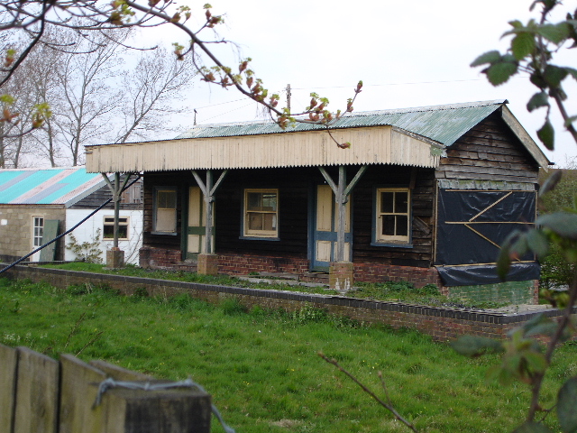
Biddenden railway station

Biddenden was a railway station on the Kent and East Sussex Railway which closed in January 1954. As of 2014 the station building has been converted to...
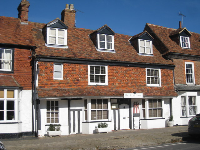
The West House

The West House is a family restaurant located in Biddenden, Kent, England. As of 2008, the restaurant holds one star in the Michelin Guide. == See also... ==
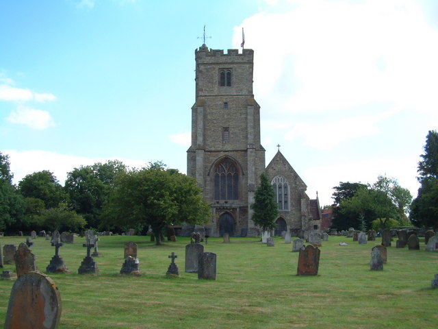
Biddenden

Biddenden is a large, mostly agricultural and wooded village and civil parish in the borough of Ashford in Kent, England. The village lies on the Weald...

Chart Hills Golf Club

Chart Hills Golf Club is a championship golf club in England, located in Biddenden, Kent. == History == The golf course at Chart Hills was designed by...

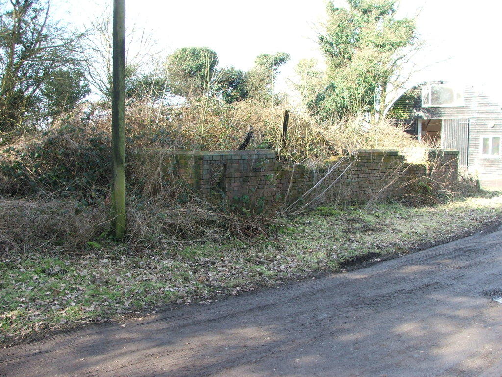
Frittenden Road railway station

Frittenden Road was a railway station on the Kent and East Sussex Railway which closed in January 1954. The wooden station building lay derelict for years...

High Halden Road railway station

High Halden Road is a disused railway station on the defunct Kent and East Sussex Railway which closed in 1954. The station building and platform still...
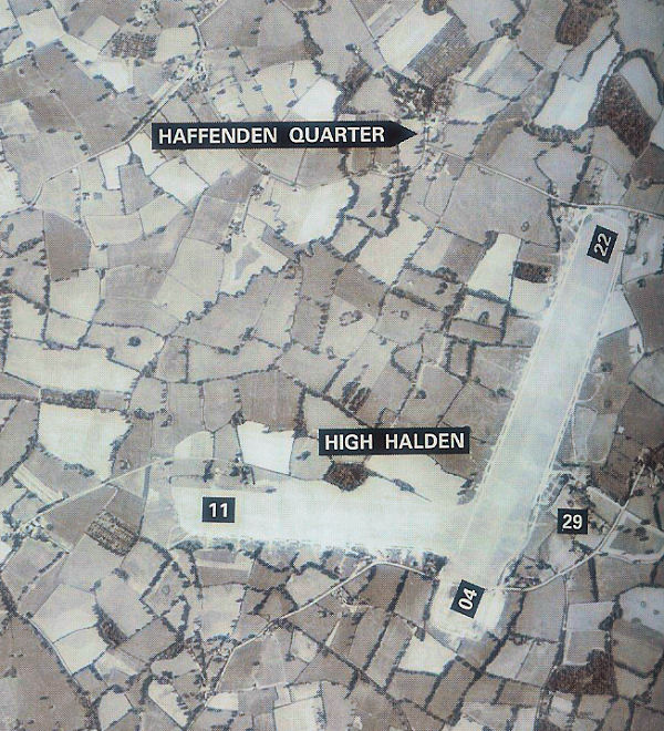
RAF High Halden

Royal Air Force High Halden or more simply RAF High Halden is a former Royal Air Force Advanced Landing Ground in Kent, England. The airfield is located...

Lashenden Air Warfare Museum

Lashenden Air Warfare Museum is an aviation museum at Lashenden (Headcorn) Airfield in Kent in southeast England. == Exhibits == A Fieseler Fi 103R Reichenberg...

Nearby Amenities

Located within 500m of 51.122495,0.65937068
The data included in this document is from www.openstreetmap.org. The data is made available under ODbL.

Have you been to Halden Wood?

Leave your review of Halden Wood below (or comments, questions and feedback).