Ashill Coppice

Wood, Forest in Norfolk Breckland

England

Ashill Coppice

St Mary's, Houghton-on-the-hill A most interesting historic church in Norfolk.
St Mary's, Houghton-on-the-hill Credit: David Bremner

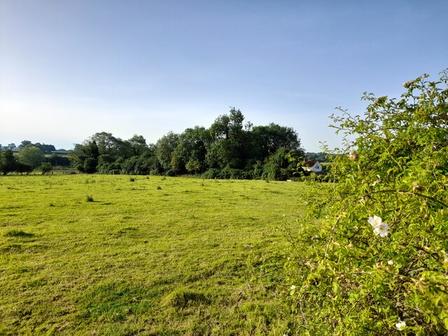
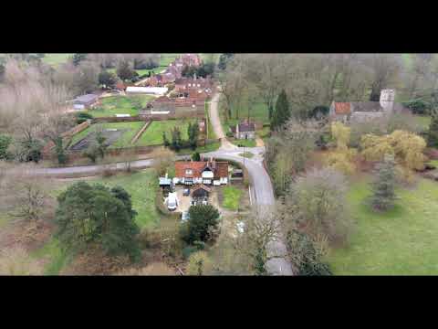
Ashill Coppice is a picturesque woodland located in Norfolk, England. Covering an area of approximately 20 acres, it is known for its diverse range of flora and fauna, making it a popular spot for nature enthusiasts and walkers alike. The woodland is situated near the village of Ashill, providing easy access for visitors.

The coppice is primarily made up of native broadleaf trees, including oak, ash, and beech, which create a dense canopy that provides shade and shelter for a variety of wildlife. The forest floor is covered in a thick layer of leaf litter, creating a rich habitat for insects, small mammals, and fungi.

Walking through Ashill Coppice, visitors can enjoy the peaceful ambiance and observe the abundance of wildlife that call the woodland home. Birdwatchers will delight in spotting species such as woodpeckers, nuthatches, and jays, while those with a keen eye may even catch a glimpse of a deer or fox in the distance.

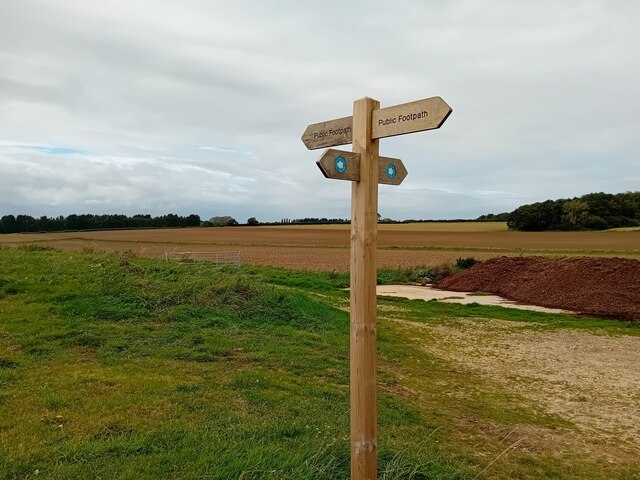
The woodland offers a network of well-maintained footpaths, allowing visitors to explore its beauty at their own pace. There are also several benches strategically placed throughout the coppice, providing an opportunity for visitors to sit and appreciate the tranquility of the surroundings.

Ashill Coppice is open to the public year-round, with no admission fee. It is a cherished natural gem in the Norfolk countryside, offering a serene escape from the hustle and bustle of everyday life.

If you have any feedback on the listing, please let us know in the comments section below.

Ashill Coppice Images

Images are sourced within 2km of 52.599692/0.7455874 or Grid Reference TF8603. Thanks to Geograph Open Source API. All images are credited.

St Mary's, Houghton-on-the-hill A most interesting historic church in Norfolk.
St Mary's, Houghton-on-the-hill
A most interesting historic church in Norfolk.
A Field in Norfolk Near Lower Farm.
A Field in Norfolk
Near Lower Farm.
A Glimpse of Norfolk Taken from a spot very near to the Peddars Way.
A Glimpse of Norfolk
Taken from a spot very near to the Peddars Way.
A Glimpse of Norfolk Agricultural land is glimpsed through a roadside hedge.
A Glimpse of Norfolk
Agricultural land is glimpsed through a roadside hedge.
Benchmark, St Mary's Church The church sports this nice large cut benchmark. It is shown on the 1905 1/2500 OS map as being 222.9 feet above sea level.
Benchmark, St Mary's Church
The church sports this nice large cut benchmark. It is shown on the 1905 1/2500 OS map as being 222.9 feet above sea level.
View to the West from near St Mary's Church The wind turbine farm at west of North Pickenham dominates this view.
View to the West from near St Mary's Church
The wind turbine farm at west of North Pickenham dominates this view.
Footpath Sign Typical scenery of the area.
Footpath Sign
Typical scenery of the area.
Church of All Saints, South Pickenham <span class="nowrap"><a title="https://historicengland.org.uk/listing/the-list/list-entry/1077235?section=official-list-entry" rel="nofollow ugc noopener" href="https://historicengland.org.uk/listing/the-list/list-entry/1077235?section=official-list-entry">Link</a><img style="margin-left:2px;" alt="External link" title="External link - shift click to open in new window" src="https://s1.geograph.org.uk/img/external.png" width="10" height="10"/></span>
Church of All Saints, South Pickenham
Church of St Mary, North Pickenham <span class="nowrap"><a title="https://historicengland.org.uk/listing/the-list/list-entry/1152224?section=official-list-entry" rel="nofollow ugc noopener" href="https://historicengland.org.uk/listing/the-list/list-entry/1152224?section=official-list-entry">Link</a><img style="margin-left:2px;" alt="External link" title="External link - shift click to open in new window" src="https://s1.geograph.org.uk/img/external.png" width="10" height="10"/></span>
Church of St Mary, North Pickenham
All Saints church, South Pickenham The round base of the tower is Norman, the octagonal upper stage is probably 15th c. The church itself was built in the Early English period but later alterations have been made particularly the good 14th c. east window which has an unusual ogee arch, and below is a small trefoil-headed image niche. In the nave the roof structure is also somewhat unusual, it replaces the old roof after a violent storm destroyed it in the early 17th c. The upper part of the nave wall was replaced at the same time. The font is 14th c. has a traceried octagonal bowl with a coved corona. On the north wall one can just make out a painting of St Christopher. The 17th c. pulpit was presented to the church in 1973 and came from a private chapel in the west country. In the chancel is an angle piscina and dropped-sill sedilia.
All Saints church, South Pickenham
The round base of the tower is Norman, the octagonal upper stage is probably 15th c. The church itself was built in the Early English period but later alterations have been made particularly the good 14th c. east window which has an unusual ogee arch, and below is a small trefoil-headed image niche. In the nave the roof structure is also somewhat unusual, it replaces the old roof after a violent storm destroyed it in the early 17th c. The upper part of the nave wall was replaced at the same time. The font is 14th c. has a traceried octagonal bowl with a coved corona. On the north wall one can just make out a painting of St Christopher. The 17th c. pulpit was presented to the church in 1973 and came from a private chapel in the west country. In the chancel is an angle piscina and dropped-sill sedilia.
Fields of plastic Air pollution from the continent is obscuring the landscape.
Fields of plastic
Air pollution from the continent is obscuring the landscape.
Road to South Pickenham
South Pickenham information sign
Road to Swaffham from South Pickenham
Field boundary at South Pickenham
Part of the Peddars Way through country lanes
Pasture by Houghton Carr One of the dispersed campsites associated with RAF North Pickenham when it was an active airfield during WW2 was located in this pasture. A fraction of the old concreted road leading into it can be seen in the foreground.
Pasture by Houghton Carr
One of the dispersed campsites associated with RAF North Pickenham when it was an active airfield during WW2 was located in this pasture. A fraction of the old concreted road leading into it can be seen in the foreground.
Show me another place!

Ashill Coppice is located at Grid Ref: TF8603 (Lat: 52.599692, Lng: 0.7455874)

Administrative County: Norfolk

District: Breckland

Police Authority: Norfolk

What 3 Words

///became.encoded.coconuts. Near Ashill, Norfolk

Related Wikis

Related Videos

The Killing Fields #shorts

Filmed in South Pickenham in Norfolk.

Look Around Olde Windmill Inn CL

Trip to the Windmill Inn Motorhome And Caravan CL Site Great Cressingham Norfolk.

HOUSE TOUR UK Country Cottage! To Let £850 PCM Ashill, Norfolk with Longsons Estate Agents.

NOW LET! PROPERTY TOUR UK Country Cottage in a Rural Location! To Let: £850 Per Calendar Month. Ashill, Norfolk.

Nearby Amenities

Located within 500m of 52.599692,0.7455874
The data included in this document is from www.openstreetmap.org. The data is made available under ODbL.

Have you been to Ashill Coppice?

Leave your review of Ashill Coppice below (or comments, questions and feedback).