Ash Plantation
Wood, Forest in Kent Ashford
England
Ash Plantation

Ash Plantation is a charming woodland area located in the county of Kent, England. Situated near the town of Ashford, this plantation is known for its dense growth of ash trees, which give it its distinctive name. Covering an approximate area of 50 acres, the plantation is a haven for nature enthusiasts and provides a tranquil escape from the hustle and bustle of city life.
The ash trees in the plantation create a picturesque landscape, with their tall trunks and vibrant green foliage that changes with the seasons. The woodland is home to a diverse range of wildlife, including various bird species, mammals, and insects. Visitors often enjoy birdwatching and can spot species such as woodpeckers, owls, and thrushes.
In addition to its natural beauty, Ash Plantation offers a network of walking trails that wind through the woodland, providing an opportunity for visitors to explore the area at their own pace. The trails are well-maintained and suitable for all levels of fitness, making it an ideal destination for families and individuals alike.
The plantation is easily accessible, with ample parking available for visitors. It also features picnic areas where visitors can relax and enjoy a meal amidst the peaceful surroundings. The management of Ash Plantation takes great care in preserving the natural habitat and maintaining the woodland, ensuring that it remains a thriving ecosystem for both flora and fauna.
Overall, Ash Plantation is a hidden gem in Kent, offering a delightful woodland experience for nature lovers, hikers, and those seeking a peaceful retreat in the heart of nature.
If you have any feedback on the listing, please let us know in the comments section below.
Ash Plantation Images
Images are sourced within 2km of 51.052714/0.65164519 or Grid Reference TQ8531. Thanks to Geograph Open Source API. All images are credited.


Ash Plantation is located at Grid Ref: TQ8531 (Lat: 51.052714, Lng: 0.65164519)
Administrative County: Kent
District: Ashford
Police Authority: Kent
What 3 Words
///floating.rival.prefect. Near Tenterden, Kent
Nearby Locations
Related Wikis

Rolvenden railway station
Rolvenden railway station is a heritage railway station on the Kent and East Sussex Railway in Tenterden, Kent, in the United Kingdom. == Early history... ==

Great Maytham Hall
Great Maytham Hall, near Rolvenden, Kent, England, is a Grade II* listed country house. The gardens are famous for providing the inspiration for The Secret...
Rolvenden
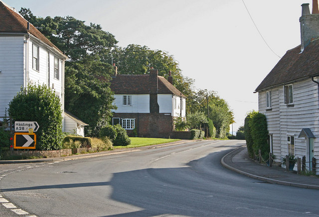
Rolvenden is a village and civil parish in the Ashford District of Kent, England. The village is centred on the A28 Ashford to Hastings road, 5 miles...

Rolvenden Layne
Rolvenden Layne is a hamlet within the civil parish of Rolvenden in the Ashford District of Kent, England. It is located approximately one mile (1.6 km...

Rolvenden War Memorial
Rolvenden War Memorial is a First World War memorial in the village of Rolvenden, Kent, in south-eastern England. Designed by Sir Edwin Lutyens, the memorial...
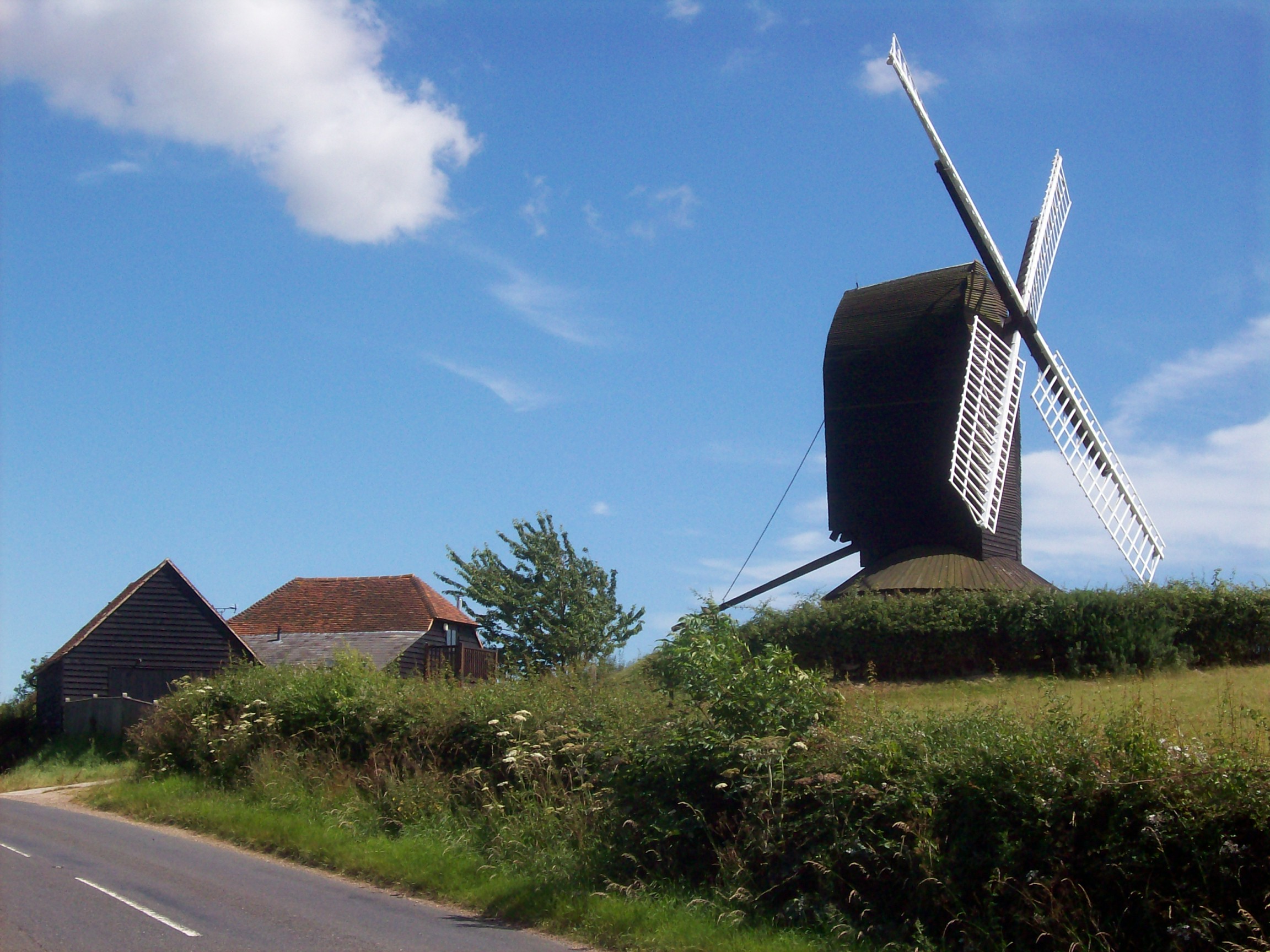
Rolvenden Windmill
Rolvenden Windmill is a grade II* listed Post mill on the B2086 road west of Rolvenden in southeast England. It is maintained as a memorial to a local...

Halden, Rolvenden
Halden is an historic manor in the parish of Rolvenden in Kent, England. The manor house was later known as Halden Place and is a Grade II listed building...
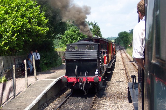
Wittersham Road railway station
Wittersham Road is a railway station on the Kent and East Sussex Railway. It is located to the north-east of the level crossing on Maytham Road which links...
Nearby Amenities
Located within 500m of 51.052714,0.65164519Have you been to Ash Plantation?
Leave your review of Ash Plantation below (or comments, questions and feedback).