Bottom Plantation

Wood, Forest in Suffolk West Suffolk

England

Bottom Plantation

Farm on Station Road, Barnham
Farm on Station Road, Barnham Credit: David Howard

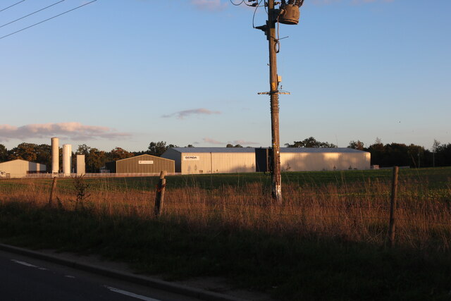
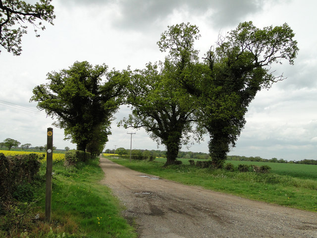
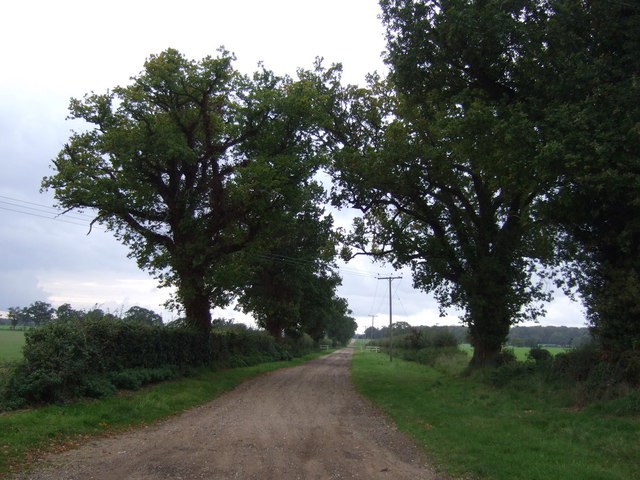
Bottom Plantation is a captivating woodland located in Suffolk, England. Spanning over a vast area, this forest is a cherished natural treasure renowned for its serene beauty and rich biodiversity. Nestled in the heart of the county, Bottom Plantation offers a peaceful retreat from the hustle and bustle of modern life.

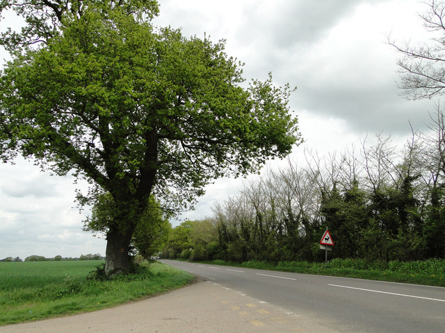
The plantation is characterized by its dense canopy of towering trees, predominantly consisting of oak, beech, and ash. This lush greenery provides a haven for a diverse array of flora and fauna, making it a paradise for nature enthusiasts and wildlife lovers alike. Rare species such as red squirrels, deer, and various bird species can be spotted within the woodland.

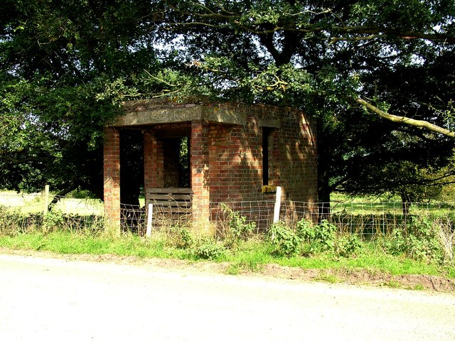
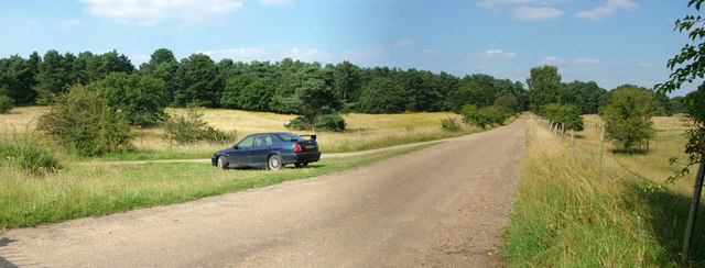
The forest features a network of well-maintained trails, ideal for leisurely walks and hikes. Exploring these pathways offers visitors the opportunity to immerse themselves in the tranquility of the surroundings, while also providing a chance to observe the forest's abundant wildlife. The plantation also houses a small lake, adding to its allure and serving as a habitat for numerous aquatic creatures.

Bottom Plantation has a rich historical significance, with records dating back several centuries. The woodland was once used for timber production and as a hunting ground for aristocrats. Today, it stands as a testament to the enduring beauty of nature and the importance of conservation efforts.

Whether one seeks solitude, a connection with nature, or a chance to explore the region's history, Bottom Plantation is a destination that offers something for everyone. Its picturesque landscapes and diverse ecosystem make it a true gem in the Suffolk countryside.

If you have any feedback on the listing, please let us know in the comments section below.

Bottom Plantation Images

Images are sourced within 2km of 52.36255/0.7213802 or Grid Reference TL8577. Thanks to Geograph Open Source API. All images are credited.

Farm on Station Road, Barnham
Military building, Barnham The small Suffolk village of Barnham has been the home to several military establishments. This was evidently some form of guardhouse or checkpoint (officially a picket apparently) on Station Road, leading to the Little Heath Forward Filling Station. It is opposite Triangle Covert. 

For more details (a little out of date) 
<span class="nowrap"><a title="http://www.subbrit.org.uk/sb-sites/sites/l/little_heath_forward_filling_depot/index.shtml" rel="nofollow ugc noopener" href="http://www.subbrit.org.uk/sb-sites/sites/l/little_heath_forward_filling_depot/index.shtml">Link</a><img style="margin-left:2px;" alt="External link" title="External link - shift click to open in new window" src="https://s1.geograph.org.uk/img/external.png" width="10" height="10"/></span>
Military building, Barnham
The small Suffolk village of Barnham has been the home to several military establishments. This was evidently some form of guardhouse or checkpoint (officially a picket apparently) on Station Road, leading to the Little Heath Forward Filling Station. It is opposite Triangle Covert. For more details (a little out of date) LinkExternal link
Road to Little Heath military site, Barnham This is officially Station Road, although the station was far away at the northern end of it. It leads to the Little Heath military site, used for tank testing in WW1, chemical weapon storage in WW2 and after, then (illegal) storage of old tyres, then a tank museum, and now a company making wooden shavings for horse bedding. This photo was taken from the gate to the site, although the fence on the right encloses a larger ex-military area on that side, full of mysterious earthworks. On the left a dirt track turns off to curve round the western side of the site.

My MG ZS180 makes another Geograph appearance. 

The field on the left is designated as Open Access but the vegetation growth doesn't make access easy, suggesting it is not actually used.
Road to Little Heath military site, Barnham
This is officially Station Road, although the station was far away at the northern end of it. It leads to the Little Heath military site, used for tank testing in WW1, chemical weapon storage in WW2 and after, then (illegal) storage of old tyres, then a tank museum, and now a company making wooden shavings for horse bedding. This photo was taken from the gate to the site, although the fence on the right encloses a larger ex-military area on that side, full of mysterious earthworks. On the left a dirt track turns off to curve round the western side of the site. My MG ZS180 makes another Geograph appearance. The field on the left is designated as Open Access but the vegetation growth doesn't make access easy, suggesting it is not actually used.
Equestro Bed occupy former military site The Little Heath military site has had an interesting history - tank testing in WW1, chemical storage in WW2 and later, illegal tyre storage, a tank museum, and now Equestro, who appear to make horse bedding from wood.

For more of the history, slightly out of date, see <span class="nowrap"><a title="http://www.subbrit.org.uk/sb-sites/sites/l/little_heath_forward_filling_depot/index.shtml" rel="nofollow ugc noopener" href="http://www.subbrit.org.uk/sb-sites/sites/l/little_heath_forward_filling_depot/index.shtml">Link</a><img style="margin-left:2px;" alt="External link" title="External link - shift click to open in new window" src="https://s1.geograph.org.uk/img/external.png" width="10" height="10"/></span>
Equestro Bed occupy former military site
The Little Heath military site has had an interesting history - tank testing in WW1, chemical storage in WW2 and later, illegal tyre storage, a tank museum, and now Equestro, who appear to make horse bedding from wood. For more of the history, slightly out of date, see LinkExternal link
Track to New Zealand Cottages, almost a mile away
Deer warning sign on the A134
Northbound A134 near to Barnham The A134 road runs for 71 miles between Colchester, in Essex, and Tottenhill, a few miles to the south of King's Lynn, in Norfolk. Other towns on the A134 road include Sudbury, Bury St. Edmunds and Thetford. 

The A134 used to be the main route for commercial traffic from the North to the port of Felixstowe; however since the construction of the A14 very little commercial traffic uses it.

More detailed information at <span class="nowrap"><a title="http://www.sabre-roads.org.uk/wiki/index.php?title=A134" rel="nofollow ugc noopener" href="http://www.sabre-roads.org.uk/wiki/index.php?title=A134">Link</a><img style="margin-left:2px;" alt="External link" title="External link - shift click to open in new window" src="https://s1.geograph.org.uk/img/external.png" width="10" height="10"/></span>  SABRE Wiki
Northbound A134 near to Barnham
The A134 road runs for 71 miles between Colchester, in Essex, and Tottenhill, a few miles to the south of King's Lynn, in Norfolk. Other towns on the A134 road include Sudbury, Bury St. Edmunds and Thetford. The A134 used to be the main route for commercial traffic from the North to the port of Felixstowe; however since the construction of the A14 very little commercial traffic uses it. More detailed information at LinkExternal link SABRE Wiki
A134 Northbound near to Barnham The A134 road runs for 71 miles between Colchester, in Essex, and Tottenhill, a few miles to the south of King's Lynn, in Norfolk. Other towns on the A134 road include Sudbury, Bury St. Edmunds and Thetford. 

The A134 used to be the main route for commercial traffic from the North to the port of Felixstowe; however since the construction of the A14 very little commercial traffic uses it.

More detailed information at <span class="nowrap"><a title="http://www.sabre-roads.org.uk/wiki/index.php?title=A134" rel="nofollow ugc noopener" href="http://www.sabre-roads.org.uk/wiki/index.php?title=A134">Link</a><img style="margin-left:2px;" alt="External link" title="External link - shift click to open in new window" src="https://s1.geograph.org.uk/img/external.png" width="10" height="10"/></span>  SABRE Wiki
A134 Northbound near to Barnham
The A134 road runs for 71 miles between Colchester, in Essex, and Tottenhill, a few miles to the south of King's Lynn, in Norfolk. Other towns on the A134 road include Sudbury, Bury St. Edmunds and Thetford. The A134 used to be the main route for commercial traffic from the North to the port of Felixstowe; however since the construction of the A14 very little commercial traffic uses it. More detailed information at LinkExternal link SABRE Wiki
A134 South of Barnham The A134 road runs for 71 miles between Colchester, in Essex, and Tottenhill, a few miles to the south of King's Lynn, in Norfolk. Other towns on the A134 road include Sudbury, Bury St. Edmunds and Thetford. 

The A134 used to be the main route for commercial traffic from the North to the port of Felixstowe; however since the construction of the A14 very little commercial traffic uses it.

More detailed information at <span class="nowrap"><a title="http://www.sabre-roads.org.uk/wiki/index.php?title=A134" rel="nofollow ugc noopener" href="http://www.sabre-roads.org.uk/wiki/index.php?title=A134">Link</a><img style="margin-left:2px;" alt="External link" title="External link - shift click to open in new window" src="https://s1.geograph.org.uk/img/external.png" width="10" height="10"/></span>  SABRE Wiki
A134 South of Barnham
The A134 road runs for 71 miles between Colchester, in Essex, and Tottenhill, a few miles to the south of King's Lynn, in Norfolk. Other towns on the A134 road include Sudbury, Bury St. Edmunds and Thetford. The A134 used to be the main route for commercial traffic from the North to the port of Felixstowe; however since the construction of the A14 very little commercial traffic uses it. More detailed information at LinkExternal link SABRE Wiki
HGV on the A134 near to Barnham Hewicks Haulage Scania R500 (AY12 AEX) heading south on the A134 near Barnham.
HGV on the A134 near to Barnham
Hewicks Haulage Scania R500 (AY12 AEX) heading south on the A134 near Barnham.
Layby on Southbound A134 The A134 road runs for 71 miles between Colchester, in Essex, and Tottenhill, a few miles to the south of King's Lynn, in Norfolk. Other towns on the A134 road include Sudbury, Bury St. Edmunds and Thetford. 

The A134 used to be the main route for commercial traffic from the North to the port of Felixstowe; however since the construction of the A14 very little commercial traffic uses it.

More detailed information at <span class="nowrap"><a title="http://www.sabre-roads.org.uk/wiki/index.php?title=A134" rel="nofollow ugc noopener" href="http://www.sabre-roads.org.uk/wiki/index.php?title=A134">Link</a><img style="margin-left:2px;" alt="External link" title="External link - shift click to open in new window" src="https://s1.geograph.org.uk/img/external.png" width="10" height="10"/></span>  SABRE Wiki
Layby on Southbound A134
The A134 road runs for 71 miles between Colchester, in Essex, and Tottenhill, a few miles to the south of King's Lynn, in Norfolk. Other towns on the A134 road include Sudbury, Bury St. Edmunds and Thetford. The A134 used to be the main route for commercial traffic from the North to the port of Felixstowe; however since the construction of the A14 very little commercial traffic uses it. More detailed information at LinkExternal link SABRE Wiki
Northbound A134 The A134 road runs for 71 miles between Colchester, in Essex, and Tottenhill, a few miles to the south of King's Lynn, in Norfolk. Other towns on the A134 road include Sudbury, Bury St. Edmunds and Thetford. 

The A134 used to be the main route for commercial traffic from the North to the port of Felixstowe; however since the construction of the A14 very little commercial traffic uses it.

More detailed information at <span class="nowrap"><a title="http://www.sabre-roads.org.uk/wiki/index.php?title=A134" rel="nofollow ugc noopener" href="http://www.sabre-roads.org.uk/wiki/index.php?title=A134">Link</a><img style="margin-left:2px;" alt="External link" title="External link - shift click to open in new window" src="https://s1.geograph.org.uk/img/external.png" width="10" height="10"/></span>  SABRE Wiki
Northbound A134
The A134 road runs for 71 miles between Colchester, in Essex, and Tottenhill, a few miles to the south of King's Lynn, in Norfolk. Other towns on the A134 road include Sudbury, Bury St. Edmunds and Thetford. The A134 used to be the main route for commercial traffic from the North to the port of Felixstowe; however since the construction of the A14 very little commercial traffic uses it. More detailed information at LinkExternal link SABRE Wiki
A134 Northbound The A134 road runs for 71 miles between Colchester, in Essex, and Tottenhill, a few miles to the south of King's Lynn, in Norfolk. Other towns on the A134 road include Sudbury, Bury St. Edmunds and Thetford. 

The A134 used to be the main route for commercial traffic from the North to the port of Felixstowe; however since the construction of the A14 very little commercial traffic uses it.

More detailed information at <span class="nowrap"><a title="http://www.sabre-roads.org.uk/wiki/index.php?title=A134" rel="nofollow ugc noopener" href="http://www.sabre-roads.org.uk/wiki/index.php?title=A134">Link</a><img style="margin-left:2px;" alt="External link" title="External link - shift click to open in new window" src="https://s1.geograph.org.uk/img/external.png" width="10" height="10"/></span>  SABRE Wiki
A134 Northbound
The A134 road runs for 71 miles between Colchester, in Essex, and Tottenhill, a few miles to the south of King's Lynn, in Norfolk. Other towns on the A134 road include Sudbury, Bury St. Edmunds and Thetford. The A134 used to be the main route for commercial traffic from the North to the port of Felixstowe; however since the construction of the A14 very little commercial traffic uses it. More detailed information at LinkExternal link SABRE Wiki
Mercedes Actros Travelling South on the A134 HSF Logistics Mercedes Actros (AY14 GUX) travelling southwards on the A134 towards Bury St Edmunds.
Mercedes Actros Travelling South on the A134
HSF Logistics Mercedes Actros (AY14 GUX) travelling southwards on the A134 towards Bury St Edmunds.
Northbound A134 The A134 road runs for 71 miles between Colchester, in Essex, and Tottenhill, a few miles to the south of King's Lynn, in Norfolk. Other towns on the A134 road include Sudbury, Bury St. Edmunds and Thetford. 

The A134 used to be the main route for commercial traffic from the North to the port of Felixstowe; however since the construction of the A14 very little commercial traffic uses it.

More detailed information at <span class="nowrap"><a title="http://www.sabre-roads.org.uk/wiki/index.php?title=A134" rel="nofollow ugc noopener" href="http://www.sabre-roads.org.uk/wiki/index.php?title=A134">Link</a><img style="margin-left:2px;" alt="External link" title="External link - shift click to open in new window" src="https://s1.geograph.org.uk/img/external.png" width="10" height="10"/></span>  SABRE Wiki
Northbound A134
The A134 road runs for 71 miles between Colchester, in Essex, and Tottenhill, a few miles to the south of King's Lynn, in Norfolk. Other towns on the A134 road include Sudbury, Bury St. Edmunds and Thetford. The A134 used to be the main route for commercial traffic from the North to the port of Felixstowe; however since the construction of the A14 very little commercial traffic uses it. More detailed information at LinkExternal link SABRE Wiki
Flat farmland off the A134 The A134 road runs for 71 miles between Colchester, in Essex, and Tottenhill, a few miles to the south of King's Lynn, in Norfolk. Other towns on the A134 road include Sudbury, Bury St. Edmunds and Thetford. 

The A134 used to be the main route for commercial traffic from the North to the port of Felixstowe; however since the construction of the A14 very little commercial traffic uses it.

More detailed information at <span class="nowrap"><a title="http://www.sabre-roads.org.uk/wiki/index.php?title=A134" rel="nofollow ugc noopener" href="http://www.sabre-roads.org.uk/wiki/index.php?title=A134">Link</a><img style="margin-left:2px;" alt="External link" title="External link - shift click to open in new window" src="https://s1.geograph.org.uk/img/external.png" width="10" height="10"/></span>  SABRE Wiki
Flat farmland off the A134
The A134 road runs for 71 miles between Colchester, in Essex, and Tottenhill, a few miles to the south of King's Lynn, in Norfolk. Other towns on the A134 road include Sudbury, Bury St. Edmunds and Thetford. The A134 used to be the main route for commercial traffic from the North to the port of Felixstowe; however since the construction of the A14 very little commercial traffic uses it. More detailed information at LinkExternal link SABRE Wiki
Farmland near West Farm Off the A134.
Farmland near West Farm
Off the A134.
Track to West Farm Off the A134.
Track to West Farm
Off the A134.
Show me another place!

Bottom Plantation is located at Grid Ref: TL8577 (Lat: 52.36255, Lng: 0.7213802)

Administrative County: Suffolk

District: West Suffolk

Police Authority: Suffolk

What 3 Words

///zones.workloads.marker. Near Thetford, Norfolk

Related Wikis

Little Heath, Barnham

Little Heath, Barnham lies south-west of Barnham, Suffolk. Much of the area is now a Site of Special Scientific Interest, which almost surrounds the former...

Barnham railway station (Suffolk)

Barnham railway station is a former station in Barnham, Suffolk on a now closed line between Thetford and Bury St Edmunds. It was located close to the...

Barnham Windmill, Suffolk

Barnham Mill is a tower mill at Barnham, Suffolk, England which has been converted to residential accommodation. == History == Barnham Mill was built for...

Brandon Rural District

Brandon was a rural district in Suffolk, England from 1894 to 1935. The district was created in 1894 as the Suffolk part of the Thetford rural sanitary...

Nearby Amenities

Located within 500m of 52.36255,0.7213802
Fixme: incomplete
Lat/Long: 52.3664941/0.7212129
Power: pole
Lat/Long: 52.3602175/0.7168518
Power: pole
Lat/Long: 52.3612256/0.7177315
Power: pole
Lat/Long: 52.3622499/0.7186235
Power: pole
Lat/Long: 52.363258/0.7194971
Power: pole
Lat/Long: 52.3642648/0.7203707
Power: pole
Lat/Long: 52.3652783/0.7212415
Power: pole
Lat/Long: 52.3661879/0.7228508
Power: pole
Lat/Long: 52.3662279/0.7220592
The data included in this document is from www.openstreetmap.org. The data is made available under ODbL.

Have you been to Bottom Plantation?

Leave your review of Bottom Plantation below (or comments, questions and feedback).