Flint

Settlement in Flintshire

Wales

Flint

Flint Castle, NE Round Tower With view along River Dee to A548 bridge
Flint Castle, NE Round Tower Credit: Kevin Waterhouse

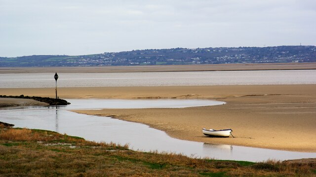
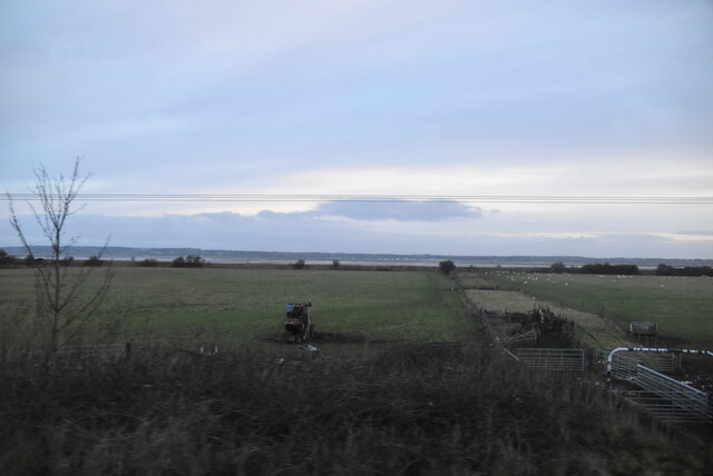
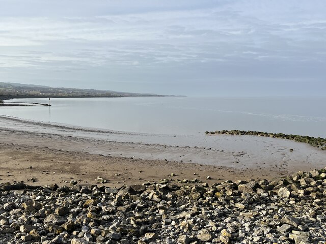
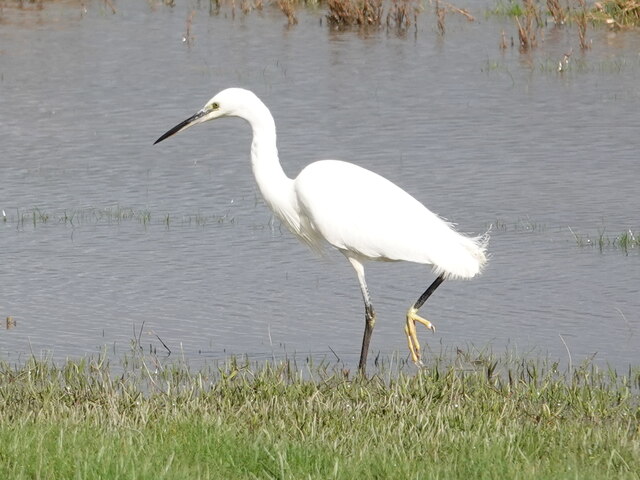
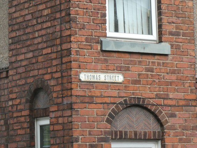
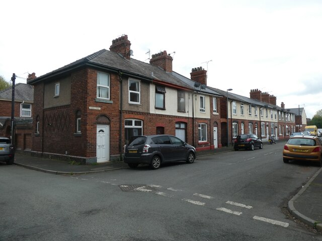
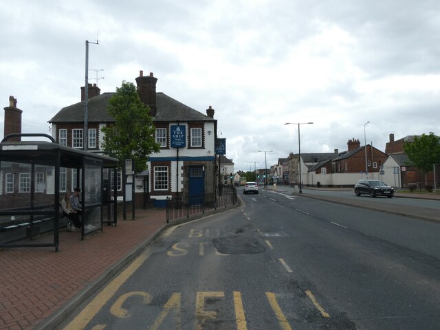
Flint is a coastal town located in Flintshire, Wales, with a population of around 14,000 residents. Situated on the estuary of the River Dee, it is approximately 6 miles north-west of the city of Chester in England. The town has a rich historical background, dating back to the Bronze Age, and is known for its notable landmarks and industrial heritage.

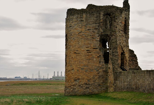
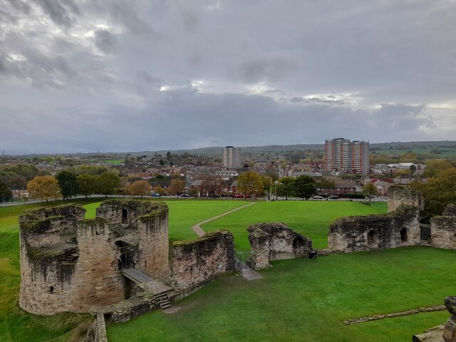
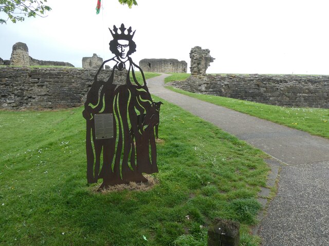
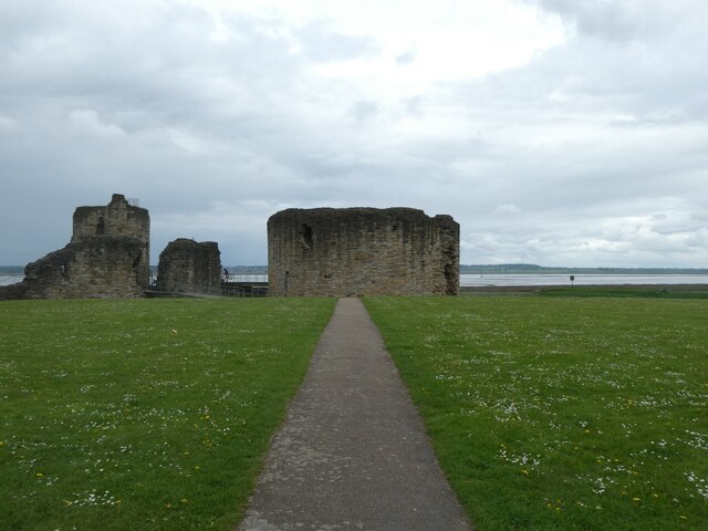
Flint boasts an impressive medieval castle, which was constructed in the 13th century and played a significant role in Welsh history. The castle ruins stand tall, overlooking the town and offering panoramic views of the surrounding countryside. The area also features a picturesque dock, once a thriving port during the industrial revolution, adding to the town's charm.

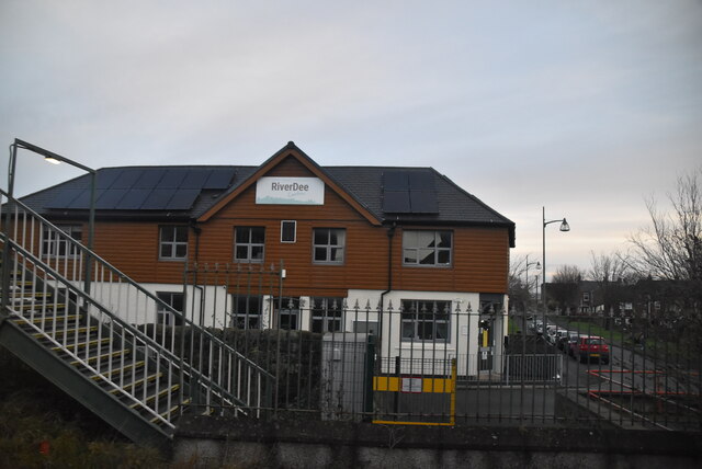
In terms of amenities, Flint offers a range of facilities and services to its residents and visitors. There is a selection of shops, supermarkets, and local businesses catering to everyday needs. The town also has various schools, healthcare facilities, and recreational spaces, including parks and sports clubs.

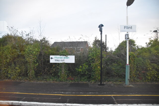
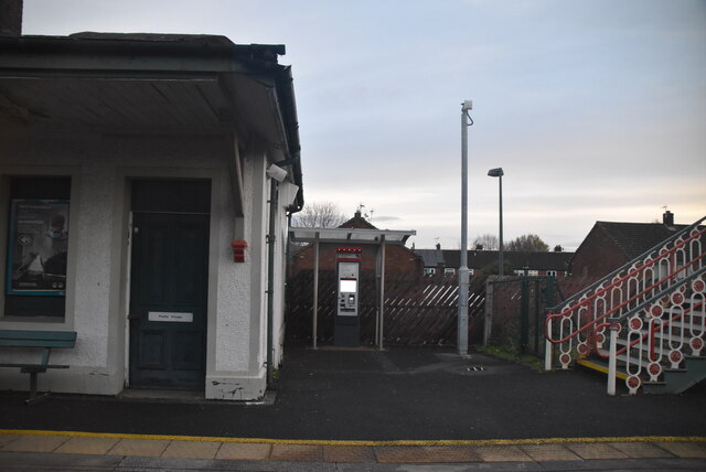
Flint is well-connected with good transportation links, making it accessible to both nearby cities and tourist destinations. The town has its own railway station, providing frequent connections to Chester, Liverpool, and Manchester. Additionally, major roads and motorways, such as the A55, provide convenient access to the rest of North Wales and England.

Overall, Flint is a historic and vibrant town, offering a blend of natural beauty, cultural heritage, and modern amenities. It attracts visitors with its historical sites, waterfront views, and easy access to nearby attractions, making it a popular destination worth exploring.

If you have any feedback on the listing, please let us know in the comments section below.

Flint Images

Images are sourced within 2km of 53.248264/-3.136557 or Grid Reference SJ2472. Thanks to Geograph Open Source API. All images are credited.

Flint Castle, NE Round Tower With view along River Dee to A548 bridge
Flint Castle, NE Round Tower
With view along River Dee to A548 bridge
Creek off River Dee View from north of Flint Castle on Wales Coast Path
Creek off River Dee
View from north of Flint Castle on Wales Coast Path
View from Flint Castle View from the NE tower.
View from Flint Castle
View from the NE tower.
Postbox at Flint CH6 168. Royal Mail list this box as 'Flint Main Post Office'.
Postbox at Flint
CH6 168. Royal Mail list this box as 'Flint Main Post Office'.
Flint Station Flint station serves the town of Flint in Flintshire. It located on the North Wales Coast Line and is managed by Arriva Trains Wales, who provide most of the passenger trains that call here. There are certain Virgin Trains services that serve the station.
Flint Station
Flint station serves the town of Flint in Flintshire. It located on the North Wales Coast Line and is managed by Arriva Trains Wales, who provide most of the passenger trains that call here. There are certain Virgin Trains services that serve the station.
River Dee Centre
River Dee Centre
Panton Cop
Panton Cop
Dee estuary at Flint Point
Little Egret at Flint Castle The Little Egret was taking advantage of the very high tide to explore the marsh in front of Flint Castle.
Little Egret at Flint Castle
The Little Egret was taking advantage of the very high tide to explore the marsh in front of Flint Castle.
Flint, Y Fflint station
Trelawney Towers on Chester Road, Flint The building was named on the 1930s OS map; now it is used by a hair salon and day nursery
Trelawney Towers on Chester Road, Flint
The building was named on the 1930s OS map; now it is used by a hair salon and day nursery
Methodist church, Flint Notable ornate brickwork from the end of the 19th century
Methodist church, Flint
Notable ornate brickwork from the end of the 19th century
Cast metal street sign, Thomas Street, Flint
Houses in Thomas Street, Flint A close up of the street sign is at <a href="https://www.geograph.org.uk/photo/7542045">SJ2473 : Cast metal street sign, Thomas Street, Flint</a>
Houses in Thomas Street, Flint
A close up of the street sign is at SJ2473 : Cast metal street sign, Thomas Street, Flint
Welcome sign for Flint Castle Listed buildings and structures are officially designated as being of special architectural, historical or cultural significance. There are over half a million listed structures in the United Kingdom, covered by around 375,000 listings.
Listed status is more commonly associated with buildings or groups of buildings, however it can cover many other structures, including bridges, headstones, steps, ponds, monuments, walls, phone boxes, wrecks, parks, and heritage sites, and in more recent times a road crossing (Abbey Road) and graffiti art (Banksy 'Spy-booth') have been included.

In England and Wales there are three main listing designations;
Grade I (2.5%) - exceptional interest, sometimes considered to be internationally important.
Grade II* (5.5%) - particularly important buildings of more than special interest. 
Grade II (92%) - nationally important and of special interest. 

There are also locally listed structures (at the discretion of local authorities) using A, B and C designations.

In Scotland three classifications are also used but the criteria are different. There are around 47,500 Listed buildings.
Category A (8%)- generally equivalent to Grade I and II* in England and Wales
Category B (51%)- this appears generally to cover the ground of Grade II, recognising national importance.
Category C (41%)- buildings of local importance, probably with some overlap with English Grade II.

In Northern Ireland the criteria are similar to Scotland, but the classifications are:
Grade A (2.3%)
Grade B+ (4.7%)
Grade B (93%)

Read more at Wikipedia <span class="nowrap"><a title="http://en.wikipedia.org/wiki/Listed_building" rel="nofollow ugc noopener" href="http://en.wikipedia.org/wiki/Listed_building">Link</a><img style="margin-left:2px;" alt="External link" title="External link - shift click to open in new window" src="https://s1.geograph.org.uk/img/external.png" width="10" height="10"/></span>
Welcome sign for Flint Castle
Listed buildings and structures are officially designated as being of special architectural, historical or cultural significance. There are over half a million listed structures in the United Kingdom, covered by around 375,000 listings. Listed status is more commonly associated with buildings or groups of buildings, however it can cover many other structures, including bridges, headstones, steps, ponds, monuments, walls, phone boxes, wrecks, parks, and heritage sites, and in more recent times a road crossing (Abbey Road) and graffiti art (Banksy 'Spy-booth') have been included. In England and Wales there are three main listing designations; Grade I (2.5%) - exceptional interest, sometimes considered to be internationally important. Grade II* (5.5%) - particularly important buildings of more than special interest. Grade II (92%) - nationally important and of special interest. There are also locally listed structures (at the discretion of local authorities) using A, B and C designations. In Scotland three classifications are also used but the criteria are different. There are around 47,500 Listed buildings. Category A (8%)- generally equivalent to Grade I and II* in England and Wales Category B (51%)- this appears generally to cover the ground of Grade II, recognising national importance. Category C (41%)- buildings of local importance, probably with some overlap with English Grade II. In Northern Ireland the criteria are similar to Scotland, but the classifications are: Grade A (2.3%) Grade B+ (4.7%) Grade B (93%) Read more at Wikipedia LinkExternal link
Flint Castle with River Dee in background
Bus shelter and the Ship Inn, Flint
Show me another place!

Flint is located at Grid Ref: SJ2472 (Lat: 53.248264, Lng: -3.136557)

Unitary Authority: Flintshire

Police Authority: North Wales

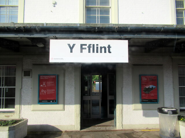
Also known as: Y Fflint

What 3 Words

///slower.daffodils.obstruct. Near Flint, Flintshire

Related Wikis

Flint, Flintshire

Flint (Welsh: Y Fflint) is a town and community in Flintshire, Wales, lying on the estuary of the River Dee. It is the former county town of Flintshire...

Flint Town Hall

Flint Town Hall (Welsh: Neuadd y Dref Y Fflint) is a municipal structure in the Market Square, Flint, Flintshire, Wales. The town hall, which is the meeting...

Flint railway station

Flint railway station (Welsh: Y Fflint) serves the town of Flint in Flintshire, North Wales. It is located on the North Wales Coast Line and is managed...
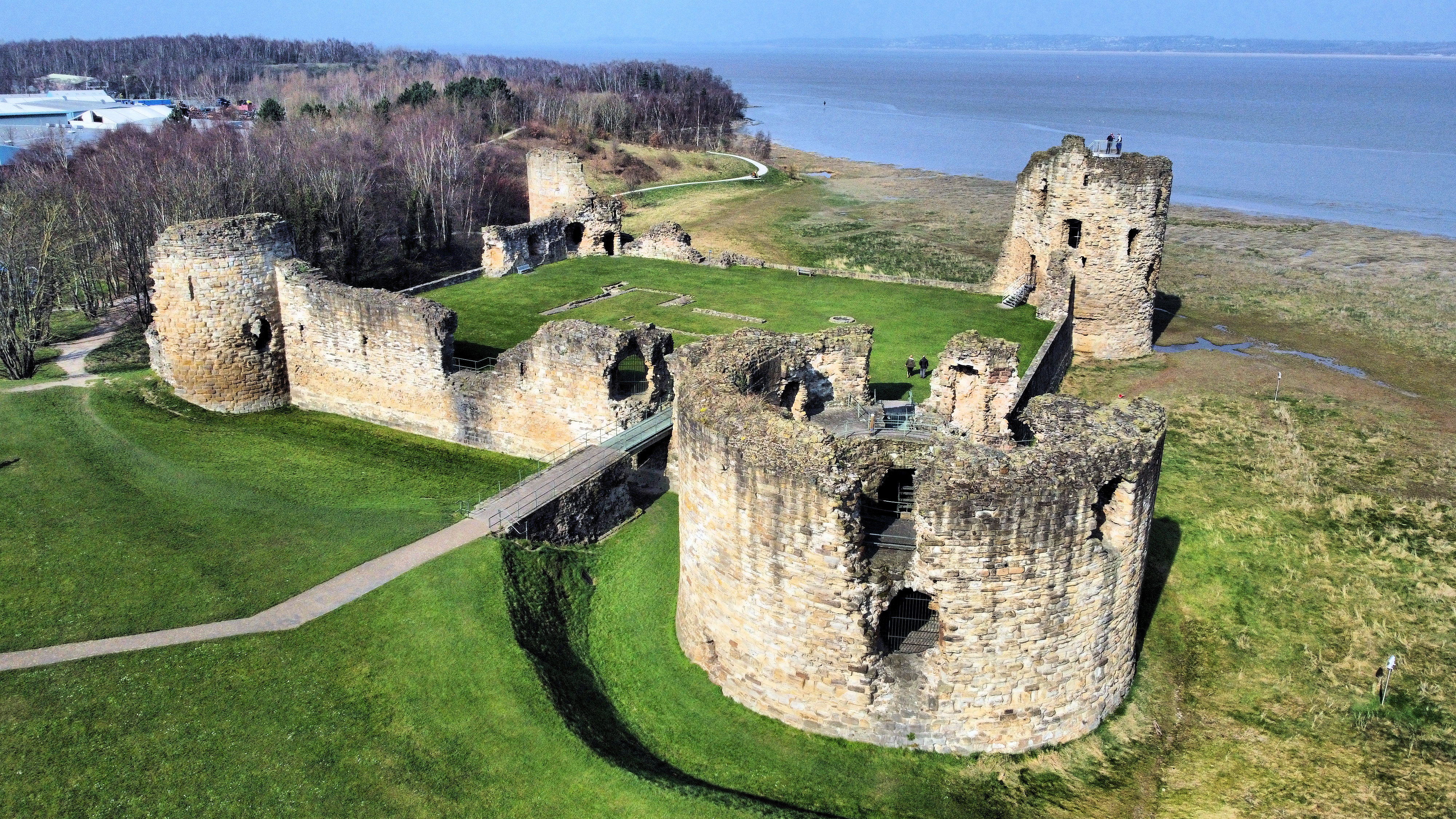
Flint Castle

Flint Castle (Welsh: Castell y Fflint) in Flint, Flintshire, was the first of a series of castles built during King Edward I's campaign to conquer Wales...

Cae-y-Castell

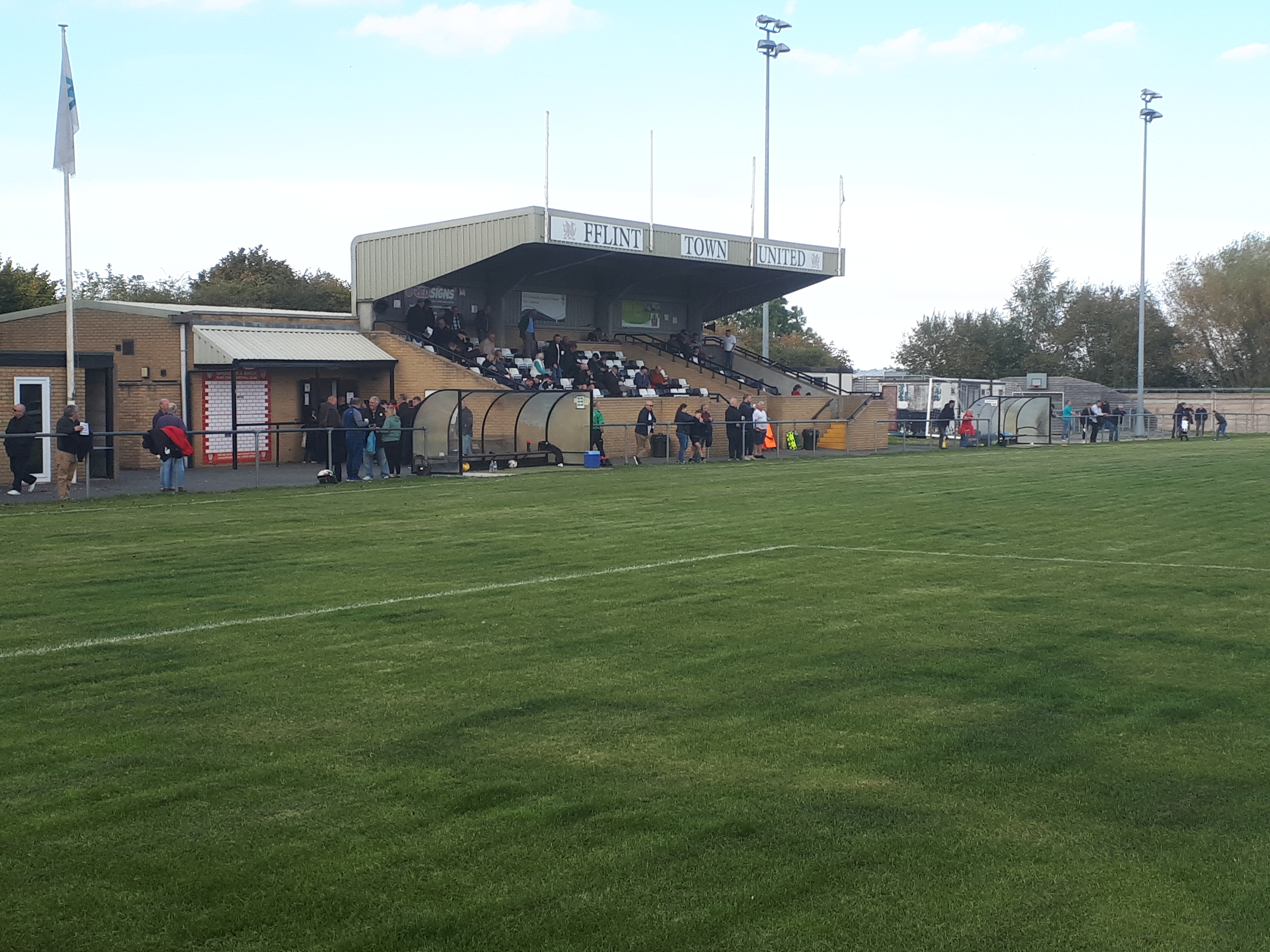
Cae-y-Castell (currently known as the Essity Stadium for sponsorship reasons) is a football stadium in Flint, Flintshire, Wales. Located on the banks of...

Flint Town United F.C.

Flint Town United Football Club (Welsh: Clwb PĂȘl-droed Tref Y Fflint Unedig) is a football club based in Flint, Flintshire, Wales, that will compete in...

St Richard Gwyn Catholic High School, Flint

St Richard Gwyn Catholic High School is a Catholic co-educational voluntary aided secondary school situated on Albert Avenue in Flint, Flintshire, United...

Cornist Hall

Cornist Hall is a large house 1 mile (1.6 km) west-southwest of the town of Flint, Flintshire, Wales. It was the birthplace in 1746 of Thomas Totty, an...

Nearby Amenities

Located within 500m of 53.248264,-3.136557
Flint
Name Cy: Y Fflint
Name En: Flint
Naptan AtcoCode: 9100FLINT
Network: National Rail
Network Website: https://www.nationalrail.co.uk/stations/fln/
Network Wikidata: Q26334
Operator En: Transport for Wales
Operator Website: https://tfw.wales/places/stations/flint
Operator Wikidata: Q104878180
Railway: station
Ref Crs: FLN
Source: NPE
Wikidata: Q2110992
Wikipedia: en:Flint railway station
Lat/Long: 53.249742/-3.1322555
Flint
Name Cy: Y Fflint
Place: town
Population: 14907
Wikidata: Q1428848
Wikipedia: en:Flint, Flintshire
Lat/Long: 53.2492828/-3.1345262
Turning Circle
Lat/Long: 53.2461168/-3.1313218
Swan Hotel
Addr Housenumber: 34
Addr Postcode: CH6 5DH
Addr Street: Chester Street
Fhrs Id: 492366
Source Addr: FHRS Open Data
Tourism: hotel
Wikidata: Q80855224
Lat/Long: 53.2486253/-3.1323548
Tesco Express
Addr City: Flint
Addr Housenumber: 22-28
Addr Postcode: CH6 5NR
Addr Street: Chester Street
Brand: Tesco Express
Brand Wikidata: Q98456772
Contact Website: https://www.tesco.com/store-locator/flint/22-28-chester-st
Fhrs Id: 654663
Shop: convenience
Source Addr: FHRS Open Data
Lat/Long: 53.2487629/-3.1327012
Pub
Royal Oak
Addr City: Flint
Addr Housenumber: 6
Addr Postcode: CH6 5AE
Addr Street: Heol-yr-Eglwys / Church Street
Fhrs Id: 905988
Source Addr: FHRS Open Data
Wikidata: Q80855226
Lat/Long: 53.2497125/-3.1339676
Mini Roundabout
Source: Bing
Lat/Long: 53.2492522/-3.1375138
Post Office
Flint Post Office
Addr Country: GB
Addr Postcode: CH6 5AD
Brand: Post Office
Brand Wikidata: Q1783168
Contact Website: https://www.postoffice.co.uk/branch-finder/3326144/flint
Ref Pol Id: 13096
Lat/Long: 53.248503/-3.1358373
S. Jones & Son
Shop: newsagent
Lat/Long: 53.2505287/-3.1345552
Pub
The Ship
Addr City: Flint
Addr Postcode: CH6 5NW
Addr Street: Market Square
Fhrs Id: 980386
Source Addr: FHRS Open Data
Wikidata: Q80581511
Lat/Long: 53.250237/-3.1340455
Traffic Signals
Crossing: traffic_signals
Crossing Ref: puffin
Lat/Long: 53.2472473/-3.1292646
Traffic Signals
Crossing: traffic_signals
Crossing Ref: puffin
Kerb: flush
Tactile Paving: yes
Lat/Long: 53.2484125/-3.1316448
Bus Stop
Flint, Chester Street / Swan Hotel
Bench: yes
Bus: yes
Naptan AtcoCode: 5120AWF81010
Naptan Bearing: SE
Naptan CommonName: Swan Hotel
Naptan Crossing: Duke Street
Naptan Indicator: after
Naptan Landmark: Swan Hotel PH
Naptan LocalityName: Flint
Naptan NaptanCode: fliaptd
Naptan PlusbusZoneRef: FLINT
Naptan Street: Chester Street
Public Transport: platform
Shelter: yes
Source: naptan_import
Timetable: yes
Lat/Long: 53.2486396/-3.1318847
Traffic Signals
Traffic Signals: signal
Traffic Signals Direction: forward
Lat/Long: 53.2498885/-3.1338625
Bus Stop
Flint, Holywell Street / The Ship Hotel
Bay: yes
Bench: yes
Bus: yes
Naptan AtcoCode: 5120AWF80996
Naptan Bearing: SE
Naptan CommonName: The Ship Hotel
Naptan Crossing: Raven Square
Naptan Indicator: o/s
Naptan Landmark: Ship PH
Naptan LocalityName: Flint
Naptan NaptanCode: fliapmd
Naptan PlusbusZoneRef: FLINT
Naptan ShortCommonName: Raven Square
Naptan Street: Holywell Street
Public Transport: platform
Shelter: yes
Source: naptan_import
Timetable: yes
Lat/Long: 53.2503563/-3.134309
Addr Housenumber: 13
Lat/Long: 53.2456186/-3.1376164
Addr Housenumber: 11
Lat/Long: 53.2456947/-3.1376048
Addr Housenumber: 9
Lat/Long: 53.2458788/-3.1376511
Addr Housenumber: 7
Lat/Long: 53.246195/-3.1376859
Addr Housenumber: 12
Lat/Long: 53.2456123/-3.1381241
Addr Housenumber: 18
Lat/Long: 53.2454846/-3.138138
Addr Housenumber: 20
Lat/Long: 53.2454364/-3.1381435
Addr Housenumber: 40
Lat/Long: 53.2450355/-3.1382113
Addr Housenumber: 22
Lat/Long: 53.2453016/-3.1382862
Addr Housenumber: 22B
Lat/Long: 53.2450057/-3.1382139
Addr Housenumber: 22C
Lat/Long: 53.2449415/-3.1382221
Addr Housenumber: 22D
Lat/Long: 53.244903/-3.1382248
Addr Housenumber: 14
Lat/Long: 53.2455673/-3.1381283
Addr Housenumber: 16
Lat/Long: 53.245528/-3.138135
Addr Housenumber: 10
Lat/Long: 53.2456556/-3.1381203
Traffic Signals
Lat/Long: 53.2482876/-3.1369187
Traffic Signals
Lat/Long: 53.2480516/-3.1369223
Addr Housenumber: 3
Lat/Long: 53.2464519/-3.1376667
Addr Housenumber: 8
Lat/Long: 53.2459832/-3.1381012
Addr Housenumber: 2
Lat/Long: 53.2448156/-3.1383614
Addr Housenumber: 6
Lat/Long: 53.2448188/-3.1384634
Addr Housenumber: 4
Lat/Long: 53.2447778/-3.1383641
Addr Housenumber: 8
Lat/Long: 53.244781/-3.138462
Addr Housenumber: 10
Lat/Long: 53.245163/-3.1387002
Addr Housenumber: 5
Lat/Long: 53.2463765/-3.138238
Addr Housenumber: 7
Lat/Long: 53.2463058/-3.1383104
Addr Housenumber: 6
Lat/Long: 53.2463395/-3.1382729
Addr Housenumber: 37
Lat/Long: 53.2472303/-3.1373692
Addr Housenumber: 8
Lat/Long: 53.2472046/-3.1369992
Addr Housenumber: 7
Lat/Long: 53.2472255/-3.1370529
Addr Housenumber: 65
Lat/Long: 53.2475672/-3.1372231
Addr Housenumber: 94
Lat/Long: 53.247922/-3.1373773
Addr Housenumber: 84
Lat/Long: 53.2482349/-3.1371682
Addr Housenumber: 96
Lat/Long: 53.2478899/-3.1375084
Addr Housenumber: 46
Lat/Long: 53.2482975/-3.1317149
Addr Housenumber: 44
Lat/Long: 53.2483345/-3.1317699
Addr Housenumber: 42
Lat/Long: 53.2483328/-3.1319228
Addr Housenumber: 43
Lat/Long: 53.2484725/-3.1358025
Addr Housenumber: 53
Lat/Long: 53.2483105/-3.1361646
Addr Housenumber: 45
Lat/Long: 53.2484469/-3.1358722
Addr Housenumber: 6
Lat/Long: 53.2441069/-3.1369912
Addr Housenumber: 31
Lat/Long: 53.2450807/-3.1392905
Addr Housenumber: 18
Lat/Long: 53.2452768/-3.1391419
Addr Housenumber: 16
Lat/Long: 53.245264/-3.1390642
Addr City: Flint
Addr Housenumber: 29
Lat/Long: 53.2450593/-3.1392064
Addr Housenumber: 12
Lat/Long: 53.2452222/-3.1388397
Addr Housenumber: 14
Lat/Long: 53.2452377/-3.1389089
Addr Housenumber: 1-3
Lat/Long: 53.2466285/-3.1380325
Addr Housenumber: 9
Lat/Long: 53.2459831/-3.1387477
Addr Housenumber: 2
Lat/Long: 53.2468377/-3.1378467
Addr Housenumber: 2
Lat/Long: 53.247023/-3.1370449
Addr Housenumber: 1
Lat/Long: 53.2470552/-3.1370073
Addr City: Flint
Addr Housenumber: 12
Lat/Long: 53.2459798/-3.136554
Addr Housenumber: 9
Lat/Long: 53.2461757/-3.1368664
Addr Housenumber: 2
Lat/Long: 53.2461548/-3.134022
Addr Housenumber: 30-36
Lat/Long: 53.247856/-3.131836
Addr Housenumber: 21-29
Lat/Long: 53.2474885/-3.1319004
Addr Housenumber: 54-62
Lat/Long: 53.2477341/-3.1323805
Addr Housenumber: 39-44
Lat/Long: 53.2480358/-3.1320104
Addr Housenumber: 45-53
Lat/Long: 53.2479283/-3.1325414
Addr Housenumber: 48
Lat/Long: 53.2482203/-3.1315839
Addr Housenumber: 54
Lat/Long: 53.2481193/-3.1314337
Addr Housenumber: 40
Lat/Long: 53.2484194/-3.1322841
Addr Housenumber: 38
Lat/Long: 53.2484836/-3.1321392
Addr Housenumber: 48
Lat/Long: 53.2489316/-3.1355053
Addr Housenumber: 50
Lat/Long: 53.2489612/-3.1356046
Addr Housenumber: 42
Lat/Long: 53.2490335/-3.1353136
Addr Housenumber: 22
Lat/Long: 53.249348/-3.1346725
Addr Housenumber: 16
Lat/Long: 53.2494676/-3.1344311
Addr Housenumber: 7
Lat/Long: 53.249531/-3.1331316
Addr Housenumber: 7
Lat/Long: 53.2493978/-3.1339832
Addr Housenumber: 14
Lat/Long: 53.2494989/-3.1343641
Addr Housenumber: 9
Lat/Long: 53.2494339/-3.1340355
Addr Housenumber: 12
Lat/Long: 53.2491787/-3.1344901
Addr Housenumber: 56
Lat/Long: 53.2488465/-3.1356757
Addr Housenumber: 19
Lat/Long: 53.2492132/-3.1344217
Addr Housenumber: 35
Lat/Long: 53.2488706/-3.1350963
Addr Housenumber: 12
Lat/Long: 53.2494555/-3.1336466
Addr Housenumber: 8
Lat/Long: 53.2495013/-3.1331906
Addr Housenumber: 32a
Lat/Long: 53.2492189/-3.135103
Addr Housenumber: 11a
Lat/Long: 53.2493529/-3.1341414
Addr Housenumber: 44
Lat/Long: 53.2489829/-3.1354074
Addr Housenumber: 27
Lat/Long: 53.2490632/-3.1347181
Addr Housenumber: 13
Lat/Long: 53.2493288/-3.134191
Addr Housenumber: 28
Lat/Long: 53.2492686/-3.1348361
Addr City: Flint
Addr Housenumber: 9
Building: yes
Lat/Long: 53.2493392/-3.1334628
Addr Housenumber: 55
Lat/Long: 53.2489051/-3.1356435
Addr Housenumber: 33
Lat/Long: 53.2489356/-3.1349461
Addr Housenumber: 23
Lat/Long: 53.249141/-3.1345719
Addr Housenumber: 52
Lat/Long: 53.2488818/-3.1356032
Addr Housenumber: 40
Lat/Long: 53.2490664/-3.1353578
Addr Housenumber: 32
Lat/Long: 53.2492028/-3.1349729
Addr Housenumber: 6
Lat/Long: 53.2496393/-3.1341253
Addr Housenumber: 25
Lat/Long: 53.2491017/-3.1346443
Addr Housenumber: 11
Lat/Long: 53.2493834/-3.1341012
Addr Housenumber: 30
Lat/Long: 53.2492325/-3.1349112
Ref: 97
Lat/Long: 53.2496893/-3.1337563
Addr Housenumber: 5
Lat/Long: 53.2473699/-3.1359854
Traffic Signals
Lat/Long: 53.2473088/-3.1376333
Clinic
Lat/Long: 53.2455439/-3.1317784
Jade Jones Pavilion
Addr City: Flint
Leisure: sports_centre
Name Cy: Pafliwn Jade Jones
Lat/Long: 53.2496224/-3.138674
Historic: memorial
Lat/Long: 53.2501576/-3.1422035
Pub
Addr City: Flint
Lat/Long: 53.250924/-3.1352097
Argos Extra
Addr City: Flint
Shop: yes
Lat/Long: 53.2498656/-3.1396404
Traffic Signals
Lat/Long: 53.2483694/-3.1363686
Traffic Signals
Lat/Long: 53.248193/-3.1363617
Post Box
Collection Times: Mo-Fr 17:45; Sa 12:30
Operator: Royal Mail
Post Box Type: pillar
Ref: CH6 169
Lat/Long: 53.2466817/-3.1413831
Post Box
Collection Times: Mo-Fr 16:15; Sa 12:00
Operator: Royal Mail
Ref: CH6 179
Lat/Long: 53.2513875/-3.1382687
Addr City: Flint
Leisure: bowling_alley
Lat/Long: 53.2494217/-3.1391906
Crossing
Crossing: marked
Lat/Long: 53.2508847/-3.1358361
Barrier: bollard
Lat/Long: 53.2503269/-3.1354326
Man Made: mast
Tower Type: communication
Lat/Long: 53.2525101/-3.1380113
Noexit: yes
Lat/Long: 53.2477501/-3.1337664
Addr Country: GB
Addr Housename: Flintshire Retail Park
Addr Postcode: CH6 5GB
Addr Street: Holywell Road
Shop: yes
Lat/Long: 53.2511043/-3.1400675
Addr Country: GB
Addr Housename: Flintshire Retail Park
Addr Postcode: CH6 5GB
Addr Street: Holywell Road
Shop: yes
Lat/Long: 53.25087/-3.1402954
Addr Country: GB
Addr Housename: Flintshire Retail Park
Addr Postcode: CH6 5GB
Addr Street: Holywell Road
Shop: yes
Lat/Long: 53.2506807/-3.1402901
Addr Country: GB
Addr Housename: Flintshire Retail Park
Addr Postcode: CH6 5GB
Addr Street: Holywell Road
Shop: yes
Lat/Long: 53.2501447/-3.1400701
Addr Country: GB
Addr Housename: Flintshire Retail Park
Addr Postcode: CH6 5GB
Addr Street: Holywell Road
Shop: yes
Lat/Long: 53.2500259/-3.1398636
Addr Country: GB
Addr Housename: Flintshire Retail Park
Addr Postcode: CH6 5GB
Addr Street: Holywell Road
Shop: yes
Lat/Long: 53.2508116/-3.1389825
Addr Country: GB
Addr Housename: Flintshire Retail Park
Addr Postcode: CH6 5GB
Addr Street: Holywell Road
Shop: yes
Lat/Long: 53.2509278/-3.1392038
Addr Country: GB
Addr Housename: Flintshire Retail Park
Addr Postcode: CH6 5GB
Addr Street: Holywell Road
Shop: yes
Lat/Long: 53.2503815/-3.1378101
Addr Country: GB
Addr Housename: Flintshire Retail Park
Addr Postcode: CH6 5GB
Addr Street: Holywell Road
Shop: yes
Lat/Long: 53.2500866/-3.1378031
The Food Warehouse
Addr Country: GB
Addr Housename: Flintshire Retail Park
Addr Postcode: CH6 5GB
Addr Street: Holywell Road
Addr Unit: 3
Brand: The Food Warehouse
Brand Wikidata: Q87263899
Fhrs Id: 1367701
Shop: supermarket
Website: https://www.thefoodwarehouse.com/store-locator/flint
Lat/Long: 53.2502441/-3.1375607
Fast Food
Greggs
Addr Country: GB
Addr Housename: Flintshire Retail Park
Addr Postcode: CH6 5GB
Addr Street: Holywell Road
Addr Unit: A
Brand: Greggs
Brand Wikidata: Q3403981
Brand Wikipedia: en:Greggs
Contact Website: https://www.greggs.co.uk/shop-finder?shop-code=5534
Cuisine: sandwich;bakery
Fhrs Id: 1337628
Takeaway: yes
Lat/Long: 53.2505077/-3.1380392
B&M
Addr Country: GB
Addr Housename: Flintshire Retail Park
Addr Postcode: CH6 5GB
Addr Street: Holywell Road
Addr Unit: E,F
Brand Wikidata: Q4836931
Fhrs Id: 1390347
Operator: B & M Retail Ltd
Shop: variety_store
Lat/Long: 53.2512407/-3.1399387
Cafe
Temptations
Addr Country: GB
Addr Housename: Flintshire Retail Park
Addr Postcode: CH6 5GB
Addr Street: Holywell Road
Addr Unit: B1
Lat/Long: 53.250379/-3.1401318
Sports Direct
Addr Country: GB
Addr Housename: Flintshire Retail Park
Addr Postcode: CH6 5GB
Addr Street: Holywell Road
Addr Unit: B
Brand: Sports Direct
Brand Wikidata: Q7579661
Brand Wikipedia: en:SportsDirect.com
Fhrs Id: 1337623
Shop: sports
Lat/Long: 53.2504351/-3.1402311
Addr Country: GB
Addr Housename: Flintshire Retail Park
Addr Postcode: CH6 5GB
Addr Street: Holywell Road
Shop: yes
Lat/Long: 53.2506999/-3.1387693
Home Bargains
Addr Country: GB
Addr Housename: Flintshire Retail Park
Addr Postcode: CH6 5GB
Addr Street: Holywell Road
Addr Unit: K
Brand: Home Bargains
Brand Wikidata: Q5888229
Brand Wikipedia: en:Home Bargains
Fhrs Id: 654617
Shop: variety_store
Website: https://storelocator.homebargains.co.uk/store/A578/Flint
Lat/Long: 53.2506165/-3.138611
Farmfoods
Addr Country: GB
Addr Housename: Flintshire Retail Park
Addr Postcode: CH6 5GB
Addr Street: Holywell Road
Addr Unit: D2
Brand: Farmfoods
Brand Wikidata: Q5435841
Brand Wikipedia: en:Farmfoods
Fhrs Id: 534407
Shop: frozen_food
Lat/Long: 53.2509711/-3.1402016
Direction: E
Generator Method: photovoltaic
Generator Output Electricity: yes
Generator Solar Modules: 10
Generator Source: solar
Generator Type: solar_photovoltaic_panel
Location: roof
Power: generator
Lat/Long: 53.2439371/-3.1357531
Direction: SW
Generator Method: photovoltaic
Generator Output Electricity: yes
Generator Solar Modules: 16
Generator Source: solar
Generator Type: solar_photovoltaic_panel
Location: roof
Power: generator
Lat/Long: 53.2466937/-3.1339795
Direction: SW
Generator Method: photovoltaic
Generator Output Electricity: yes
Generator Solar Modules: 16
Generator Source: solar
Generator Type: solar_photovoltaic_panel
Location: roof
Power: generator
Lat/Long: 53.2464085/-3.1334183
Direction: 260
Generator Method: photovoltaic
Generator Output Electricity: yes
Generator Solar Modules: 12
Generator Source: solar
Generator Type: solar_photovoltaic_panel
Location: roof
Power: generator
Lat/Long: 53.2456349/-3.1372257
Direction: 100
Generator Method: photovoltaic
Generator Output Electricity: yes
Generator Solar Modules: 8
Generator Source: solar
Generator Type: solar_photovoltaic_panel
Location: roof
Power: generator
Lat/Long: 53.2493374/-3.1294325
Direction: 145
Generator Method: photovoltaic
Generator Output Electricity: yes
Generator Solar Modules: 8
Generator Source: solar
Generator Type: solar_photovoltaic_panel
Location: roof
Power: generator
Lat/Long: 53.250318/-3.1327893
Direction: SW
Generator Method: photovoltaic
Generator Output Electricity: yes
Generator Solar Modules: 4
Generator Source: solar
Generator Type: solar_photovoltaic_panel
Location: roof
Power: generator
Lat/Long: 53.2503156/-3.1328604
Direction: SW
Generator Method: photovoltaic
Generator Output Electricity: yes
Generator Solar Modules: 12
Generator Source: solar
Generator Type: solar_photovoltaic_panel
Location: roof
Power: generator
Lat/Long: 53.2503758/-3.1329878
Bus Stop
Flint, Holywell Street / McDonalds
Bus: yes
Naptan AtcoCode: 5120AWF80997
Naptan Bearing: NW
Naptan CommonName: McDonalds
Naptan Crossing: Raven Square
Naptan Indicator: before
Naptan Landmark: McDonalds
Naptan LocalityName: Flint
Naptan NaptanCode: fliapjw
Naptan PlusbusZoneRef: FLINT
Naptan ShortCommonName: Raven Square
Naptan Street: Holywell Street
Public Transport: platform
Public Transport Version: 2
Source: naptan_import
Lat/Long: 53.2506289/-3.1353769
Traffic Signals
Traffic Signals: signal
Traffic Signals Direction: forward
Lat/Long: 53.2495656/-3.1335964
Traffic Calming: table
Lat/Long: 53.2506497/-3.1346301
Bus Stop
Flint, Holywell Road / Aber Park
Bus: yes
Naptan AtcoCode: 5120AWF80995
Naptan Bearing: SE
Naptan CommonName: Aber Park
Naptan Indicator: after
Naptan Landmark: Aber Park Industrial Estate
Naptan LocalityName: Flint
Naptan NaptanCode: fliapja
Naptan PlusbusZoneRef: FLINT
Naptan ShortCommonName: Aber Park Industrial Estate
Naptan Street: Holywell Road
Public Transport: platform
Source: naptan_import
Lat/Long: 53.2522288/-3.1377427
Bus Stop
Flint, Chester Street / Swan Hotel
Bus: yes
Naptan AtcoCode: 5120WDB22485
Naptan Bearing: NW
Naptan CommonName: Swan Hotel
Naptan Crossing: Duke Street
Naptan Indicator: before
Naptan Landmark: Swan Hotel PH
Naptan LocalityName: Flint
Naptan NaptanCode: flimpam
Naptan PlusbusZoneRef: FLINT
Naptan Street: Chester Street
Public Transport: platform
Source: naptan_import
Lat/Long: 53.2478937/-3.130901
Cafe
Ritz Cafe
Lat/Long: 53.249284/-3.132895
Restaurant
ThaiDee
Cuisine: thai
Lat/Long: 53.2491198/-3.1332453
Atm
Lat/Long: 53.2487594/-3.1326216
Shop: butcher
Lat/Long: 53.2489856/-3.1330239
Male: yes
Shop: hairdresser
Lat/Long: 53.2489652/-3.132982
Shop: charity
Lat/Long: 53.2489507/-3.1329455
Crossing
Crossing: unmarked
Crossing Markings: no
Lat/Long: 53.2501866/-3.1380865
The data included in this document is from www.openstreetmap.org. The data is made available under ODbL.

Have you been to Flint?

Leave your review of Flint below (or comments, questions and feedback).