John's Wood
Wood, Forest in Norfolk Breckland
England
John's Wood

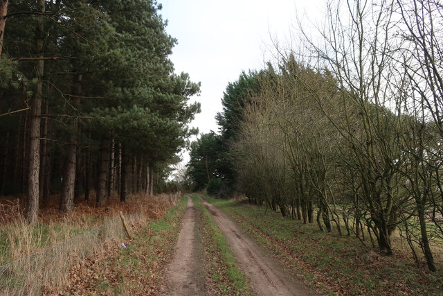
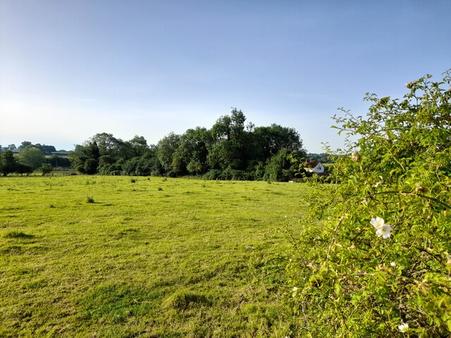
John's Wood is a picturesque woodland located in Norfolk, England. Situated in the heart of the county, this enchanting forest covers a sprawling area of approximately 100 acres. Named after John, an ancient landowner, the wood is known for its natural beauty and diverse range of flora and fauna.
The woodland is characterized by its dense canopy of towering oak, beech, and birch trees, providing a serene and tranquil environment for visitors. The forest floor is covered in a thick carpet of ferns, wildflowers, and moss, creating a vibrant and colorful undergrowth. This rich biodiversity attracts a variety of wildlife, including deer, foxes, badgers, and a plethora of bird species.
The wood offers a myriad of walking trails, allowing visitors to explore its hidden treasures and immerse themselves in nature. These trails wind through the forest, leading to secluded ponds, bubbling streams, and a charming little waterfall. The peaceful atmosphere and the gentle sound of nature make John's Wood a popular destination for hikers, birdwatchers, and nature enthusiasts alike.
For those seeking a deeper connection with the natural world, the wood also offers educational programs and guided tours. These activities aim to educate visitors about the importance of conservation and sustainable practices to preserve the delicate ecosystem of the wood.
Overall, John's Wood in Norfolk is a magical retreat for individuals seeking solace in nature. Its breathtaking beauty, diverse wildlife, and educational opportunities make it a must-visit destination for anyone looking to escape the hustle and bustle of everyday life.
If you have any feedback on the listing, please let us know in the comments section below.
John's Wood Images
Images are sourced within 2km of 52.604563/0.72701585 or Grid Reference TF8404. Thanks to Geograph Open Source API. All images are credited.


John's Wood is located at Grid Ref: TF8404 (Lat: 52.604563, Lng: 0.72701585)
Administrative County: Norfolk
District: Breckland
Police Authority: Norfolk
What 3 Words
///sifts.chuck.swinging. Near Ashill, Norfolk
Nearby Locations
Related Wikis

South Pickenham
South Pickenham is a small village and civil parish in the Breckland district of mid Norfolk, East Anglia, England. It has an area of 758 hectares (2.93...

Great Cressingham Fen
Great Cressingham Fen is a 14.3-hectare (35-acre) biological Site of Special Scientific Interest near Great Cressingham in Norfolk. It is part of the Norfolk...

Houghton on the Hill, Norfolk
Houghton on the Hill is a deserted medieval village and former civil parish, now in the parish of North Pickenham in the Breckland district of Norfolk...
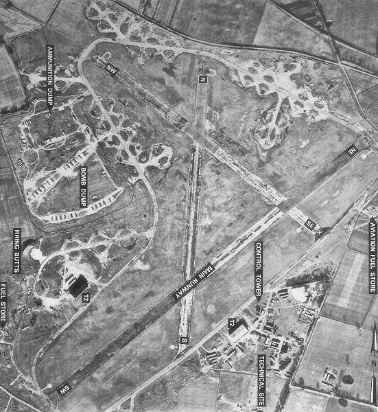
RAF North Pickenham
Royal Air Force North Pickenham or more simply RAF North Pickenham is a former Royal Air Force station located 3 miles (4.8 km) East of Swaffham, Norfolk...
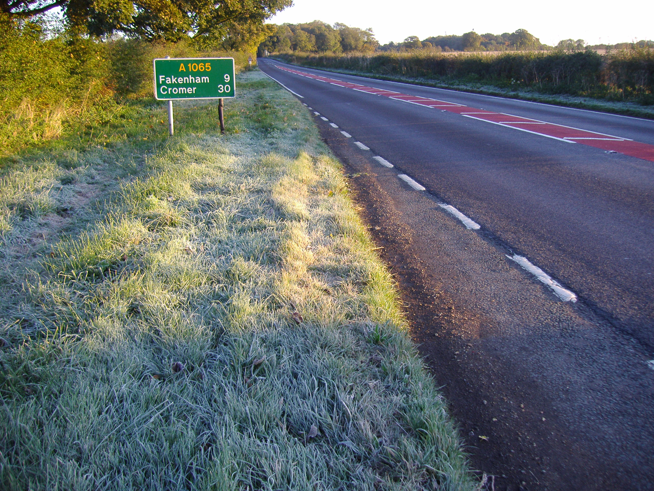
A1065 road
The A1065 is a main road in the English region of East Anglia. It provides the principal road connection to parts of the west and north of the county of...

North Pickenham
North Pickenham is a village in the Breckland district of mid-Norfolk, East Anglia, England. It lies three miles from the Georgian market town of Swaffham...

Hooks Well Meadows, Great Cressingham
Hooks Well Meadows, Great Cressingham is a 15.6-hectare (39-acre) biological Site of Special Scientific Interest near Great Cressingham] in Norfolk.This...

Ashill, Norfolk
Ashill (pronounced Ash- ill ) is a village and civil parish in the English county of Norfolk. The village is between Watton and Swaffham. == Parish... ==
Have you been to John's Wood?
Leave your review of John's Wood below (or comments, questions and feedback).