Calves Wood

Wood, Forest in Suffolk Babergh

England

Calves Wood

Track To Blooms Hall Track leading to Blooms Hall near to Stanstead, Suffolk.
Track To Blooms Hall Credit: Keith Evans

Calves Wood is a picturesque woodland located in the county of Suffolk, England. It covers an area of approximately 30 hectares and is nestled within the rolling countryside of East Anglia. The wood is situated near the village of Calvesford and is easily accessible via a network of country lanes.

This ancient woodland is predominantly composed of oak and beech trees, which create a dense canopy that filters the sunlight, casting a tranquil atmosphere throughout the forest. The forest floor is adorned with a rich carpet of bluebells in the springtime, adding a vibrant burst of color to the landscape.

Calves Wood is a haven for wildlife, providing a diverse habitat for a range of flora and fauna. The wood is home to a wide variety of bird species, including woodpeckers, tawny owls, and jays. Small mammals such as foxes, badgers, and squirrels can also be spotted darting amongst the undergrowth.

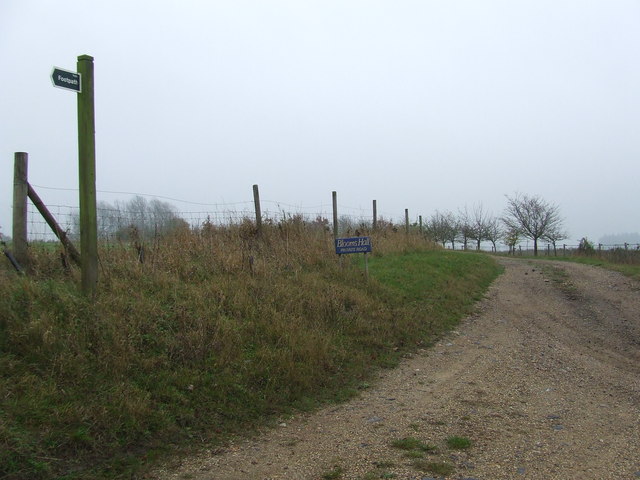
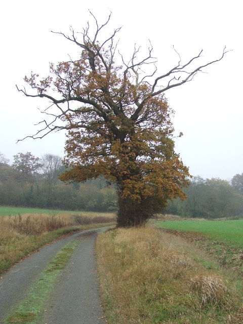
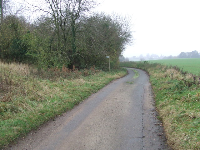
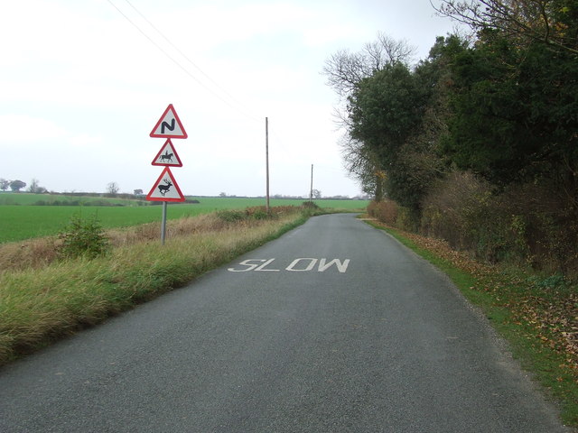
An extensive network of footpaths and trails crisscrosses the woodland, allowing visitors to explore the natural beauty at their leisure. The paths wind through the ancient trees, leading to hidden clearings, babbling brooks, and small ponds. The wood is a popular destination for walkers, nature enthusiasts, and photographers, who are drawn to its tranquil ambiance and scenic vistas.

Calves Wood offers a peaceful retreat from the hustle and bustle of everyday life, where visitors can immerse themselves in the beauty of nature and experience the wonders of an ancient English woodland.

If you have any feedback on the listing, please let us know in the comments section below.
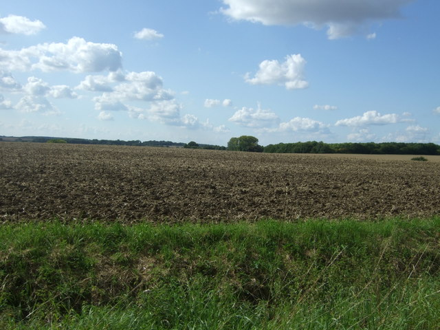
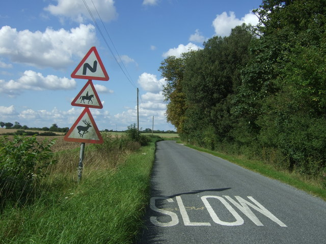
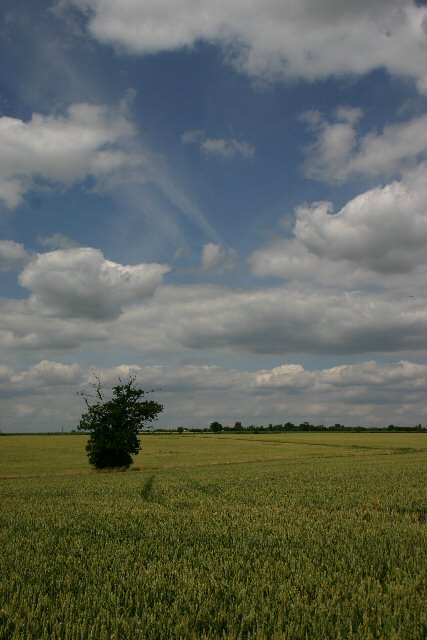
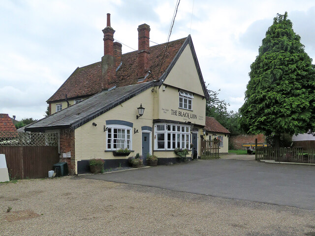
Calves Wood Images

Images are sourced within 2km of 52.103676/0.69423822 or Grid Reference TL8448. Thanks to Geograph Open Source API. All images are credited.

Track To Blooms Hall Track leading to Blooms Hall near to Stanstead, Suffolk.
Track To Blooms Hall
Track leading to Blooms Hall near to Stanstead, Suffolk.
Tree Tree on Bloom's Hall Lane near to Stanstead, Suffolk.
Tree
Tree on Bloom's Hall Lane near to Stanstead, Suffolk.
Bloom's Hall Lane Footpath off Bloom's Hall Lane near to Stanstead, Suffolk.
Bloom's Hall Lane
Footpath off Bloom's Hall Lane near to Stanstead, Suffolk.
Three Caution Signs Three caution signs near to Spring Hall Stanstead, Suffolk.
Three Caution Signs
Three caution signs near to Spring Hall Stanstead, Suffolk.
Field north of Stanstead West of Upper Street.
Field north of Stanstead
West of Upper Street.
Information overload north of Stanstead Warning signs on Upper Street.
Information overload north of Stanstead
Warning signs on Upper Street.
Lone tree and clouds Looking north west across wheat fields near Stanstead.
Lone tree and clouds
Looking north west across wheat fields near Stanstead.
Glemsford: at the corner of Angel Lane Part of the Grade II listed Angel public house is on the right. The Grade II listing for the house opposite reads "A timber-framed and plastered building refronted in the C18-C19 and altered in the C20. Two storeys. Four-window range, double-hung sashes with vertical glazing bars. The window range at the south end has 3-light windows with narrow side lights. At the north end there is a C20 shop. Roof tiled (old tiles), with a gambrel at the south end."
Glemsford: at the corner of Angel Lane
Part of the Grade II listed Angel public house is on the right. The Grade II listing for the house opposite reads "A timber-framed and plastered building refronted in the C18-C19 and altered in the C20. Two storeys. Four-window range, double-hung sashes with vertical glazing bars. The window range at the south end has 3-light windows with narrow side lights. At the north end there is a C20 shop. Roof tiled (old tiles), with a gambrel at the south end."
Glemsford: north along Egremont Street Looking towards the Grade II* listed Angel House and the Angel Inn. The 18th-century timber-framed house on the left, with a former shop front, is Grade II listed.
Glemsford: north along Egremont Street
Looking towards the Grade II* listed Angel House and the Angel Inn. The 18th-century timber-framed house on the left, with a former shop front, is Grade II listed.
Glemsford: historic buildings on Egremont Street The grand timber-framed house on the right dates from the 16th or 17th century and is Grade II listed. Beyond are The Angel public house (Grade II listed) and Angel House (Grade II* listed).
Glemsford: historic buildings on Egremont Street
The grand timber-framed house on the right dates from the 16th or 17th century and is Grade II listed. Beyond are The Angel public house (Grade II listed) and Angel House (Grade II* listed).
Glemsford: Chinese bond on Hunts Hill The original part of this house has Chinese bond brickwork. The bricks are laid on edge rather than flat, which makes them appear larger than if laid conventionally. This method enabled fewer bricks to be used and a house made more cheaply.
Glemsford: Chinese bond on Hunts Hill
The original part of this house has Chinese bond brickwork. The bricks are laid on edge rather than flat, which makes them appear larger than if laid conventionally. This method enabled fewer bricks to be used and a house made more cheaply.
Glemsford Primary Academy "Startling red-brick school for 500, 1871," wrote Norman Scarfe in the Shell Guide of 1960. However, according to Historic England's Grade II listing it was "built circa 1895 as an Urban District Office and later used as a school ... The tower is surmounted by a cruciform slate roof gabled on each front."
Glemsford Primary Academy
"Startling red-brick school for 500, 1871," wrote Norman Scarfe in the Shell Guide of 1960. However, according to Historic England's Grade II listing it was "built circa 1895 as an Urban District Office and later used as a school ... The tower is surmounted by a cruciform slate roof gabled on each front."
Glemsford: The Black Lion This Grade II listed timber-framed and plastered building dates from the 16th century.
Glemsford: The Black Lion
This Grade II listed timber-framed and plastered building dates from the 16th century.
Glemsford: a mixture of styles on Lion Road Though old, this house, partly thatched and partly roofed with corrugated iron, is not listed.
Glemsford: a mixture of styles on Lion Road
Though old, this house, partly thatched and partly roofed with corrugated iron, is not listed.
Glemsford: Wongs Cherry Tree When it was a public house this Chinese takeaway was a different colour - see Robert Edwards' <a href="https://www.geograph.org.uk/photo/2437819">TL8248 : Glemsford's village sign and the 'Cherry Tree' pub</a>, taken in 2011.
Glemsford: Wongs Cherry Tree
When it was a public house this Chinese takeaway was a different colour - see Robert Edwards' TL8248 : Glemsford's village sign and the 'Cherry Tree' pub, taken in 2011.
Glemsford: Bells Lane and the former Horsehair Factory In the 19th and 20th centuries Glemsford was a centre for linen, silk, coconut matting and horsehair manufacture. The factory complex on Bells Lane dates from the 1820s and was built as a silk mill. According to the Shell Guide, 500 employees were grading and processing horsehair by 1855. Horsehair was much used in uphostery in the Victorian period, and production continued until late in the twentieth century. Glemsford's finest white horsehair was used in the production of such things as cavalrymen's helmet plumes and in the Scottish sporran trade. The factory buildings are now housing, with the fine and unusual postal address "Former Horsehair Factory, Bells Lane, Glemsford".
Glemsford: Bells Lane and the former Horsehair Factory
In the 19th and 20th centuries Glemsford was a centre for linen, silk, coconut matting and horsehair manufacture. The factory complex on Bells Lane dates from the 1820s and was built as a silk mill. According to the Shell Guide, 500 employees were grading and processing horsehair by 1855. Horsehair was much used in uphostery in the Victorian period, and production continued until late in the twentieth century. Glemsford's finest white horsehair was used in the production of such things as cavalrymen's helmet plumes and in the Scottish sporran trade. The factory buildings are now housing, with the fine and unusual postal address "Former Horsehair Factory, Bells Lane, Glemsford".
Glemsford: Stanway Close and the former Horsehair Factory In the 19th and 20th centuries Glemsford was a centre for linen, silk, coconut matting and horsehair manufacture. The factory complex on Bells Lane dates from the 1820s and was built as a silk mill. According to the Shell Guide, 500 employees were grading and processing horsehair by 1855. Horsehair was much used in uphostery in the Victorian period, and production continued until late in the twentieth century. Glemsford's finest white horsehair was used in the production of such things as cavalrymen's helmet plumes and in the Scottish sporran trade. The factory buildings are now housing, with the fine and unusual postal address "Former Horsehair Factory, Bells Lane, Glemsford", as the sign above the ground-floor windows just to the right of centre shows.
Glemsford: Stanway Close and the former Horsehair Factory
In the 19th and 20th centuries Glemsford was a centre for linen, silk, coconut matting and horsehair manufacture. The factory complex on Bells Lane dates from the 1820s and was built as a silk mill. According to the Shell Guide, 500 employees were grading and processing horsehair by 1855. Horsehair was much used in uphostery in the Victorian period, and production continued until late in the twentieth century. Glemsford's finest white horsehair was used in the production of such things as cavalrymen's helmet plumes and in the Scottish sporran trade. The factory buildings are now housing, with the fine and unusual postal address "Former Horsehair Factory, Bells Lane, Glemsford", as the sign above the ground-floor windows just to the right of centre shows.
Glemsford: the former Horsehair Factory In the 19th and 20th centuries Glemsford was a centre for linen, silk, coconut matting and horsehair manufacture. The factory complex on Bells Lane dates from the 1820s and was built as a silk mill. According to the Shell Guide, 500 employees were grading and processing horsehair by 1855. Horsehair was much used in uphostery in the Victorian period, and production continued until late in the twentieth century. Glemsford's finest white horsehair was used in the production of such things as cavalrymen's helmet plumes and in the Scottish sporran trade. The factory buildings are now housing, with the fine and unusual postal address "Former Horsehair Factory, Bells Lane, Glemsford".
Glemsford: the former Horsehair Factory
In the 19th and 20th centuries Glemsford was a centre for linen, silk, coconut matting and horsehair manufacture. The factory complex on Bells Lane dates from the 1820s and was built as a silk mill. According to the Shell Guide, 500 employees were grading and processing horsehair by 1855. Horsehair was much used in uphostery in the Victorian period, and production continued until late in the twentieth century. Glemsford's finest white horsehair was used in the production of such things as cavalrymen's helmet plumes and in the Scottish sporran trade. The factory buildings are now housing, with the fine and unusual postal address "Former Horsehair Factory, Bells Lane, Glemsford".
Show me another place!

Calves Wood is located at Grid Ref: TL8448 (Lat: 52.103676, Lng: 0.69423822)

Administrative County: Suffolk

District: Babergh

Police Authority: Suffolk

What 3 Words

///mountain.spinning.occupiers. Near Glemsford, Suffolk

Nearby Locations

Bar Wood Calves Wood

Related Wikis

Stanstead, Suffolk

Stanstead is a village and civil parish in Suffolk, England. The name Stanstead comes from the Old English for "Stony place". Located off the B1066, it...

Glemsford

Glemsford is a village in the Babergh district in Suffolk, England, near the town of Sudbury. Glemsford is located near the River Glem and the River Stour...

Kentwell Woods

Kentwell Woods is a 77.6-hectare (192-acre) biological Site of Special Scientific Interest in fifteen woods in fourteen separate blocks east and north...

Glemsford Pits

Glemsford Pits is a 37.5-hectare (93-acre) biological Site of Special Scientific Interest south of Glemsford in Suffolk. The River Stour, which forms the...

Nearby Amenities

Located within 500m of 52.103676,0.69423822
Bus Stop
White Hart
Naptan AtcoCode: 390010184
Naptan Bearing: NW
Naptan BusStopType: CUS
Naptan CommonName: White Hart
Naptan Indicator: opp
Naptan Landmark: White Hart
Naptan NaptanCode: sufadmtd
Naptan Street: Lower Street
Naptan Verified: no
Source: naptan_import
Lat/Long: 52.1054269/0.689394
Bus Stop
White Hart
Local Ref: NR
Naptan AtcoCode: 390010185
Naptan Bearing: SE
Naptan BusStopType: CUS
Naptan CommonName: White Hart
Naptan Indicator: nr
Naptan Landmark: White Hart
Naptan NaptanCode: sufadmtg
Naptan Street: Lower Street
Naptan Verified: no
Source: naptan_import
Lat/Long: 52.1056674/0.6891018
Post Box
Mapillary: 778318544274024
Operator: Royal Mail
Operator Wikidata: Q638098
Post Box Type: wall
Lat/Long: 52.1054644/0.6894782
The data included in this document is from www.openstreetmap.org. The data is made available under ODbL.

Have you been to Calves Wood?

Leave your review of Calves Wood below (or comments, questions and feedback).