Barn Covert

Wood, Forest in Norfolk Breckland

England

Barn Covert

Ride in Big Wood, Lynford
Ride in Big Wood, Lynford Credit: Jonathan Thacker

Barn Covert is a picturesque woodland located in Norfolk, England. Situated near the village of Wood, this forested area covers a significant portion of the landscape, providing a serene and tranquil environment for visitors to enjoy.

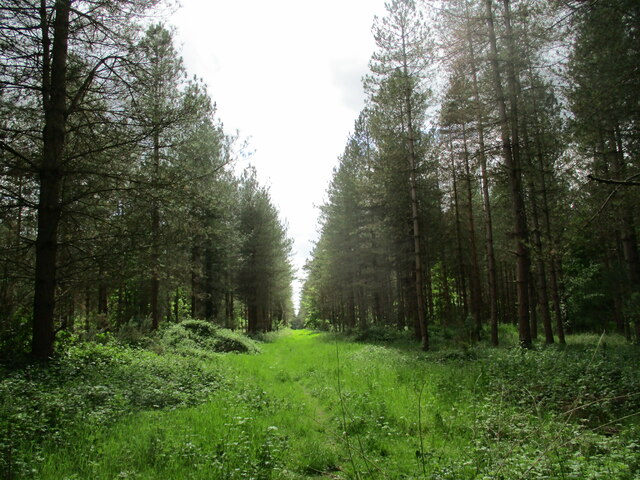
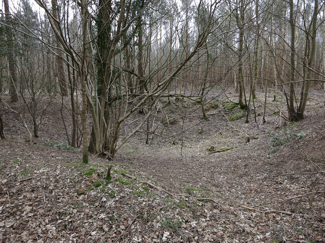
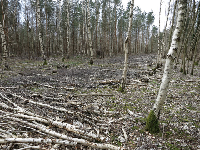
The woodland is characterized by its dense canopy of towering trees, predominantly consisting of oak, beech, and birch. These majestic trees offer shade and shelter to a variety of wildlife that call Barn Covert their home. Squirrels, rabbits, and numerous bird species can often be spotted flitting among the branches, adding to the charm and natural beauty of this woodland.

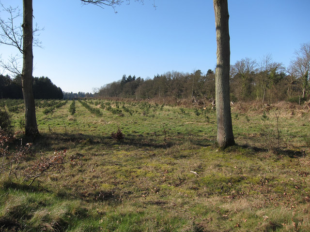
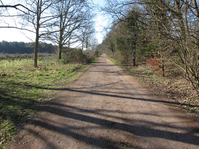
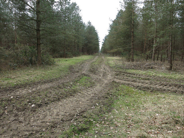
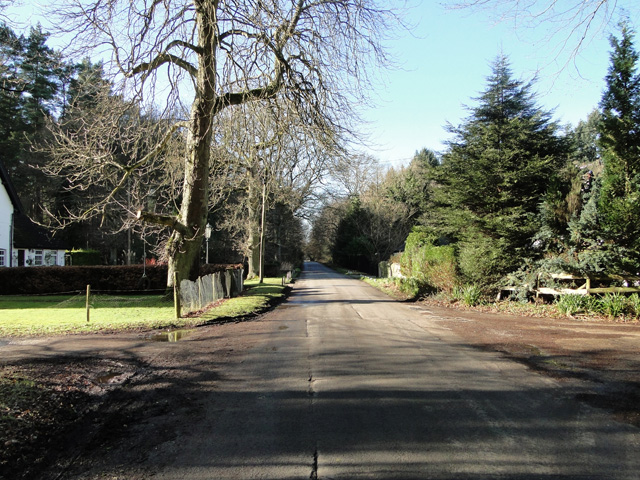
Barn Covert is intersected by a network of footpaths and trails, allowing visitors to explore the area at their own pace. The paths wind through the forest, leading to hidden glades and enchanting clearings, where sunlight filters through the foliage, creating an ethereal atmosphere. The forest floor is carpeted with a rich tapestry of wildflowers and ferns, adding bursts of vibrant color to the otherwise green landscape.

Nature enthusiasts will find plenty to admire in Barn Covert. The forest is home to a diverse array of plant species, including bluebells, primroses, and foxgloves, which bloom in abundance during the spring and summer months. The wood also boasts a small pond, providing a habitat for frogs, newts, and dragonflies.

Barn Covert is a haven for those seeking respite from the hustle and bustle of everyday life. Its peaceful ambiance, natural beauty, and abundant wildlife make it an idyllic destination for a leisurely stroll, a picnic, or simply a moment of quiet reflection in the heart of Norfolk's countryside.

If you have any feedback on the listing, please let us know in the comments section below.

Barn Covert Images

Images are sourced within 2km of 52.504117/0.71137514 or Grid Reference TL8493. Thanks to Geograph Open Source API. All images are credited.

Ride in Big Wood, Lynford
Ash Carr Dry part of the woodland by Lynford Arboretum.
Ash Carr
Dry part of the woodland by Lynford Arboretum.
Path around Ash Carr The path is from Lynford Arboretum. The other side of the fence is STANTA (Stanford Training Area) a British Army infantry training area.
Path around Ash Carr
The path is from Lynford Arboretum. The other side of the fence is STANTA (Stanford Training Area) a British Army infantry training area.
Path through Ash Carr By Lynford Arboretum.
Path through Ash Carr
By Lynford Arboretum.
Path through Ash Carr Heading towards Lynford Arboretum.
Path through Ash Carr
Heading towards Lynford Arboretum.
Road from STANTA STANTA is a large army training area in the Brecks.
Road from STANTA
STANTA is a large army training area in the Brecks.
Gravelpit Cottages On the road to one of the entrances to STANTA (Stanford Training Area), a large military training area.
Gravelpit Cottages
On the road to one of the entrances to STANTA (Stanford Training Area), a large military training area.
Replanted plantation South of West Tofts Road.
Replanted plantation
South of West Tofts Road.
Restricted byway South of West Tofts Road.
Restricted byway
South of West Tofts Road.
Obstacle Course Entrance to a M.O.D.s obstacle course near to West Tofts, Norfolk.
Obstacle Course
Entrance to a M.O.D.s obstacle course near to West Tofts, Norfolk.
Country Road Country road near to West Tofts, Norfolk.
Country Road
Country road near to West Tofts, Norfolk.
Bombhole, Great Covert One of several in the area.
Bombhole, Great Covert
One of several in the area.
New track through the birch Parallel to West Tofts Road.
New track through the birch
Parallel to West Tofts Road.
Tyre tracks in Great Covert Signs of forest operations in the area.
Tyre tracks in Great Covert
Signs of forest operations in the area.
Semi-detached by West Tofts Road
West Tofts Road near Marly Covert
West Tofts Road sign
Postbox outside STANTA STANTA stands for STANford Training Area situated roughly TL 8495. 
The area was established in 1942 when a battle training area was required and a 'Nazi village' established. Military exercises were already taking place in the area; tanks had deployed to Thetford in the First World War. The complete takeover involved the complete evacuation of the villages of Buckenham Tofts, Langford, Stanford, Sturston, Tottington and West Tofts. The occupants of the houses were all rehoused in the belief that they would be allowed to return after the war. However the site was so valuable to the military that they have taken up permanent occupancy.  
The area was used during the run-up to the D-Day invasion and since then has hosted many exercises. 
The battle area includes four historic churches; the one at West Tofts was restored by Pugin and a new "church" forms part of the specially constructed village of Eastmere. Eastmere was originally built to give soldiers experience of fighting on the northern European plains.
There is a short landing strip for Harrier aircraft at TL 8332 9704
As a live firing area, access is not allowed without special permission from the Army. In the main this is limited to a number of tours a year and compassionate grounds for former residents of the villages or their relatives.
The area forms part of the distinctive Breckland landscape region, a gorse-covered sandy heath which offers poor agricultural opportunities but farms are still active and sheep graze within its confines. Arguably, its use as a military training area has safeguarded a substantial archaeological landscape. It is the home of a wealth of rare species of flora and fauna already lost in other parts of the country. Parts of the training area are designated Site of Special Scientific Interest (SSSI).
The battle area was used in the filming of many of the episodes of the TV comedy series, Dad's Army.
Postbox outside STANTA
STANTA stands for STANford Training Area situated roughly TL 8495. The area was established in 1942 when a battle training area was required and a 'Nazi village' established. Military exercises were already taking place in the area; tanks had deployed to Thetford in the First World War. The complete takeover involved the complete evacuation of the villages of Buckenham Tofts, Langford, Stanford, Sturston, Tottington and West Tofts. The occupants of the houses were all rehoused in the belief that they would be allowed to return after the war. However the site was so valuable to the military that they have taken up permanent occupancy. The area was used during the run-up to the D-Day invasion and since then has hosted many exercises. The battle area includes four historic churches; the one at West Tofts was restored by Pugin and a new "church" forms part of the specially constructed village of Eastmere. Eastmere was originally built to give soldiers experience of fighting on the northern European plains. There is a short landing strip for Harrier aircraft at TL 8332 9704 As a live firing area, access is not allowed without special permission from the Army. In the main this is limited to a number of tours a year and compassionate grounds for former residents of the villages or their relatives. The area forms part of the distinctive Breckland landscape region, a gorse-covered sandy heath which offers poor agricultural opportunities but farms are still active and sheep graze within its confines. Arguably, its use as a military training area has safeguarded a substantial archaeological landscape. It is the home of a wealth of rare species of flora and fauna already lost in other parts of the country. Parts of the training area are designated Site of Special Scientific Interest (SSSI). The battle area was used in the filming of many of the episodes of the TV comedy series, Dad's Army.
Show me another place!

Barn Covert is located at Grid Ref: TL8493 (Lat: 52.504117, Lng: 0.71137514)

Administrative County: Norfolk

District: Breckland

Police Authority: Norfolk

What 3 Words

///pets.installs.mills. Near Mundford, Norfolk

Nearby Locations

Barn Covert

Related Wikis

West Tofts

West Tofts is a deserted village dating back to the medieval period, which was emparked in the 18th century. It is located in the civil parish of Lynford...

Buckenham Tofts

Buckenham Tofts (or Buckenham Parva; Little Buckenham) is a former civil parish, now in the parish of Stanford, in the Breckland district, in the county...

Stanford, Norfolk

Stanford is a deserted village and civil parish in the English county of Norfolk. It is situated 7+1⁄2 miles (12 km) north of the town of Thetford and...

Lynford Hall

Lynford Hall is a neo-Jacobean country house at Mundford, near Thetford in the English county of Norfolk. It is now a hotel. == Location == The Lynford...

Lynford

Lynford is a village and civil parish in the Breckland District of Norfolk. The parish covers an area of 24.72 km2 (9.54 sq mi), and the 2001 Census recorded...

Stanford Training Area SSSI

Stanford Training Area SSSI is part of the British Army Stanford Training Area. It is a 4,678-hectare (11,560-acre) biological and geological Site of Special...

Stanford Training Area

The Stanford Training Area (STANTA), originally known as the Stanford Battle Area, is a British Army training area situated in the English county of Norfolk...

Langford, Norfolk

Langford is a village and former civil parish, now in the parish of Ickburgh, in the Breckland district, in the county of Norfolk, England. The village...

Nearby Amenities

Located within 500m of 52.504117,0.71137514
West Tofts
Place: locality
Lat/Long: 52.5021511/0.7052952
Hunting Stand
Lat/Long: 52.5079953/0.7085812
Hunting Stand
Lat/Long: 52.5075537/0.7086396
Hunting Stand
Lat/Long: 52.5076657/0.7091528
The data included in this document is from www.openstreetmap.org. The data is made available under ODbL.

Have you been to Barn Covert?

Leave your review of Barn Covert below (or comments, questions and feedback).