Bullock Wood

Wood, Forest in Essex Braintree

England

Bullock Wood

Stanstead Hall: aerial 2022 (1)
Stanstead Hall: aerial 2022 (1) Credit: Simon Tomson

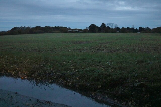
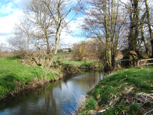
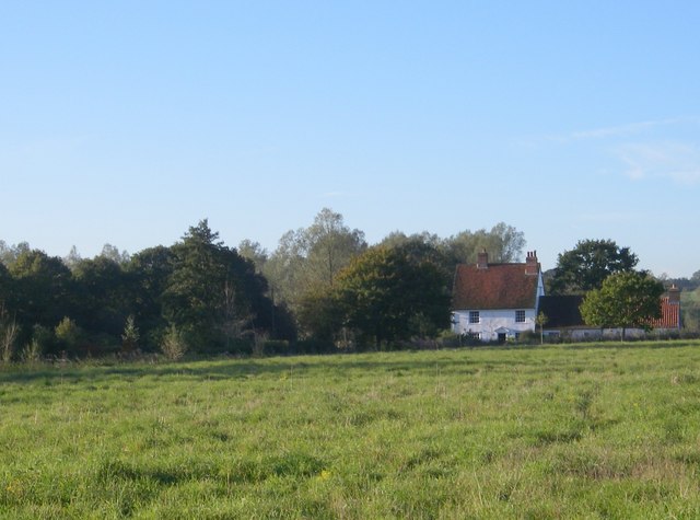
Bullock Wood is a picturesque woodland located in the county of Essex, England. Covering an area of approximately 50 acres, it is known for its abundant natural beauty and diverse ecosystem. The wood is situated near the village of Bullock, hence its name, and is easily accessible to visitors.

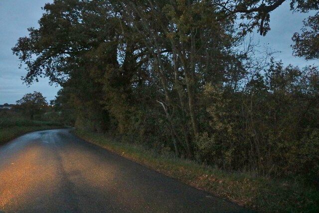
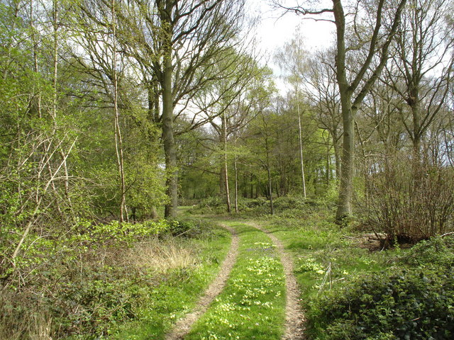
The woodland is primarily composed of a mix of deciduous and evergreen trees, including oak, ash, beech, and pine. These trees provide a dense canopy, creating a cool and shaded environment within the wood. The forest floor is covered in a thick layer of leaf litter, which supports a wide variety of plant species, such as bluebells, ferns, and wild garlic.

Bullock Wood is home to a rich array of wildlife, making it a popular destination for nature enthusiasts and photographers. Visitors may spot various bird species, including woodpeckers, owls, and thrushes, as well as small mammals like squirrels and rabbits. The wood is also inhabited by a diverse range of insects, including butterflies and beetles.

The wood offers several walking trails, allowing visitors to explore its natural wonders at their own pace. These paths meander through the trees, offering glimpses of the surrounding countryside and providing a tranquil escape from the hustle and bustle of daily life.

Overall, Bullock Wood in Essex is a haven of natural beauty and a valuable habitat for a wide range of flora and fauna. It provides a serene and peaceful environment for visitors to immerse themselves in nature and enjoy the tranquility of this enchanting woodland.

If you have any feedback on the listing, please let us know in the comments section below.
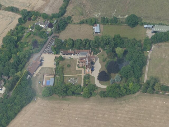
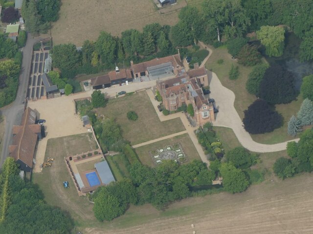
Bullock Wood Images

Images are sourced within 2km of 51.925397/0.67455506 or Grid Reference TL8428. Thanks to Geograph Open Source API. All images are credited.

Stanstead Hall: aerial 2022 (1)
Stanstead Hall: aerial 2022 (2)
Passing The Lion, Earls Colne – 1971 The Lion dates back to as early as the 14th century.

Hedingham and District bus L42 on a works service. This was a family business set up in 1960 in Sible Hedingham which survived the upheavals of the 1985 Transport Act to continue to provide local bus services in the area, finally selling to the Go-Ahead group in 2012. The Hedingham fleetname continues to be used.

Bus L42 is a Bristol LS with ECW body, originally new to Eastern National in 1955.

This is one of a series of views featuring buses in the 60s, 70s, and 80s. <a title="https://www.geograph.org.uk/search.php?i=137652761" href="https://www.geograph.org.uk/search.php?i=137652761">Link</a>
Passing The Lion, Earls Colne – 1971
The Lion dates back to as early as the 14th century. Hedingham and District bus L42 on a works service. This was a family business set up in 1960 in Sible Hedingham which survived the upheavals of the 1985 Transport Act to continue to provide local bus services in the area, finally selling to the Go-Ahead group in 2012. The Hedingham fleetname continues to be used. Bus L42 is a Bristol LS with ECW body, originally new to Eastern National in 1955. This is one of a series of views featuring buses in the 60s, 70s, and 80s. Link
Colchester Road at the end of Church Road
Crocklands Corner, Greenstead Green
Field by Greenstead Hall Road
Greenstead Hall Road entering Halstead
The Lion, public house, Earls Colne, Essex This 14th century Tudor Style inn stands at the top of the High Street on the right hand side as you head towards Halstead. It hasn't always been an inn. At one time the public bar, which is at the front, was a stilted building and used to house the indoor market.
The Lion, public house, Earls Colne, Essex
This 14th century Tudor Style inn stands at the top of the High Street on the right hand side as you head towards Halstead. It hasn't always been an inn. At one time the public bar, which is at the front, was a stilted building and used to house the indoor market.
Colne Engaine village, Essex This village stands on high ground in the Colne Valley and there are nice views from the church.
Colne Engaine village, Essex
This village stands on high ground in the Colne Valley and there are nice views from the church.
Colne Engaine village, Essex Village scene showing St.Andrew's church hidden behind the trees.
Colne Engaine village, Essex
Village scene showing St.Andrew's church hidden behind the trees.
Bridge Out! This picture shows what is left of a bridge on the Colne Valley railway. The railway embankment to the right as far as White Colne was a nature reserve managed by Essex wildlife Trust <span class="nowrap"><a title="http://www.essexwt.org.uk/" rel="nofollow ugc noopener" href="http://www.essexwt.org.uk/">Link</a><img style="margin-left:2px;" alt="External link" title="External link - shift click to open in new window" src="https://s1.geograph.org.uk/img/external.png" width="10" height="10"/></span> however management has now passed back to the local authority. The photo was taken looking upstream.
Bridge Out!
This picture shows what is left of a bridge on the Colne Valley railway. The railway embankment to the right as far as White Colne was a nature reserve managed by Essex wildlife Trust LinkExternal link however management has now passed back to the local authority. The photo was taken looking upstream.
Earls Colne Airfield This is Earls Colne airfield <span class="nowrap"><a title="http://www.anglianflightcentres.co.uk/airfield.shtml" rel="nofollow ugc noopener" href="http://www.anglianflightcentres.co.uk/airfield.shtml">Link</a><img style="margin-left:2px;" alt="External link" title="External link - shift click to open in new window" src="https://s1.geograph.org.uk/img/external.png" width="10" height="10"/></span> a busy private landing field using runways of the wartime RAF Earls Colne which operated both RAF and USAAF aircraft at various times during the war. An aerial shot of the base in during the war can be seen at <span class="nowrap"><a title="http://www.colnevalley.com/b26.htm" rel="nofollow ugc noopener" href="http://www.colnevalley.com/b26.htm">Link</a><img style="margin-left:2px;" alt="External link" title="External link - shift click to open in new window" src="https://s1.geograph.org.uk/img/external.png" width="10" height="10"/></span> . Military operation ceased in 1946. The runways now enclose a golf course and the perimeter area at the south of the aerodrome is an industrial estate. The part of perimeter track and one of the runways is designated as a public footpath however they are well made private roads. To go to the next field in an alphabetical tour of Essex WW2 airfields click on <a href="https://www.geograph.org.uk/photo/255648">TQ4590 : RAF Fairlop Survivor?</a>. Much information was gleaned from Graham Smith’s book “Essex Airfields In The Second World War”. <span class="nowrap"><a title="https://books.google.co.uk/books/about/Essex_Airfields_in_the_Second_World_War.html?id=u3atAAAACAAJ&redir_esc=y" rel="nofollow ugc noopener" href="https://books.google.co.uk/books/about/Essex_Airfields_in_the_Second_World_War.html?id=u3atAAAACAAJ&redir_esc=y">Link</a><img style="margin-left:2px;" alt="External link" title="External link - shift click to open in new window" src="https://s1.geograph.org.uk/img/external.png" width="10" height="10"/></span>
Earls Colne Airfield
This is Earls Colne airfield LinkExternal link a busy private landing field using runways of the wartime RAF Earls Colne which operated both RAF and USAAF aircraft at various times during the war. An aerial shot of the base in during the war can be seen at LinkExternal link . Military operation ceased in 1946. The runways now enclose a golf course and the perimeter area at the south of the aerodrome is an industrial estate. The part of perimeter track and one of the runways is designated as a public footpath however they are well made private roads. To go to the next field in an alphabetical tour of Essex WW2 airfields click on TQ4590 : RAF Fairlop Survivor?. Much information was gleaned from Graham Smith’s book “Essex Airfields In The Second World War”. LinkExternal link
Lancaster Way This is Lancaster Way a road on an industrial estate that follows the course of the southern runway of <a href="https://www.geograph.org.uk/photo/149989">TL8427 : Earls Colne Airfield</a> at this point it is being used as a storage depot overflow for precast concrete mouldings from a manufacturer on the estate.
Lancaster Way
This is Lancaster Way a road on an industrial estate that follows the course of the southern runway of TL8427 : Earls Colne Airfield at this point it is being used as a storage depot overflow for precast concrete mouldings from a manufacturer on the estate.
Makeshift Navigation Markers These decapitated telegraph poles with traffic cone caps align perfectly with the runway of <a href="https://www.geograph.org.uk/photo/149989">TL8427 : Earls Colne Airfield</a> the white material was once high-visibility orange but it has become sun bleached. They are clearly intended to aid pilots in judging their landing approach. The exact locations of the markers is TL85182 27673 and TL85232 27701
Makeshift Navigation Markers
These decapitated telegraph poles with traffic cone caps align perfectly with the runway of TL8427 : Earls Colne Airfield the white material was once high-visibility orange but it has become sun bleached. They are clearly intended to aid pilots in judging their landing approach. The exact locations of the markers is TL85182 27673 and TL85232 27701
Greenstead Green, Essex This is a view looking across the green at Greenstead Green, which is south-east of Halstead.
Greenstead Green, Essex
This is a view looking across the green at Greenstead Green, which is south-east of Halstead.
The Old School, Greenstead Green, Essex This old school now appears to be converted into a house.
The Old School, Greenstead Green, Essex
This old school now appears to be converted into a house.
Tyler's wood Main ride in this ancient semi natural wood
Tyler's wood
Main ride in this ancient semi natural wood
Ford Mill - Colne valley An ancient farmhouse in the bottom of the Colne valley.
Ford Mill - Colne valley
An ancient farmhouse in the bottom of the Colne valley.
Show me another place!

Bullock Wood is located at Grid Ref: TL8428 (Lat: 51.925397, Lng: 0.67455506)

Administrative County: Essex

District: Braintree

Police Authority: Essex

What 3 Words

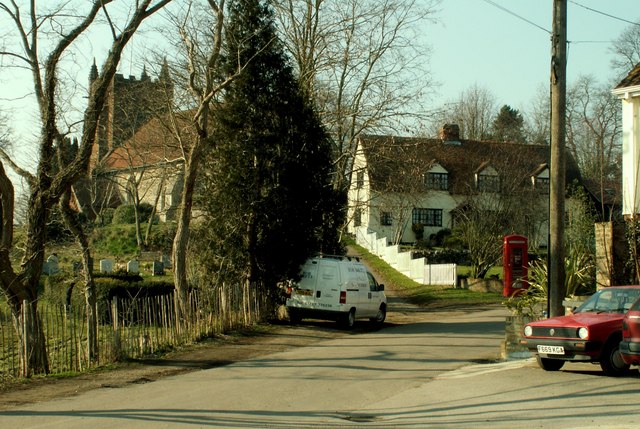
///massaged.knots.trickling. Near Earls Colne, Essex

Related Wikis

Earls Colne railway station

Earls Colne railway station was located in Earls Colne, Essex. It was 53 miles 77 chains (86.84 km) from London Liverpool Street via Marks Tey. == References... ==

Greenstead Green and Halstead Rural

Greenstead Green and Halstead Rural is a civil parish in the Braintree district, in the county of Essex, England. The parish includes the village of Greenstead...

Brickfield and Long Meadow

Brickfield and Long Meadow is a 3.9 hectare Local Nature Reserve in Earls Colne in Essex, England. There is access by footpaths from Park Lane, Church...

Earls Colne Grammar School

Earls Colne Grammar School was a grammar school in Earls Colne, Essex, England that was founded in 1520 and closed in 1975. == History == === Foundation... ===

Have you been to Bullock Wood?

Leave your review of Bullock Wood below (or comments, questions and feedback).