Cleveland Wood

Wood, Forest in Essex Braintree

England

Cleveland Wood

Ornamental lake at Markshall gardens
Ornamental lake at Markshall gardens Credit: Mr James D

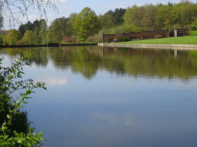
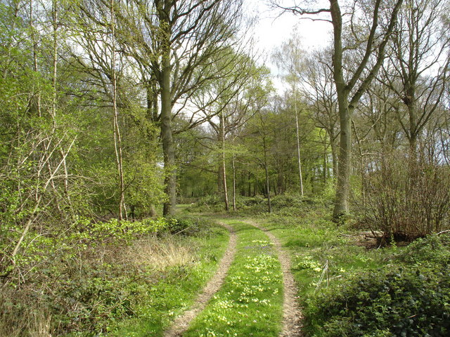
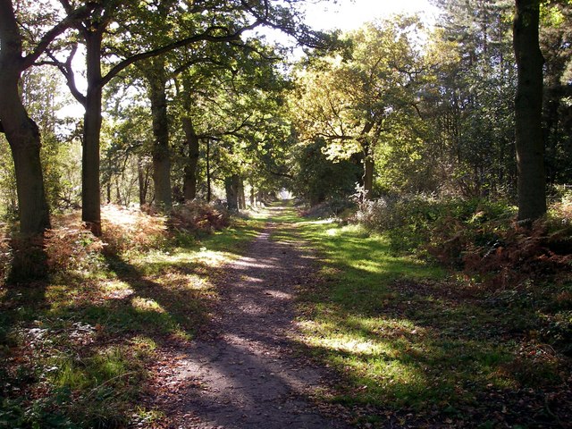
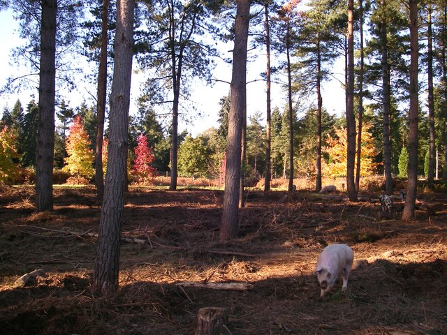
Cleveland Wood is a picturesque forest located in the county of Essex, England. Spanning over 500 acres, it is considered one of the largest woodlands in the region. The wood is primarily composed of mixed deciduous trees, including oak, beech, and birch, offering a diverse and vibrant landscape throughout the year.

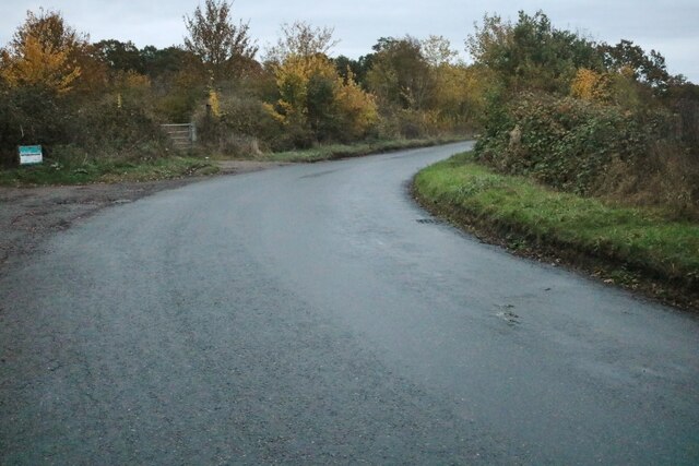
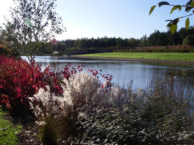
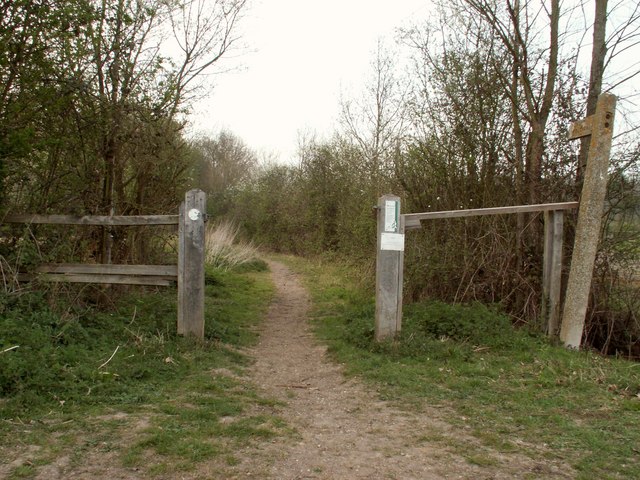
The wood is renowned for its natural beauty and serves as a popular destination for nature enthusiasts, hikers, and birdwatchers alike. It boasts an extensive network of well-maintained trails, allowing visitors to explore the area and immerse themselves in its peaceful surroundings. The diverse range of flora and fauna found within the wood makes it an ideal habitat for various wildlife species, including deer, foxes, and a wide variety of birds.

In addition to its natural attractions, Cleveland Wood offers recreational facilities to cater to the needs of visitors. There are picnic areas, where families and friends can gather and enjoy a relaxing day out amidst nature. The wood also hosts educational activities and guided tours, providing visitors with an opportunity to learn about the local ecosystem and conservation efforts.

Cleveland Wood holds historical significance as well, with evidence of human activity dating back several centuries. Ancient earthworks, such as ditches and banks, can be found within the wood, adding an intriguing element to its allure.

Overall, Cleveland Wood in Essex offers a tranquil escape from the hustle and bustle of urban life, providing visitors with an opportunity to connect with nature and appreciate the beauty of the British countryside.

If you have any feedback on the listing, please let us know in the comments section below.

Cleveland Wood Images

Images are sourced within 2km of 51.907345/0.66158843 or Grid Reference TL8326. Thanks to Geograph Open Source API. All images are credited.

Ornamental lake at Markshall gardens
Trees at Markshall park; somewhere west of war memorial site
Crocklands Corner, Greenstead Green
Brooks Farm Road, Greenstead Green
Stisted Road, Greenstead Green
Grange Hill, Greenstead Green
Earls Colne Airfield This is Earls Colne airfield <span class="nowrap"><a title="http://www.anglianflightcentres.co.uk/airfield.shtml" rel="nofollow ugc noopener" href="http://www.anglianflightcentres.co.uk/airfield.shtml">Link</a><img style="margin-left:2px;" alt="External link" title="External link - shift click to open in new window" src="https://s1.geograph.org.uk/img/external.png" width="10" height="10"/></span> a busy private landing field using runways of the wartime RAF Earls Colne which operated both RAF and USAAF aircraft at various times during the war. An aerial shot of the base in during the war can be seen at <span class="nowrap"><a title="http://www.colnevalley.com/b26.htm" rel="nofollow ugc noopener" href="http://www.colnevalley.com/b26.htm">Link</a><img style="margin-left:2px;" alt="External link" title="External link - shift click to open in new window" src="https://s1.geograph.org.uk/img/external.png" width="10" height="10"/></span> . Military operation ceased in 1946. The runways now enclose a golf course and the perimeter area at the south of the aerodrome is an industrial estate. The part of perimeter track and one of the runways is designated as a public footpath however they are well made private roads. To go to the next field in an alphabetical tour of Essex WW2 airfields click on <a href="https://www.geograph.org.uk/photo/255648">TQ4590 : RAF Fairlop Survivor?</a>. Much information was gleaned from Graham Smith’s book “Essex Airfields In The Second World War”. <span class="nowrap"><a title="https://books.google.co.uk/books/about/Essex_Airfields_in_the_Second_World_War.html?id=u3atAAAACAAJ&redir_esc=y" rel="nofollow ugc noopener" href="https://books.google.co.uk/books/about/Essex_Airfields_in_the_Second_World_War.html?id=u3atAAAACAAJ&redir_esc=y">Link</a><img style="margin-left:2px;" alt="External link" title="External link - shift click to open in new window" src="https://s1.geograph.org.uk/img/external.png" width="10" height="10"/></span>
Earls Colne Airfield
This is Earls Colne airfield LinkExternal link a busy private landing field using runways of the wartime RAF Earls Colne which operated both RAF and USAAF aircraft at various times during the war. An aerial shot of the base in during the war can be seen at LinkExternal link . Military operation ceased in 1946. The runways now enclose a golf course and the perimeter area at the south of the aerodrome is an industrial estate. The part of perimeter track and one of the runways is designated as a public footpath however they are well made private roads. To go to the next field in an alphabetical tour of Essex WW2 airfields click on TQ4590 : RAF Fairlop Survivor?. Much information was gleaned from Graham Smith’s book “Essex Airfields In The Second World War”. LinkExternal link
Lancaster Way This is Lancaster Way a road on an industrial estate that follows the course of the southern runway of <a href="https://www.geograph.org.uk/photo/149989">TL8427 : Earls Colne Airfield</a> at this point it is being used as a storage depot overflow for precast concrete mouldings from a manufacturer on the estate.
Lancaster Way
This is Lancaster Way a road on an industrial estate that follows the course of the southern runway of TL8427 : Earls Colne Airfield at this point it is being used as a storage depot overflow for precast concrete mouldings from a manufacturer on the estate.
Visitor Centre at Markshall Country Park, Essex The Country Park lies to the north of Coggeshall.
Visitor Centre at Markshall Country Park, Essex
The Country Park lies to the north of Coggeshall.
Greenstead Green, Essex This is a view looking across the green at Greenstead Green, which is south-east of Halstead.
Greenstead Green, Essex
This is a view looking across the green at Greenstead Green, which is south-east of Halstead.
Tyler's wood Main ride in this ancient semi natural wood
Tyler's wood
Main ride in this ancient semi natural wood
Markshall lake The upper of 2 lakes, reputedly dug by General Honeywood's troops during the siege of Colchester.
Markshall lake
The upper of 2 lakes, reputedly dug by General Honeywood's troops during the siege of Colchester.
The avenue - Markshall This long avenue stretches from the site of the old hall to the boundary of the deer park here oak, further down small leaved lime with mistletoe.
The avenue - Markshall
This long avenue stretches from the site of the old hall to the boundary of the deer park here oak, further down small leaved lime with mistletoe.
Woodland pigs - Markshall Pigs being used to control bracken in the pine plantations prior to conversion to arboretum.
Woodland pigs - Markshall
Pigs being used to control bracken in the pine plantations prior to conversion to arboretum.
Grange wood - Markshall Grange wood is an excellent example of a naturally occurring monoculture - in this case small leaved lime (Tilia cordata).
Grange wood - Markshall
Grange wood is an excellent example of a naturally occurring monoculture - in this case small leaved lime (Tilia cordata).
Ancient trackway between Grange and Lilly woods This trackway runs through a recently coppiced coupe in this area of ancient woodland.
Ancient trackway between Grange and Lilly woods
This trackway runs through a recently coppiced coupe in this area of ancient woodland.
Little Nunty's farm This arable field was originally divided into 7 and named after the days of the week and during WW II a horse was caught in cross fire from a "dog fight" going on overhead and, alas, died.
Little Nunty's farm
This arable field was originally divided into 7 and named after the days of the week and during WW II a horse was caught in cross fire from a "dog fight" going on overhead and, alas, died.
Show me another place!

Cleveland Wood is located at Grid Ref: TL8326 (Lat: 51.907345, Lng: 0.66158843)

Administrative County: Essex

District: Braintree

Police Authority: Essex

What 3 Words

///stream.undercuts.daunted. Near Earls Colne, Essex

Related Wikis

Marks Hall

Marks Hall was a Jacobean country house some 2 miles (3.2 km) north of Coggeshall in Essex, England. Previously a timber manor house, the 17th-century...

Greenstead Green

Greenstead Green is a village in the civil parish of Greenstead Green and Halstead Rural, near the town of Halstead, in the Braintree district, in the...

Belcher's and Broadfield Woods

Belcher's and Broadfield Woods is a 14.4-hectare (36-acre) biological Site of Special Scientific Interest between Halstead and Braintree in Essex. It is...

Tumbler's Green

Tumbler's Green is a hamlet near the towns of Halstead and Braintree in the Braintree district, in the English county of Essex. Other nearby settlements...

Nearby Amenities

Located within 500m of 51.907345,0.66158843
Barrier: yes
Lat/Long: 51.9029793/0.6614218
The data included in this document is from www.openstreetmap.org. The data is made available under ODbL.

Have you been to Cleveland Wood?

Leave your review of Cleveland Wood below (or comments, questions and feedback).