Bog Wood
Wood, Forest in Essex Maldon
England
Bog Wood

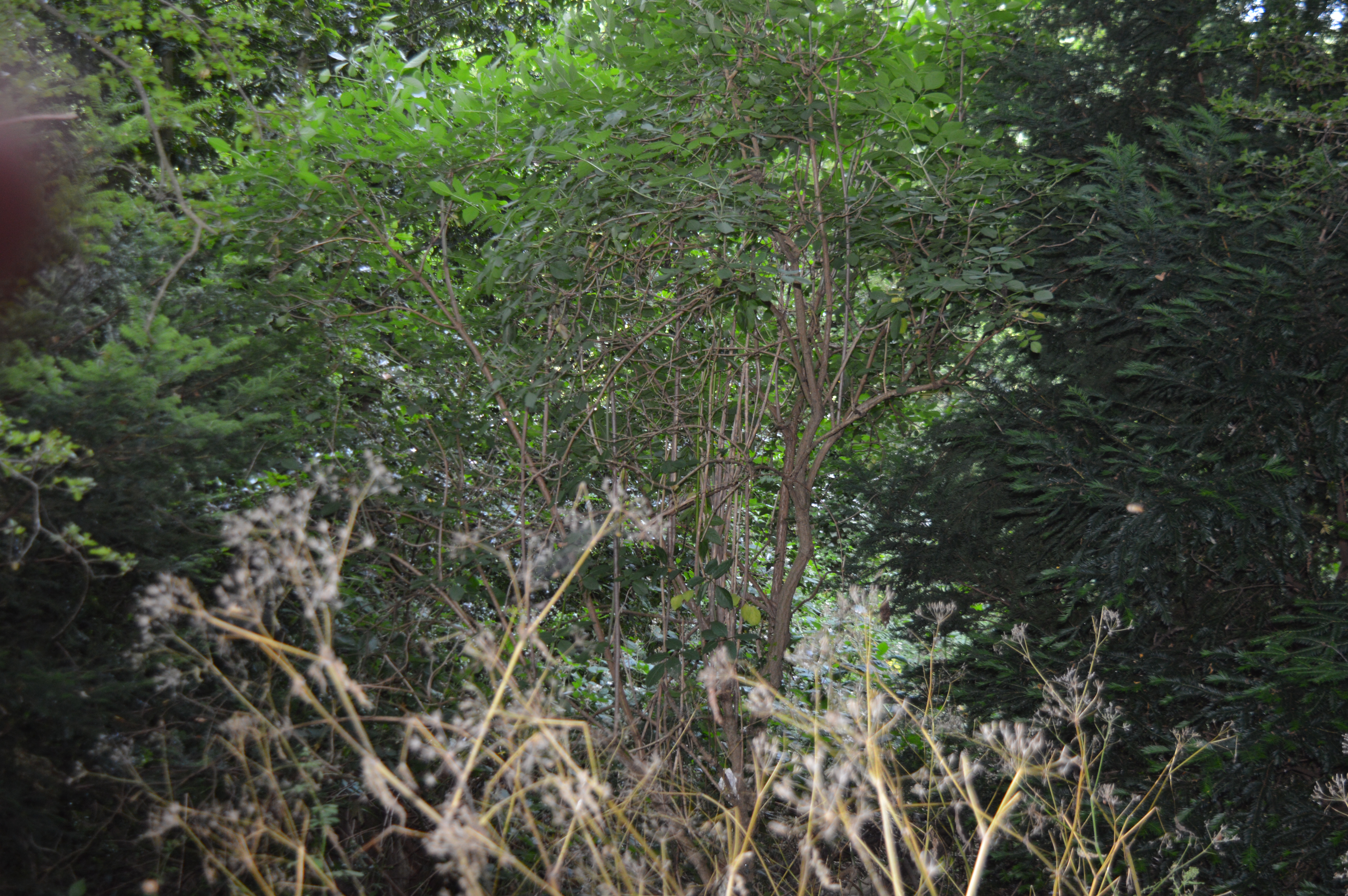
Bog Wood, located in Essex, England, is a unique and ancient forest that holds significant historical and ecological value. The woodland covers an area of approximately 1,000 acres and is considered one of the largest remaining areas of ancient wet woodland in the county.
The name "Bog Wood" accurately describes the nature of this forest, as it is characterized by its wet and boggy conditions. The forest is primarily composed of deciduous trees such as oaks, birches, and willows, which thrive in this damp environment. The dense canopy of the trees creates a shaded and serene atmosphere, providing a habitat for a variety of wildlife.
The forest is home to a diverse range of flora and fauna, including several rare and protected species. The wetland nature of Bog Wood attracts numerous water-loving plants, such as sphagnum mosses and water lilies. Additionally, the forest serves as a breeding ground for birds like warblers, woodpeckers, and owls, making it a popular spot for birdwatchers.
Bog Wood has a rich history that dates back thousands of years. Archaeological evidence suggests that the forest has been inhabited since the Neolithic period, with remnants of ancient settlements and burial sites discovered within its boundaries. The forest also played a significant role during the Roman occupation, serving as a source of timber and providing a natural defense barrier.
Today, Bog Wood is cherished as both a natural and historical treasure. It attracts visitors who seek tranquility, as well as those interested in exploring its cultural and ecological significance. The forest offers various walking trails, allowing visitors to immerse themselves in its enchanting beauty while also appreciating its ecological importance.
If you have any feedback on the listing, please let us know in the comments section below.
Bog Wood Images
Images are sourced within 2km of 51.729931/0.64703628 or Grid Reference TL8206. Thanks to Geograph Open Source API. All images are credited.


Bog Wood is located at Grid Ref: TL8206 (Lat: 51.729931, Lng: 0.64703628)
Administrative County: Essex
District: Maldon
Police Authority: Essex
What 3 Words
///shorthand.cutaway.hires. Near Maldon, Essex
Nearby Locations
Related Wikis
Maldon Cutting
Maldon Cutting is a 0.1-hectare (0.25-acre) geological Site of Special Scientific Interest in Maldon in Essex. It is a Geological Conservation Review site...

Maldon West railway station
Maldon West railway station served the town of Maldon, Essex. It was opened on 1 October 1889 by the Great Eastern Railway on a branch line from Woodham...
Beeleigh Abbey
Beeleigh Abbey near Maldon in Essex, England, was a monastery constructed in 1180 for the Order of Canons Regular of Prémontré, as known as the Norbertines...
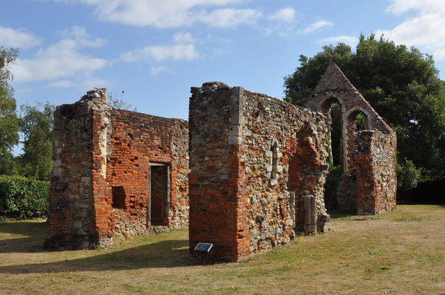
The Leper Hospital of St Giles
The Leper Hospital of St Giles is a ruined medieval hospital located in the village of Maldon in Essex, England. Originally established to treat and...

Maldon Sea Salt
Maldon Sea Salt is a salt-producing company in Maldon on the high-salinity banks of the River Blackwater in Essex, England. The river is favoured by flat...

Maldon Wick
Maldon Wick is a 6.1-hectare (15-acre) nature reserve in Maldon in Essex. It is managed by the Essex Wildlife Trust.This is a 2.4 kilometres (1.5 mi) linear...

St Peter's Hospital, Maldon
St Peter's Hospital is a health facility in Spital Road, Maldon, Essex. It is managed by Mid and South Essex NHS Foundation Trust. == History == The facility...
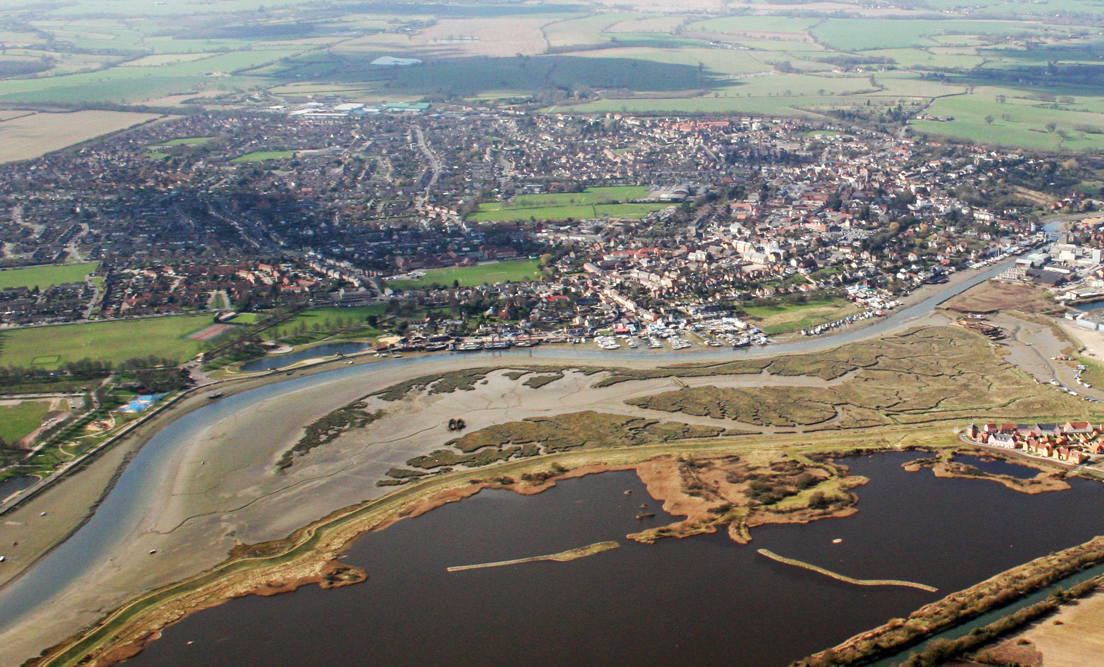
Maldon
Maldon (, locally ) is a town and civil parish on the Blackwater estuary in Essex, England. It is the seat of the Maldon District and starting point of...
Nearby Amenities
Located within 500m of 51.729931,0.64703628Have you been to Bog Wood?
Leave your review of Bog Wood below (or comments, questions and feedback).