Norwich Plantations
Wood, Forest in Norfolk Breckland
England
Norwich Plantations
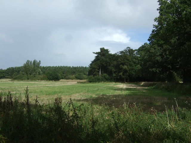
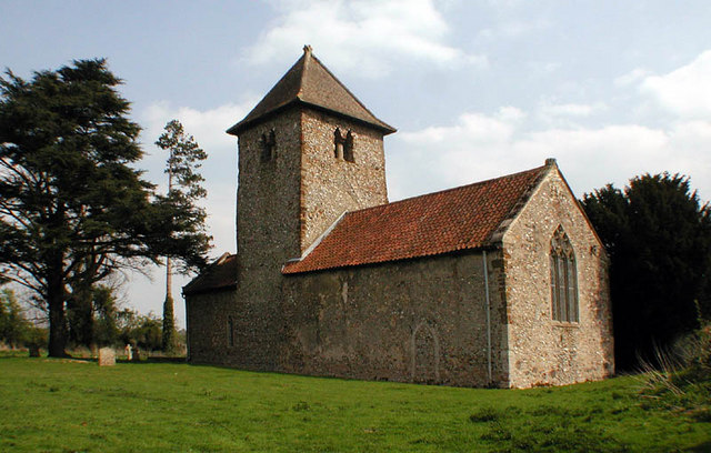
Norwich Plantations, located in Norfolk, England, is a vast woodland area known for its picturesque beauty and rich biodiversity. Spanning over a large expanse of land, the plantations are a popular destination for locals and tourists alike, offering a tranquil retreat from the bustling city life.
The woodlands of Norwich Plantations are primarily made up of various species of trees, including oak, beech, and pine, creating a diverse and vibrant forest ecosystem. The lush greenery and dense foliage provide a haven for a wide range of flora and fauna, making it an ideal spot for nature enthusiasts.
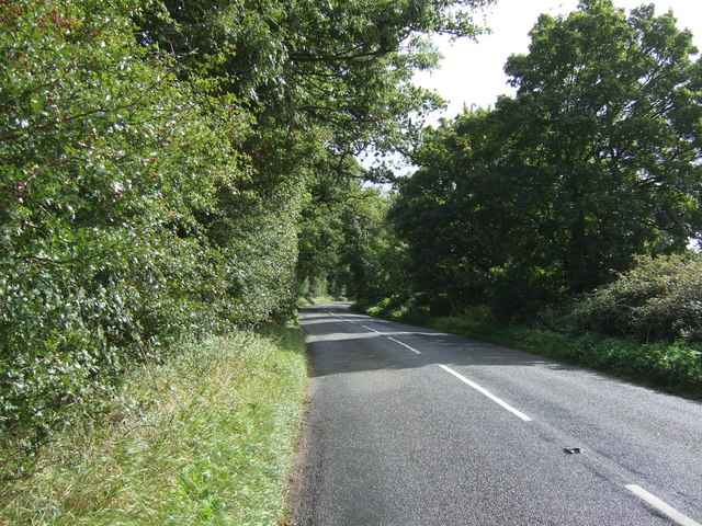
Visitors to Norwich Plantations can enjoy a multitude of recreational activities, such as hiking, cycling, and bird-watching. The numerous well-maintained trails that crisscross the woodlands offer opportunities for exploration and discovery. The plantations are also home to a variety of wildlife, including deer, squirrels, and a plethora of bird species, making it a paradise for birdwatchers.
In addition to its natural beauty, Norwich Plantations hold historical significance. The woodlands were originally part of a larger estate and were used for timber production during the medieval period. Remnants of this historical past can still be found within the plantations, including ancient trees and archaeological sites.
Overall, Norwich Plantations in Norfolk is a captivating destination for those seeking a peaceful escape into nature. With its scenic landscapes, diverse wildlife, and historical charm, it provides a delightful experience for all who venture into its enchanting woodlands.
If you have any feedback on the listing, please let us know in the comments section below.
Norwich Plantations Images
Images are sourced within 2km of 52.736208/0.69968882 or Grid Reference TF8218. Thanks to Geograph Open Source API. All images are credited.


Norwich Plantations is located at Grid Ref: TF8218 (Lat: 52.736208, Lng: 0.69968882)
Administrative County: Norfolk
District: Breckland
Police Authority: Norfolk
What 3 Words
///gosh.erupts.tomato. Near Narborough, Norfolk
Nearby Locations
Related Wikis

Rougham, Norfolk
Rougham is a village and civil parish in the English county of Norfolk. It covers an area of 10.85 km2 (4.19 sq mi) and had a population of 152 in 69 households...

Peddars Way
The Peddars Way is a long distance footpath that passes through Suffolk and Norfolk, England. == Route == The Peddars Way is 46 miles (74 km) long and...

West Lexham
West Lexham is a village and former civil parish, now in the parish of Lexham, in the Breckland district, in the county of Norfolk, England. It is 5.9...

Lexham
Lexham is a parish consisting of the twin villages of East Lexham and West Lexham situated in the Breckland District of Norfolk and covers an area of 9...
Newton by Castle Acre
Newton by Castle Acre is a village, Anglican parish and civil parish in the Breckland district of the English county of Norfolk. It is situated on the...

Weasenham All Saints
Weasenham All Saints is a civil parish in the English county of Norfolk. It covers an area of 8.16 km2 (3.15 sq mi) and had a population of 178 in 76 households...
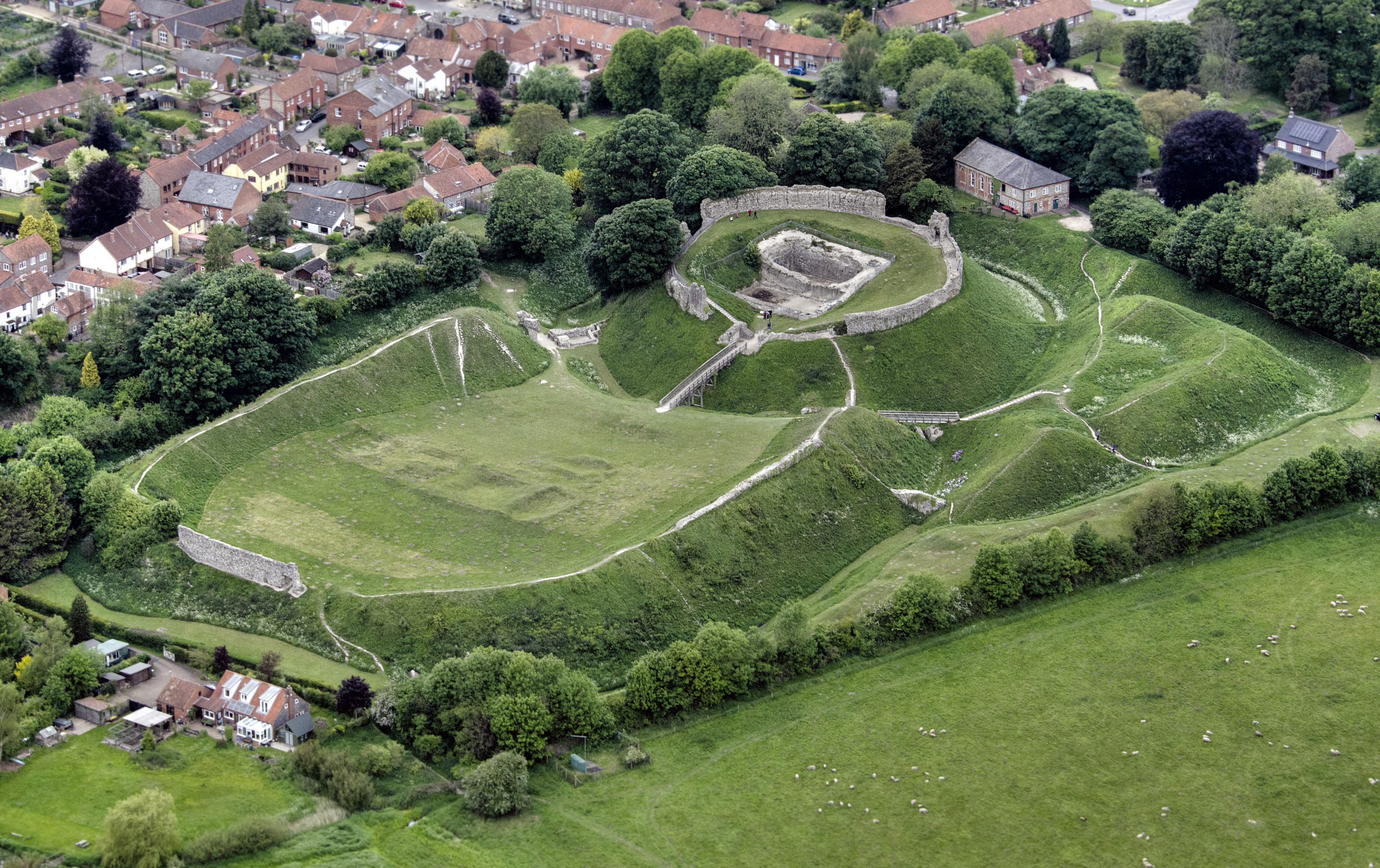
Castle Acre Castle and town walls
Castle Acre Castle and town walls are a set of ruined medieval defences built in the village of Castle Acre, Norfolk. The castle was built soon after the...

Castle Acre
Castle Acre is a village and civil parish in the English county of Norfolk. The village is situated on the River Nar some 4 miles (6.4 km) north of the...
Nearby Amenities
Located within 500m of 52.736208,0.69968882Have you been to Norwich Plantations?
Leave your review of Norwich Plantations below (or comments, questions and feedback).