West Rudham Common

Wood, Forest in Norfolk King's Lynn and West Norfolk

England

West Rudham Common

East and West Rudham: aerial 2015
East and West Rudham: aerial 2015 Credit: Chris

West Rudham Common is a picturesque woodland area located in the county of Norfolk, England. Covering an area of approximately 50 acres, it is a popular destination for nature enthusiasts and outdoor enthusiasts alike.

The common is characterized by its dense and diverse woodland, predominantly consisting of traditional broadleaf trees such as oak, beech, and birch. These trees create a lush and vibrant canopy, providing habitat for a wide variety of wildlife. The forest floor is adorned with an array of wildflowers, adding to the area's natural beauty.

Tranquil and peaceful, West Rudham Common offers visitors the chance to escape the hustle and bustle of everyday life. It boasts a network of well-maintained walking trails, allowing visitors to explore the area at their own pace. These trails wind through the woodland, offering glimpses of the local wildlife, including deer, foxes, and an abundance of bird species.

In addition to its natural beauty, West Rudham Common also holds historical significance. It was once part of the extensive royal hunting grounds during the medieval period, and remnants of this history can still be found in the form of ancient ditches and earthworks.

Overall, West Rudham Common is a haven for nature lovers, offering a serene environment to relax, explore, and appreciate the beauty of Norfolk's woodlands. Whether it's a leisurely stroll through the forest or a birdwatching adventure, this charming common provides a delightful escape into nature.

If you have any feedback on the listing, please let us know in the comments section below.

West Rudham Common Images

Images are sourced within 2km of 52.817593/0.70295115 or Grid Reference TF8227. Thanks to Geograph Open Source API. All images are credited.

East and West Rudham: aerial 2015
East and West Rudham War Memorial The brass memorial hangs in East Rudham church but has the names of 29 men who were lost from both villages in WW1. 
A further ten names relate to WW2 encompassing both parishes.
East and West Rudham War Memorial
The brass memorial hangs in East Rudham church but has the names of 29 men who were lost from both villages in WW1. A further ten names relate to WW2 encompassing both parishes.
Back Lane, West Rudham An old part of the village, the road is still little more than a rough track.
Back Lane, West Rudham
An old part of the village, the road is still little more than a rough track.
West Rudham: aerial 2017 View to Houghton Park and the Wash.
West Rudham: aerial 2017
View to Houghton Park and the Wash.
East Rudham Village Sign East Rudham is a village on the A148, King's Lynn to Cromer road, about 6 miles west of Fakenham.
The village sign is located at the western end of the village green.
East Rudham Village Sign
East Rudham is a village on the A148, King's Lynn to Cromer road, about 6 miles west of Fakenham. The village sign is located at the western end of the village green.
East Rudham Village Green Looking east along the village green with the A148, King's Lynn to Cromer road, to the left of the village green.
East Rudham Village Green
Looking east along the village green with the A148, King's Lynn to Cromer road, to the left of the village green.
West Rudham Village Sign and Village Green Looking east along the village green with the A148, King's Lynn to Cromer road, to the left of the green.
West Rudham Village Sign and Village Green
Looking east along the village green with the A148, King's Lynn to Cromer road, to the left of the green.
The Duke's Head West Rudham Built in 1663 and still serving pints.
<a title="https://www.geograph.org.uk/photo/5616155" href="https://www.geograph.org.uk/photo/5616155">Link</a>
The Duke's Head West Rudham
Built in 1663 and still serving pints. Link
Hanging sign for 'The Duke's Head' West Rudham <a title="https://www.geograph.org.uk/photo/5616152" href="https://www.geograph.org.uk/photo/5616152">Link</a>
Hanging sign for 'The Duke's Head' West Rudham
Lynn Road, West Rudham
Hall Farm Barn on School Road, West Rudham
East Rudham cemetery On the outskirts of the village.
East Rudham cemetery
On the outskirts of the village.
Old Milestone by the A148, East Rudham Carved stone post by the A148, in parish of EAST RUDHAM (KINGS LYNN AND WEST NORFOLK District), 80yds East of junction with Eye Lane, at rear of wide verge, on South side of road. Wells stone, erected by the Wells to Fakenham turnpike trust in the 20th century. 

Inscription reads:-
: TO / LYNN / 15 : : E. RUDHAM : : TO / FAKENHAM / 6 :

Norfolk HER listed.  
NHER Number: 56750 <span class="nowrap"><a title="https://www.heritagegateway.org.uk/Gateway/Results_Single.aspx?uid=MNF63161&resourceID=1002" rel="nofollow ugc noopener" href="https://www.heritagegateway.org.uk/Gateway/Results_Single.aspx?uid=MNF63161&resourceID=1002">Link</a><img style="margin-left:2px;" alt="External link" title="External link - shift click to open in new window" src="https://s1.geograph.org.uk/img/external.png" width="10" height="10"/></span>

Milestone Society National ID: NO_FKL06.
Old Milestone by the A148, East Rudham
Carved stone post by the A148, in parish of EAST RUDHAM (KINGS LYNN AND WEST NORFOLK District), 80yds East of junction with Eye Lane, at rear of wide verge, on South side of road. Wells stone, erected by the Wells to Fakenham turnpike trust in the 20th century. Inscription reads:- : TO / LYNN / 15 : : E. RUDHAM : : TO / FAKENHAM / 6 : Norfolk HER listed. NHER Number: 56750 LinkExternal link Milestone Society National ID: NO_FKL06.
Old Milestone by the A148, West Rudham Carved stone post by the A148, in parish of West Rudham (Kings Lynn and West Norfolk District), opposite drive between "Rosedean" and "Albion House", at edge of village green about 1ft from edge of road, on South side of road. Wells stone, erected by the Wells to Fakenham turnpike trust in the 20th century. 

Inscription reads:-
: TO / LYNN / 14 : : W RUDHAM : : TO / FAKENHAM / 7 :

Norfolk HER.
NHER Number: 56751 <span class="nowrap"><a title="https://www.heritagegateway.org.uk/Gateway/Results_Single.aspx?uid=MNF63162&resourceID=1002" rel="nofollow ugc noopener" href="https://www.heritagegateway.org.uk/Gateway/Results_Single.aspx?uid=MNF63162&resourceID=1002">Link</a><img style="margin-left:2px;" alt="External link" title="External link - shift click to open in new window" src="https://s1.geograph.org.uk/img/external.png" width="10" height="10"/></span>  

Milestone Society National ID: NO_FKL07
Old Milestone by the A148, West Rudham
Carved stone post by the A148, in parish of West Rudham (Kings Lynn and West Norfolk District), opposite drive between "Rosedean" and "Albion House", at edge of village green about 1ft from edge of road, on South side of road. Wells stone, erected by the Wells to Fakenham turnpike trust in the 20th century. Inscription reads:- : TO / LYNN / 14 : : W RUDHAM : : TO / FAKENHAM / 7 : Norfolk HER. NHER Number: 56751 LinkExternal link Milestone Society National ID: NO_FKL07
Old Milestone by the A148, West Rudham parish Carved stone post by the A148, in parish of West Rudham (Kings Lynn and West Norfolk District), 300yds West of crosstracks, on the verge, backed by field, on South side of road. Wells stone, erected by the Wells to Fakenham turnpike trust in the 20th century. 

Inscription reads:-
: TO / LYNN / 13 : : (W) RUDHAM : : TO / FAKENHAM / 8 :
Carved benchmark on top.

Norfolk HER.
NHER Number: 56752 <span class="nowrap"><a title="https://www.heritagegateway.org.uk/Gateway/Results_Single.aspx?uid=MNF63163&resourceID=1002" rel="nofollow ugc noopener" href="https://www.heritagegateway.org.uk/Gateway/Results_Single.aspx?uid=MNF63163&resourceID=1002">Link</a><img style="margin-left:2px;" alt="External link" title="External link - shift click to open in new window" src="https://s1.geograph.org.uk/img/external.png" width="10" height="10"/></span>

Milestone Society National ID: NO_FKL08
Old Milestone by the A148, West Rudham parish
Carved stone post by the A148, in parish of West Rudham (Kings Lynn and West Norfolk District), 300yds West of crosstracks, on the verge, backed by field, on South side of road. Wells stone, erected by the Wells to Fakenham turnpike trust in the 20th century. Inscription reads:- : TO / LYNN / 13 : : (W) RUDHAM : : TO / FAKENHAM / 8 : Carved benchmark on top. Norfolk HER. NHER Number: 56752 LinkExternal link Milestone Society National ID: NO_FKL08
Approaching  East  Rudham  on  the  A148 Westbound toward Kings Lynn
Approaching East Rudham on the A148
Westbound toward Kings Lynn
Entering  East  Rudham  on  the  A148 Toward Kings Lynn
Entering East Rudham on the A148
Toward Kings Lynn
Road  junction  in  village  street  East  Rudham The main road through is the A148. Up to the junction it is Fakenham Road after the junction it is Lynn Road. The minor road going left is Station Road to West Raynham
Road junction in village street East Rudham
The main road through is the A148. Up to the junction it is Fakenham Road after the junction it is Lynn Road. The minor road going left is Station Road to West Raynham
Show me another place!

West Rudham Common is located at Grid Ref: TF8227 (Lat: 52.817593, Lng: 0.70295115)

Administrative County: Norfolk

District: King's Lynn and West Norfolk

Police Authority: Norfolk

What 3 Words

///bars.skirting.cocktail. Near Fakenham, Norfolk

Nearby Locations

West Rudham Common

Related Wikis

West Rudham

West Rudham is a civil parish in the English county of Norfolk. The village straddles the A148 King's Lynn to Cromer road. It covers an area of 11.81 km2...

Coxford, Norfolk

Coxford is a village in the English county of Norfolk. The village is on the south side of the A 148 King's Lynn to Cromer road. The River Tat, which...
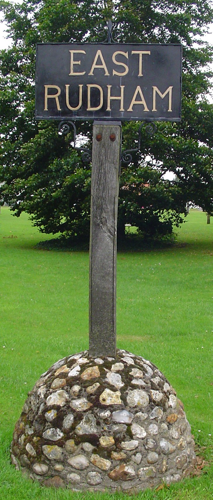
East Rudham

East Rudham is a village and civil parish in the English county of Norfolk. The village is located 14 miles (23 km) north-east of King's Lynn and 28 miles...

Broomsthorpe

Broomsthorpe is a place and former civil parish, now in the parish of East Rudham, in the King's Lynn and West Norfolk district, in the English county...

Nearby Amenities

Located within 500m of 52.817593,0.70295115
Bus Stop
Groveside, opp
Kerb: raised
Naptan AtcoCode: 2900R1810
Naptan Bearing: W
Naptan CommonName: Groveside
Naptan Indicator: opp
Naptan Landmark: Groveside
Naptan Locality: East Rudham
Naptan NaptanCode: nfodpmpg
Naptan Street: Lynn Road
Naptan Verified: no
Shelter: no
Source: naptan_import
Tactile Paving: yes
Lat/Long: 52.8191329/0.7027398
Groveside, adj
Naptan AtcoCode: 2900R189
Naptan Bearing: E
Naptan BusStopType: CUS
Naptan CommonName: Groveside
Naptan Indicator: adj
Naptan Landmark: Groveside
Naptan Locality: East Rudham
Naptan NaptanCode: nfodpmtm
Naptan ShortCommonName: Groveside
Naptan Street: Lynn Road
Naptan Verified: no
Shelter: yes
Source: naptan_import
Lat/Long: 52.8192933/0.7031383
West Rudham
Place: hamlet
Lat/Long: 52.8175671/0.6997921
Crossing
Crossing: unmarked
Crossing Island: no
Tactile Paving: no
Lat/Long: 52.8193706/0.7032304
Power: pole
Lat/Long: 52.8192317/0.7048604
Power: pole
Lat/Long: 52.8198963/0.7051447
Power: pole
Lat/Long: 52.820616/0.705421
Power: pole
Lat/Long: 52.8212578/0.7051045
Entrance: main
Lat/Long: 52.8155312/0.6984727
Give Way
Lat/Long: 52.819581/0.7084197
Power: pole
Lat/Long: 52.8137558/0.7023713
Power: pole
Lat/Long: 52.813845/0.7040021
Power: pole
Lat/Long: 52.8139455/0.7058367
Power: pole
Lat/Long: 52.8136407/0.7003838
Power: pole
Lat/Long: 52.8178932/0.6975353
Power: pole
Lat/Long: 52.8172652/0.6967369
Power: pole
Lat/Long: 52.8165933/0.6958853
East Rudham
Colour: black
Man Made: village_sign
Material: metal
Lat/Long: 52.8196819/0.7086101
Give Way
Lat/Long: 52.8194735/0.7081192
Give Way
Lat/Long: 52.8195366/0.7080567
Give Way
Lat/Long: 52.8196102/0.708307
Board Type: notice
Information: board
Tourism: information
Lat/Long: 52.8190461/0.6975199
Give Way
Lat/Long: 52.8192456/0.7032699
Post Box
Operator: Royal Mail
Operator Wikidata: Q638098
Post Box Mounting: concrete_post
Post Box Type: lamp
Royal Cypher: EIIR
Royal Cypher Wikidata: Q33102113
Lat/Long: 52.8194048/0.703313
The data included in this document is from www.openstreetmap.org. The data is made available under ODbL.

Have you been to West Rudham Common?

Leave your review of West Rudham Common below (or comments, questions and feedback).