Yaugher Woods

Wood, Forest in Kent Swale

England

Yaugher Woods

Hartlip War Memorial
Hartlip War Memorial Credit: Chris Whippet

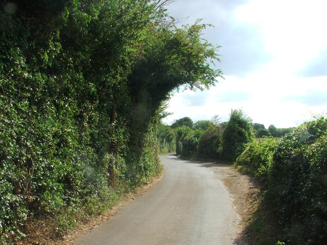
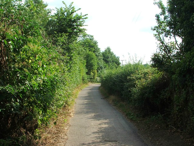
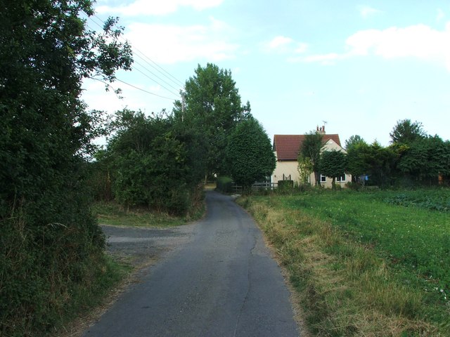
Yaugher Woods, located in Kent, England, is a picturesque woodland area that spans across a vast expanse of approximately 300 acres. Situated in the southeastern part of the county, this woodland is known for its diverse range of flora and fauna, offering visitors an immersive experience in nature.

The woods are predominantly composed of deciduous trees, including oak, beech, and ash, which provide a lush canopy of greenery throughout the year. The forest floor is adorned with an array of wildflowers, creating a vibrant and colorful landscape. It is also home to a variety of wildlife, such as deer, foxes, badgers, and numerous bird species, making it a haven for nature enthusiasts and wildlife photographers.

A network of well-maintained walking trails winds its way through Yaugher Woods, allowing visitors to explore its beauty at their own pace. These trails vary in length and difficulty, catering to both casual strollers and more adventurous hikers. Along the way, there are several designated picnic areas where visitors can take a break and enjoy a meal amidst the serenity of the woods.

Yaugher Woods is not only renowned for its natural beauty but also for its historical significance. The area contains remnants of ancient earthworks and burial mounds, dating back to the Iron Age, providing a glimpse into the region's rich past.

Overall, Yaugher Woods in Kent is a magnificent woodland destination that offers a harmonious blend of natural splendor, wildlife diversity, and historical intrigue. Whether one seeks a peaceful stroll, a wildlife encounter, or a journey into the past, this enchanting forest provides an idyllic setting for all.

If you have any feedback on the listing, please let us know in the comments section below.

Yaugher Woods Images

Images are sourced within 2km of 51.340105/0.61376736 or Grid Reference TQ8263. Thanks to Geograph Open Source API. All images are credited.

Hartlip War Memorial
Hollow Lane, Hartlip
Mount Lane, Hartlip
Mount Lane, Hartlip
Warren Lane, near Hartlip
Place Lane, Hartlip
Place Lane, Hartlip
Dane Lane, Hartlip
Dane Lane, Hartlip
Yaugher Lane, near Hartlip
Spade Lane, near Hartlip
Meresborough Lane, near Rainham
South Bush Lane, near Rainham
Meresborough Road, Meresborough
Parker Close, Park Wood
Barlow Close, Park Wood
Goldsmith Road, Park Wood
Sinclair Close, Park Wood
Cragie Walk, Park Wood
Style Close, Park Wood
Lyall Way, Park Wood
Show me another place!

Yaugher Woods is located at Grid Ref: TQ8263 (Lat: 51.340105, Lng: 0.61376736)

Administrative County: Kent

District: Swale

Police Authority: Kent

What 3 Words

///glassware.rezoning.ranged. Near Rainham, Kent

Related Wikis

Medway services

Medway is a service area on the M2 motorway south of Medway, near Junction 4 in Kent, southeast England. It is managed by Moto and was previously named...

Queendown Warren

Queendown Warren is a 22.2-hectare (55-acre) biological Site of Special Scientific Interest south-east of Rainham in Kent. It is a Local Nature Reserve...

Yelsted

Yelsted is a hamlet in the Borough of Maidstone, in the county of Kent, England. In 1800, Edward Hasted noted that it was spelt Gillested. It was a manor...

Park Wood, Medway

Park Wood or Parkwood is a housing estate and district in Gillingham at the south-eastern corner of the Medway conurbation in Kent, England. It was built...

Purple Hill

Purple Hill is a 14.9-hectare (37-acre) biological Site of Special Scientific Interest south of Gillingham in Kent. It is a Nature Conservation Review...

Foxburrow Wood

Foxburrow Wood is a 6.1-hectare (15-acre) Local Nature Reserve in Rainham in Kent. It is owned and managed by Medway Council.This is a remnant of a much...

Levan Strice

Levan Strice is a 2.8-hectare (6.9-acre) Local Nature Reserve in Wigmore in Kent. It consists mostly of woodland with public access trails. It is owned...

Wigmore, Kent

Wigmore is a village in the southeast of Medway in Kent, England. It lies opposite Hempstead to the east and Rainham to the north east. == History == The...

Nearby Amenities

Located within 500m of 51.340105,0.61376736
Post Box
Collection Plate: CP8D
Collection Times: Mo-Fr 09:00; Sa 07:00
Old Ref: ME8 381
Operator: Royal Mail
Operator Wikidata: Q638098
Post Box Type: pillar
Postal Code: ME8
Ref: ME8 381D
Royal Cypher: EIIR
Royal Cypher Wikidata: Q33102113
Source: survey
Survey Date: 2023-03-14
Lat/Long: 51.3415853/0.6076631
Motorway Junction
Medway Services
Lat/Long: 51.341998/0.6144912
Toilets
Check Date: 2022-01-07
Fee: no
Lat/Long: 51.3416831/0.6081104
The North Downs Reserve
Addr Street: Matt's Hill Lane
Lat/Long: 51.3390071/0.6130259
Fuel
Addr City: Rainham
Addr Place: Farthing Corner Motorway Services A
Addr Postcode: ME8 8PW
Brand: BP
Fhrs Id: 786143
Fuel GTL Diesel: yes
Fuel Diesel: yes
Fuel Lpg: yes
Fuel Octane 100: yes
Fuel Octane 95: yes
Source Addr: FHRS Open Data
Lat/Long: 51.340282/0.6071623
Bus Stop
Medway Services
Bus: yes
Local Ref: E-bound
Naptan AtcoCode: 249097362
Naptan Bearing: E
Naptan BusStopType: CUS
Naptan CommonName: Medway Services
Naptan Indicator: E-bound
Naptan Landmark: Service Station
Naptan NaptanCode: chajtpj
Naptan RevisionNumber: 7
Naptan Status: act
Naptan Street: Medway Services
Naptan Verified: no
Public Transport: platform
Ref: chajtpj
Source: naptan_import
Source Date: 2018-08-29
Lat/Long: 51.3415183/0.6073429
Power: tower
Lat/Long: 51.3381069/0.6084797
Power: tower
Lat/Long: 51.3397103/0.6116532
Power: tower
Lat/Long: 51.3414875/0.6151051
Power: tower
Lat/Long: 51.3431465/0.6182229
Crossing
Crossing: uncontrolled
Crossing Island: no
Lat/Long: 51.3407874/0.6083667
Crossing
Crossing: marked
Crossing Markings: yes
Tactile Paving: no
Lat/Long: 51.3417107/0.6076671
Crossing
Crossing: uncontrolled
Crossing Island: no
Lat/Long: 51.3408904/0.6081092
Fuel
Addr City: Rainham
Addr Place: Farthing Corner Motorway Services A
Addr Postcode: ME8 8PW
Brand: BP
Fhrs Id: 786142
Fuel GTL Diesel: yes
Fuel Diesel: yes
Fuel Lpg: yes
Fuel Octane 100: yes
Fuel Octane 95: yes
Source Addr: FHRS Open Data
Lat/Long: 51.3422024/0.6090063
Charging Station
Contact Website: https://electrichighway.gridserve.com/medway-westbound
Fee: yes
Operator: Gridserve
Operator Wikidata: Q89575318
Lat/Long: 51.3407402/0.6082506
Fee: yes
Man Made: charging_station
Operator: Gridserve
Operator Wikidata: Q89575318
Lat/Long: 51.3419373/0.6077282
Fee: yes
Man Made: charging_station
Operator: Gridserve
Operator Wikidata: Q89575318
Lat/Long: 51.3419922/0.6077021
Entrance: main
Lat/Long: 51.3410973/0.6083872
Barrier: bollard
Lat/Long: 51.3410892/0.608406
Crossing
Crossing: uncontrolled
Crossing Island: no
Lat/Long: 51.3409535/0.6084597
Crossing
Crossing: uncontrolled
Crossing Island: no
Lat/Long: 51.3408429/0.6085149
WHSmith
Addr City: Rainham
Addr Place: Farthing Corner Motorway Services A
Addr Postcode: ME8 8PW
Brand: WHSmith
Brand Wikidata: Q1548712
Brand Wikipedia: en:WHSmith
Fhrs Id: 732146
Shop: newsagent
Source Addr: FHRS Open Data
Lat/Long: 51.3410709/0.6080075
Fast Food
Burger King
Addr City: Rainham
Addr Place: Farthing Corner Motorway Services A
Addr Postcode: ME8 8PQ
Brand: Burger King
Brand Wikidata: Q177054
Brand Wikipedia: en:Burger King
Cuisine: burger
Fhrs Id: 683384
Source Addr: FHRS Open Data
Takeaway: yes
Lat/Long: 51.3412921/0.6080544
Fast Food
Greggs
Addr City: Rainham
Addr Place: Farthing Corner Motorway Services A
Addr Postcode: ME8 8PQ
Brand: Greggs
Brand Wikidata: Q3403981
Brand Wikipedia: en:Greggs
Contact Website: https://www.greggs.co.uk/shop-finder?shop-code=2264
Cuisine: sandwich;bakery
Fhrs Id: 683400
Opening Hours: Mo-Fr 05:00-17:00; Sa,Su 06:00-17:00
Source Addr: FHRS Open Data
Takeaway: yes
Lat/Long: 51.3414714/0.6079069
Cafe
Costa
Addr City: Rainham
Addr Place: Farthing Corner Motorway Services A
Addr Postcode: ME8 8PQ
Brand: Costa
Brand Wikidata: Q608845
Brand Wikipedia: en:Costa Coffee
Cuisine: coffee_shop
Fhrs Id: 683387
Opening Hours: Mo-Su 00:00-24:00
Source Addr: FHRS Open Data
Takeaway: yes
Lat/Long: 51.3415015/0.6083052
M&S Simply Food
Addr City: Rainham
Addr Place: Farthing Corner Motorway Services A
Addr Postcode: ME8 8PQ
Brand: M&S Simply Food
Brand Wikidata: Q714491
Brand Wikipedia: en:Marks & Spencer
Opening Hours: Mo-Su 07:00-22:00
Shop: supermarket
Website: https://www.marksandspencer.com/stores/medway-moto-1185
Lat/Long: 51.3416699/0.6082543
Noexit: yes
Lat/Long: 51.3418241/0.6079512
Bus Stop
Medway Services
Bus: yes
Local Ref: W-bound
Naptan AtcoCode: 2490101042
Naptan Bearing: W
Naptan BusStopType: CUS
Naptan CommonName: Medway Services
Naptan Indicator: W-bound
Naptan Landmark: Medway Services
Naptan NaptanCode: chajwpw
Naptan RevisionNumber: 1
Naptan Status: act
Naptan Street: Medway Services
Naptan Verified: no
Public Transport: platform
Ref: chajwpw
Source: naptan_import
Source Date: 2018-08-29
Lat/Long: 51.3410623/0.6086479
Entrance: main
Lat/Long: 51.341632/0.6077978
Barrier: bollard
Lat/Long: 51.3416738/0.6076853
Crossing
Crossing: uncontrolled
Crossing Island: no
Lat/Long: 51.3408205/0.6096004
Crossing
Crossing: uncontrolled
Crossing Island: no
Lat/Long: 51.3407848/0.6093647
Crossing
Crossing: uncontrolled
Crossing Island: no
Tactile Paving: no
Lat/Long: 51.340749/0.6091287
Crossing
Crossing: uncontrolled
Crossing Island: no
Tactile Paving: no
Lat/Long: 51.3407101/0.6088717
Crossing
Crossing: uncontrolled
Crossing Island: no
Lat/Long: 51.340825/0.6085815
Defibrillator
Access: yes
Defibrillator Location: On wall just beyond and opposite toilets, coastbound side of services
Emergency: defibrillator
Indoor: yes
Level: 0
Lat/Long: 51.3417031/0.6081466
Parcel Locker
glossy
Colour: blue
Operator: Amazon
Lat/Long: 51.3414378/0.6078503
Charging Station
Contact Website: https://electrichighway.gridserve.com/medway-eastbound
Fee: yes
Operator: Gridserve
Operator Wikidata: Q89575318
Lat/Long: 51.3419671/0.6077161
Charging Station
Operator: Tesla
Lat/Long: 51.3405554/0.6086036
Fee: yes
Man Made: charge_point
Operator: Tesla
Lat/Long: 51.3405016/0.6085909
Fee: yes
Man Made: charge_point
Operator: Tesla
Lat/Long: 51.3405261/0.6085808
Fee: yes
Man Made: charge_point
Operator: Tesla
Lat/Long: 51.3405507/0.6085708
Fee: yes
Man Made: charge_point
Operator: Tesla
Lat/Long: 51.3405752/0.6085607
Fee: yes
Man Made: charge_point
Operator: Tesla
Lat/Long: 51.3405998/0.6085506
Fee: yes
Man Made: charge_point
Operator: Tesla
Lat/Long: 51.340511/0.6086536
Fee: yes
Man Made: charge_point
Operator: Tesla
Lat/Long: 51.3405356/0.6086435
Fee: yes
Man Made: charge_point
Operator: Tesla
Lat/Long: 51.3405601/0.6086335
Fee: yes
Man Made: charge_point
Operator: Tesla
Lat/Long: 51.3405847/0.6086234
Fee: yes
Man Made: charge_point
Operator: Tesla
Lat/Long: 51.3406092/0.6086133
Fee: yes
Man Made: charge_point
Operator: Tesla
Lat/Long: 51.3406338/0.6086033
Leisure: picnic_table
Lat/Long: 51.3411399/0.6084149
Leisure: picnic_table
Lat/Long: 51.3411717/0.6084511
Leisure: picnic_table
Lat/Long: 51.3411424/0.6085256
Leisure: picnic_table
Lat/Long: 51.3410854/0.608722
Leisure: picnic_table
Lat/Long: 51.3414377/0.6077927
Leisure: picnic_table
Lat/Long: 51.3414059/0.6078175
Building: bunker
Military: bunker
Lat/Long: 51.3366529/0.6133907
The data included in this document is from www.openstreetmap.org. The data is made available under ODbL.

Have you been to Yaugher Woods?

Leave your review of Yaugher Woods below (or comments, questions and feedback).