Cobble Hill Plantation

Wood, Forest in Norfolk King's Lynn and West Norfolk

England

Cobble Hill Plantation

B1155 north of Muckton Towards Burnham Market.
B1155 north of Muckton Credit: J.Hannan-Briggs

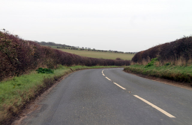
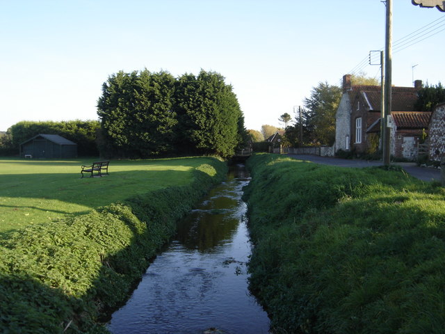
Cobble Hill Plantation, located in Norfolk, is a picturesque woodland area known for its diverse range of plant and animal species. Spread across a vast expanse, this plantation is a thriving ecosystem that offers a serene and natural environment for visitors to explore.

The main feature of Cobble Hill Plantation is its dense forest cover, which is dominated by a mix of deciduous and coniferous trees. The woodland is home to a variety of tree species, including oaks, pines, maples, and beeches. The forest floor is carpeted with moss, ferns, and wildflowers, creating a vibrant and colorful landscape.

The plantation is known for its rich wildlife, with numerous animal species inhabiting the area. Visitors may encounter white-tailed deer, squirrels, rabbits, and various species of birds, such as cardinals, blue jays, and woodpeckers. The forest also supports a diverse range of insects and reptiles, contributing to the overall biodiversity of the area.

Cobble Hill Plantation offers several trails and walking paths, allowing visitors to immerse themselves in the natural beauty of the woodland. These trails provide opportunities for hiking, birdwatching, and photography. Additionally, the plantation is equipped with picnic areas and benches, providing visitors with a chance to relax and enjoy the tranquility of the surroundings.

Overall, Cobble Hill Plantation in Norfolk is a stunning woodland area that showcases the beauty of nature. With its diverse range of plant and animal life, it offers visitors a chance to experience the wonders of a thriving ecosystem.

If you have any feedback on the listing, please let us know in the comments section below.

Cobble Hill Plantation Images

Images are sourced within 2km of 52.937299/0.70281819 or Grid Reference TF8141. Thanks to Geograph Open Source API. All images are credited.

B1155 north of Muckton Towards Burnham Market.
B1155 north of Muckton
Towards Burnham Market.
St Ethelbert’s Church ruins <a href="https://www.geograph.org.uk/photo/2047694">TF8341 : The ruins of St Ethelbert's church in Burnham Sutton</a> gives useful information about this site. The church was dedicated to St Ethelbert, an 8th century king of East Anglia.
St Ethelbert’s Church ruins
TF8341 : The ruins of St Ethelbert's church in Burnham Sutton gives useful information about this site. The church was dedicated to St Ethelbert, an 8th century king of East Anglia.
Village sign, Burnham Market This village sign has been combined with a four-sided bench, where you can rest after buying books, delicatessen goods and green wellies, all of which can be purchased in the eponymous Market Place. Behind the sign the former Grooms Bakery is now Bombay Sprout <span class="nowrap"><a title="https://bombaysprout.com/" rel="nofollow ugc noopener" href="https://bombaysprout.com/">Link</a><img style="margin-left:2px;" alt="External link" title="External link - shift click to open in new window" src="https://s1.geograph.org.uk/img/external.png" width="10" height="10"/></span> and Aurina <span class="nowrap"><a title="https://burnhammarket.co.uk/aurina/" rel="nofollow ugc noopener" href="https://burnhammarket.co.uk/aurina/">Link</a><img style="margin-left:2px;" alt="External link" title="External link - shift click to open in new window" src="https://s1.geograph.org.uk/img/external.png" width="10" height="10"/></span> , both homewares shops.
Village sign, Burnham Market
This village sign has been combined with a four-sided bench, where you can rest after buying books, delicatessen goods and green wellies, all of which can be purchased in the eponymous Market Place. Behind the sign the former Grooms Bakery is now Bombay Sprout LinkExternal link and Aurina LinkExternal link , both homewares shops.
New housing development at Burnham Market
St Mary's Church, Burnham Market Parish church of Burnham Westgate. Largely C14, with a heavy restoration
of 1872 accounting for most exterior details. Flint with stone dressings. Listed Grade 1
St Mary's Church, Burnham Market
Parish church of Burnham Westgate. Largely C14, with a heavy restoration of 1872 accounting for most exterior details. Flint with stone dressings. Listed Grade 1
Houses on The Green, Burnham Market
The Hoste Arms, Burnham Market Grade II listed public house on The Green
The Hoste Arms, Burnham Market
Grade II listed public house on The Green
Playing fields, Burnham Market
Methodist Church, Burnham Market On Station Road
Methodist Church, Burnham Market
On Station Road
Graveyard, St Mary's Church
Young barley shimmering near Muckleton Farm
B1155 leaves Muckleton south down hill towards Burnham Market Muckleton is a hamlet of, perhaps, five or six houses and a farm.  It proudly displays its status with signs besides the road on the way in and way out.
B1155 leaves Muckleton south down hill towards Burnham Market
Muckleton is a hamlet of, perhaps, five or six houses and a farm. It proudly displays its status with signs besides the road on the way in and way out.
Copse in wheat crop field
Sussex Farm entrance
Farm track Heading away from Sussex Farm.
Farm track
Heading away from Sussex Farm.
'Norfolk Living', Burnham Market The rear display area of this lifestyle emporium, an intriguing mix of objets (of desire? d'Art?) a cipher for the pretensions of the area's residents and tourists like us.
'Norfolk Living', Burnham Market
The rear display area of this lifestyle emporium, an intriguing mix of objets (of desire? d'Art?) a cipher for the pretensions of the area's residents and tourists like us.
Burnham Market Pictorial village sign and colourful buildings containing shops on the market place.
Burnham Market
Pictorial village sign and colourful buildings containing shops on the market place.
Burnham Market Parish Church Westgate St Mary at the west end of the long and wide market place.
<span class="nowrap"><a title="www.burnhammarket.com" rel="nofollow ugc noopener" href="http://www.burnhammarket.com">Link</a><img style="margin-left:2px;" alt="External link" title="External link - shift click to open in new window" src="https://s1.geograph.org.uk/img/external.png" width="10" height="10"/></span>
Burnham Market Parish Church
Westgate St Mary at the west end of the long and wide market place. LinkExternal link
Show me another place!

Cobble Hill Plantation is located at Grid Ref: TF8141 (Lat: 52.937299, Lng: 0.70281819)

Administrative County: Norfolk

District: King's Lynn and West Norfolk

Police Authority: Norfolk

What 3 Words

///goodnight.nods.diamond. Near Wells-next-the-Sea, Norfolk

Related Wikis

Burnham Westgate Hall

Burnham Westgate Hall is a Georgian country house near Burnham Market, Norfolk, about 2 mi (3.2 km) south of the north Norfolk coast. It was remodelled...

Burnham Market railway station

Burnham Market was a railway station which served the village of Burnham Market in Norfolk, England. Opened by the West Norfolk Junction railway in 1866...
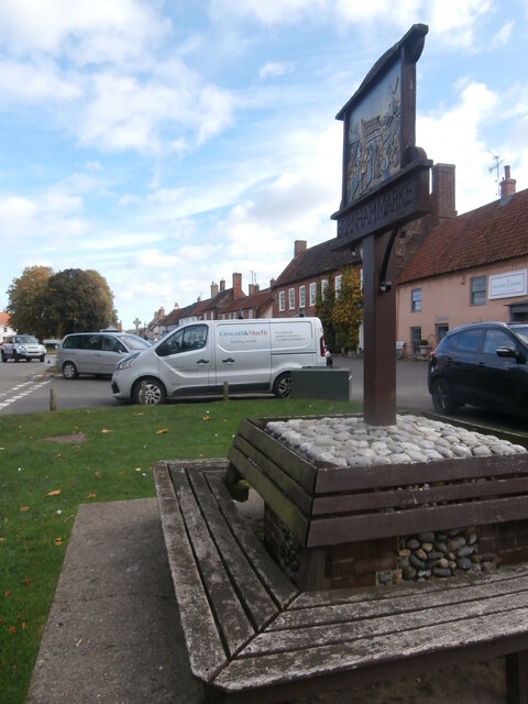
Burnham Market

Burnham Market is an English village and civil parish near the north coast of Norfolk. It is one of the Burnhams, a group of three adjacent villages that...

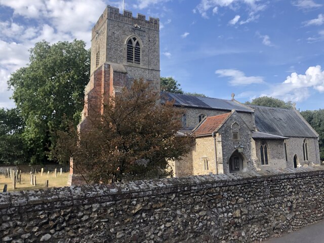
St Margaret's Church, Burnham Norton

St Margaret's Church is a round-tower church in Burnham Norton, Norfolk, England. Likely to have been built in the 11th century, the building retains many...

Burnham Norton Friary

Burnham Norton Friary was a Carmelite (White Friars) friary near Burnham Market in Norfolk, England. It is now a ruin. The friary was founded by Sir William...

Burnham Norton

Burnham Norton is a village and civil parish in the English county of Norfolk, one of the Burnhams, an adjacent group in the northernmost part of Norfolk...

Norfolk Burnhams

The Norfolk Burnhams are a group of adjacent villages on the north coast of Norfolk, England. The villages are located near a large natural bay named Brancaster...

River Burn, Norfolk

The River Burn (also known as "Nelsons River") is a river in the northwest of the County of Norfolk, in the East of England. From its source to its mouth...

Nearby Amenities

Located within 500m of 52.937299,0.70281819
Chalk Hill Farm
Place: farm
Lat/Long: 52.940335/0.7046697
Pagets Farm
Place: farm
Lat/Long: 52.9360963/0.7076973
The data included in this document is from www.openstreetmap.org. The data is made available under ODbL.

Have you been to Cobble Hill Plantation?

Leave your review of Cobble Hill Plantation below (or comments, questions and feedback).