Zigzag Covert

Wood, Forest in Norfolk Breckland

England

Zigzag Covert

Paddock at Lynford Arboretum The best place to see Hawfinch in the Brecks, see <a href="https://www.geograph.org.uk/photo/1036176">TL8293 : Hawfinch (Coccothraustes coccothraustes)</a>
Paddock at Lynford Arboretum Credit: Hugh Venables

Zigzag Covert, located in Norfolk, England, is a picturesque woodland area known for its natural beauty and diverse ecosystem. Spanning over a vast area, it is part of the wider Norfolk Broads National Park, making it an important conservation site.

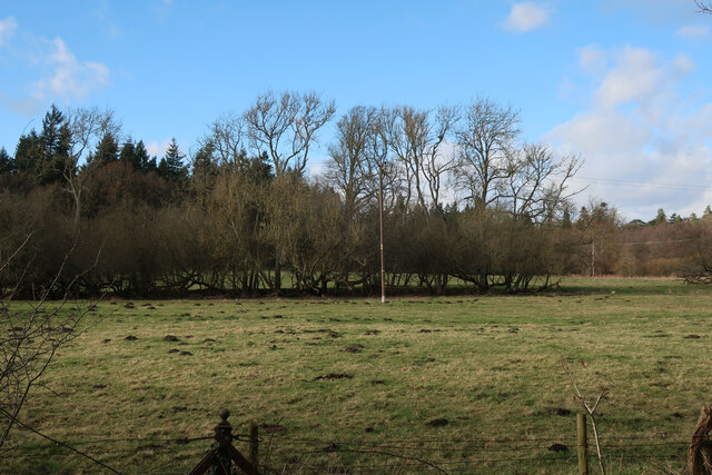
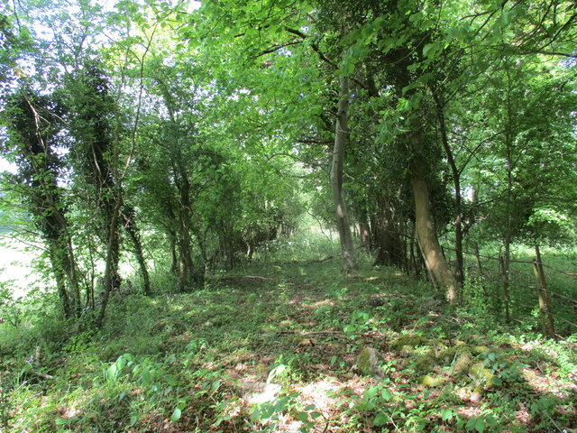
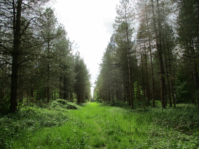
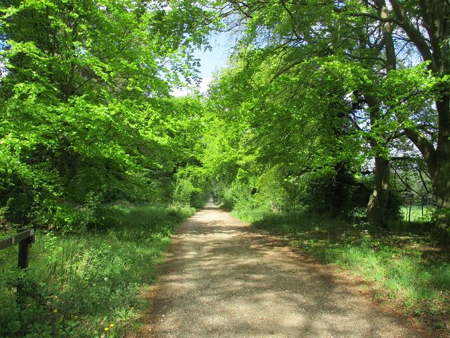
The woodland in Zigzag Covert is primarily composed of deciduous trees, including oak, beech, and birch, which provide a rich habitat for a variety of flora and fauna. The forest floor is covered with a lush carpet of ferns, mosses, and wildflowers, creating a vibrant and enchanting atmosphere.

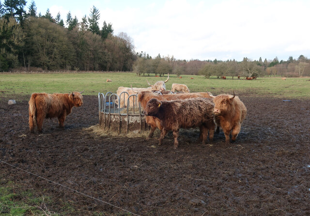
The area is home to a wide range of wildlife, including several species of birds, such as woodpeckers, owls, and warblers, which can be heard singing their melodious tunes throughout the day. Mammals like deer, foxes, and squirrels can often be spotted foraging in the undergrowth, adding to the natural charm of the woodland.

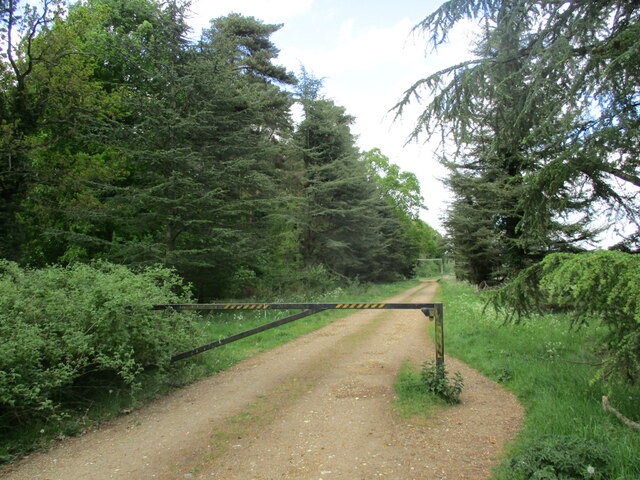
Visitors to Zigzag Covert can explore the forest through a network of well-maintained footpaths and trails, allowing for peaceful walks and a chance to connect with nature. The tranquil setting makes it a popular spot for hiking, birdwatching, and photography.

Conservation efforts are in place to preserve the integrity of Zigzag Covert, with initiatives focusing on woodland management and the protection of rare and endangered species. These measures ensure the long-term sustainability of the ecosystem and maintain the area's natural beauty for future generations to enjoy.

In conclusion, Zigzag Covert in Norfolk is a captivating woodland area characterized by its diverse flora and fauna. Its tranquil ambiance and well-preserved ecosystem make it a haven for nature enthusiasts and a valuable conservation site within the Norfolk Broads National Park.

If you have any feedback on the listing, please let us know in the comments section below.

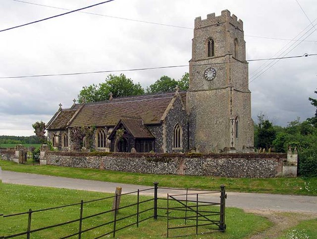
Zigzag Covert Images

Images are sourced within 2km of 52.510403/0.67504867 or Grid Reference TL8193. Thanks to Geograph Open Source API. All images are credited.

Paddock at Lynford Arboretum The best place to see Hawfinch in the Brecks, see <a href="https://www.geograph.org.uk/photo/1036176">TL8293 : Hawfinch (Coccothraustes coccothraustes)</a>
Paddock at Lynford Arboretum
The best place to see Hawfinch in the Brecks, see TL8293 : Hawfinch (Coccothraustes coccothraustes)
Paddock at Lynford Arboretum
Forest track at Lynford
Overgrown track to the church of Our Lady of Consolation and St. Stephen, Lynford
Ride in Big Wood, Lynford
Forest track at Lynford
Restoration at the Church of Our Lady of Consolation and St Stephen, Lynford The church was built in 1879 and designed by Henry Clutton <span class="nowrap"><a title="https://historicengland.org.uk/listing/the-list/list-entry/1077247?section=official-list-entry" rel="nofollow ugc noopener" href="https://historicengland.org.uk/listing/the-list/list-entry/1077247?section=official-list-entry">Link</a><img style="margin-left:2px;" alt="External link" title="External link - shift click to open in new window" src="https://s1.geograph.org.uk/img/external.png" width="10" height="10"/></span>
Restoration at the Church of Our Lady of Consolation and St Stephen, Lynford
The church was built in 1879 and designed by Henry Clutton LinkExternal link
Study of a Gasoline Station Gulf, Ickburgh.

 This photograph is part of a series taken in homage to the American artist Ed Ruscha's 1963 publication of 'Twentysix Gasoline Stations'.
 More properly known as filling stations in the UK, I am attempting to photograph as many as possible to mark the sixty year anniversary.
Study of a Gasoline Station
Gulf, Ickburgh. This photograph is part of a series taken in homage to the American artist Ed Ruscha's 1963 publication of 'Twentysix Gasoline Stations'. More properly known as filling stations in the UK, I am attempting to photograph as many as possible to mark the sixty year anniversary.
Path through Big Wood Close to Lynford Stag car park <a href="https://www.geograph.org.uk/photo/1456866">TL8191 : Lynford Stag</a>, hence the bench. This area is within the open access land that makes up a large part of Thetford Forest.
Path through Big Wood
Close to Lynford Stag car park TL8191 : Lynford Stag, hence the bench. This area is within the open access land that makes up a large part of Thetford Forest.
Path through Big Wood Looking back towards the Lynford Stag car park.
Path through Big Wood
Looking back towards the Lynford Stag car park.
Path through Big Wood Heading towards Lynford Arboretum.
Path through Big Wood
Heading towards Lynford Arboretum.
Track in Thetford Forest Most of the forest is designated as open access land so you are free to wander down any of the tracks.
Track in Thetford Forest
Most of the forest is designated as open access land so you are free to wander down any of the tracks.
Lynford Arboretum paddocks Looking towards Lynford Hall Hotel.
Lynford Arboretum paddocks
Looking towards Lynford Hall Hotel.
Lynford Water Former gravel pits, now opened for access. This pit is left undisturbed for the birds.
Lynford Water
Former gravel pits, now opened for access. This pit is left undisturbed for the birds.
Lynford Lakes bird hide Overlooking the western pit.
Lynford Lakes bird hide
Overlooking the western pit.
Lynford Water beach The sign says the water is not up to designated standards for swimming and no-one has got round to removing the quicksand sign. There would have been the potential for quicksand when gravel was cleaned and the sand and silt laden water poured back into the pit creating sand supersaturated with water. By now it will have all settled.
Lynford Water beach
The sign says the water is not up to designated standards for swimming and no-one has got round to removing the quicksand sign. There would have been the potential for quicksand when gravel was cleaned and the sand and silt laden water poured back into the pit creating sand supersaturated with water. By now it will have all settled.
Lynford Water information board Giving details about access to the gravel pits.
Lynford Water information board
Giving details about access to the gravel pits.
Lynford Arboretum lake Alders growing on the island.
Lynford Arboretum lake
Alders growing on the island.
Show me another place!

Zigzag Covert is located at Grid Ref: TL8193 (Lat: 52.510403, Lng: 0.67504867)

Administrative County: Norfolk

District: Breckland

Police Authority: Norfolk

What 3 Words

///candle.cheerily.body. Near Mundford, Norfolk

Related Wikis

Lynford Hall

Lynford Hall is a neo-Jacobean country house at Mundford, near Thetford in the English county of Norfolk. It is now a hotel. == Location == The Lynford...

Mundford

Mundford is a village and civil parish in the English county of Norfolk. It is situated at the intersection of two major routes, the A134 Colchester to...

Ickburgh

Ickburgh is a village and civil parish in the English county of Norfolk. It is situated on the A1065 Mildenhall to Fakenham road, some 5.5 miles (8.9 km...

West Tofts

West Tofts is a deserted medieval village within the Stanford Training Area, an army training area in the English county of Norfolk. It is in the civil...

Buckenham Tofts

Buckenham Tofts (or Buckenham Parva; Little Buckenham) is a former civil parish, now in the parish of Stanford, in the Breckland district, in the county...

Lynford

Lynford is a village and civil parish in the Breckland District of Norfolk. The parish covers an area of 24.72 km2 (9.54 sq mi), and the 2001 Census recorded...

Weeting-with-Broomhill

Weeting-with-Broomhill is a civil parish in the English county of Norfolk. It covers an area of 25.16 km2 (9.71 sq mi) and had a population of 1,751 in...

Thetford Rural District

Thetford Rural District was a rural district in Norfolk, England from 1894 to 1935.It was formed under the Local Government Act 1894 based on the Thetford...

Related Videos

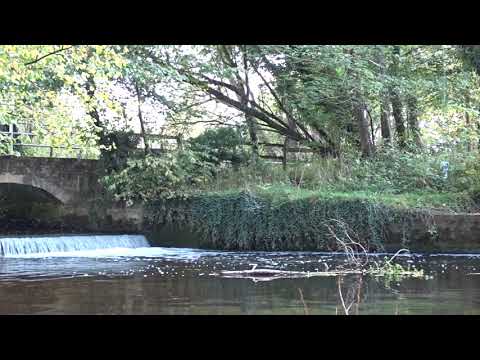
Mindful moments @ Ashburton Rd, Ickburgh

Filmed on 18th October @ Ashbourne Rd, Ickburgh On this day I was suffering with the tail end of a migraine. I was still sensitive to ...

Nearby Amenities

Located within 500m of 52.510403,0.67504867
Barrier: bar
Lat/Long: 52.5090916/0.6783028
Barrier: bar
Lat/Long: 52.5089669/0.6785539
Barrier: bar
Bicycle: yes
Foot: yes
Lat/Long: 52.5077685/0.6775404
Barrier: bar
Lat/Long: 52.5062805/0.6765326
Bench
Lat/Long: 52.5119977/0.6817241
Bench
Lat/Long: 52.512099/0.6808068
Bench
Lat/Long: 52.5116158/0.6776364
Bench
Lat/Long: 52.5110379/0.6721272
Bench
Lat/Long: 52.5114721/0.6737365
Bench
Lat/Long: 52.5115146/0.6755658
Barrier: bar
Lat/Long: 52.5102908/0.6713817
Barrier: bar
Lat/Long: 52.5096955/0.6700882
Barrier: bar
Lat/Long: 52.5080975/0.6692231
Barrier: bar
Lat/Long: 52.5080688/0.6696772
Man Made: statue
Url: http://www.racns.co.uk/sculptures.asp?action=getsurvey&id=38
Lat/Long: 52.5137006/0.6765501
Barrier: bar
Lat/Long: 52.5079037/0.6776125
Power: pole
Lat/Long: 52.5112252/0.680003
Power: pole
Source: Bing
Lat/Long: 52.5108179/0.6808707
Power: pole
Lat/Long: 52.5104326/0.6816807
The data included in this document is from www.openstreetmap.org. The data is made available under ODbL.

Have you been to Zigzag Covert?

Leave your review of Zigzag Covert below (or comments, questions and feedback).