Twenty Acre Plantation

Wood, Forest in Norfolk Breckland

England

Twenty Acre Plantation

Overgrown track to the church of Our Lady of Consolation and St. Stephen, Lynford
Overgrown track to the church of Our Lady of Consolation and St. Stephen, Lynford Credit: Jonathan Thacker

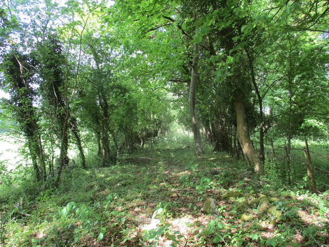
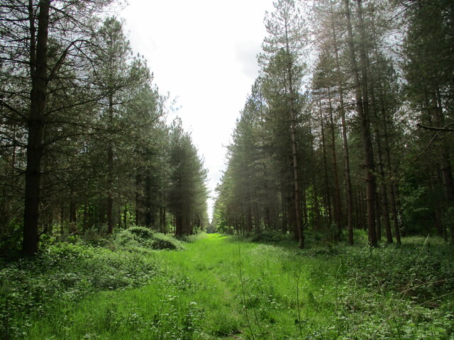
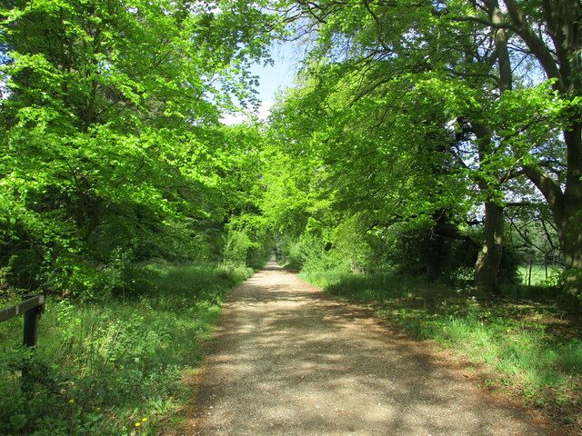
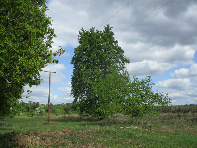
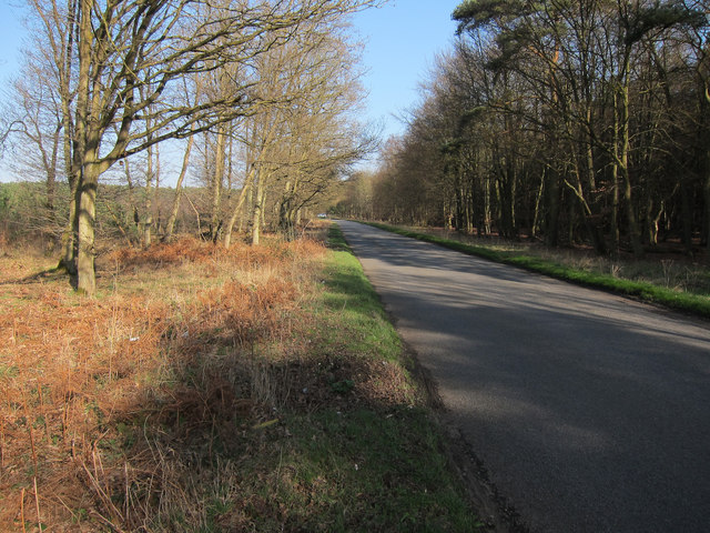
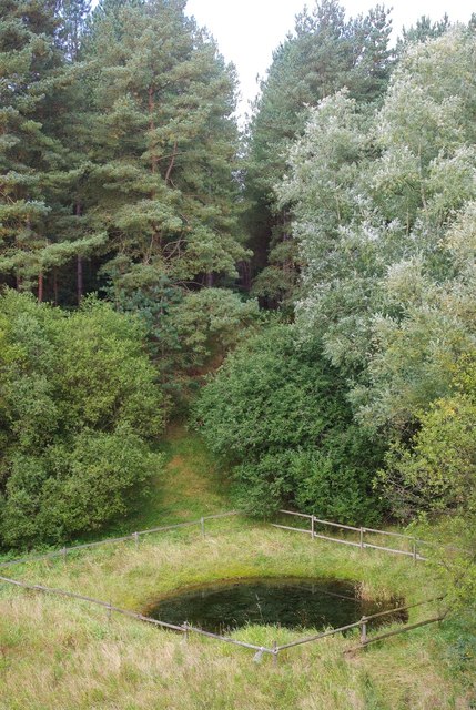
Twenty Acre Plantation, located in Norfolk, is a picturesque woodland area encompassing twenty acres of pristine forest. Situated amidst the charming countryside, this natural haven offers visitors a tranquil escape from the hustle and bustle of city life.

The plantation boasts a diverse range of trees, including oak, birch, beech, and pine, creating a lush green canopy that provides shade and shelter for a variety of wildlife. The forest floor is blanketed with a rich carpet of ferns, mosses, and wildflowers, adding to the enchanting atmosphere of the woodland.

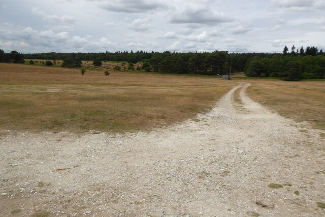
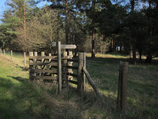
A network of well-maintained paths meanders through the plantation, inviting hikers and nature enthusiasts to explore its hidden treasures. Along these trails, visitors can discover babbling brooks, small ponds, and enchanting clearings, each offering a unique glimpse into the natural wonders of the area.

For birdwatchers, Twenty Acre Plantation is a paradise, as it is home to a plethora of avian species. From the melodious songs of thrushes to the majestic flight of the buzzard, bird lovers will find themselves captivated by the diversity and beauty of the feathered residents.

The plantation also serves as an important habitat for various mammals, such as deer, foxes, and rabbits. Nature enthusiasts may be fortunate enough to catch a glimpse of these creatures as they go about their daily routines.

Overall, Twenty Acre Plantation is a hidden gem in Norfolk, offering a peaceful retreat for individuals seeking solace in nature. It provides an idyllic setting for outdoor activities, wildlife observation, and appreciation of the natural world.

If you have any feedback on the listing, please let us know in the comments section below.

Twenty Acre Plantation Images

Images are sourced within 2km of 52.489586/0.67101525 or Grid Reference TL8191. Thanks to Geograph Open Source API. All images are credited.

Overgrown track to the church of Our Lady of Consolation and St. Stephen, Lynford
Ride in Big Wood, Lynford
Clear felled area near Lynford
Access track to Grime's Graves This is the track which gives access to the English Heritage of Grime's Grave.
Access track to Grime's Graves
This is the track which gives access to the English Heritage of Grime's Grave.
Forest track at Lynford
Remaining tree This area has been clear felled but one or two trees remain.
Remaining tree
This area has been clear felled but one or two trees remain.
Old Milestone by the A134, north of Lynford Carved stone post by the A134, in parish of Lynford (Breckland District), West Tofts Heath, on the verge, on East side of road. Erected by the Bury St Edmunds to Cranwich turnpike trust in the 19th century. An earlier photograph can be found here <a title="https://www.geograph.org.uk/photo/6035325" href="https://www.geograph.org.uk/photo/6035325">Link</a>.

Inscription reads:-
: THETFORD / 4 / MILES : : STOKE FY / 11 / MILES :
Carved benchmark on top.

Norfolk HER listed. NHER Number: 56804 <span class="nowrap"><a title="https://www.heritagegateway.org.uk/Gateway/Results_Single.aspx?uid=MNF63218&resourceID=1002" rel="nofollow ugc noopener" href="https://www.heritagegateway.org.uk/Gateway/Results_Single.aspx?uid=MNF63218&resourceID=1002">Link</a><img style="margin-left:2px;" alt="External link" title="External link - shift click to open in new window" src="https://s1.geograph.org.uk/img/external.png" width="10" height="10"/></span>

Milestone Society National ID: NO_SFT11
Old Milestone by the A134, north of Lynford
Carved stone post by the A134, in parish of Lynford (Breckland District), West Tofts Heath, on the verge, on East side of road. Erected by the Bury St Edmunds to Cranwich turnpike trust in the 19th century. An earlier photograph can be found here Link. Inscription reads:- : THETFORD / 4 / MILES : : STOKE FY / 11 / MILES : Carved benchmark on top. Norfolk HER listed. NHER Number: 56804 LinkExternal link Milestone Society National ID: NO_SFT11
Path through Big Wood Close to Lynford Stag car park <a href="https://www.geograph.org.uk/photo/1456866">TL8191 : Lynford Stag</a>, hence the bench. This area is within the open access land that makes up a large part of Thetford Forest.
Path through Big Wood
Close to Lynford Stag car park TL8191 : Lynford Stag, hence the bench. This area is within the open access land that makes up a large part of Thetford Forest.
Path through Big Wood Looking back towards the Lynford Stag car park.
Path through Big Wood
Looking back towards the Lynford Stag car park.
Path through Big Wood Heading towards Lynford Arboretum.
Path through Big Wood
Heading towards Lynford Arboretum.
Track in Thetford Forest Most of the forest is designated as open access land so you are free to wander down any of the tracks.
Track in Thetford Forest
Most of the forest is designated as open access land so you are free to wander down any of the tracks.
A path through an avenue of Lime Trees in Lynford Stag Picnic Area
Arable field within Thetford Forest Small pocket of farmland within the woodland.
Arable field within Thetford Forest
Small pocket of farmland within the woodland.
Footpath into danger area Oddly, no signs here about the danger area, though there are elsewhere.
Footpath into danger area
Oddly, no signs here about the danger area, though there are elsewhere.
Road to Grime's Graves
Across the pit This disused sand pit isn't as wet as the current OS mapping suggests.  The tracks around it suggest that it's heavily used by two-wheeled vehicles.
Across the pit
This disused sand pit isn't as wet as the current OS mapping suggests. The tracks around it suggest that it's heavily used by two-wheeled vehicles.
Pool in a pit This pool sits at the bottom of the disused sand pit, carefully fenced off to stop anyone falling in.
Pool in a pit
This pool sits at the bottom of the disused sand pit, carefully fenced off to stop anyone falling in.
On the edge This birch tree clings to the edge of the disused sand pit.
On the edge
This birch tree clings to the edge of the disused sand pit.
Show me another place!

Twenty Acre Plantation is located at Grid Ref: TL8191 (Lat: 52.489586, Lng: 0.67101525)

Administrative County: Norfolk

District: Breckland

Police Authority: Norfolk

What 3 Words

///restores.bleaching.multiply. Near Mundford, Norfolk

Related Wikis

Lynford

Lynford is a village and civil parish in the Breckland District of Norfolk. The parish covers an area of 24.72 km2 (9.54 sq mi), and the 2001 Census recorded...

Thetford Rural District

Thetford Rural District was a rural district in Norfolk, England from 1894 to 1935.It was formed under the Local Government Act 1894 based on the Thetford...

Grime's Graves

Grime's Graves is a large Neolithic flint mining complex in Norfolk, England. It lies 8 km (5.0 mi) north east from Brandon, Suffolk in the East of England...

Weeting-with-Broomhill

Weeting-with-Broomhill is a civil parish in the English county of Norfolk. It covers an area of 25.16 km2 (9.71 sq mi) and had a population of 1,751 in...

Mundford

Mundford is a village and civil parish in the English county of Norfolk. It is situated at the intersection of two major routes, the A134 Colchester to...

West Tofts

West Tofts is a deserted medieval village in the civil parish of Lynford, within the Breckland district, in the county of Norfolk, England. It is within...

Lynford Hall

Lynford Hall is a neo-Jacobean country house at Mundford, near Thetford in the English county of Norfolk. It is now a hotel. == Location == The Lynford...

Ickburgh

Ickburgh is a village and civil parish in the English county of Norfolk. It is situated on the A1065 Mildenhall to Fakenham road, some 5.5 miles (8.9 km...

Nearby Amenities

Located within 500m of 52.489586,0.67101525
Pipeline: marker
Substance: oil
Lat/Long: 52.4938406/0.668648
Barrier: bar
Lat/Long: 52.4930636/0.6709937
Man Made: sculpture
Note: Metal deer
Lat/Long: 52.4931108/0.6711997
Information: board
Tourism: information
Lat/Long: 52.493053/0.671182
Barrier: bar
Lat/Long: 52.4930278/0.6714985
Pipeline: marker
Substance: gas
Lat/Long: 52.4931147/0.6706055
Pipeline: marker
Substance: gas
Lat/Long: 52.4935406/0.6698196
Pipeline: marker
Substance: gas
Lat/Long: 52.4926951/0.6713284
Pipeline: marker
Substance: oil
Lat/Long: 52.4922252/0.6713503
Pipeline: marker
Substance: gas
Lat/Long: 52.4918406/0.6728543
Leisure: picnic_table
Lat/Long: 52.4933442/0.6707529
Leisure: picnic_table
Lat/Long: 52.4934258/0.6705708
Leisure: picnic_table
Lat/Long: 52.4932405/0.671115
Leisure: picnic_table
Lat/Long: 52.4935143/0.6707173
Leisure: picnic_table
Lat/Long: 52.4938317/0.6706341
The data included in this document is from www.openstreetmap.org. The data is made available under ODbL.

Have you been to Twenty Acre Plantation?

Leave your review of Twenty Acre Plantation below (or comments, questions and feedback).