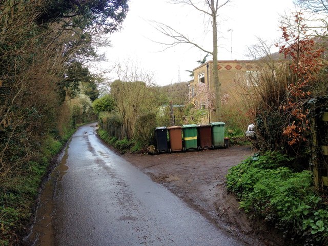
Sherway Wood

Wood, Forest in Kent Maidstone

England

Sherway Wood

The A249 The A249 is a road running from Maidstone to Sheerness on the Isle of Sheppey. It mainly functions as a link between the M2 and M20 motorways,up Detling Hill and for goods vehicle traffic to the port at Sheerness.
In 2006, an upgraded dual carriageway section opened between Iwade and Queenborough, including a new fixed crossing over the Swale. The existing lifting Kingsferry Bridge has been retained as an alternative route.
The old Sheppey way runs parallel to the new road.
Wikipedia: <span class="nowrap"><a title="http://en.wikipedia.org/wiki/A249_road" rel="nofollow ugc noopener" href="http://en.wikipedia.org/wiki/A249_road">Link</a><img style="margin-left:2px;" alt="External link" title="External link - shift click to open in new window" src="https://s1.geograph.org.uk/img/external.png" width="10" height="10"/></span>
The A249 Credit: N Chadwick

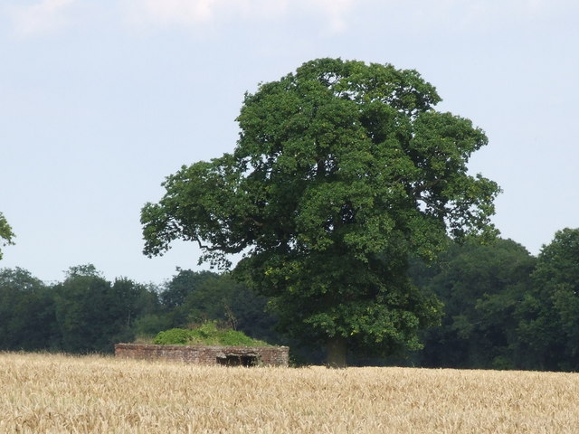
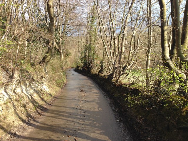
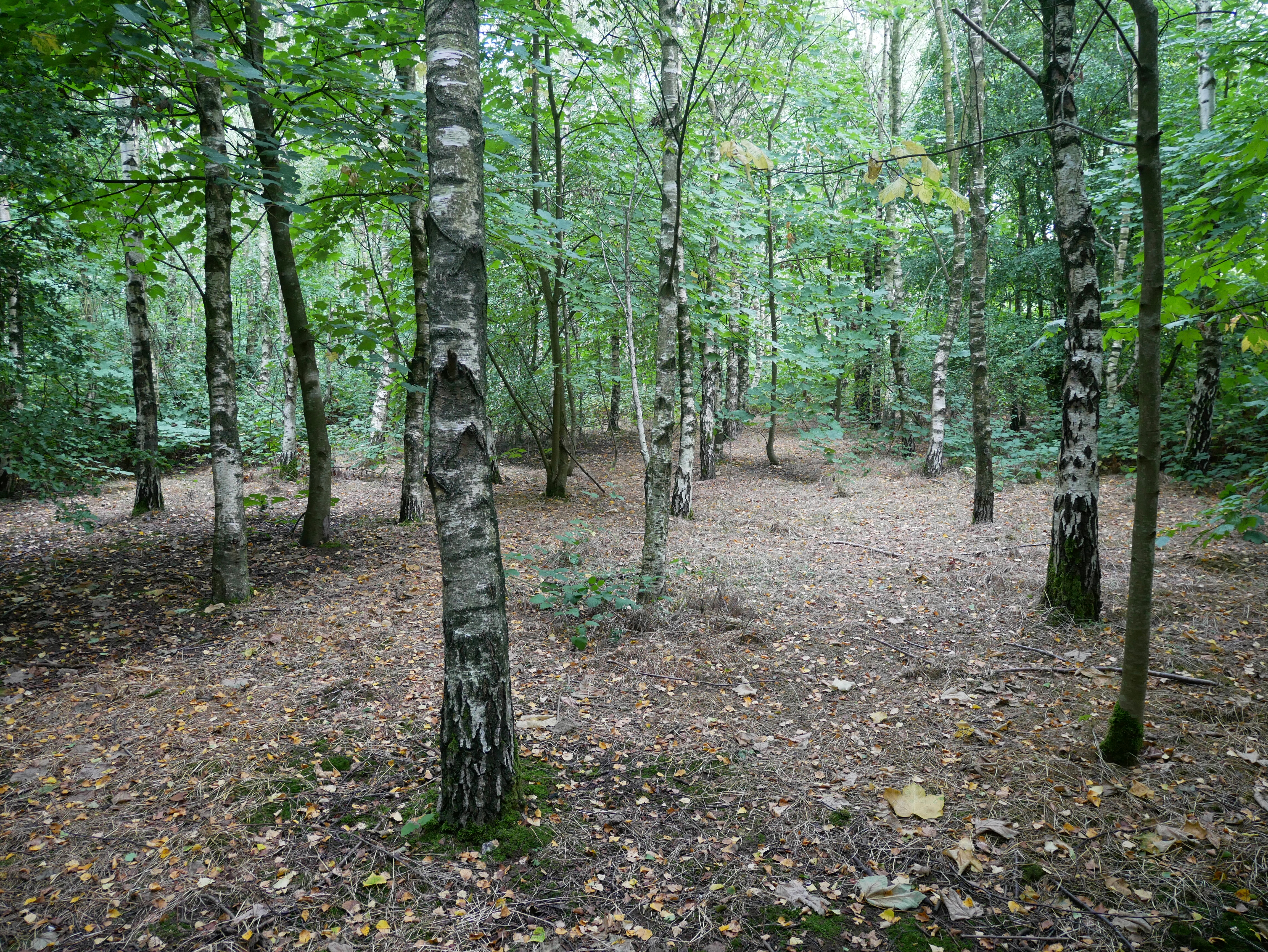
Sherway Wood, located in Kent, is a picturesque forest that spans over a vast area. It is known for its rich history, diverse wildlife, and serene atmosphere. The wood is predominantly made up of deciduous trees, such as oak, beech, and birch, which provide a stunning display of colors during the autumn season.

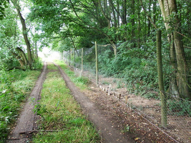
The wood is a popular destination for nature enthusiasts and outdoor lovers. It offers a range of activities, including hiking, birdwatching, and nature photography. The well-maintained trails allow visitors to explore the beauty of the wood at their own pace, while also providing opportunities to spot various species of birds, mammals, and insects.

One of the notable features of Sherway Wood is its ancient woodland status. This means that the wood has been in existence for a significant period, typically since at least 1600 AD. This designation ensures the preservation of the wood's unique ecosystem and the protection of its diverse flora and fauna.

In addition to its natural beauty, Sherway Wood holds historical significance. It is believed to have been used as a hunting ground during medieval times and as a source of timber for local communities. Some remnants of ancient structures, such as charcoal hearths and boundary ditches, can still be found within the wood, adding to its historical charm.

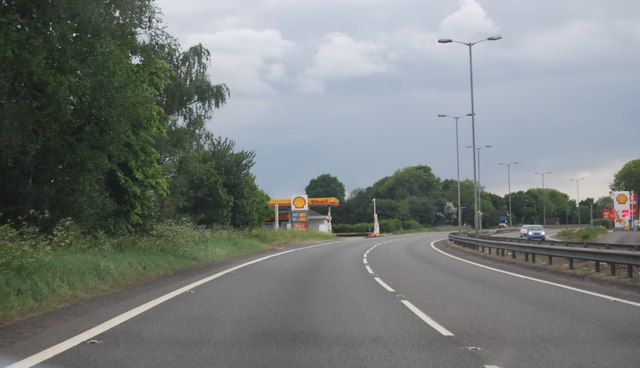
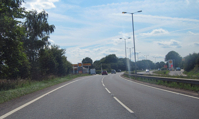
Sherway Wood is easily accessible, with ample parking facilities and well-marked entrances. Whether one is seeking a peaceful retreat or an adventurous day out, this enchanting wood offers a delightful escape into nature's tranquil embrace.

If you have any feedback on the listing, please let us know in the comments section below.

Sherway Wood Images

Images are sourced within 2km of 51.317709/0.60211705 or Grid Reference TQ8160. Thanks to Geograph Open Source API. All images are credited.

The A249 The A249 is a road running from Maidstone to Sheerness on the Isle of Sheppey. It mainly functions as a link between the M2 and M20 motorways,up Detling Hill and for goods vehicle traffic to the port at Sheerness.
In 2006, an upgraded dual carriageway section opened between Iwade and Queenborough, including a new fixed crossing over the Swale. The existing lifting Kingsferry Bridge has been retained as an alternative route.
The old Sheppey way runs parallel to the new road.
Wikipedia: <span class="nowrap"><a title="http://en.wikipedia.org/wiki/A249_road" rel="nofollow ugc noopener" href="http://en.wikipedia.org/wiki/A249_road">Link</a><img style="margin-left:2px;" alt="External link" title="External link - shift click to open in new window" src="https://s1.geograph.org.uk/img/external.png" width="10" height="10"/></span>
The A249
The A249 is a road running from Maidstone to Sheerness on the Isle of Sheppey. It mainly functions as a link between the M2 and M20 motorways,up Detling Hill and for goods vehicle traffic to the port at Sheerness. In 2006, an upgraded dual carriageway section opened between Iwade and Queenborough, including a new fixed crossing over the Swale. The existing lifting Kingsferry Bridge has been retained as an alternative route. The old Sheppey way runs parallel to the new road. Wikipedia: LinkExternal link
Fuel Station, A249 The A249 is a road running from Maidstone to Sheerness on the Isle of Sheppey. It mainly functions as a link between the M2 and M20 motorways,up Detling Hill and for goods vehicle traffic to the port at Sheerness.
In 2006, an upgraded dual carriageway section opened between Iwade and Queenborough, including a new fixed crossing over the Swale. The existing lifting Kingsferry Bridge has been retained as an alternative route.
The old Sheppey way runs parallel to the new road.
Wikipedia: <span class="nowrap"><a title="http://en.wikipedia.org/wiki/A249_road" rel="nofollow ugc noopener" href="http://en.wikipedia.org/wiki/A249_road">Link</a><img style="margin-left:2px;" alt="External link" title="External link - shift click to open in new window" src="https://s1.geograph.org.uk/img/external.png" width="10" height="10"/></span>
Fuel Station, A249
The A249 is a road running from Maidstone to Sheerness on the Isle of Sheppey. It mainly functions as a link between the M2 and M20 motorways,up Detling Hill and for goods vehicle traffic to the port at Sheerness. In 2006, an upgraded dual carriageway section opened between Iwade and Queenborough, including a new fixed crossing over the Swale. The existing lifting Kingsferry Bridge has been retained as an alternative route. The old Sheppey way runs parallel to the new road. Wikipedia: LinkExternal link
A259, Detling Hill
A259, Detling Hill
Highland Garage on the A249 Highland Garage on the A249 consists of a Shell petrol station and a Little Chef (out of view).
Highland Garage on the A249
Highland Garage on the A249 consists of a Shell petrol station and a Little Chef (out of view).
Sheep grazing in a field Sheep grazing in a field behind Highland Garage on the A249 and next to the Kent County Showground.
Sheep grazing in a field
Sheep grazing in a field behind Highland Garage on the A249 and next to the Kent County Showground.
Wireless Transmitter near Friningham With another transmitter in the woods behind.
Wireless Transmitter near Friningham
With another transmitter in the woods behind.
Lane leading towards Friningham Manor
Old farm building near Binbury Lane
Track near Stockings Wood
A249 near Highland Garage The A249 is a road running from Maidstone to Sheerness on the Isle of Sheppey. It mainly functions as a link between the M2 and M20 motorways,up Detling Hill and for goods vehicle traffic to the port at Sheerness.
In 2006, an upgraded dual carriageway section opened between Iwade and Queenborough, including a new fixed crossing over the Swale. The existing lifting Kingsferry Bridge has been retained as an alternative route.
The old Sheppey way runs parallel to the new road.
Wikipedia: <span class="nowrap"><a title="http://en.wikipedia.org/wiki/A249_road" rel="nofollow ugc noopener" href="http://en.wikipedia.org/wiki/A249_road">Link</a><img style="margin-left:2px;" alt="External link" title="External link - shift click to open in new window" src="https://s1.geograph.org.uk/img/external.png" width="10" height="10"/></span>
A249 near Highland Garage
The A249 is a road running from Maidstone to Sheerness on the Isle of Sheppey. It mainly functions as a link between the M2 and M20 motorways,up Detling Hill and for goods vehicle traffic to the port at Sheerness. In 2006, an upgraded dual carriageway section opened between Iwade and Queenborough, including a new fixed crossing over the Swale. The existing lifting Kingsferry Bridge has been retained as an alternative route. The old Sheppey way runs parallel to the new road. Wikipedia: LinkExternal link
A249 near Thurnham The A249 is a road running from Maidstone to Sheerness on the Isle of Sheppey. It mainly functions as a link between the M2 and M20 motorways,up Detling Hill and for goods vehicle traffic to the port at Sheerness.
In 2006, an upgraded dual carriageway section opened between Iwade and Queenborough, including a new fixed crossing over the Swale. The existing lifting Kingsferry Bridge has been retained as an alternative route.
The old Sheppey way runs parallel to the new road.
Wikipedia: <span class="nowrap"><a title="http://en.wikipedia.org/wiki/A249_road" rel="nofollow ugc noopener" href="http://en.wikipedia.org/wiki/A249_road">Link</a><img style="margin-left:2px;" alt="External link" title="External link - shift click to open in new window" src="https://s1.geograph.org.uk/img/external.png" width="10" height="10"/></span>
A249 near Thurnham
The A249 is a road running from Maidstone to Sheerness on the Isle of Sheppey. It mainly functions as a link between the M2 and M20 motorways,up Detling Hill and for goods vehicle traffic to the port at Sheerness. In 2006, an upgraded dual carriageway section opened between Iwade and Queenborough, including a new fixed crossing over the Swale. The existing lifting Kingsferry Bridge has been retained as an alternative route. The old Sheppey way runs parallel to the new road. Wikipedia: LinkExternal link
A249, Longton Wood The A249 is a road running from Maidstone to Sheerness on the Isle of Sheppey. It mainly functions as a link between the M2 and M20 motorways,up Detling Hill and for goods vehicle traffic to the port at Sheerness.
In 2006, an upgraded dual carriageway section opened between Iwade and Queenborough, including a new fixed crossing over the Swale. The existing lifting Kingsferry Bridge has been retained as an alternative route.
The old Sheppey way runs parallel to the new road.
Wikipedia: <span class="nowrap"><a title="http://en.wikipedia.org/wiki/A249_road" rel="nofollow ugc noopener" href="http://en.wikipedia.org/wiki/A249_road">Link</a><img style="margin-left:2px;" alt="External link" title="External link - shift click to open in new window" src="https://s1.geograph.org.uk/img/external.png" width="10" height="10"/></span>
A249, Longton Wood
The A249 is a road running from Maidstone to Sheerness on the Isle of Sheppey. It mainly functions as a link between the M2 and M20 motorways,up Detling Hill and for goods vehicle traffic to the port at Sheerness. In 2006, an upgraded dual carriageway section opened between Iwade and Queenborough, including a new fixed crossing over the Swale. The existing lifting Kingsferry Bridge has been retained as an alternative route. The old Sheppey way runs parallel to the new road. Wikipedia: LinkExternal link
Lancasters over Detling Show Ground
Road (A249) at Highland Garage Looking north-eastward.
Road (A249) at Highland Garage
Looking north-eastward.
Kemsley Street Road, Bredhurst
White Hill Road, Yelsted
Show me another place!

Sherway Wood is located at Grid Ref: TQ8160 (Lat: 51.317709, Lng: 0.60211705)

Administrative County: Kent

District: Maidstone

Police Authority: Kent

What 3 Words

///confining.grouping.liberty. Near Rainham, Kent

Related Wikis

Purple Hill

Purple Hill is a 14.9-hectare (37-acre) biological Site of Special Scientific Interest south of Gillingham in Kent. It is a Nature Conservation Review...

RAF Detling

Royal Air Force Detling, or more simply RAF Detling, is a former Royal Air Force station situated 600 feet (180 m) above sea level, located near Detling...

Yelsted

Yelsted is a hamlet in the Borough of Maidstone, in the county of Kent, England. In 1800, Edward Hasted noted that it was spelt Gillested. It was a manor...

Stockbury Hill Wood

Stockbury Hill Wood is a 5-hectare (12-acre) nature reserve near Stockbury, north-east of Maidstone in Kent. It is managed by the Kent Wildlife Trust...

Kent Showground

The Kent Showground, formerly (and still colloquially) known as the Kent County Showground is an area of land in Detling, Kent, England, north of the county...

Kent County Show

The Kent County Show is an event hosted annually by the Kent County Agricultural Society at their Kent Showground headquarters at Detling near Maidstone...
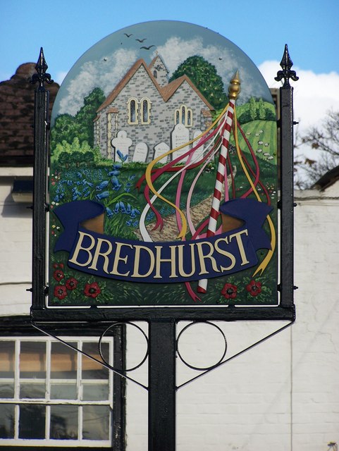
Bredhurst

Bredhurst is a village and civil parish in Kent, that forms part of the Borough of Maidstone in England. Its population was 330 (1990), increasing to 397...

White Horse Wood

White Horse Wood is a recently created English country park near Thurnham to the north of Maidstone, Kent. Located within the Kent Downs Area of Outstanding...

Nearby Amenities

Located within 500m of 51.317709,0.60211705
Lower Cox Street
Is In Country: UK
Is In County: Kent
Place: hamlet
Source: npe
Lat/Long: 51.3186814/0.5994134
The data included in this document is from www.openstreetmap.org. The data is made available under ODbL.

Have you been to Sherway Wood?

Leave your review of Sherway Wood below (or comments, questions and feedback).