Great Fir Covert

Wood, Forest in Suffolk West Suffolk

England

Great Fir Covert

Footpath to Lackford Lane
Footpath to Lackford Lane Credit: Stuart Shepherd

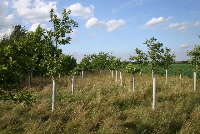
Great Fir Covert is a woodland area located in Suffolk, England. The name "covert" refers to a dense thicket or cluster of trees, indicating that this area is densely forested with fir trees. The woodland is known for its lush greenery, towering trees, and diverse wildlife.

Great Fir Covert is a popular destination for nature lovers, hikers, and bird watchers. The forest is home to a variety of bird species, including woodpeckers, owls, and thrushes. Visitors may also spot deer, rabbits, and other small mammals roaming through the trees.

The woodland provides a peaceful and serene escape from the hustle and bustle of urban life. Its winding trails and pathways offer opportunities for leisurely walks and exploration. The dense canopy of fir trees provides shade and shelter, creating a cool and tranquil atmosphere within the forest.

Overall, Great Fir Covert is a beautiful natural oasis in Suffolk, offering visitors a chance to connect with nature and enjoy the beauty of the English countryside.

If you have any feedback on the listing, please let us know in the comments section below.

Great Fir Covert Images

Images are sourced within 2km of 52.278985/0.64003067 or Grid Reference TL8067. Thanks to Geograph Open Source API. All images are credited.

Footpath to Lackford Lane
Risby Village Green There are two greens in Risby; this is the main one.
Risby Village Green
There are two greens in Risby; this is the main one.
Bullock Lodge Farm, Risby Farm buildings at the end of a metalled road.  The track continues to Lackford.
Bullock Lodge Farm, Risby
Farm buildings at the end of a metalled road. The track continues to Lackford.
Risby Poor's Heath A line of poplars at the wonderfully-named Risby Poor's Heath.  Presumably this was where the local paupers either lived, or were buried.
Risby Poor's Heath
A line of poplars at the wonderfully-named Risby Poor's Heath. Presumably this was where the local paupers either lived, or were buried.
New oaks at Risby A small plantation of oaks just off the track leading from Risby to Lackford, the only significant feature in a bleak square of open farmland.
New oaks at Risby
A small plantation of oaks just off the track leading from Risby to Lackford, the only significant feature in a bleak square of open farmland.
Track leading to Heath Barn Farm, Risby Building at the farm are currently being converted to offices, to be known as 'Highwayman's Vineyard'.
Track leading to Heath Barn Farm, Risby
Building at the farm are currently being converted to offices, to be known as 'Highwayman's Vineyard'.
Risby Village Green (2) This is the other (northern) village green in Risby. In winter the dip often fills with water.
Risby Village Green (2)
This is the other (northern) village green in Risby. In winter the dip often fills with water.
Risby Water Tower 1950's concrete octagonal water tower with mobile phone masts.
Risby Water Tower
1950's concrete octagonal water tower with mobile phone masts.
Risby Little Wood Viewed from the junction of the road to Flempton and Hall Lane.
Risby Little Wood
Viewed from the junction of the road to Flempton and Hall Lane.
Risby village sign Risby village sign on the village green Risby Suffolk.
Risby village sign
Risby village sign on the village green Risby Suffolk.
Risby Primary School Risby is a Church of England Voluntary Controlled Primary School
Risby Primary School
Risby is a Church of England Voluntary Controlled Primary School
Risby Barn Antiques Centre Set in a 15th Century thatched barn on South Street
Risby Barn Antiques Centre
Set in a 15th Century thatched barn on South Street
Allotments at Risby
Allotments at Risby
Village Hall, Risby The rear view from the boundary of the cricket field
Village Hall, Risby
The rear view from the boundary of the cricket field
Line of trees at Risby Looking south from the minor road that leads to Cavenham.
Line of trees at Risby
Looking south from the minor road that leads to Cavenham.
Ploughed field at Risby This field lies to the east of the minor road linking Risby and Flempton.
Ploughed field at Risby
This field lies to the east of the minor road linking Risby and Flempton.
Risby village green This is one of two greens in the centre of the village; this one is considered to be the 'main' one. The older building opposite is two dwellings, Lower Farm House and Cottage.
Risby village green
This is one of two greens in the centre of the village; this one is considered to be the 'main' one. The older building opposite is two dwellings, Lower Farm House and Cottage.
Frozen pond, Risby village green Not all the pond is frozen; the part under the tree has thawed, enabling the resident ducks to have a swim.
Frozen pond, Risby village green
Not all the pond is frozen; the part under the tree has thawed, enabling the resident ducks to have a swim.
Show me another place!

Great Fir Covert is located at Grid Ref: TL8067 (Lat: 52.278985, Lng: 0.64003067)

Administrative County: Suffolk

District: West Suffolk

Police Authority: Suffolk

What 3 Words

///drive.deflate.funky. Near Bury St Edmunds, Suffolk

Nearby Locations

Great Fir Covert

Related Wikis

Old Broom

Old Broom is a 6.5-hectare (16-acre) nature reserve north of Risby in Suffolk. It is managed by the Suffolk Wildlife Trust.This is a remnant of an ancient...

Risby, Suffolk

Risby is a village and civil parish in the West Suffolk district of Suffolk in eastern England, located around 3 miles (4.8 km) west of Bury St. Edmunds...
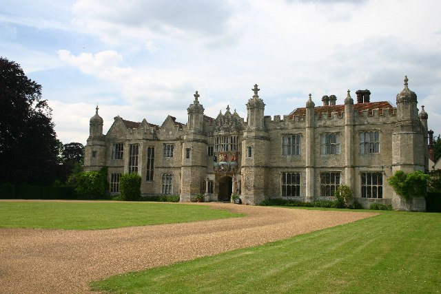
Hengrave Hall

Hengrave Hall is a Grade I listed Tudor manor house in Hengrave near Bury St. Edmunds in Suffolk, England and was the seat of the Kitson and Gage families...

Lackford Lakes

Lackford Lakes is a 105.8-hectare (261-acre) biological Site of Special Scientific Interest (SSSI) north and east of Lackford in Suffolk. The SSSI is part...

Nearby Amenities

Located within 500m of 52.278985,0.64003067
Power: pole
Lat/Long: 52.2790173/0.6465357
Power: pole
Lat/Long: 52.2775059/0.6465545
Power: pole
Lat/Long: 52.2798083/0.6465169
Power: pole
Lat/Long: 52.2782526/0.6465411
The data included in this document is from www.openstreetmap.org. The data is made available under ODbL.

Have you been to Great Fir Covert?

Leave your review of Great Fir Covert below (or comments, questions and feedback).