Basil William Covert
Wood, Forest in Suffolk West Suffolk
England
Basil William Covert

Basil William Covert is a picturesque woodland area located in Suffolk, England. Nestled within the larger Suffolk Wood, Forest, this specific section is known for its stunning beauty and tranquil atmosphere. The name "Basil William Covert" derives from the combination of two distinct elements: Basil, referring to the herb commonly found in the area, and William Covert, a nod to the historical figure who once owned the land.
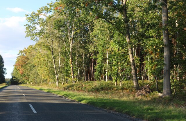
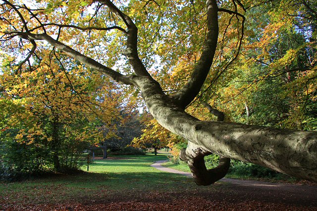
The woodland boasts an abundance of diverse flora and fauna, making it a haven for nature enthusiasts and wildlife lovers. Ancient oak trees line the forest floor, their sprawling branches creating a mesmerizing canopy overhead. Throughout the seasons, the woodland transforms, with bluebells carpeting the ground in spring and vibrant foliage painting the landscape in autumn.
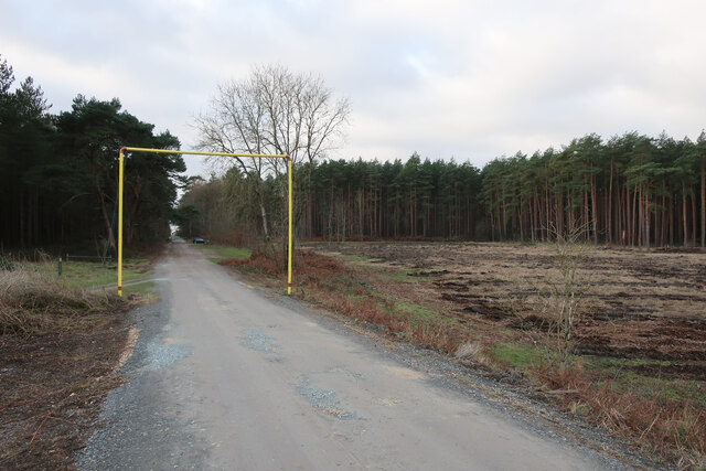
Walking trails wind their way through Basil William Covert, offering visitors the opportunity to explore the area's natural wonders. These paths vary in difficulty, catering to both casual walkers and avid hikers. Along the way, there are several designated picnic areas where visitors can rest and enjoy a meal amidst the serene surroundings.
The Suffolk Wood, Forest, including Basil William Covert, has a rich history that dates back centuries. It has been a source of inspiration for many artists, writers, and photographers, who have sought to capture its ethereal beauty. Today, it remains a cherished destination for locals and tourists alike, providing a peaceful retreat from the busyness of modern life.
If you have any feedback on the listing, please let us know in the comments section below.
Basil William Covert Images
Images are sourced within 2km of 52.419194/0.64379808 or Grid Reference TL7983. Thanks to Geograph Open Source API. All images are credited.


Basil William Covert is located at Grid Ref: TL7983 (Lat: 52.419194, Lng: 0.64379808)
Administrative County: Suffolk
District: West Suffolk
Police Authority: Suffolk
What 3 Words
///grocers.whisk.belt. Near Weeting, Norfolk
Nearby Locations
Related Wikis
Brandon Country Park
Brandon Country Park is a country park in Brandon, Suffolk, England. == History == In 1820 Edward Bliss bought Brandon Park house and grounds using wealth...
London Road Industrial Estate, Brandon
London Road Industrial Estate, Brandon is a 0.1-hectare (0.25-acre) biological Site of Special Scientific Interest (SSSI) in Brandon in Suffolk.This very...

Brandon, Suffolk
Brandon is a town and civil parish in the English county of Suffolk. Brandon is located in the Breckland area of Suffolk, close to the adjoining county...

Breckland Farmland
Breckland Farmland is a 13,392.4 hectare biological Site of Special Scientific Interest (SSSI) in many separate areas between Swaffham in Norfolk and Bury...

Brandon railway station
Brandon railway station is on the Breckland Line in the East of England, serving the town of Brandon, Suffolk, although the station is actually situated...

Elveden
Elveden is a village and civil parish in the West Suffolk district of Suffolk in eastern England. In 2005 it had a population of 270. The village is bypassed...

Wangford Warren and Carr
Wangford Warren and Carr is a 67.8-hectare (168-acre) biological Site of Special Scientific Interest between Brandon and Lakenheath in Suffolk. It is...

Breckland Forest
Breckland Forest is an 18,126 hectare biological and geological Site of Special Scientific Interest in many separate areas between Swaffham in Norfolk...
Nearby Amenities
Located within 500m of 52.419194,0.64379808Have you been to Basil William Covert?
Leave your review of Basil William Covert below (or comments, questions and feedback).