Elveden Warren
Wood, Forest in Suffolk West Suffolk
England
Elveden Warren

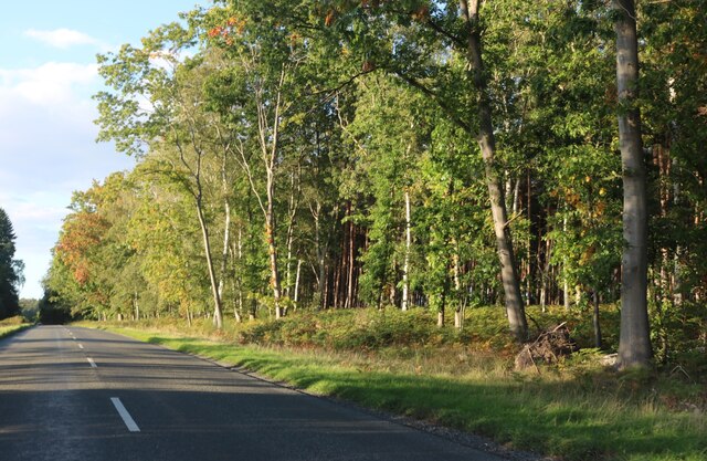
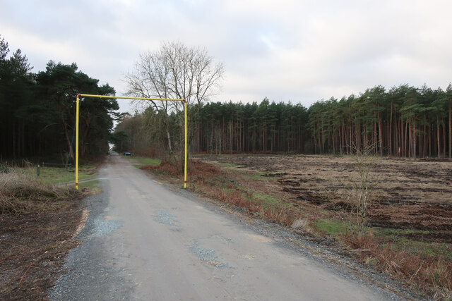
Elveden Warren is a picturesque woodland area situated in the county of Suffolk, England. Covering an extensive area, it is known for its dense forest, beautiful landscapes, and rich wildlife. The Warren is part of the wider Elveden Estate, which encompasses over 22,000 acres of land.
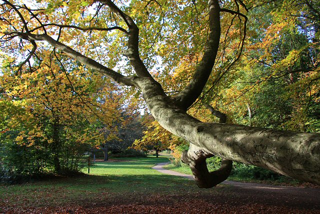
The woodlands of Elveden Warren are predominantly made up of ancient oak and beech trees, creating a serene and tranquil environment for visitors to explore. The forest floor is carpeted with a diverse range of flora, including bluebells, wild garlic, and ferns, adding to the natural beauty of the area.
This woodland is not only aesthetically pleasing but also serves as a vital habitat for a variety of wildlife. Red and fallow deer roam freely, and their presence adds to the sense of wilderness and natural harmony. The Warren is also home to a plethora of bird species, making it a popular spot for birdwatchers and nature enthusiasts.
Visitors to Elveden Warren can enjoy a range of activities, including walking, cycling, and horseback riding. There are well-maintained trails that wind through the forest, allowing visitors to immerse themselves in the peaceful surroundings. The woodlands also offer opportunities for foraging and wildlife spotting, allowing visitors to connect with nature on a deeper level.
Overall, Elveden Warren in Suffolk is a remarkable woodland area that showcases the beauty of nature in all its glory. With its ancient trees, rich wildlife, and diverse flora, it is a haven for those seeking solace and tranquility in the heart of the English countryside.
If you have any feedback on the listing, please let us know in the comments section below.
Elveden Warren Images
Images are sourced within 2km of 52.403371/0.6399993 or Grid Reference TL7981. Thanks to Geograph Open Source API. All images are credited.


Elveden Warren is located at Grid Ref: TL7981 (Lat: 52.403371, Lng: 0.6399993)
Administrative County: Suffolk
District: West Suffolk
Police Authority: Suffolk
What 3 Words
///allowable.muscular.vipers. Near Weeting, Norfolk
Nearby Locations
Related Wikis

Breckland Farmland
Breckland Farmland is a 13,392.4 hectare biological Site of Special Scientific Interest (SSSI) in many separate areas between Swaffham in Norfolk and Bury...

Elveden
Elveden is a village and civil parish in the West Suffolk district of Suffolk in eastern England. In 2005 it had a population of 270. The village is bypassed...

Elveden Hall
Elveden Hall is a large stately home on the Elveden Estate in Elveden, Suffolk, England. The seat of the Earls of Iveagh, it is a Grade II* listed building...

Lakenheath Warren
Lakenheath Warren is a 588.3-hectare (1,454-acre) biological Site of Special Scientific Interest south-east of Lakenheath in Suffolk, England. It is a...
Brandon Country Park
Brandon Country Park is a country park in Brandon, Suffolk, England. == History == In 1820 Edward Bliss bought Brandon Park house and grounds using wealth...

Weather and Horn Heaths, Eriswell
Weather and Horn Heaths, Eriswell is a 133.3-hectare (329-acre) biological Site of Special Scientific Interest east of Eriswell in Suffolk. It is a Nature...

Breckland Forest
Breckland Forest is an 18,126 hectare biological and geological Site of Special Scientific Interest in many separate areas between Swaffham in Norfolk...

Wangford Warren and Carr
Wangford Warren and Carr is a 67.8-hectare (168-acre) biological Site of Special Scientific Interest between Brandon and Lakenheath in Suffolk. It is...
Have you been to Elveden Warren?
Leave your review of Elveden Warren below (or comments, questions and feedback).