Ponds Wood

Wood, Forest in Sussex Hastings

England

Ponds Wood

St Leonards Academy
St Leonards Academy Credit: N Chadwick

Ponds Wood is a picturesque woodland located in Sussex, England. Covering an area of approximately 50 acres, it is nestled in the heart of the South Downs National Park, making it a popular destination for nature enthusiasts and hikers alike.

The woodland is characterized by its dense canopy of mature trees, including oak, beech, and ash, which provide a rich habitat for a diverse array of wildlife. Visitors to Ponds Wood can expect to encounter a variety of bird species, such as woodpeckers, jays, and thrushes, as well as small mammals like foxes, badgers, and squirrels.

One of the standout features of Ponds Wood is its tranquil atmosphere, offering visitors a peaceful retreat away from the hustle and bustle of everyday life. The presence of several ponds scattered throughout the wood adds to its charm, providing a haven for aquatic creatures and creating a serene ambiance.

There are several well-maintained walking trails that wind their way through the wood, allowing visitors to explore its natural beauty at their own pace. These paths are suitable for all ages and fitness levels, making Ponds Wood an ideal destination for families and individuals seeking a leisurely stroll or a more challenging hike.

In addition to its natural splendor, Ponds Wood also offers educational opportunities, with information boards placed strategically throughout the woodland, providing insights into the local flora and fauna. This makes it an excellent location for school trips and nature workshops.

Overall, Ponds Wood in Sussex is a beautiful and diverse woodland, providing visitors with a chance to immerse themselves in nature and enjoy the tranquility of the surrounding environment.

If you have any feedback on the listing, please let us know in the comments section below.
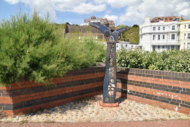
Ponds Wood Images

Images are sourced within 2km of 50.866822/0.54825385 or Grid Reference TQ7910. Thanks to Geograph Open Source API. All images are credited.

St Leonards Academy
St Leonards Academy
Marina Fountain sign
Leolyn House Large Victorian building, converted from care home into sixteen flats in 2020.
Leolyn House
Large Victorian building, converted from care home into sixteen flats in 2020.
Pevensey Road Residential road heading towards Upper Maze Hill, St John the Evangelist's Church in the background.
Pevensey Road
Residential road heading towards Upper Maze Hill, St John the Evangelist's Church in the background.
Lazonby Court Addressed Cumberland Gardens, large block of 45 flats.
Lazonby Court
Addressed Cumberland Gardens, large block of 45 flats.
Du Cros House Two blocks of seven flats in each. Built c2007 on the site of Levetleigh, which was destroyed after an attack by Suffragettes in 1913.
Du Cros House
Two blocks of seven flats in each. Built c2007 on the site of Levetleigh, which was destroyed after an attack by Suffragettes in 1913.
Brittany Road Residential road looking heading towards Upper Maze Hill. St John's Church -The Evangelist in the background.
Brittany Road
Residential road looking heading towards Upper Maze Hill. St John's Church -The Evangelist in the background.
Finch Mansions Block of 38 flats located on Upper Maze Hill.
Finch Mansions
Block of 38 flats located on Upper Maze Hill.
Charles Road West, St Leonards
Footpath by Combe Haven Combe Valley Countryside Park is an 600 acre area of marshlands, woodland and beach between Bexhill and St Leonards.

Originally called the Pebsham Countryside Park, the park was first mooted in 1993 as part of the North Bexhill Strategic Framework. 

In 2008 the Pebsham Countryside Park Project Management Board was formed comprising representatives from Hastings Borough Council, Rother District Council, East Sussex County Council and Crowhurst Parish Council.

In 2012 the Management Board renamed the park Combe Valley Countryside Park following feedback from the public that the name Pebsham did not reflect the full extent of the greenspace within the Combe Haven area. The proposed Countryside Park covers an area of 600 hectares within Rother District and Hastings Borough. 

The Hastings to Bexhill link road, Combe Valley Way construction, started in 2013 to the north of the park area, which cuts through the park.
Footpath by Combe Haven
Combe Valley Countryside Park is an 600 acre area of marshlands, woodland and beach between Bexhill and St Leonards. Originally called the Pebsham Countryside Park, the park was first mooted in 1993 as part of the North Bexhill Strategic Framework. In 2008 the Pebsham Countryside Park Project Management Board was formed comprising representatives from Hastings Borough Council, Rother District Council, East Sussex County Council and Crowhurst Parish Council. In 2012 the Management Board renamed the park Combe Valley Countryside Park following feedback from the public that the name Pebsham did not reflect the full extent of the greenspace within the Combe Haven area. The proposed Countryside Park covers an area of 600 hectares within Rother District and Hastings Borough. The Hastings to Bexhill link road, Combe Valley Way construction, started in 2013 to the north of the park area, which cuts through the park.
Footpath, Combe Haven Combe Valley Countryside Park is an 600 acre area of marshlands, woodland and beach between Bexhill and St Leonards.

Originally called the Pebsham Countryside Park, the park was first mooted in 1993 as part of the North Bexhill Strategic Framework. 

In 2008 the Pebsham Countryside Park Project Management Board was formed comprising representatives from Hastings Borough Council, Rother District Council, East Sussex County Council and Crowhurst Parish Council.

In 2012 the Management Board renamed the park Combe Valley Countryside Park following feedback from the public that the name Pebsham did not reflect the full extent of the greenspace within the Combe Haven area. The proposed Countryside Park covers an area of 600 hectares within Rother District and Hastings Borough. 

The Hastings to Bexhill link road, Combe Valley Way construction, started in 2013 to the north of the park area, which cuts through the park.
Footpath, Combe Haven
Combe Valley Countryside Park is an 600 acre area of marshlands, woodland and beach between Bexhill and St Leonards. Originally called the Pebsham Countryside Park, the park was first mooted in 1993 as part of the North Bexhill Strategic Framework. In 2008 the Pebsham Countryside Park Project Management Board was formed comprising representatives from Hastings Borough Council, Rother District Council, East Sussex County Council and Crowhurst Parish Council. In 2012 the Management Board renamed the park Combe Valley Countryside Park following feedback from the public that the name Pebsham did not reflect the full extent of the greenspace within the Combe Haven area. The proposed Countryside Park covers an area of 600 hectares within Rother District and Hastings Borough. The Hastings to Bexhill link road, Combe Valley Way construction, started in 2013 to the north of the park area, which cuts through the park.
St Ethelburga's Church
Sussex Cars
Sussex Cars
Derelict shelter
Derelict shelter
National Cycleroute Network Milepost 1000 Millennium cast iron mileposts were funded by the Royal Bank of Scotland to mark the creation of the National Cycle Network, and found along the cycles routes through the UK.

There are four different types of posts, "Fossil Tree" by John Mills, "The Cockerel" by Iain McColl, "Rowe Type" by Andrew Rowe, and "Tracks" by David Dudgeon. The four artists are from each country of the UK though all posts can be found in all four countries.

Read the National Cycle Network article <a title="https://www.geograph.org.uk/article/National-Cycle-Network" href="https://www.geograph.org.uk/article/National-Cycle-Network">Link</a>
National Cycleroute Network Milepost
1000 Millennium cast iron mileposts were funded by the Royal Bank of Scotland to mark the creation of the National Cycle Network, and found along the cycles routes through the UK. There are four different types of posts, "Fossil Tree" by John Mills, "The Cockerel" by Iain McColl, "Rowe Type" by Andrew Rowe, and "Tracks" by David Dudgeon. The four artists are from each country of the UK though all posts can be found in all four countries. Read the National Cycle Network article Link
The Marina Fountain
The Marina Fountain
Promenade, West St Leonards
National Cycleroute 2 National Route 2 will link Dover with St. Austell  when complete via the south coast of England and is sometimes referred to as the South Coast Cycle Route.
The route is only fully open, at present, and signed between Dover and Brighton, but is still under development between Brighton and St. Austell.
National Cycleroute 2
National Route 2 will link Dover with St. Austell when complete via the south coast of England and is sometimes referred to as the South Coast Cycle Route. The route is only fully open, at present, and signed between Dover and Brighton, but is still under development between Brighton and St. Austell.
Show me another place!

Ponds Wood is located at Grid Ref: TQ7910 (Lat: 50.866822, Lng: 0.54825385)

Administrative County: East Sussex

District: Hastings

Police Authority: Sussex

What 3 Words

///mini.play.crash. Near St Leonards-on-Sea, East Sussex

Related Wikis

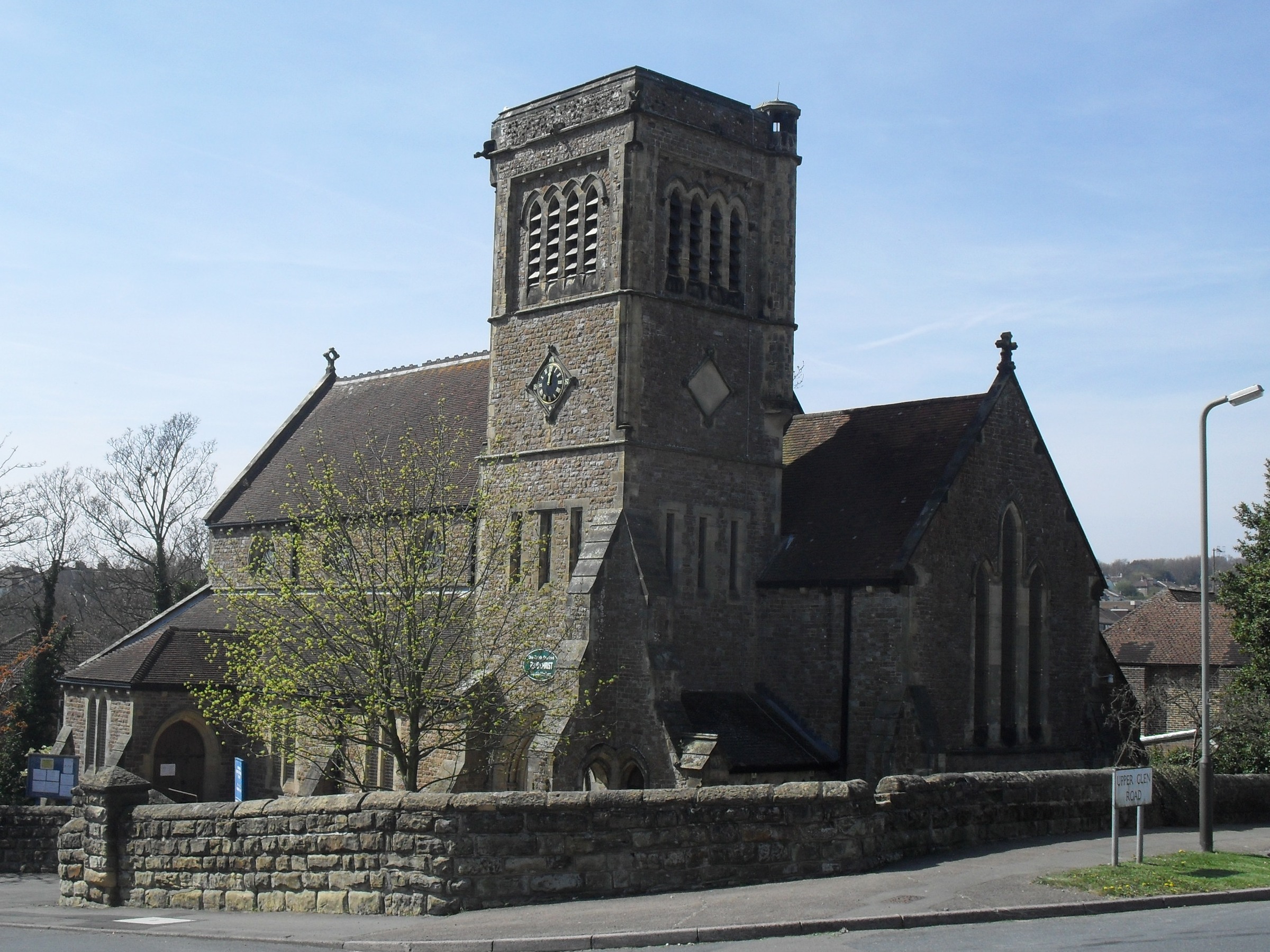
St Matthew's Church, Silverhill

St Matthew's Church is an Anglican church in the Silverhill suburb of Hastings, a town and borough in the English county of East Sussex. The present building...

Silverhill, East Sussex

Silverhill is a suburb and local government ward of Hastings, East Sussex, England. It has a central location within the town, where the A21 meets the...

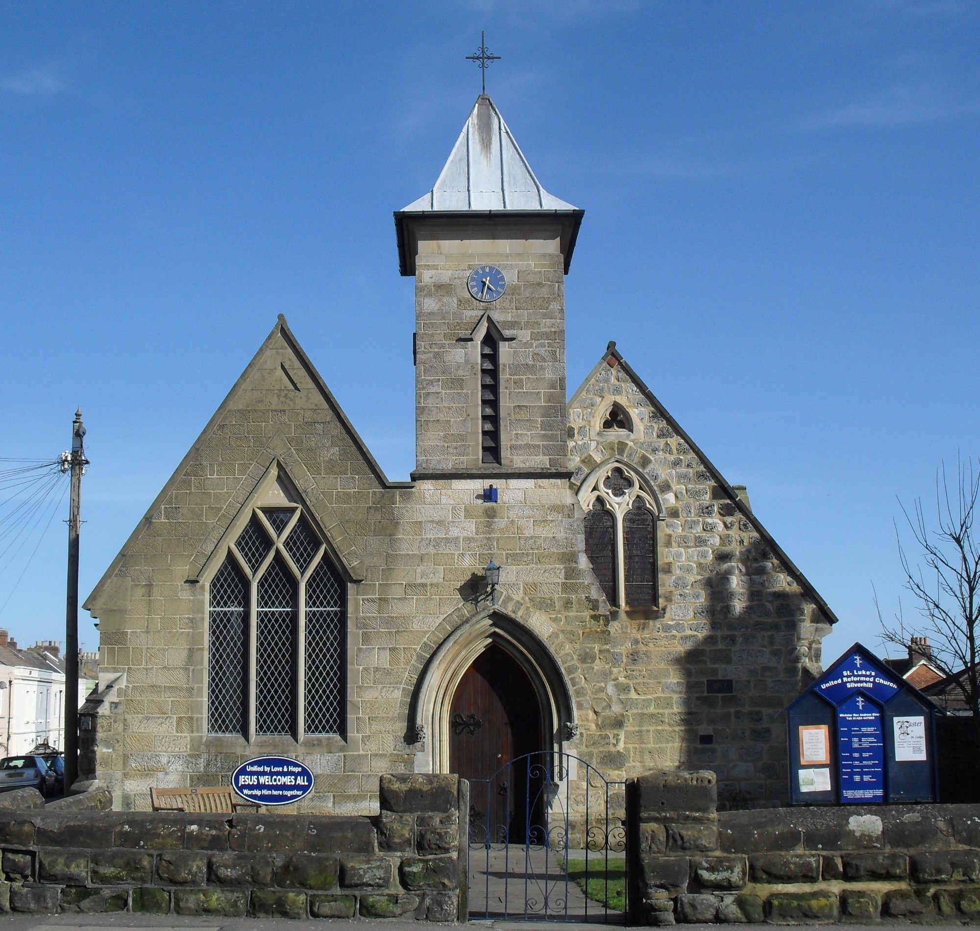
St Luke's United Reformed Church, Silverhill, Hastings

St Luke's Church is a United Reformed church in the Silverhill suburb of Hastings, a town and borough in East Sussex, England. The congregation was originally...

Hollington, Hastings

Hollington is a council estate and local government ward in the northwest of Hastings, in the Hastings district, in the county of East Sussex, England...

Nearby Amenities

Located within 500m of 50.866822,0.54825385
Traffic Signals
Traffic Signals: signal
Traffic Signals Direction: forward
Lat/Long: 50.8636149/0.5514311
Turning Circle
Lat/Long: 50.8657515/0.5421838
Barrier: swing_gate
Lat/Long: 50.8698376/0.5531533
Post Box
Collection Times: Mo-Fr 16:45, Sa 12:15
Ref: TN38 97
Royal Cypher: EIIR
Royal Cypher Wikidata: Q33102113
Lat/Long: 50.8660959/0.5540697
Post Box
Operator: Royal Mail
Operator Wikidata: Q638098
Ref: TN38 123
Lat/Long: 50.8636168/0.5515003
Post Box
Collection Times: Mo-Fr 18:15; Sa 12:15
Operator: Royal Mail
Operator Wikidata: Q638098
Post Box Design: type_k
Post Box Type: pillar
Ref: TN38 10
Royal Cypher: EIIR
Royal Cypher Wikidata: Q33102113
Lat/Long: 50.8681958/0.5484497
Shop: car
Lat/Long: 50.8632668/0.5510829
Bus Stop
Springfield Road
Bus: yes
Public Transport: platform
Ref: esuagtjt
Shelter: yes
Lat/Long: 50.8630015/0.5505258
Bus Stop
Ponswood Road
Bench: no
Bin: no
Bus: yes
Lit: yes
Public Transport: platform
Ref: esuagwam
Shelter: no
Tactile Paving: yes
Lat/Long: 50.8667898/0.5549239
Bus Stop
St Matthew's Gardens
Bench: no
Bin: no
Bus: yes
Lit: yes
Public Transport: platform
Ref: esudgmgt
Shelter: no
Tactile Paving: yes
Lat/Long: 50.8642137/0.5520776
Bus Stop
Ponswood Road
Bench: no
Bin: no
Bus: yes
Lit: yes
Public Transport: platform
Ref: esuagtmd
Shelter: no
Tactile Paving: yes
Lat/Long: 50.8667306/0.5547361
Traffic Signals
Traffic Signals: signal
Traffic Signals Direction: forward
Lat/Long: 50.8633495/0.550875
Bus Stop
St Matthew's Gardens
Bench: no
Bin: no
Bus: yes
Lit: yes
Public Transport: platform
Ref: esuagtma
Shelter: no
Tactile Paving: no
Lat/Long: 50.8646884/0.5528419
Bus Stop
Springfield Road
Bus: yes
Naptan AtcoCode: 1400HA0129
Naptan NaptanCode: esuagtjw
Public Transport: platform
Ref: esuagtjw
Shelter: yes
Lat/Long: 50.862958/0.550568
Bus Stop
Bus: yes
Public Transport: platform
Lat/Long: 50.8702075/0.5515671
Bus Stop
Bus: yes
Public Transport: platform
Lat/Long: 50.8686323/0.5507094
Bus Stop
Bus: yes
Public Transport: platform
Lat/Long: 50.8689012/0.5510842
Bus Stop
Conveyancing Direct
Bench: no
Bin: no
Bus: yes
Lit: yes
Naptan AtcoCode: 1400HA0132
Naptan NaptanCode: esuagtmg
Public Transport: platform
Shelter: no
Tactile Paving: no
Lat/Long: 50.8677683/0.5500476
Post Box
Collection Times: Mo-Fr 09:00, Sa 07:00
Ref: TN38 96D
Royal Cypher: EIIR
Royal Cypher Wikidata: Q33102113
Lat/Long: 50.8645699/0.5434
Traffic Signals
Traffic Signals: signal
Traffic Signals Direction: forward
Lat/Long: 50.8634354/0.5513851
Traffic Signals
Traffic Signals: signal
Traffic Signals Direction: backward
Lat/Long: 50.8631399/0.5507929
Crossing
Crossing: zebra
Crossing Island: no
Kerb: lowered
Tactile Paving: yes
Lat/Long: 50.8658022/0.5540833
Crossing
Crossing: uncontrolled
Lat/Long: 50.866879/0.55236
Crossing
Crossing: uncontrolled
Crossing Markings: yes
Lat/Long: 50.869438/0.5530357
247 Transport Solutions Ltd
Website: https://www.247.uk.com/
Lat/Long: 50.8690443/0.5507094
Fuel
Asda
Brand: Asda
Brand Wikidata: Q297410
Brand Wikipedia: en:Asda
Contact Website: https://storelocator.asda.com/south-east/saint-leonards/battle-road
Operator: Asda Stores Ltd
Lat/Long: 50.86916/0.5530573
Crossing
Crossing: uncontrolled
Crossing Island: no
Lat/Long: 50.8697439/0.5530279
Recycling
Recycling Type: centre
Lat/Long: 50.8697934/0.552869
Social Facility
Queen Mary Nursing Home
Addr City: Hastings
Addr Housename: Queen Marys Lodge
Addr Postcode: TN38 0SE
Addr Street: Hollington Park Road
Fhrs Id: 169284
Note: Approx location
Social Facility: group_home
Social Facility For: senior
Lat/Long: 50.8635535/0.5451376
Pharmacy
Asda
Brand: Asda
Brand Wikidata: Q297410
Brand Wikipedia: en:Asda
Contact Phone: +44 1424 857430
Contact Website: https://storelocator.asda.com/south-east/saint-leonards/battle-road/pharmacy
Fixme: Location not accurate
Healthcare: pharmacy
Operator: Asda Stores Ltd
Lat/Long: 50.8678094/0.5536509
Turning Circle
Lat/Long: 50.8696077/0.5533567
Screwfix
Addr City: St Leonards-on-Sea
Addr Housenumber: 12-14
Addr Street: Theaklen Drive
Brand: Screwfix
Brand Wikidata: Q7439115
Brand Wikipedia: en:Screwfix
Shop: doityourself
Website: https://www.screwfix.com/stores/UA1/st-leonards-hastings
Lat/Long: 50.8682067/0.5531647
DHS Bathrooms and Tiles
Addr City: St Leonards-on-Sea
Addr Housenumber: 16
Addr Street: Theaklen Drive
Shop: bathroom_furnishing
Lat/Long: 50.8683337/0.5530014
Airtemp AC
Addr City: St Leonards-on-Sea
Addr Housenumber: 18
Addr Street: Theaklen Drive
Office: yes
Lat/Long: 50.86843/0.5529259
Bausch & Lomb
Addr City: St Leonards-on-Sea
Addr Housenumber: 20
Addr Street: Theaklen Drive
Man Made: works
Lat/Long: 50.8685943/0.5527595
Photonic Science & Engineering
Addr City: St Leonards-on-Sea
Addr Housenumber: 22
Addr Street: Theaklen Drive
Man Made: works
Lat/Long: 50.8688335/0.5525284
M-Tech Body Shop
Addr City: St Leonards-on-Sea
Addr Housenumber: 34-36
Addr Street: Theaklen Drive
Shop: car_repair
Lat/Long: 50.8695218/0.5517828
Hastings & Rye Conservative Association
Addr City: St Leonards-on-Sea
Addr Housename: Swallow House
Addr Street: Theaklen Drive
Office: political_party
Lat/Long: 50.869706/0.5515363
Zeus Gym
Addr City: St Leonards-on-Sea
Addr Street: Theaklen Drive
Leisure: fitness_centre
Lat/Long: 50.8698501/0.5517894
We Buy Any Car Hastings
Addr City: St Leonards-on-Sea
Addr Housename: Suite 17 Tremlon House
Addr Housenumber: 100
Addr Street: Menzies Road
Second Hand: only
Shop: car
Lat/Long: 50.8695852/0.5482315
Hastings Hire
Addr City: St Leonards-on-Sea
Addr Housename: VIP House
Addr Street: Menzies Road
Shop: tool_hire
Lat/Long: 50.8695613/0.5486753
Crossing
Crossing: uncontrolled
Lat/Long: 50.8684896/0.5541068
Fast Food
KFC
Addr City: St Leonards-on-Sea
Addr Housenumber: 5
Addr Postcode: TN37 7AA
Addr Street: Battle Road
Alt Name: Kentucky Fried Chicken
Brand: KFC
Brand Wikidata: Q524757
Brand Wikipedia: en:KFC
Contact Website: https://www.kfc.co.uk/kfc-near-me/saint-leonards-battle-road
Cuisine: chicken
Takeaway: yes
Lat/Long: 50.8680955/0.5548894
Crossing
Crossing Island: yes
Tactile Paving: yes
Lat/Long: 50.8631783/0.5508444
Crossing
Crossing: uncontrolled
Crossing Island: no
Crossing Markings: yes
Lat/Long: 50.8690565/0.5530235
Crossing
Crossing: uncontrolled
Crossing Island: no
Crossing Markings: yes
Lat/Long: 50.8690312/0.5532334
Crossing
Crossing: uncontrolled
Crossing Island: no
Crossing Markings: yes
Lat/Long: 50.8690054/0.5534608
Crossing
Crossing: uncontrolled
Crossing Island: no
Crossing Markings: yes
Lat/Long: 50.868977/0.5536766
Crossing
Crossing: uncontrolled
Crossing Island: no
Crossing Markings: yes
Lat/Long: 50.8689524/0.5538884
Crossing
Crossing: uncontrolled
Crossing Island: no
Crossing Markings: yes
Lat/Long: 50.8689288/0.5541076
Motorcycle Parking
Access: customers
Lat/Long: 50.8684813/0.5539893
Post Box
Collection Times: Mo-Fr 17:00; Sa 12:15
Operator: Royal Mail
Post Box Design: indoor_pillar
Post Box Type: pillar
Ref: TN38 206
Royal Cypher: EIIR
Survey Date: 2024-02-17
Lat/Long: 50.8683265/0.5542731
Post Box
Collection Times: Mo-Fr 09:00; Sa 07:00
Operator: Royal Mail
Post Box Mounting: pier
Post Box Type: lamp
Ref: TN37 44D
Royal Cypher: EIIR
Survey Date: 2024-02-17
Lat/Long: 50.8674954/0.5413945
Post Box
Collection Times: Mo-Fr 18:15; Sa 12:15
Operator: Royal Mail
Operator Wikidata: Q638098
Post Box Type: meter
Ref: TN38 89P
Royal Cypher: EIIR
Royal Cypher Wikidata: Q33102113
Survey Date: 2024-02-17
Lat/Long: 50.868193/0.5484695
The data included in this document is from www.openstreetmap.org. The data is made available under ODbL.

Have you been to Ponds Wood?

Leave your review of Ponds Wood below (or comments, questions and feedback).