Fishpool

Settlement in Montgomeryshire

Wales

Fishpool

Walkers leave the south cairn on Corndon Hill Corndon Hill has five stone cairns on prominent points around its summit, of which three can be easily accessed, two being sited in sheep pasture rather than on Open Access Land.
Walkers leave the south cairn on Corndon Hill Credit: Jeremy Bolwell

Fishpool is a small village located in the county of Montgomeryshire, Wales. Situated in the picturesque Welsh countryside, it is renowned for its tranquil and idyllic setting. The village is nestled amidst rolling hills, with lush green fields and meandering streams that add to its natural charm.

Historically, Fishpool has been an agricultural community, with farming playing a significant role in its economy. The village is dotted with traditional Welsh farmhouses and barns, showcasing the area's rich agricultural heritage. The fertile land surrounding Fishpool supports a variety of crops, including wheat, barley, and potatoes.

The village itself is compact, with a close-knit community that values its rural lifestyle. It features a few quaint cottages, a local pub, and a small village store to cater to the basic needs of its residents. The village pub serves as a gathering place for locals and visitors alike, offering a warm and friendly atmosphere.

Nature lovers are drawn to Fishpool for its natural beauty and abundance of wildlife. The surrounding countryside provides ample opportunities for outdoor activities such as hiking, cycling, and birdwatching. The nearby rivers and lakes are also popular spots for fishing enthusiasts.

Despite its small size, Fishpool enjoys a rich cultural heritage. The village hosts various community events throughout the year, including traditional festivals and agricultural shows, which offer a glimpse into the local customs and traditions.

In summary, Fishpool is a charming and peaceful village in Montgomeryshire, Wales, offering a serene escape from the hustle and bustle of city life. Its natural beauty, agricultural roots, and strong sense of community make it a truly special place to visit or call home.

If you have any feedback on the listing, please let us know in the comments section below.
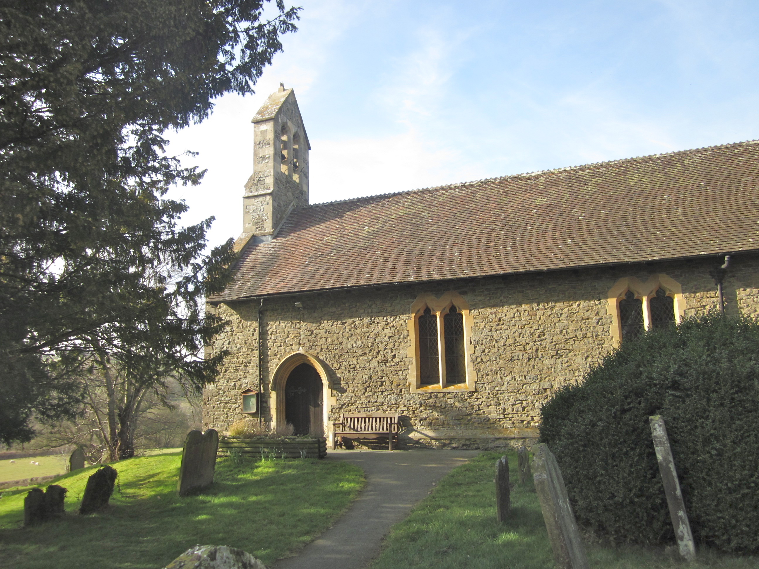
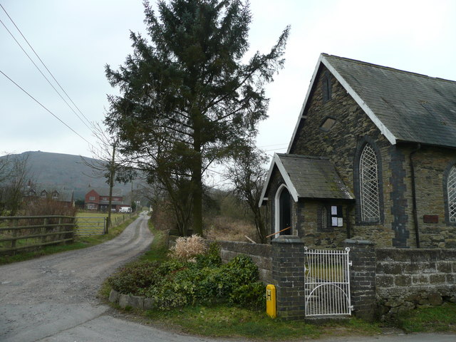
Fishpool Images

Images are sourced within 2km of 52.557089/-3.005207 or Grid Reference SO3195. Thanks to Geograph Open Source API. All images are credited.

Walkers leave the south cairn on Corndon Hill Corndon Hill has five stone cairns on prominent points around its summit, of which three can be easily accessed, two being sited in sheep pasture rather than on Open Access Land.
Walkers leave the south cairn on Corndon Hill
Corndon Hill has five stone cairns on prominent points around its summit, of which three can be easily accessed, two being sited in sheep pasture rather than on Open Access Land.
The north east cairn on Corndon Hill A shelter has been excavated into the cairn hence its 'flying saucer' profile. The summit of Corndon is in the background.
The north east cairn on Corndon Hill
A shelter has been excavated into the cairn hence its 'flying saucer' profile. The summit of Corndon is in the background.
Corndon Hill summit Here are three good things to find at a summit; a trig point of course, a cairn and a wooden bench. In warm weather a great point to sit with powerful binoculars as you can spend ages birdwatching and spotting out features in the landscape below such as Mitchell's Fold Stone Circle.
Corndon Hill summit
Here are three good things to find at a summit; a trig point of course, a cairn and a wooden bench. In warm weather a great point to sit with powerful binoculars as you can spend ages birdwatching and spotting out features in the landscape below such as Mitchell's Fold Stone Circle.
Slime mould on Corndon Hill If you have ever encountered this on walks you may well, as I have, discount it as dog vomit but it is in fact a slime mould, a life form that used to be classified as a fungi. It feeds on micro-organisms that you may find on the forest floor, lawns or logs. It grows to form a substance, such as this one, eventually dries out and becomes 'dust', dissolved in rain or washed away. The grass blades give scale but this example is five or six inches in length.
Slime mould on Corndon Hill
If you have ever encountered this on walks you may well, as I have, discount it as dog vomit but it is in fact a slime mould, a life form that used to be classified as a fungi. It feeds on micro-organisms that you may find on the forest floor, lawns or logs. It grows to form a substance, such as this one, eventually dries out and becomes 'dust', dissolved in rain or washed away. The grass blades give scale but this example is five or six inches in length.
Smaller slime mould on Corndon Hill The common name for this slime mould is 'Dog's vomit slime mould' as that is what it most readily resembles. I'm not a great person for getting on my knees to closely inspect things like this but I must say that they are amazing little life forms; emerging or forming, living their life cycle and drying out awaiting the opportunity to reform via spores released during their brief existence. They mystified early scientists and observers for years if not centuries until they have been more understood and studied only in recent decades.
Smaller slime mould on Corndon Hill
The common name for this slime mould is 'Dog's vomit slime mould' as that is what it most readily resembles. I'm not a great person for getting on my knees to closely inspect things like this but I must say that they are amazing little life forms; emerging or forming, living their life cycle and drying out awaiting the opportunity to reform via spores released during their brief existence. They mystified early scientists and observers for years if not centuries until they have been more understood and studied only in recent decades.
"Yeah, we're bored of slime moulds now" For scale, the slime moulds and some average sized human life forms.
"Yeah, we're bored of slime moulds now"
For scale, the slime moulds and some average sized human life forms.
Rock outcrops on the edge of Corndon Hill
Footpath under Corndon Hill The stile only serves to mark the way.
Footpath under Corndon Hill
The stile only serves to mark the way.
The lower slopes of Corndon Hill Sheep graze on the lower slopes.
The lower slopes of Corndon Hill
Sheep graze on the lower slopes.
Footpath on the northern side of Corndon Hill
Stile on Corndon Hill With a view into Powys and the River Severn valley.
Stile on Corndon Hill
With a view into Powys and the River Severn valley.
Bronze age cairn on Corndon Hill One of five cairns on Corndon Hill.
Bronze age cairn on Corndon Hill
One of five cairns on Corndon Hill.
Bronze age cairns on Corndon Hill The small cairn on the edge of the plateau appears to align with the possible chambers and entrance on the larger cairn on a south west (sunrise on summer solstice) axis.
Bronze age cairns on Corndon Hill
The small cairn on the edge of the plateau appears to align with the possible chambers and entrance on the larger cairn on a south west (sunrise on summer solstice) axis.
Bronze age cairn on Corndon Hill
Summit of Corndon Hill The summit with its Bronze Age cairns offers a panorama including the Shropshire Hills and Cambrian Mountains.
Summit of Corndon Hill
The summit with its Bronze Age cairns offers a panorama including the Shropshire Hills and Cambrian Mountains.
Corndon Hill View from the north. Corndon Hill is in Montgomeryshire, but is traditionally lumped in with the Shropshire Hills and is the starting hill for the Shropshire 1500' hill challenge walk over Stiperstones, Long Mynd, The Caradoc group and Clees.
Since this was taken, the plantation has been felled.
Corndon Hill
View from the north. Corndon Hill is in Montgomeryshire, but is traditionally lumped in with the Shropshire Hills and is the starting hill for the Shropshire 1500' hill challenge walk over Stiperstones, Long Mynd, The Caradoc group and Clees. Since this was taken, the plantation has been felled.
Summit of Corndon Hill Triangulation pillar at the corner of a wood, since felled.  (Corndon Hill, 513m, 201 prominence.)
Summit of Corndon Hill
Triangulation pillar at the corner of a wood, since felled. (Corndon Hill, 513m, 201 prominence.)
Eastern top of Corndon Hill Seen from a fence corner south-east of the actual summit of Corndon Hill, the view is over low grass to a slightly lower rise of the same hill with Heath Mynd, (in another country), the dome beyond.
Eastern top of Corndon Hill
Seen from a fence corner south-east of the actual summit of Corndon Hill, the view is over low grass to a slightly lower rise of the same hill with Heath Mynd, (in another country), the dome beyond.
Show me another place!

Fishpool is located at Grid Ref: SO3195 (Lat: 52.557089, Lng: -3.005207)

Unitary Authority: Powys

Police Authority: Dyfed Powys

What 3 Words

///beard.warmers.bulge. Near Norbury, Shropshire

Related Wikis

Hyssington

Hyssington (Welsh: Isatyn) is a parish in the South-Eastern corner of the historic county of Montgomeryshire in Wales and borders the county of Shropshire...

White Grit

White Grit is a small, scattered village beneath Corndon Hill in Powys, Wales, directly on the border with (and partly in) Shropshire. The nearby village...

Corndon Hill

Corndon Hill (Welsh: Cornatyn) is a hill in Powys, Mid Wales, whose isolated summit rises to 513.6 metres (1,685 ft) above sea level. It has a topographic...

Whetstones (stone circle)

The Whetstones are, or were, a stone circle beneath Corndon Hill in the parish of Church Stoke, Montgomeryshire, Wales, near the border with Shropshire...

Nearby Amenities

Located within 500m of 52.557089,-3.005207
Building: yes
Lat/Long: 52.5553561/-3.0056661
The data included in this document is from www.openstreetmap.org. The data is made available under ODbL.

Have you been to Fishpool?

Leave your review of Fishpool below (or comments, questions and feedback).