Five Acre Wood

Wood, Forest in Kent Maidstone

England

Five Acre Wood

Eastbound Javelin train on the HS1 route at Detling
Eastbound Javelin train on the HS1 route at Detling Credit: David Martin

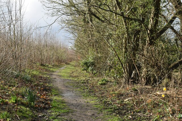
Five Acre Wood is a picturesque woodland located in the county of Kent, England. Encompassing an area of approximately five acres, it is a small yet enchanting forest that offers a tranquil escape from the hustle and bustle of everyday life.

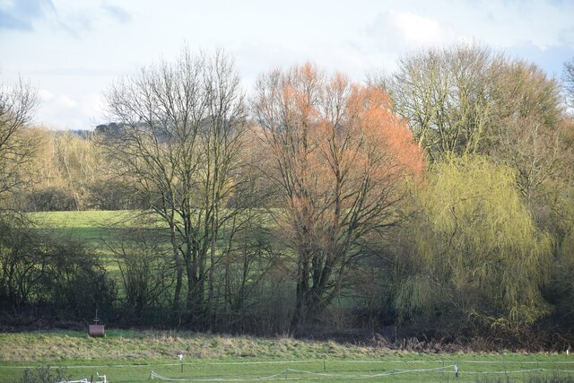
The woodland is characterized by its diverse range of tree species, including oak, beech, and birch trees. These majestic trees provide a dense canopy, creating a cool and shaded environment within the wood. The forest floor is covered with a thick layer of moss and fallen leaves, giving it a lush and carpeted appearance.

Five Acre Wood is home to a variety of wildlife, making it a popular destination for nature enthusiasts and wildlife photographers. Visitors may catch glimpses of squirrels darting between the trees, or hear the enchanting songs of woodland birds echoing through the air. In the spring, the forest comes alive with vibrant wildflowers, adding a burst of color to the green landscape.

The wood is intersected by a network of well-maintained footpaths, allowing visitors to explore its beauty at their own pace. These paths lead to secluded clearings and peaceful glades, offering perfect spots for picnics or quiet contemplation. The forest also features a small stream that meanders through its heart, adding to its natural charm.

Five Acre Wood is a cherished local gem, providing a sanctuary for both humans and wildlife alike. Its natural beauty and serene atmosphere make it a must-visit destination for those seeking a peaceful retreat in the heart of Kent.

If you have any feedback on the listing, please let us know in the comments section below.

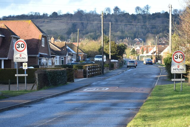
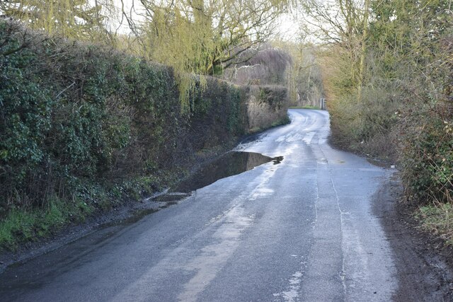
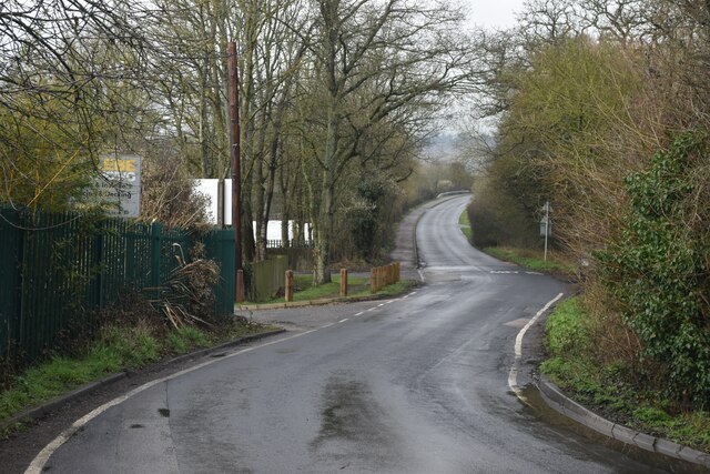
Five Acre Wood Images

Images are sourced within 2km of 51.278931/0.56000162 or Grid Reference TQ7856. Thanks to Geograph Open Source API. All images are credited.

Eastbound Javelin train on the HS1 route at Detling
Detling Village from the south With the line of Detling Hill beyond.
Detling Village from the south
With the line of Detling Hill beyond.
Puddle in Hockers Lane
Hockers Lane Looking past the waterworks entrance towards the M20 bridge.
Hockers Lane
Looking past the waterworks entrance towards the M20 bridge.
Trees and fields south of the M20
Path on the edge of Pope's Wood
Path in Mote Park, toward Ashford Road
Grovewood Drive Seen from the junction with Weavering Street
Grovewood Drive
Seen from the junction with Weavering Street
Mote House, from the southwest
Cheshire Road, Mote Park Despite the name, this is a path within the park, not a public road.
Cheshire Road, Mote Park
Despite the name, this is a path within the park, not a public road.
Bridge across the lake, Mote Park
Catamarans and swan boats, Mote Park lake
Waterfall into the lake, Mote Park
Footbridge, Mote Park, Maidstone Mote Park is an 18th and 19th century landscape park created from an earlier deer park, one of the earliest in Kent. In 1927 it was sold to Maidstone Corporation and opened to the public. Here, the footbridge spans part of the River Len that rises at a spring  to the southeast of the village of Lenham, opens up as a  lake in Mote Park and enters the River Medway at Maidstone.
Footbridge, Mote Park, Maidstone
Mote Park is an 18th and 19th century landscape park created from an earlier deer park, one of the earliest in Kent. In 1927 it was sold to Maidstone Corporation and opened to the public. Here, the footbridge spans part of the River Len that rises at a spring to the southeast of the village of Lenham, opens up as a lake in Mote Park and enters the River Medway at Maidstone.
Mote Park, Maidstone Feeding the ducks - and pigeons and geese, by the lake. Mote Park is an 18th and 19th century landscape park created from an earlier deer park, one of the earliest in Kent. In 1927 it was sold to Maidstone Corporation and opened to the public. The River Len rises at a spring  to the southeast of the village of Lenham, opens up as a  lake in Mote Park then enters the River Medway at Maidstone.
Mote Park, Maidstone
Feeding the ducks - and pigeons and geese, by the lake. Mote Park is an 18th and 19th century landscape park created from an earlier deer park, one of the earliest in Kent. In 1927 it was sold to Maidstone Corporation and opened to the public. The River Len rises at a spring to the southeast of the village of Lenham, opens up as a lake in Mote Park then enters the River Medway at Maidstone.
Mote Park lake, Maidstone The old boathouse was built in around 1800, at the same time that Mote House was rebuilt. It houses the lake sluice. Mote Park is an 18th and 19th century landscape park created from an earlier deer park, one of the earliest in Kent. In 1927 it was sold to Maidstone Corporation and opened to the public.
Mote Park lake, Maidstone
The old boathouse was built in around 1800, at the same time that Mote House was rebuilt. It houses the lake sluice. Mote Park is an 18th and 19th century landscape park created from an earlier deer park, one of the earliest in Kent. In 1927 it was sold to Maidstone Corporation and opened to the public.
Mote Park, Maidstone Young tree and a row of seating by the lake to the right of the boathouse. Mote Park is an 18th and 19th century landscape park created from an earlier deer park, one of the earliest in Kent. In 1927 it was sold to Maidstone Corporation and opened to the public. The River Len rises at a spring  to the southeast of the village of Lenham, opens up as the lake in Mote Park and enters the River Medway at Maidstone.
Mote Park, Maidstone
Young tree and a row of seating by the lake to the right of the boathouse. Mote Park is an 18th and 19th century landscape park created from an earlier deer park, one of the earliest in Kent. In 1927 it was sold to Maidstone Corporation and opened to the public. The River Len rises at a spring to the southeast of the village of Lenham, opens up as the lake in Mote Park and enters the River Medway at Maidstone.
Mote Park, Maidstone Autumn colour and one of the main tracks by the lake. Mote Park is an 18th and 19th century landscape park created from an earlier deer park, one of the earliest in Kent. In 1927 it was sold to Maidstone Corporation and opened to the public.
Mote Park, Maidstone
Autumn colour and one of the main tracks by the lake. Mote Park is an 18th and 19th century landscape park created from an earlier deer park, one of the earliest in Kent. In 1927 it was sold to Maidstone Corporation and opened to the public.
Show me another place!

Five Acre Wood is located at Grid Ref: TQ7856 (Lat: 51.278931, Lng: 0.56000162)

Administrative County: Kent

District: Maidstone

Police Authority: Kent

What 3 Words

///means.moods.lists. Near Maidstone, Kent

Related Wikis

Grove Green

Grove Green is a suburban housing development, partially forming a part of Weavering village, near the town of Maidstone in Kent, England. The population...

Weavering

Weavering is a village, mainly consisting of parts of the Grove Green and Bearsted Park housing Estates, centred on Weavering Street, within the borough...

The Maidstone Studios

The Maidstone Studios, formerly called TVS Television Centre, is the largest independent television studio complex in the United Kingdom, and is based...

KIMS Hospital, Maidstone

KIMS Hospital is the largest independent private hospital in Kent. It is situated in Maidstone and treats privately insured, self-funding and NHS patients...

Vinters Valley Park

Vinters Valley Park is a 30.2-hectare (75-acre) Local Nature Reserve in Maidstone in Kent. It is owned by Kent County Council and Maidstone Borough Council...

Bearsted railway station

Bearsted railway station serves Bearsted in Kent, England. The station and all trains serving it are operated by Southeastern. It is 42 miles 59 chains...

Bearsted

Bearsted ( BAIR-sted, traditionally BUR-) is a village and civil parish with railway station in mid-Kent, England, two miles (3.2 km) east of Maidstone...

A2020 road

The A2020 is a previous road in Kent but has been renumbered to A20 following the construction of the M20 motorway. == History == Between 1960 and 1961...

Nearby Amenities

Located within 500m of 51.278931,0.56000162
Turning Circle
Lat/Long: 51.2753093/0.5640605
Post Box
Postal Code: ME14
Ref: ME14 348
Lat/Long: 51.2768336/0.5647144
Mini Roundabout
Direction: clockwise
Lat/Long: 51.2747272/0.5608634
Mini Roundabout
Direction: clockwise
Lat/Long: 51.2760601/0.5595289
Crossing
Lat/Long: 51.2782329/0.5555794
Barrier: bollard
Lat/Long: 51.2795601/0.5628907
Post Box
Operator: Royal Mail
Post Box Type: lamp
Ref: ME14 211D
Lat/Long: 51.2795135/0.5631245
Grove Green
Tourism: village_sign
Lat/Long: 51.2788554/0.5532128
Post Office
Grove Green Post Office
Brand: Post Office
Brand Wikidata: Q1783168
Check Date: 2023-09-27
Ref Pol Id: 7334
Wheelchair: yes
Lat/Long: 51.2771356/0.5564101
Bus Stop
Tesco
Bus: yes
Local Ref: adj
Naptan AtcoCode: 2400A001770A
Naptan Bearing: NW
Naptan BusStopType: MKD
Naptan CommonName: Tesco
Naptan Indicator: adj
Naptan Landmark: Tesco
Naptan NaptanCode: kntadtwp
Naptan PlusbusZoneRef: MSTONEB
Naptan RevisionNumber: 2
Naptan Status: act
Naptan Street: Grovewood Drive North
Naptan Verified: no
Not Name: Grovewood Drive
Public Transport: platform
Ref: kntadtwp
Shelter: yes
Source: naptan_import
Source Date: 2018-02-13
Lat/Long: 51.2771406/0.5570268
Bus Stop
Averenches Road
Flag: no
Naptan AtcoCode: 2400A071300A
Naptan Bearing: NE
Naptan BusStopType: CUS
Naptan CommonName: Averenches Road
Naptan Indicator: NE-bound
Naptan Landmark: Junc Ware St
Naptan NaptanCode: kntgdmjw
Naptan PlusbusZoneRef: MSTONEB
Naptan Street: Averenches Rd
Naptan Verified: no
Public Transport: platform
Source: naptan_import
Lat/Long: 51.2768231/0.5649973
Tesco
Addr City: Weavering
Addr Country: GB
Addr Housename: Minor Centre
Addr Postcode: ME14 5TQ
Addr Street: Grovewood Drive North
Brand: Tesco
Brand Wikidata: Q487494
Contact Website: https://www.tesco.com/store-locator/maidstone/grovewood-dr-north
Fhrs Id: 720991
Operator: Tesco Stores Ltd
Shop: supermarket
Lat/Long: 51.2766515/0.5557976
Fuel
Operator: Tesco
Lat/Long: 51.276671/0.5573487
Recycling
Lat/Long: 51.2763705/0.5581852
Post Box
Operator: Royal Mail
Operator Type: private
Operator Wikidata: Q638098
Post Box Type: lamp
Ref: ME14 321D
Lat/Long: 51.2749809/0.5586032
Pub
The Early Bird
Addr City: Weavering
Addr Country: GB
Addr Housename: Minor Centre
Addr Postcode: ME14 5TQ
Addr Street: Grovewood Drive North
Fhrs Id: 1155619
Lat/Long: 51.2770751/0.5566849
Atm
Brand: RBS
Level: 0
Opening Hours: 24/7
Operator: RBS
Wheelchair: yes
Lat/Long: 51.2765774/0.556368
Atm
Brand: RBS
Level: 0
Opening Hours: 24/7
Operator: RBS
Wheelchair: yes
Lat/Long: 51.2765584/0.5563409
Doctors
The New Grove Green Medical Centre
Lat/Long: 51.2768891/0.5561679
Post Box
Operator: Royal Mail
Post Box Type: pillar
Ref: ME14 347
Lat/Long: 51.2770641/0.5564561
Addr City: Weavering
Addr Country: GB
Addr Housename: Minor Centre
Addr Postcode: ME14 5TQ
Addr Street: Grovewood Drive North
Addr Unit: 3,4
Check Date: 2016-06-04
Disused Amenity: pharmacy
Level: 0
Old Name: Lloyds Pharmacy
Wheelchair: yes
Lat/Long: 51.2769882/0.5562284
Grove Green Post Office
Level: 0
Shop: newsagent
Wheelchair: yes
Lat/Long: 51.27714/0.5564733
Bus Stop
Tesco
Bus: yes
Local Ref: opp
Naptan AtcoCode: 2400102412
Naptan Bearing: SE
Naptan BusStopType: MKD
Naptan CommonName: Tesco
Naptan Indicator: opp
Naptan Landmark: Tesco
Naptan NaptanCode: kntgtmjt
Naptan RevisionNumber: 1
Naptan Status: act
Naptan Street: Grovewood Drive North
Naptan Verified: no
Public Transport: platform
Ref: kntgtmjt
Source: naptan_import
Source Date: 2018-02-13
Lat/Long: 51.2769291/0.5578956
Give Way
Direction: forward
Lat/Long: 51.2761037/0.5594203
Crossing
Lat/Long: 51.2787111/0.5535503
Generator Method: photovoltaic
Generator Output Electricity: yes
Generator Source: solar
Generator Type: solar_photovoltaic_panel
Location: roof
Power: generator
Lat/Long: 51.277941/0.5581114
Generator Method: photovoltaic
Generator Output Electricity: yes
Generator Source: solar
Generator Type: solar_photovoltaic_panel
Location: roof
Power: generator
Lat/Long: 51.278696/0.5574006
Generator Method: photovoltaic
Generator Output Electricity: yes
Generator Source: solar
Generator Type: solar_photovoltaic_panel
Location: roof
Power: generator
Lat/Long: 51.2784376/0.5557403
Generator Method: photovoltaic
Generator Output Electricity: yes
Generator Source: solar
Generator Type: solar_photovoltaic_panel
Location: roof
Power: generator
Lat/Long: 51.2787866/0.5558154
Generator Method: photovoltaic
Generator Output Electricity: yes
Generator Source: solar
Generator Type: solar_photovoltaic_panel
Location: roof
Power: generator
Lat/Long: 51.2784578/0.5537555
Generator Method: photovoltaic
Generator Output Electricity: yes
Generator Source: solar
Generator Type: solar_photovoltaic_panel
Location: roof
Power: generator
Lat/Long: 51.2799711/0.5544367
Generator Method: photovoltaic
Generator Output Electricity: yes
Generator Source: solar
Generator Type: solar_photovoltaic_panel
Location: roof
Power: generator
Lat/Long: 51.2789712/0.5573577
Generator Method: photovoltaic
Generator Output Electricity: yes
Generator Source: solar
Generator Type: solar_photovoltaic_panel
Location: roof
Power: generator
Lat/Long: 51.2792296/0.5577788
Generator Method: photovoltaic
Generator Output Electricity: yes
Generator Source: solar
Generator Type: solar_photovoltaic_panel
Location: roof
Power: generator
Lat/Long: 51.279498/0.5578566
Generator Method: photovoltaic
Generator Output Electricity: yes
Generator Source: solar
Generator Type: solar_photovoltaic_panel
Location: roof
Power: generator
Lat/Long: 51.2817294/0.5654874
Generator Method: photovoltaic
Generator Output Electricity: yes
Generator Source: solar
Generator Type: solar_photovoltaic_panel
Location: roof
Power: generator
Lat/Long: 51.2780844/0.5595108
Generator Method: photovoltaic
Generator Output Electricity: yes
Generator Source: solar
Generator Type: solar_photovoltaic_panel
Location: roof
Power: generator
Lat/Long: 51.2776876/0.5623654
Generator Method: photovoltaic
Generator Output Electricity: yes
Generator Source: solar
Generator Type: solar_photovoltaic_panel
Location: roof
Power: generator
Lat/Long: 51.277941/0.560917
Generator Method: photovoltaic
Generator Output Electricity: yes
Generator Source: solar
Generator Type: solar_photovoltaic_panel
Location: roof
Power: generator
Lat/Long: 51.277993/0.5610055
Generator Method: photovoltaic
Generator Output Electricity: yes
Generator Source: solar
Generator Type: solar_photovoltaic_panel
Location: roof
Power: generator
Lat/Long: 51.277097/0.5586451
Generator Method: photovoltaic
Generator Output Electricity: yes
Generator Source: solar
Generator Type: solar_photovoltaic_panel
Location: roof
Power: generator
Lat/Long: 51.2764829/0.5602679
Generator Method: photovoltaic
Generator Output Electricity: yes
Generator Source: solar
Generator Type: solar_photovoltaic_panel
Location: roof
Power: generator
Lat/Long: 51.2749527/0.560976
Generator Method: photovoltaic
Generator Output Electricity: yes
Generator Source: solar
Generator Type: solar_photovoltaic_panel
Location: roof
Power: generator
Lat/Long: 51.2774595/0.5660132
Generator Method: photovoltaic
Generator Output Electricity: yes
Generator Source: solar
Generator Type: solar_photovoltaic_panel
Location: roof
Power: generator
Lat/Long: 51.2751658/0.5635777
School
Snowfields Academy
Addr City: Maidstone
Addr Postcode: ME14 5GA
Addr Street: Popesfield Way
Lat/Long: 51.2814145/0.5596231
Generator Method: photovoltaic
Generator Output Electricity: yes
Generator Source: solar
Generator Type: solar_photovoltaic_panel
Location: roof
Power: generator
Lat/Long: 51.2783537/0.5630922
Generator Method: photovoltaic
Generator Output Electricity: yes
Generator Source: solar
Generator Type: solar_photovoltaic_panel
Location: roof
Power: generator
Lat/Long: 51.2785752/0.5644548
Generator Method: photovoltaic
Generator Output Electricity: yes
Generator Source: solar
Generator Type: solar_photovoltaic_panel
Location: roof
Power: generator
Lat/Long: 51.2786675/0.5643556
Turning Loop
Lat/Long: 51.2823338/0.5597493
Turning Loop
Lat/Long: 51.2815062/0.559018
Leisure: pitch
Sport: basketball
Lat/Long: 51.2811641/0.5559319
The data included in this document is from www.openstreetmap.org. The data is made available under ODbL.

Have you been to Five Acre Wood?

Leave your review of Five Acre Wood below (or comments, questions and feedback).