Brickwell Wood

Wood, Forest in Essex Chelmsford

England

Brickwell Wood

View eastwards along Tofts Chase, Little Baddow
View eastwards along Tofts Chase, Little Baddow Credit: Christopher Hilton

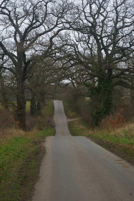
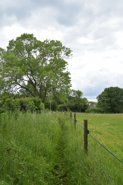
Brickwell Wood is a picturesque woodland located in the county of Essex, England. Stretching over an area of approximately 150 acres, it is a captivating destination for nature enthusiasts and locals alike. The woodland is situated near the village of Brickwell, offering a peaceful and serene environment for visitors to escape the hustle and bustle of everyday life.

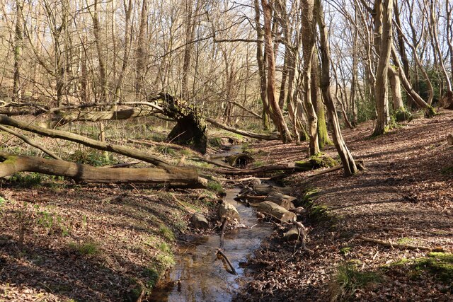
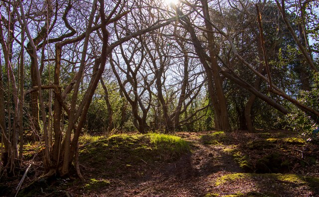
Brickwell Wood boasts a diverse range of flora and fauna, making it a haven for wildlife. The wood is predominantly comprised of broadleaf trees such as oak, beech, and birch, which create a stunning canopy during the summer months. The forest floor is adorned with an array of beautiful wildflowers, including bluebells and primroses, providing a vibrant and colorful landscape.

Numerous walking trails wind their way through Brickwell Wood, allowing visitors to explore its natural beauty at their own pace. These paths are well-maintained and clearly signposted, ensuring easy navigation. Along the way, visitors may encounter various wildlife species such as deer, foxes, and a rich variety of birdlife.

Brickwell Wood offers a range of recreational activities for visitors to enjoy. Picnic areas are scattered throughout the woodland, providing the perfect spot for a leisurely lunch surrounded by nature. Additionally, the wood is a popular destination for nature photography, with its stunning landscapes providing endless opportunities for capturing breath-taking images.

In conclusion, Brickwell Wood is a captivating woodland in Essex, offering a tranquil escape and a wealth of natural beauty. With its diverse range of flora and fauna, well-maintained walking trails, and recreational activities, it is a must-visit destination for nature enthusiasts and those seeking a peaceful retreat.

If you have any feedback on the listing, please let us know in the comments section below.

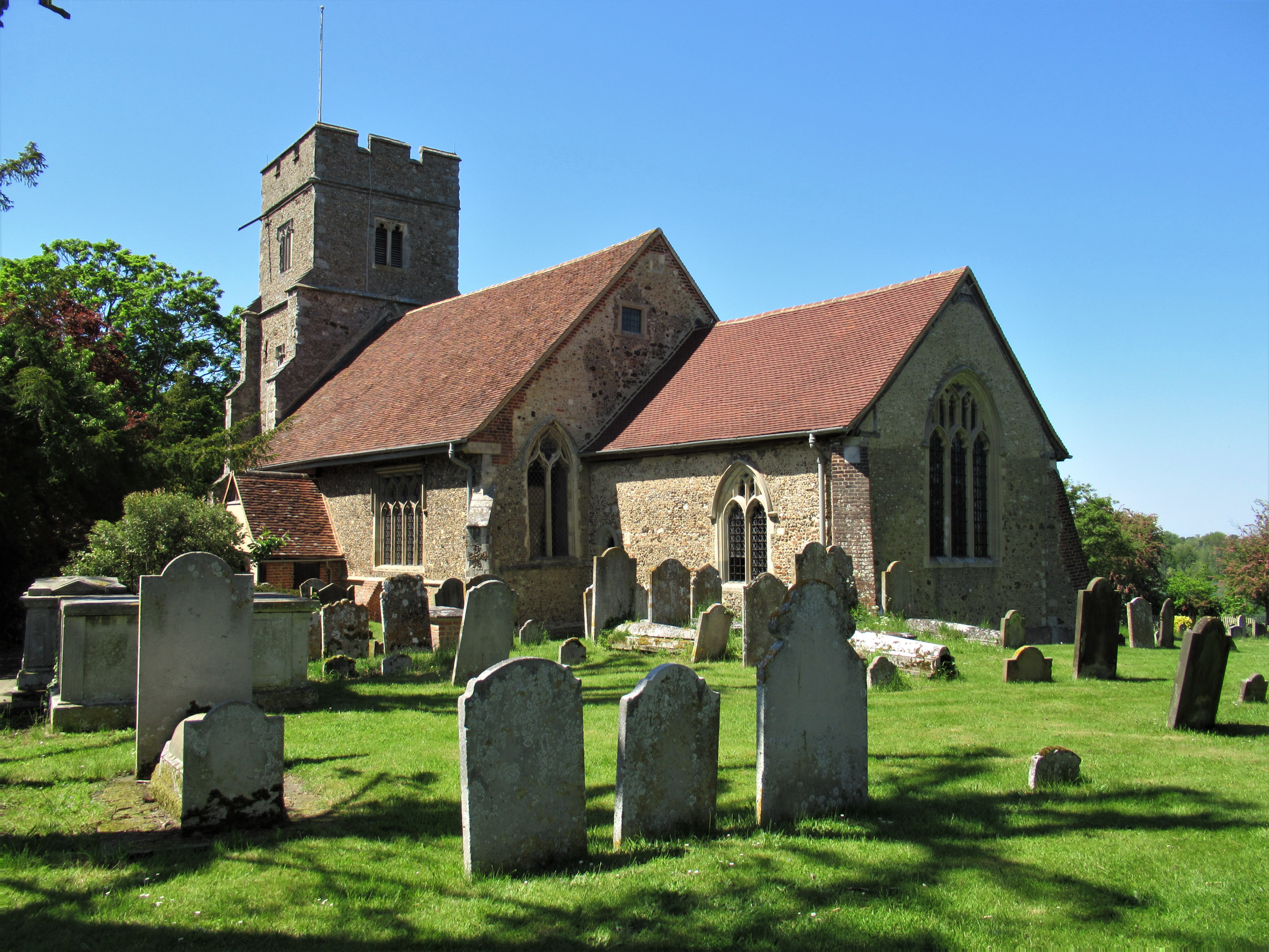
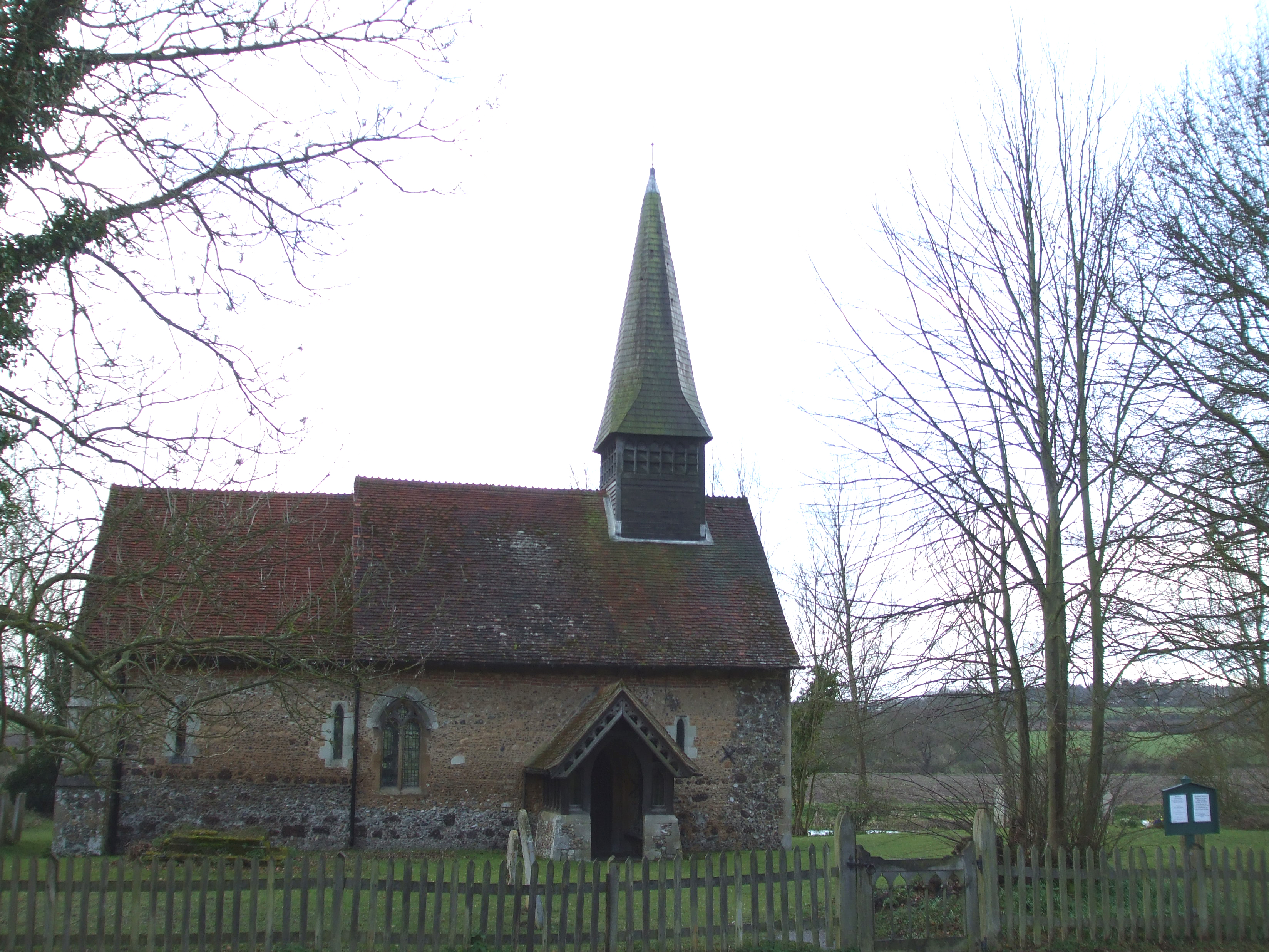
Brickwell Wood Images

Images are sourced within 2km of 51.748107/0.58479911 or Grid Reference TL7808. Thanks to Geograph Open Source API. All images are credited.

View eastwards along Tofts Chase, Little Baddow
Stream in Woodham Walter Common The Essex Wildlife Trust manages a block of nearly 250 acres of nature reserves on Danbury Ridge.

There are a range of habitats including woodland, heathland, marsh, pools, streams and bogs.

The reserves comprise: Scrubs Wood SSSI, Little Baddow Heath (mostly SSSI), Poors Piece SSSI, Pheasanthouse Wood SSSI, Birch Wood  SSSI and Woodham Walter Common SSSI.

A signposted nature trail starts at Runsell Lane, Danbury, see: <a href="https://www.geograph.org.uk/photo/2443548">TL7806 : Nature Trail Map</a>

External links:
<span class="nowrap"><a title="https://www.essexwt.org.uk/nature-reserves/danbury-ridge" rel="nofollow ugc noopener" href="https://www.essexwt.org.uk/nature-reserves/danbury-ridge">Link</a><img style="margin-left:2px;" alt="External link" title="External link - shift click to open in new window" src="https://s1.geograph.org.uk/img/external.png" width="10" height="10"/></span>
<span class="nowrap"><a title="http://www.wildessex.net/sites/Danbury%20Ridge.htm" rel="nofollow ugc noopener" href="http://www.wildessex.net/sites/Danbury%20Ridge.htm">Link</a><img style="margin-left:2px;" alt="External link" title="External link - shift click to open in new window" src="https://s1.geograph.org.uk/img/external.png" width="10" height="10"/></span>
Stream in Woodham Walter Common
The Essex Wildlife Trust manages a block of nearly 250 acres of nature reserves on Danbury Ridge. There are a range of habitats including woodland, heathland, marsh, pools, streams and bogs. The reserves comprise: Scrubs Wood SSSI, Little Baddow Heath (mostly SSSI), Poors Piece SSSI, Pheasanthouse Wood SSSI, Birch Wood SSSI and Woodham Walter Common SSSI. A signposted nature trail starts at Runsell Lane, Danbury, see: TL7806 : Nature Trail Map External links: LinkExternal link LinkExternal link
The forest is waiting for spring - Woodham Walter Common The Essex Wildlife Trust manages a block of nearly 250 acres of nature reserves on Danbury Ridge.

There are a range of habitats including woodland, heathland, marsh, pools, streams and bogs.

The reserves comprise: Scrubs Wood SSSI, Little Baddow Heath (mostly SSSI), Poors Piece SSSI, Pheasanthouse Wood SSSI, Birch Wood  SSSI and Woodham Walter Common SSSI.

A signposted nature trail starts at Runsell Lane, Danbury, see: <a href="https://www.geograph.org.uk/photo/2443548">TL7806 : Nature Trail Map</a>

External links:
<span class="nowrap"><a title="https://www.essexwt.org.uk/nature-reserves/danbury-ridge" rel="nofollow ugc noopener" href="https://www.essexwt.org.uk/nature-reserves/danbury-ridge">Link</a><img style="margin-left:2px;" alt="External link" title="External link - shift click to open in new window" src="https://s1.geograph.org.uk/img/external.png" width="10" height="10"/></span>
<span class="nowrap"><a title="http://www.wildessex.net/sites/Danbury%20Ridge.htm" rel="nofollow ugc noopener" href="http://www.wildessex.net/sites/Danbury%20Ridge.htm">Link</a><img style="margin-left:2px;" alt="External link" title="External link - shift click to open in new window" src="https://s1.geograph.org.uk/img/external.png" width="10" height="10"/></span>
The forest is waiting for spring - Woodham Walter Common
The Essex Wildlife Trust manages a block of nearly 250 acres of nature reserves on Danbury Ridge. There are a range of habitats including woodland, heathland, marsh, pools, streams and bogs. The reserves comprise: Scrubs Wood SSSI, Little Baddow Heath (mostly SSSI), Poors Piece SSSI, Pheasanthouse Wood SSSI, Birch Wood SSSI and Woodham Walter Common SSSI. A signposted nature trail starts at Runsell Lane, Danbury, see: TL7806 : Nature Trail Map External links: LinkExternal link LinkExternal link
Footpath to "The Forge" on Church Road
Holybreds Farm
Holybreds Farm
House by Mowden Hall Farm, near Hatfield Peverel, Essex
Country road near Fairfields farm, Essex The house in the picture is called Old Fairfields. The road leads to the small village of Nounsley, near Hatfield Peverel.
Country road near Fairfields farm, Essex
The house in the picture is called Old Fairfields. The road leads to the small village of Nounsley, near Hatfield Peverel.
The ford at Nounsley, Essex
The Ford at Nounsley This is the River Ter.
The Ford at Nounsley
This is the River Ter.
Nounsley Ford Ford at River Ter. It is possible the River Ter was known as the 'Ult' in Anglo-Saxon times. Hence nearby Ulting village was known as the Ult - ingas (settlers near this place).
Ref: <span class="nowrap"><a title="http://www.essexwalks.com/walks/ulting.html" rel="nofollow ugc noopener" href="http://www.essexwalks.com/walks/ulting.html">Link</a><img style="margin-left:2px;" alt="External link" title="External link - shift click to open in new window" src="https://s1.geograph.org.uk/img/external.png" width="10" height="10"/></span>
Nounsley Ford
Ford at River Ter. It is possible the River Ter was known as the 'Ult' in Anglo-Saxon times. Hence nearby Ulting village was known as the Ult - ingas (settlers near this place). Ref: LinkExternal link
Mowdena Cottages On Mowden Hall Lane.
Mowdena Cottages
On Mowden Hall Lane.
Nounsley Ford Showing a modest 1 ft deep, although it can be a good deal deeper, as is the way with fords. A crossing of the River Ter.
Nounsley Ford
Showing a modest 1 ft deep, although it can be a good deal deeper, as is the way with fords. A crossing of the River Ter.
Nounsley Ford Running at a foot deep at this time. A crossing of the River Ter.
Nounsley Ford
Running at a foot deep at this time. A crossing of the River Ter.
Chase Cottages On Mowden Hall Lane.
Chase Cottages
On Mowden Hall Lane.
Nounsley Ford Shown here at a depth of one foot six this is Nounsley ford on the River Ter.
Nounsley Ford
Shown here at a depth of one foot six this is Nounsley ford on the River Ter.
All Saints Ulting This is Ulting Church seen from the southern bank of the Chelmer & Blackwater Navigation.
All Saints Ulting
This is Ulting Church seen from the southern bank of the Chelmer & Blackwater Navigation.
All Saints; the parish church of Ulting It stands in a picturesque setting by the river Blackwater. Apart from the belfry and a couple of windows, it is essentially 13th century.
All Saints; the parish church of Ulting
It stands in a picturesque setting by the river Blackwater. Apart from the belfry and a couple of windows, it is essentially 13th century.
All Saints School at Ulting This is the old original Victorian school that was built in 1865 for Ulting village.
All Saints School at Ulting
This is the old original Victorian school that was built in 1865 for Ulting village.
Show me another place!

Brickwell Wood is located at Grid Ref: TL7808 (Lat: 51.748107, Lng: 0.58479911)

Administrative County: Essex

District: Chelmsford

Police Authority: Essex

What 3 Words

///fruit.deflated.mouth. Near Boreham, Essex

Nearby Locations

Brickwell Wood New Wood

Related Wikis

Essex

Essex ( ESS-iks) is a ceremonial county in the East of England and one of the home counties. It is bordered by Cambridgeshire and Suffolk to the north...

List of local nature reserves in Essex

Essex is a county in the east of England. It is bounded by Suffolk and Cambridgeshire to the north, Hertfordshire to the west, Greater London to the south...

Chelmer and Blackwater Navigation

The Chelmer and Blackwater Navigation is the canalisation of the Rivers Chelmer and Blackwater in Essex, in the east of England. The navigation runs for...

River Ter

The River Ter is a river in Essex, England that houses various aquatic creatures. The river rises in Stebbing Green and flowing via Terling it joins the...

Little Baddow

Little Baddow is a village to the east of Chelmsford, Essex. The name Baddow is believed to have been derived from the River Beadwan, now known as the...

Mowden, Essex

Mowden is a hamlet in the civil parish of Hatfield Peverel, in the Braintree district, in the county of Essex, England. It is about 5 miles away from the...

Ulting

Ulting is a small village and civil parish in the Maldon district, in the county of Essex, England. It shares its borders with Langford and Nounsley. It...

Elm Green Preparatory School

Elm Green Preparatory School is a day school which takes boys and girls from 4 to 11. Many pupils move on at 11 to local grammar schools, others to day...

Nearby Amenities

Located within 500m of 51.748107,0.58479911
Bench
Backrest: yes
Material: wood
Lat/Long: 51.7510134/0.5844563
The data included in this document is from www.openstreetmap.org. The data is made available under ODbL.

Have you been to Brickwell Wood?

Leave your review of Brickwell Wood below (or comments, questions and feedback).